-
- 54 Views
-
- 17 Views
-
- 22 Views
-
- 14 Views
-
- 28 Views
-
- 40 Views

-
- 34 Views
- Map of the Godhra Panchmahal's district
- Year: 1868
-
- 30 Views

-
- 34 Views
-
- 91 Views
-
- 24 Views
- Map of the Wun Taluka, East Berar .
- Year: 1876
-
- 52 Views
- Map of the Nandurbar taluka: Khandesh
- Year: 1869
-
- 57 Views
-
- 101 Views

-
- 25 Views
- Map of the Roheh Talooka, Tana Zilla. -
- Year: 1869
-
- 94 Views

-
- 101 Views
-
- 52 Views
-
- 47 Views
-
- 64 Views
-
- Sketch of the Magadi Taluka of the Bangalore District Nandidrug Division, Mysore Territory. 1877
- Year: 1877
- Subject: Topographic Map
- Publisher: Poona (Pune) Government Photozincographic Office 1877
- Language: English
- Place of Publication: Poona (Pune)
- 54 Views
-
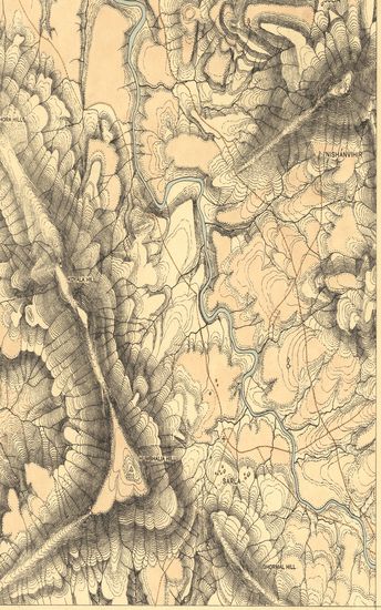
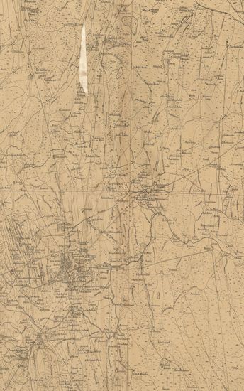
- Guzerat, Section No.3 of Sheet No.50 (Dang Forests) : Part of the Dang Wasurna State. 1879-80
- Year: 1881
- Subject: Topographic Map
- Publisher: Dehradun Office of the Trigonometrical Branch. Survey of India 1881
- Language: English
- Place of Publication: Dehradun
- 17 Views
-
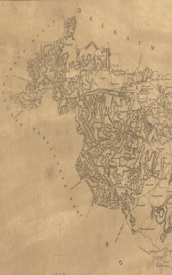
- Map of the Beedee Taluka of the Begaum collectorate.
- Year: 1878
- Subject: Topographic Map
- Publisher: Poona (Pune) Government Photozincographic Office 1878
- Language: English
- Place of Publication: Poona (Pune)
- 22 Views
-
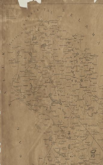
- Map of the Karmale Taluka of the Sholapur Zilla.
- Year: 1873
- Subject: Topographic Map
- Publisher: Poona (Pune) Government Photozincographic Office 1873
- Language: English
- Place of Publication: Poona (Pune)
- 14 Views
-
- Map of the Peith State of the Nasik (Nashik) Zilla.
- Subject: Topographic Map
- Publisher: Poona (Pune) Government Photozincographic Office
- Language: English
- Place of Publication: Poona (Pune)
- 28 Views
-
- Map of the Waee Talooka Sattara Collectorate.
- Year: 1876
- Subject: Topographic Map
- Publisher: Poona (Pune) Government Photozincographic Office 1876
- Language: English
- Place of Publication: Poona (Pune)
- 40 Views
-
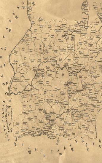
- Map of the Godhra Panchmahal's district
- Year: 1868
- Subject: Topographic Map
- Publisher: Poona (Pune) Government Photozincographic Office 1868
- Language: English
- Place of Publication: Poona (Pune)
- 34 Views
-
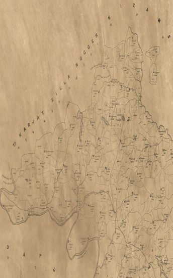
- Map of the Alibagh Talook of the Tana Zilla.
- Subject: Topographic Map
- Publisher: Poona (Pune) Government Photozincographic Office
- Language: English
- Place of Publication: Poona (Pune)
- 30 Views
-
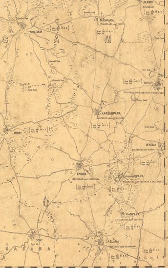
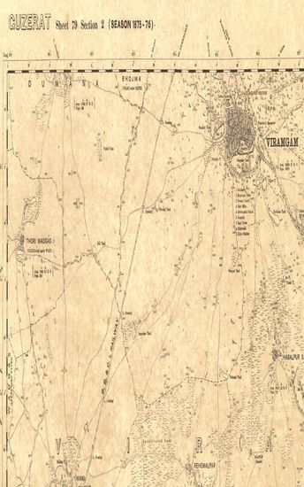
- Guzerat, Sheet 78 Section 2 : Parts of the viramgam taluka of the Ahmedabad collectorate and of the Wanod and Dasara States (Season 1875-76)
- Year: 1877
- Subject: Topographic Map
- Publisher: Dehradun G.T.S Office 1877
- Language: English
- Place of Publication: Dehradun
- 34 Views
-
- Districts Shikarpoor (Shikarpur) & Jacobabad Surveyed in 1857-58 and 59. Sind Revenue Survey (Sheet No.9)
- Subject: Cadastral Map
- Publisher: Calcutta Surveyor General's Office
- Language: English
- Place of Publication: Calcutta
- 91 Views
-
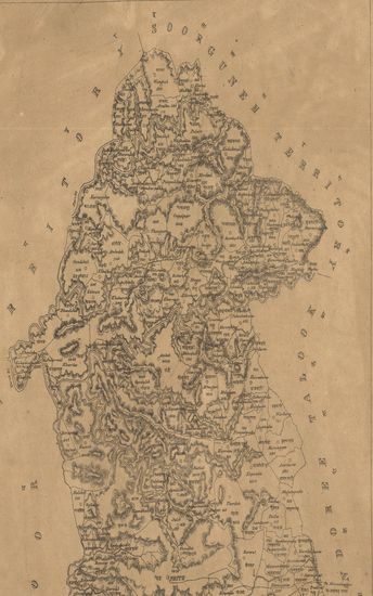
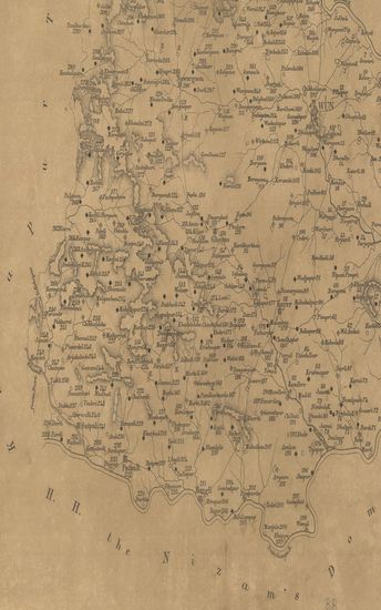
- Map of the Wun Taluka, East Berar .
- Year: 1876
- Subject: Topographic Map
- Publisher: Poona (Pune) Government Photozincographic Office 1876
- Language: English
- Place of Publication: Poona (Pune)
- 24 Views
-
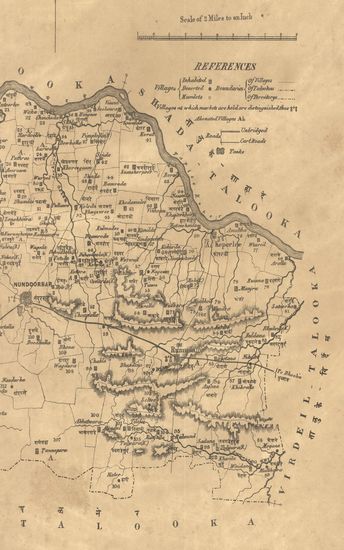
- Map of the Nandurbar taluka: Khandesh
- Year: 1869
- Subject: Topographic Map
- Publisher: Poona (Pune) Government Photozincographic Office 1869
- Language: English
- Place of Publication: Poona (Pune)
- 52 Views
-
- Map of the Shahada taluka: Khandesh collectorate
- Year: 1870
- Subject: Topographic Map
- Publisher: Poona (Pune) Government Photozincographic Office 1870
- Language: English
- Place of Publication: Poona (Pune)
- 57 Views
-
- नकाशा तालुके दर्यापूर जिल्हा वराड . - Map of the Taluka Daryapur District Varad .
- Year: 1874
- Subject: Topographic Map
- Publisher: Poona (Pune) Government Photozincographic Office 1874
- Language: English
- Place of Publication: Poona (Pune)
- 101 Views
-
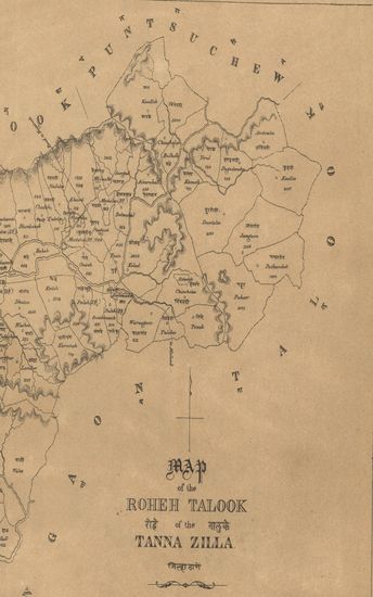
- Map of the Roheh Talooka, Tana Zilla. -
- Year: 1869
- Subject: Topographic Map
- Publisher: Poona (Pune) Government Photozincographic Office 1869
- Language: English
- Place of Publication: Poona (Pune)
- 25 Views
-
- Map of the Jhalod Taluka, Panch Mahal District.
- Year: 1878
- Subject: Topographic Map
- Publisher: Poona (Pune) Government Photozincographic Office 1878
- Language: English
- Place of Publication: Poona (Pune)
- 94 Views
-
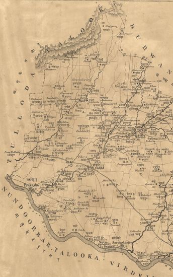
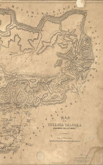
- Map of the Tulloda Taluka, Khandesh Collectorate. - नकाशा तालुके तळोदे जिल्हा खानदेश .
- Year: 1870
- Subject: Topographic Map
- Publisher: Poona (Pune) Government Photozincographic Office 1870
- Language: English
- Place of Publication: Poona (Pune)
- 101 Views
-
- Guzerat, Sheet 79 Section 1 : Parts of the Viramgam taluka Ahmedabad collectorate, Kari taluka Baroda State, and of the Dasara State (Season 1875-76)
- Year: 1877
- Subject: Topographic Map
- Publisher: Dehradhun G.T.S. Office 1877
- Language: English
- Place of Publication: Dehradhun
- 52 Views
-
- District Jacobabad, Shikarpoor (Shikarpur) and Larkana Surveyed in 1857-58-59 and 60. Sind Revenue Survey (Sheet No.10)
- Subject: Cadastral Map
- Publisher: Calcutta Surveyor General's Office
- Language: English
- Place of Publication: Calcutta
- 47 Views
-
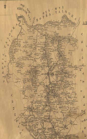
- Map of the Amulneir Taluka, Khandesh including the Petta of Parola. - नकाशा तालुके अमळनेर जिल्हा खानदेश .
- Year: 1869
- Subject: Topographic Map
- Publisher: Poona (Pune) Government Photozincographic Office 1869
- Language: English
- Place of Publication: Poona (Pune)
- 64 Views