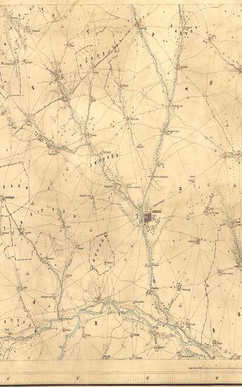
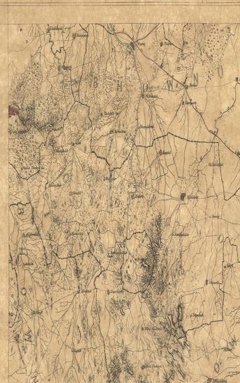
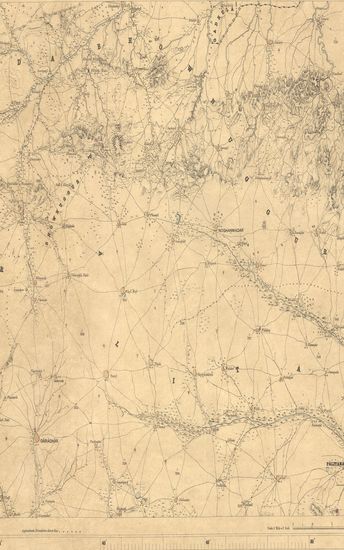
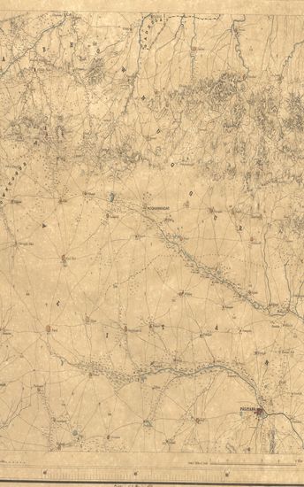
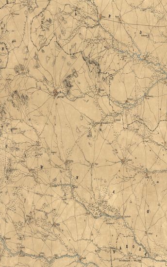
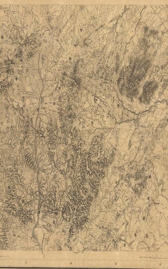
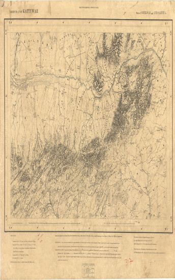
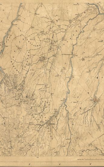
Kathiawar : Part of Gohelwar : Season 1863-64, 1866-67. Great Trigonometrical Survey of India
| Resource Type | : | Map |
| Year/Date of Publication | : | 1869 |
| Subject | : | Topographic Map |
| Publisher | : | Dehradun G.T.S. Office 1869 |
| Place of Publication | : | Dehradun |
| Language | : | English |
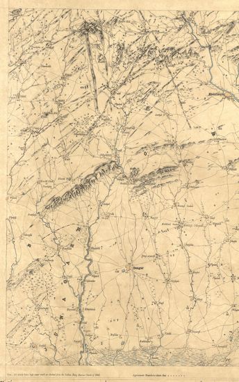
| Notes/Description | : | Orthography. Accents over letters are indicative of the proper pronunciation : a & ā have the sounds respectively of the first and second a in Mama : e has the sound of a in pale; i & ī the vowel sounds in bit & feet; υ that in full, ū that in fool & ai that in dry . Marks under letters indicate the Guzerathi letters from which they are derived, the dot anaswar over another letter. Conventional Signs. Trigonometrical Stations & Points respectively, or Taluka Boundaries, Metalled Roads, Country roads, footpaths, cultivation, Edge of cultivation, Waste, Pahlias or In Memoriam stones. In Villages each block represents 20 houses. In the largest towns the number cannot be thus shown. Relative heights of banks to beds of streams thus 17r. Barometrical heights thus 450 b The latitude are referrible to Kalianpur Observatory viz. 26° 30' 55. Longitudes to Madras Observatory Old Value viz. 80° 17' 21 Heights to Dangarwari H.S. Deduced from the Diu Tidal Observations97.97 ft. The most recent value of the longitude of Madras Observatory is 80° 14' 20, via Nautical Almanac for 1868, Consequently all longitudes in this map are liable to be diminished by 3', 1 Index to Numbers of Adjoining Sheets |
| Pages/Folios | : | 1 |
| Identifier | : | MAP_0291 |
| Digitization Sponsor | : | Government of Maharashtra |
Other Similar Items
-
- 40 Views
-
- 38 Views
-
- 54 Views
-
- 23 Views
-
- 83 Views
- Finance and Revenue Accounts and Miscellaneous Statisti ...
- Year: 1874
- Author: India (British). Financial Department
-
- 4 Views
-
- 44 Views
-
- 37 Views
-
- 42 Views
-
- 57 Views
-
- 39 Views
-
- 33 Views