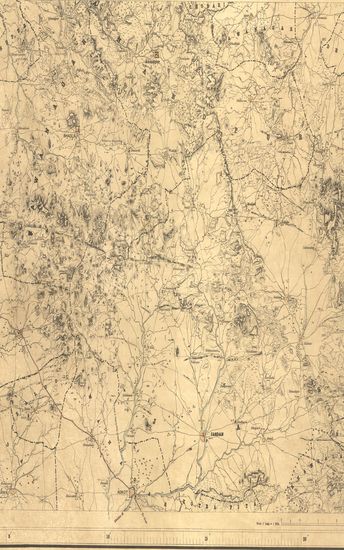
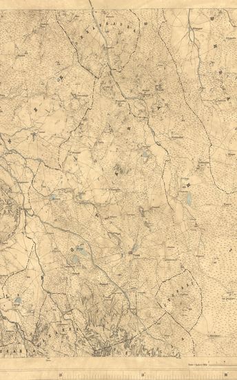
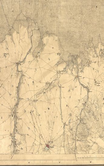
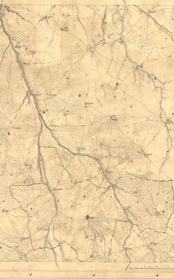
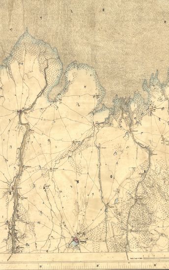
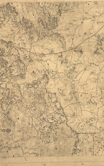
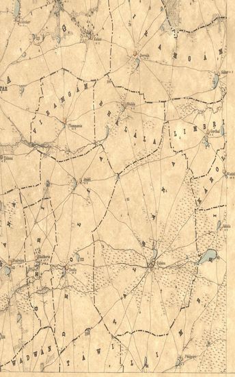
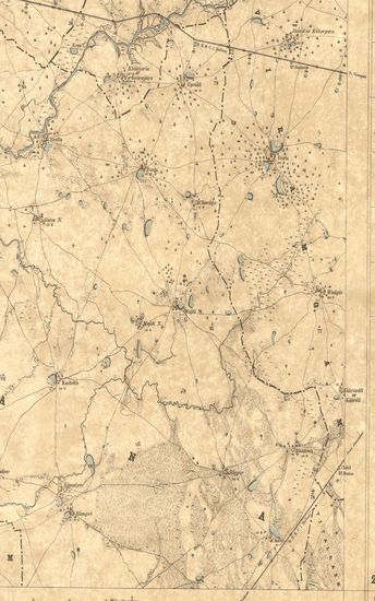
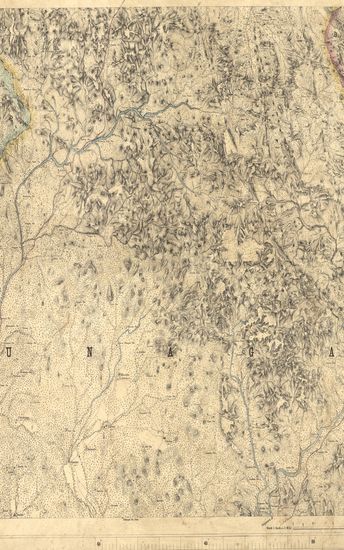
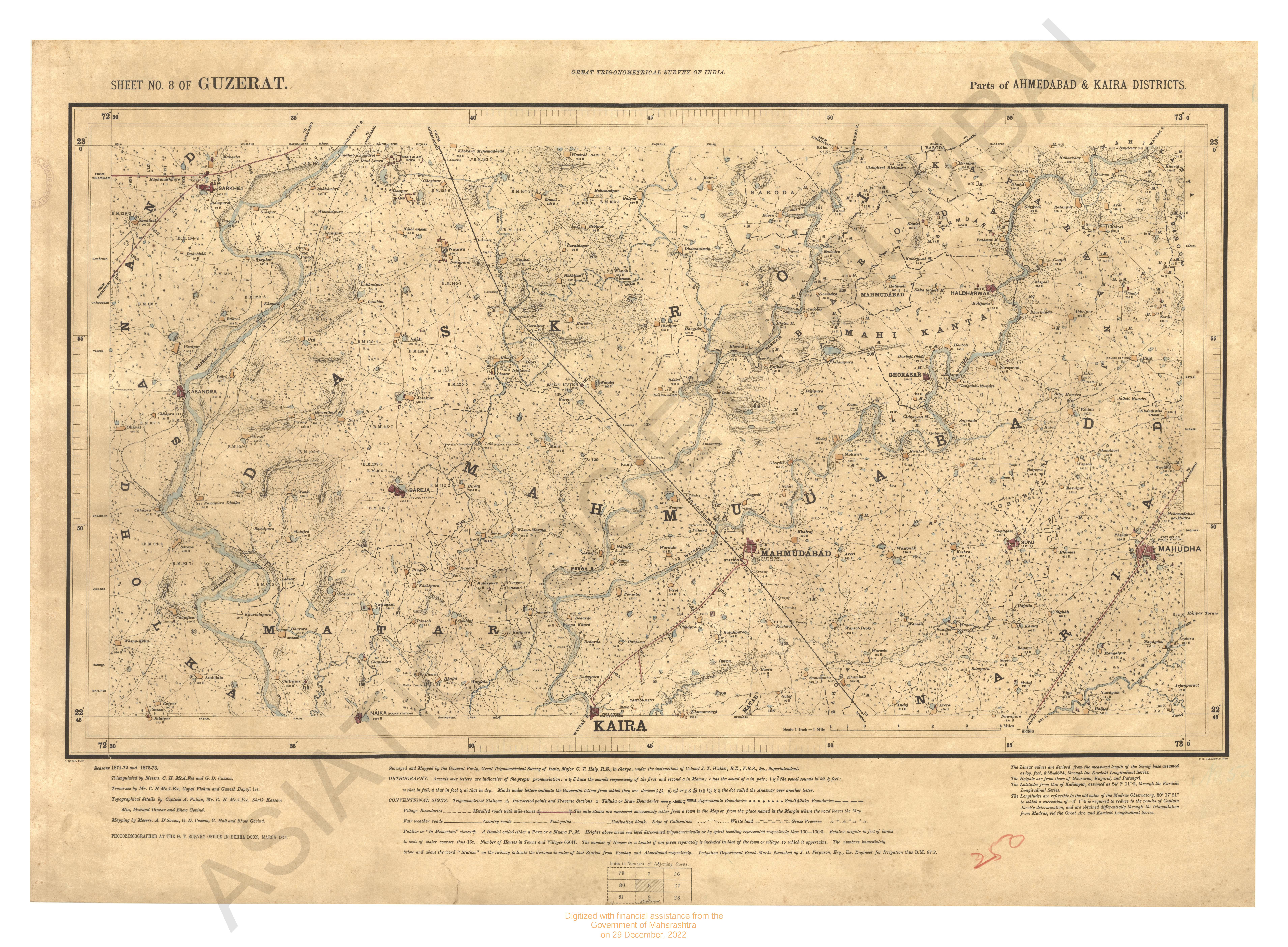
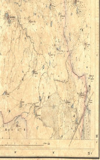
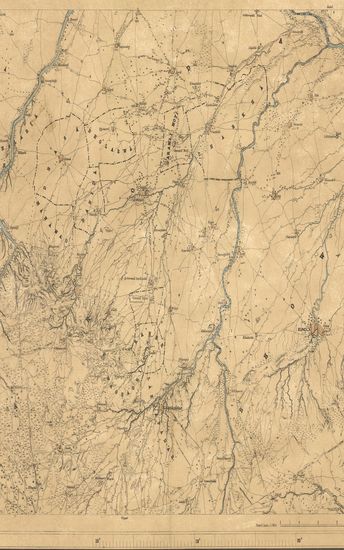
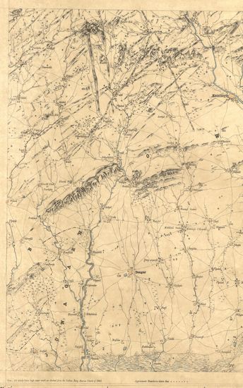
Kathiawar: Parts of Kattywar & Jhalawar. Season 1872-73. Trigonometrical Branch Survey of India.
| Resource Type | : | Map |
| Year/Date of Publication | : | 1873 |
| Subject | : | Topographic Map |
| Publisher | : | Dehradun Photozincographed at the G.T.S.Office 1873 |
| Place of Publication | : | Dehradun |
| Language | : | English |
| Notes/Description | : | (Sheet No. 22 of Kattywar) ORTHOGRAPHY is in accordance with the Hunterian system. CONVENTIONAL SIGNS. Trigonometrical Stations & Points respectively Δ & ο or ό. Taluka Boundaries, Metalled roads, Country roads, Foot paths, Cultivation, blank. Edge of Cultivation, Waste,Pahlias or In Memoriam stones †. Numerals with the affix H indicate the number of houses in the town or village whose name they are printed under, thus 472 H; with affix r they indicate the relative heights in feet of banks to beds of water courses, thus 12r. The Latitudes are referrible to that of Kalianpur Observatory, assumed as 24° 7' 11. Longitudes to Madras Observatory, taken as 80° 17' 21 Heights to Dangarwari H.S., 97.97 Ft deduced from Diu Tidal Observations. The most recent value of the Longitude of Madras Observatory is 80° 14' 20, vide Nautica Almanac for 1868 ; consequently all Longitudes in this map are liable to be diminished by 3' 1'' . Index to Numbers of adjoining sheets. |
| Pages/Folios | : | 1 |
| Identifier | : | MAP_0327 |
| Digitization Sponsor | : | Government of Maharashtra |
Other Similar Items
-
- 43 Views
-
- 71 Views
-
- 29 Views
-
- 54 Views
-
- 34 Views
-
- 19 Views
-
- 29 Views
-
- 2 Views
-
- 29 Views
-
- 57 Views
-
- 39 Views
-
- 27 Views