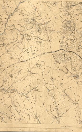
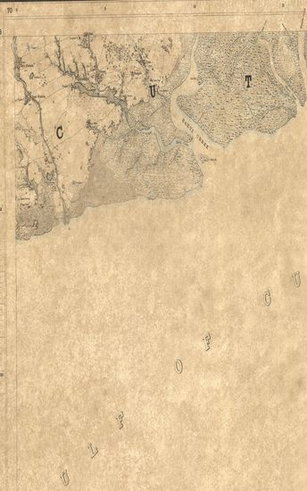
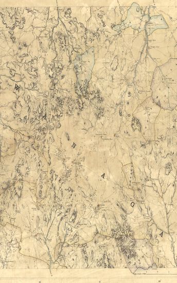
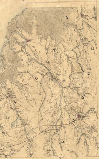
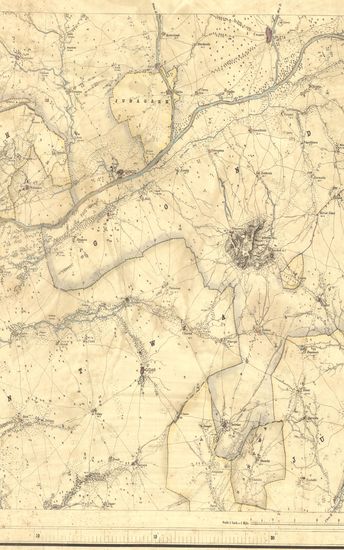
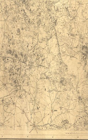
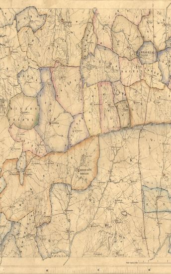
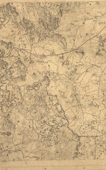
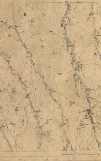
Kathiawar: Parts of Hallar and Cutch. Season 1874-75. Great Trigonometrical Survey of India.
| Resource Type | : | Map |
| Year/Date of Publication | : | 1875 |
| Subject | : | Topographic Map |
| Publisher | : | Dehradun Photozincographed at the G.T.S.Office 1875 |
| Place of Publication | : | Dehradun |
| Language | : | English |
| Notes/Description | : | (Sheet No.42 of Kattywar). ORTHOGRAPHY is in accordance with the orders of the Government of India, 26 August 1873. CONVENTIONAL SIGNS. Trigonometrical Stations & Points respectively Δ & ο or ό Approximate Taluka Boundaries, Metalled roads, Country roads, Foot paths, Cultivation, blank. Edge of Cultivation, Waste, Pahlias or In Memoriam stones †. G.T.S. Bench Marks. Numerals without an affix indicate Trigonometrical heights in feet above mean sea level ; thus 365. Numerals with the affix P indicate the population of the town or village they are they are printed near, thus 472 P; with affix r they indicate the relative heights in feet of banks to beds of watercourses, thus 12r. The Longitudes are referrible to Madras Observatory, Old Value, viz., 80° 17' 21 , to which a correction of - 3' 1'' must be applied to reduce to the most recent value, 80° 14' 20 . Vide Nautical Almanac for current year. Heights to Dangarwari H.S., 97.97 feet deduced from Diu Tidal Observations. Index to Numbers of Adjoining Sheets. |
| Pages/Folios | : | 1 |
| Identifier | : | MAP_0351 |
| Digitization Sponsor | : | Government of Maharashtra |
Other Similar Items
-
- 28 Views
-
- 25 Views
-
- 7 Views
-
- 47 Views
- Khatiwar: Part of Machu kanta and Cutch. Season 1874-75 ...
- Year: 1876
- Author: McGill, John.
-
- 31 Views
-
- 31 Views
-
- 34 Views
-
- 27 Views
-
- 15 Views
-
- 54 Views
-
- 18 Views
-
- 60 Views