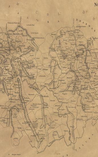
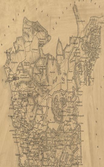
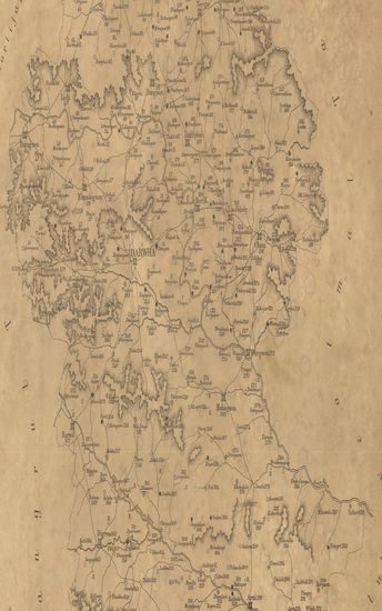
Map of the Supa Taluka of North Kanara.
| Resource Type | : | Map |
| Year/Date of Publication | : | 1877 |
| Subject | : | Topographic Map |
| Publisher | : | Poona (Pune) Government Photozincographic Office 1877 |
| Place of Publication | : | Poona (Pune) |
| Language | : | English |
| Notes/Description | : | This map is not supposed to be quite accurate; doubt exist about some boundaries. It is printed for the use of measuring and classing establishments, to shew the position of measured villages. As measured up to the end of 1877. The Trigonometrical Stations and hill ranges are taken from the Original Survey of the Officers of the Survey Department made between the years 1810 1830. |
| Pages/Folios | : | 1 |
| Identifier | : | MAP_0418 |
| Digitization Sponsor | : | Government of Maharashtra |
Other Similar Items
-
- 48 Views
-
- 32 Views
- Papers relating to the Introduction of the Revised Rate ...
- Year: 1886
- Author: India. Bombay Government Records
-
- 30 Views
- Correspondence relative to the Revenue Survey and Asses ...
- Year: 1883
- Author: India. Bombay Government Records
-
- 14 Views
-
- 72 Views
- Historical Account of Discoveries and Travels in North ...
- Year: 1829
- Author: Murray, Hugh
-
- 69 Views
- Historical Account of Discoveries and Travels in North ...
- Year: 1829
- Author: Murray, Hugh
-
- 4 Views
-
- 6 Views
-
- 51 Views
- Spanish America; or, a Descriptive, Historical and Geog ...
- Year: 1818
- Author: Bonnycastle, R. H.
-
- 53 Views
- Spanish America; or, a Descriptive, Historical and Geog ...
- Year: 1818
- Author: Bonnycastle, R. H.
-
- 28 Views
-
- 19 Views
- Map of the Darwha Taluka : east berar.
- Year: 1875