1. Home
  2. Resources
  3. Maps
  4. Book Details

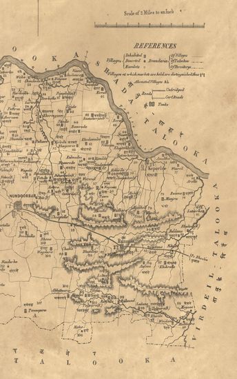
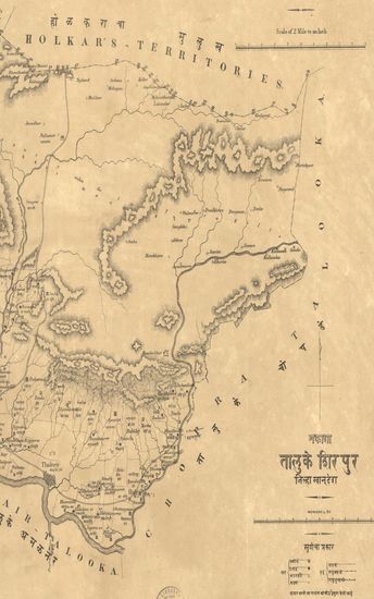
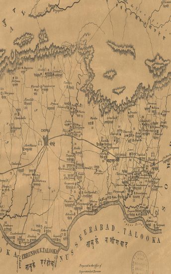
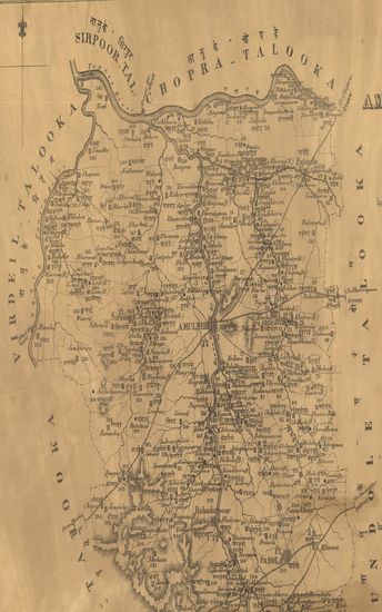
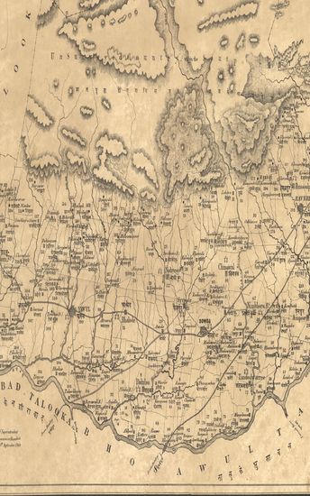
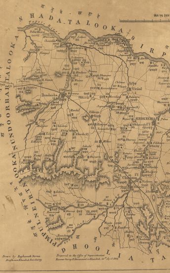
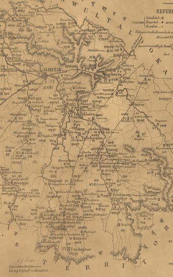
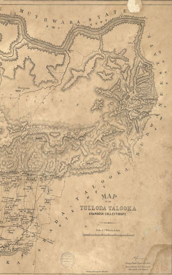
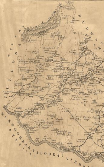
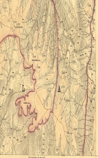
Map of the Nandurbar taluka: Khandesh

Resource Type : Map
Year/Date of Publication : 1869
Subject : Topographic Map
Publisher : Poona (Pune) Government Photozincographic Office 1869
Place of Publication : Poona (Pune)
Language : English
Pages/Folios : 1
Identifier : MAP_0474
Digitization Sponsor : Government of Maharashtra
Table of Content
Read

Other Similar Items

    • Map of the Errundole Taluka, Khandesh Collectorate. - न ...
    • Year: 1868
    • Map of the Sirpoor (Shirpur) Taluka, Khandesh Collector ...
    • Year: 1873
    • Map of the Chopra Taluka Khandesh Collectorate .
    • Year: 1868
    • Map of the Amulneir Taluka, Khandesh including the Pett ...
    • Year: 1869
    • Map of the Sowda Taluka, Khandesh Collectorate includin ...
    • Year: 1871
    • Map of the Virdeil (Virdel) Taluka, Khandesh Collectora ...
    • Year: 1869
    • Map of the Jamneir Taluka, Khandesh Collectorate. - नका ...
    • Year: 1869
    • Map of the Tulloda Taluka, Khandesh Collectorate. - नका ...
    • Year: 1870
    • Map of the Shahada taluka: Khandesh collectorate
    • Year: 1870
    • Map of the Nusseerabad (Nussirabad) Taluka, Khandesh Co ...
    • Year: 1868
    • Guzerat, Section No.14 of Sheet No.49 (Dang Forests) : ...
    • Year: 1883
    • Selections from the Records of the Bombay Government. N ...