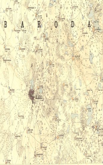
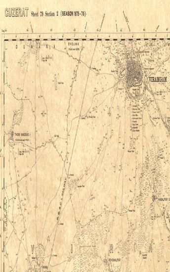
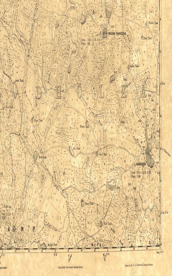
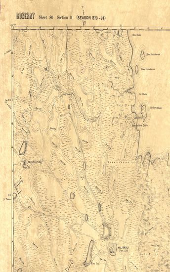
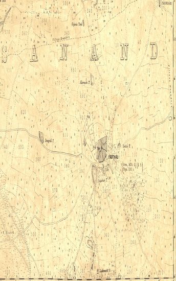
Guzerat, Sheet 78 Section 2 : Parts of the viramgam taluka of the Ahmedabad collectorate and of the Wanod and Dasara States (Season 1875-76)
| Resource Type | : | Map |
| Year/Date of Publication | : | 1877 |
| Subject | : | Topographic Map |
| Publisher | : | Dehradun G.T.S Office 1877 |
| Place of Publication | : | Dehradun |
| Language | : | English |
| Notes/Description | : | Orthography, is in accordance with the orders of the Government of India, Dated 3rd September 1875. Numerals, Thus 22/24 are the revenue survey numbers of fields. Thus ◬ 146 are the heights in feet of trigonometrical stations above the mean sea level. Thus ⊡ 145.26 are G.T. Survey Levels. Thus on made roads ║ 141.6 are levels in feet furnished by the executive engineer and reduced to mean sea level. Thus ⊙ B.M. 97.5 are levels in feet furnished by the Executive Engineer for Irrigation and reduced to mean sea level . Thus ═ 31 & 26 are milestones and indicate the number of miles from the termini mentioned on the margin where the road leaves the map. Thus 15r indicate the relative height in feet of banks to beds of water courses. The longitudes are referrible to the old value of the Madras Observatory, Viz, 80° 17' 21, to which a correction = 3' 1 must be applied to reduce to the most recent value, viz, 80° 14' 20 vide nautical almanac for current year. Index to adjoining Sections |
| Pages/Folios | : | 1 |
| Identifier | : | MAP_0280C |
| Digitization Sponsor | : | Government of Maharashtra |
Other Similar Items
-
- 29 Views
- Guzerat, Sheet 78 - Section 1 : Parts of the Viramgam T ...
- Year: 1877
- Author: Gopal, Govind
-
- 25 Views
-
- 36 Views

-
- 52 Views
-
- 27 Views
-
- 62 Views
-
- 58 Views

-
- 70 Views
-
- 65 Views
-
- 67 Views
-
- 45 Views
-
- 45 Views