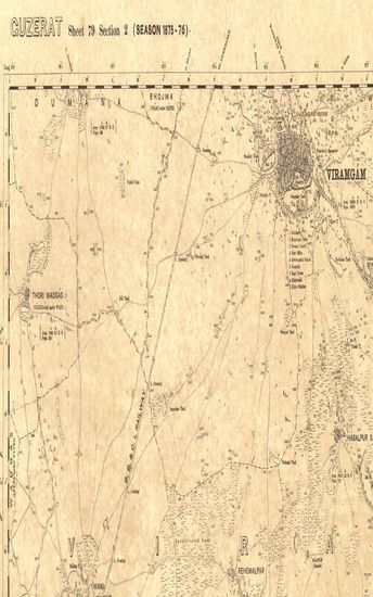
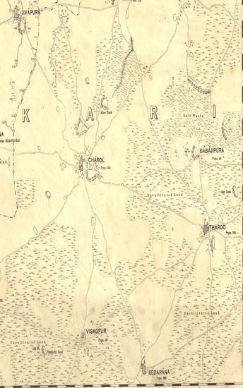
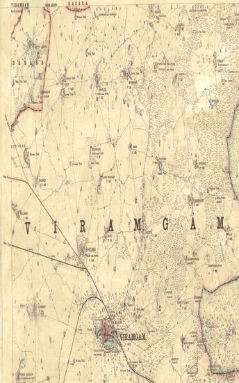
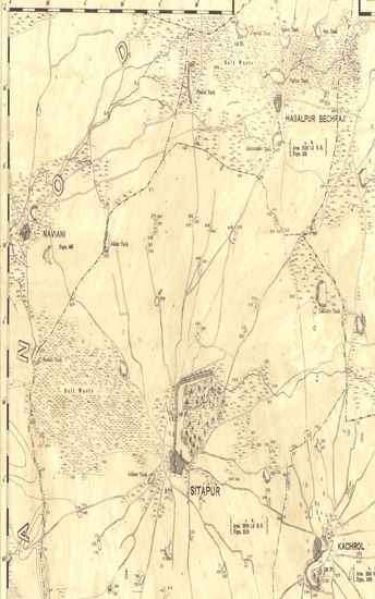
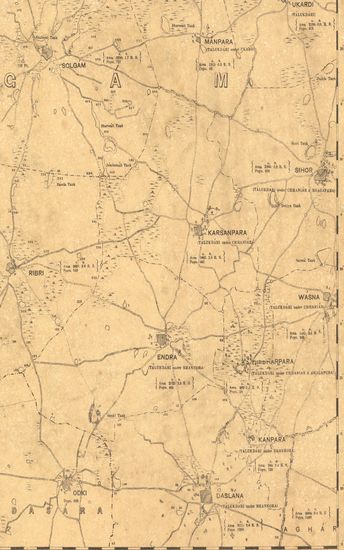
Guzerat, Sheet No.79 : Parts of the Ahmedabad District, of the Kari Taluka of the Gaikwar's Territory, and of Kattywar (Season 1875-76)
| Resource Type | : | Map |
| Year/Date of Publication | : | 1877 |
| Subject | : | Physical Map |
| Publisher | : | Dehradun G.T.S Office 1877 |
| Place of Publication | : | Dehradun |
| Language | : | English |
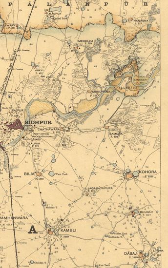
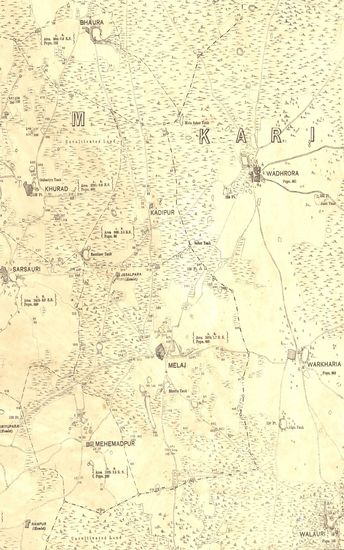
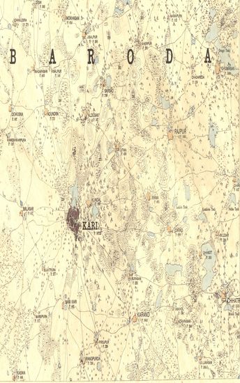
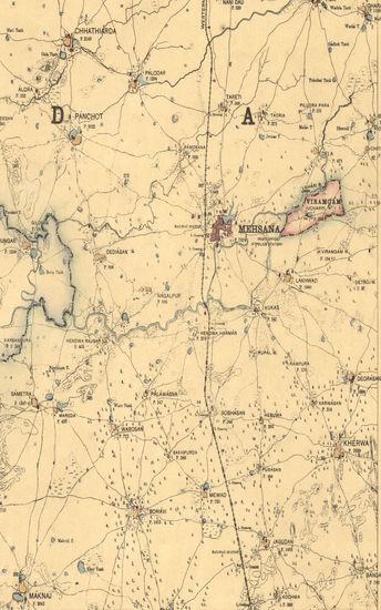
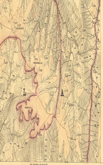
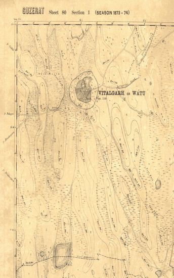
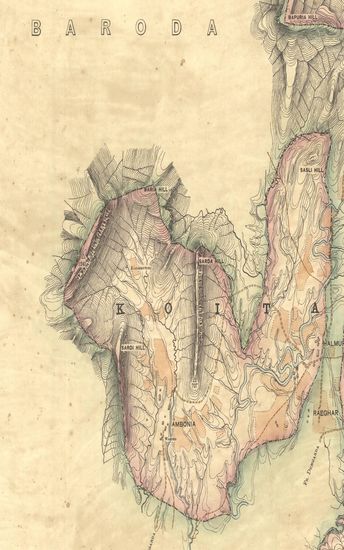
| Notes/Description | : | Orthography in accordance with the orders of the government of India, dated 3rd September 1875. Conventional Signs. Trigonometrical Stations ▲. Intersected Points and Traverse Stations ⊙ Irrigation department bench-marks furnished by the executive engineer for irrigation, thus ⊙ B.M.156.2 G.T. Survey levels, thus ⊡ B.M. 56.65, State Boundaries ~~. Sub-taluka boundaries ∕ village boundaries ┄┄┄ Metalled roads with milestones 2 & 26/3 & 25. The milestones are numbered succesively either from a town in the map or from the place named in the margin where the road leaves the map. Fair weather roads ───── Country roads ~~~ foot paths ╍╍╍╍╍╍╍ cultivation, blank. Edge of cultivation ~~~ Waste land ⁂⁂ Grass preserve ⁂⁂. Salt Waste ⑆⑆⑆⑆ pahlias or In Memoriam stones †. Height above mean sea level determined trigonometrically represented thus 131. Relative heightsin feet of banks to beds of water courses thus 15r. The Population in a hamlet, if not given separately, is included in that of the town or village to which it appertains. The linear values are derived from the measured length of the Sironj base assumed as log. feet 4.5844824, through the Karachi Longitudinal Series. The heights are referrible to mean sea level at Okha Tidal Station on the Gulf Of the Cutch. The longitudes are referrible to the old value of the Madras Observatory, 80° 17' 21 to which a correction of 3' 1 is required to reduce to the most recent value, viz : 80° 14' 20, vide nautical almanac for current year Index to numbers of adjoining sheets |
| Pages/Folios | : | 1 |
| Identifier | : | MAP_0281 |
| Digitization Sponsor | : | Government of Maharashtra |
Other Similar Items
-
- 45 Views
-
- 52 Views
-
- 36 Views

-
- 25 Views
-
- 27 Views
-
- 29 Views
- Guzerat, Sheet 78 - Section 1 : Parts of the Viramgam T ...
- Year: 1877
- Author: Gopal, Govind
-
- 34 Views
-
- 42 Views
-
- 38 Views
-
- 38 Views
-
- 36 Views
-
- 41 Views