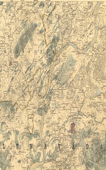
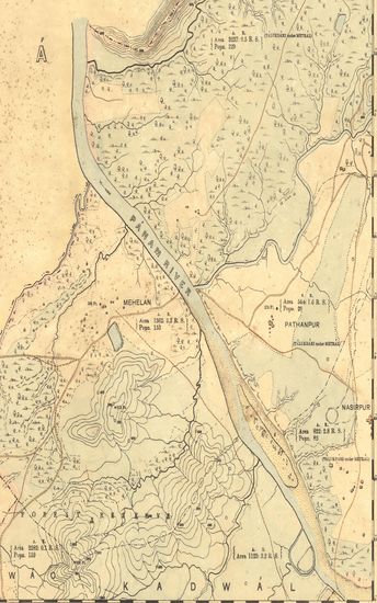
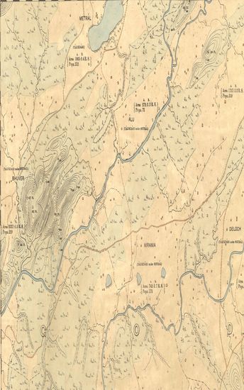
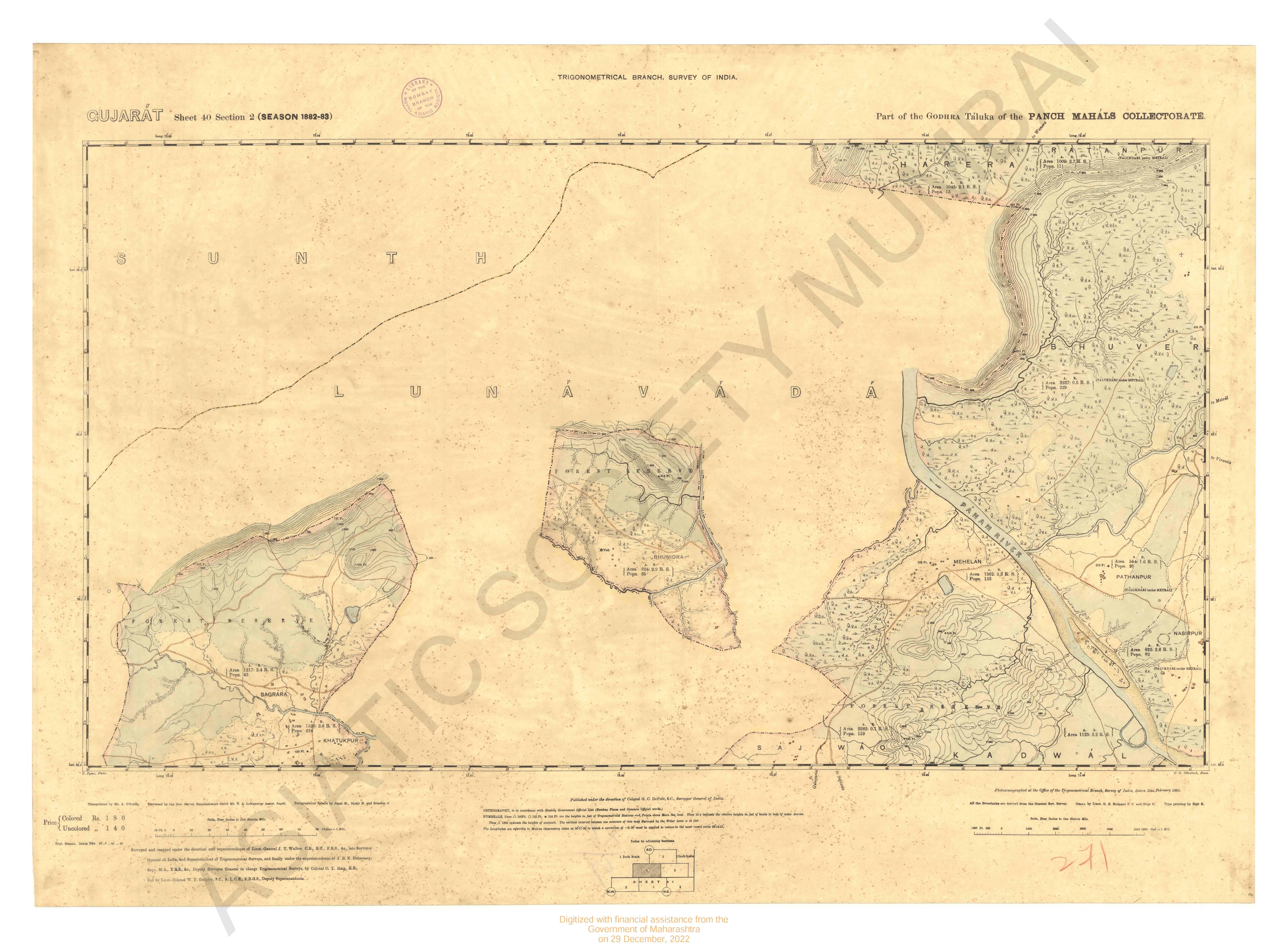
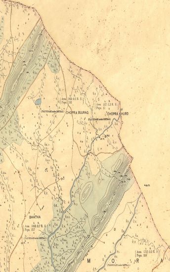
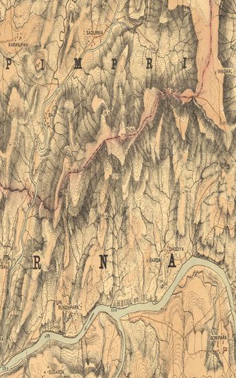
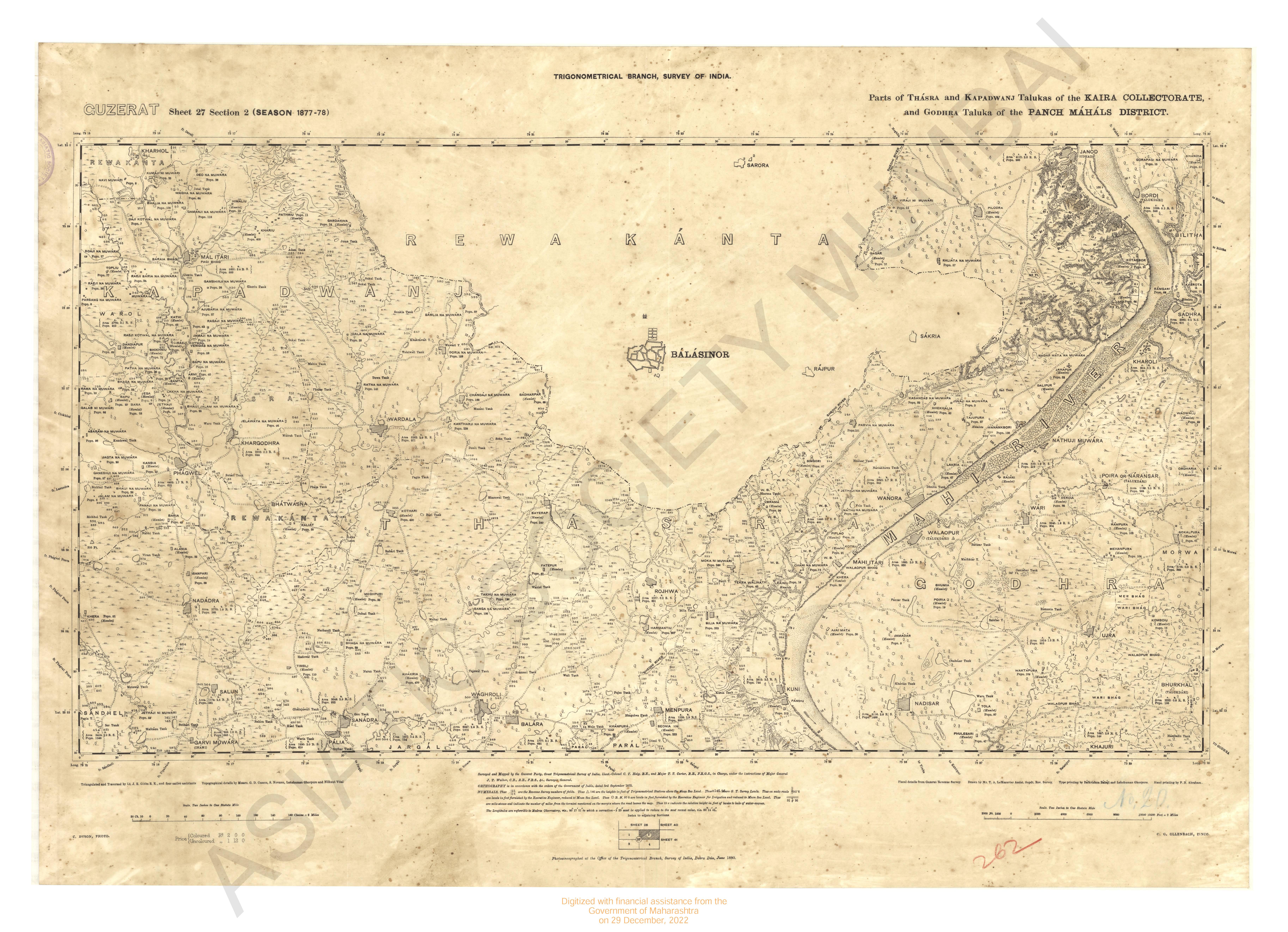
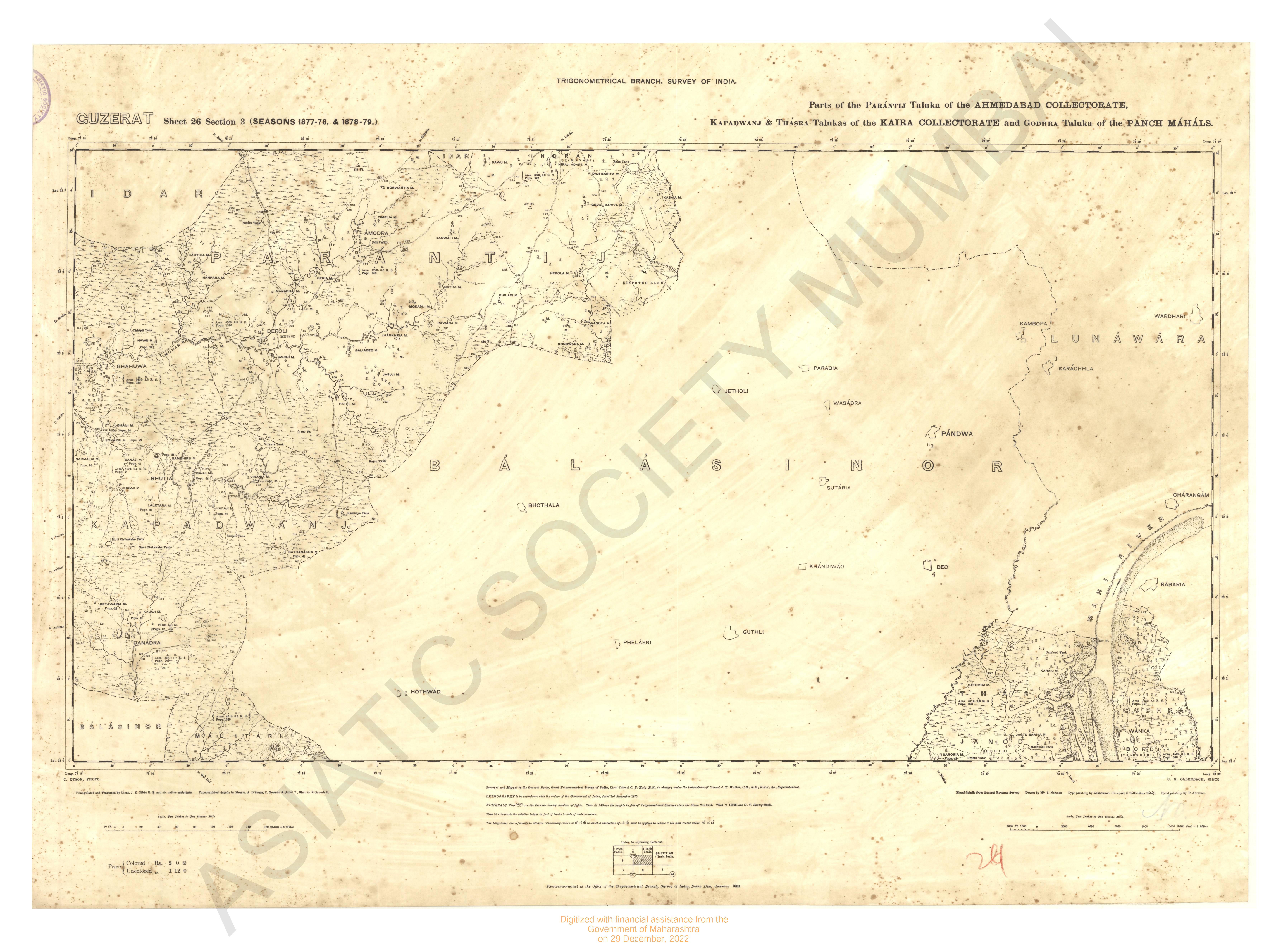
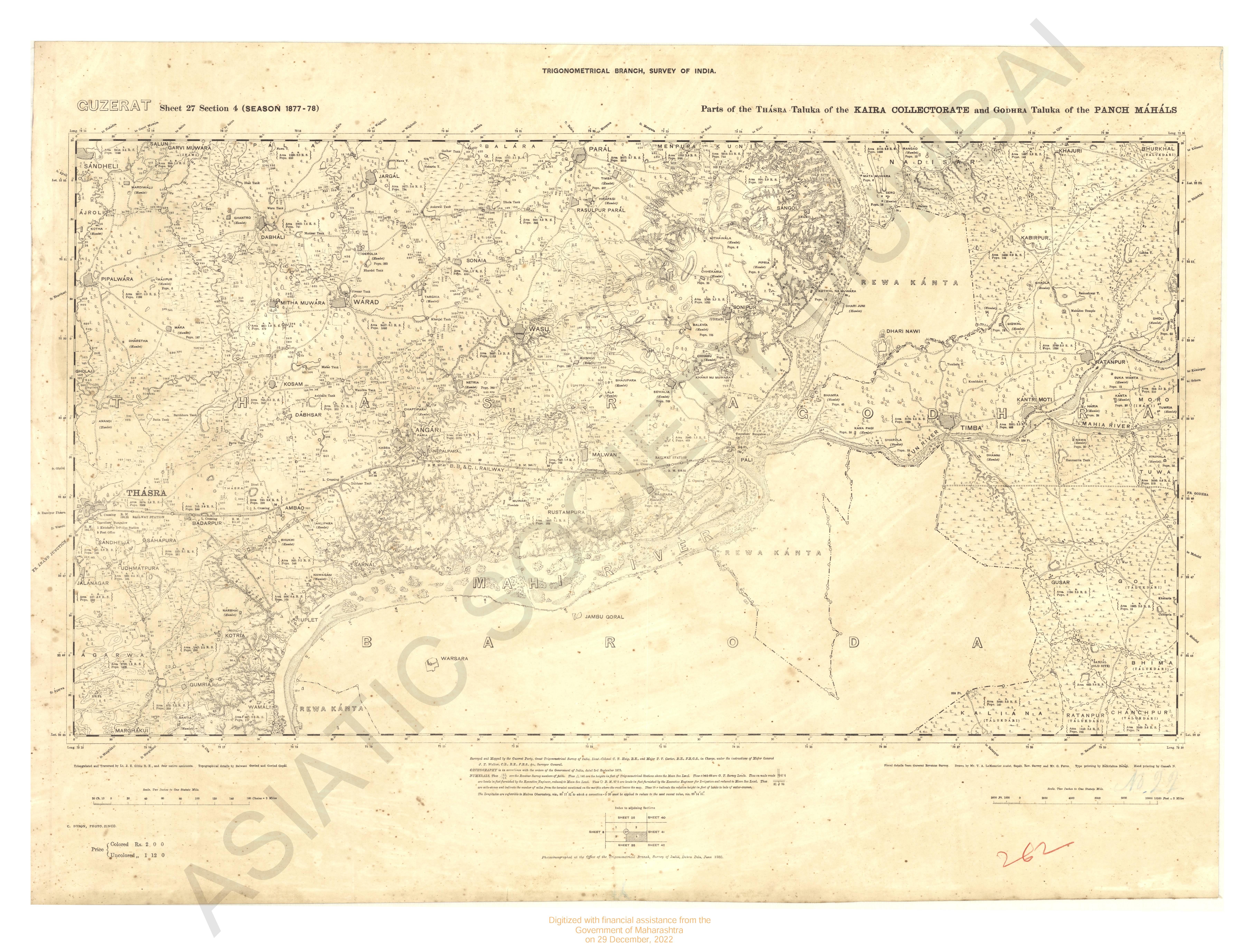
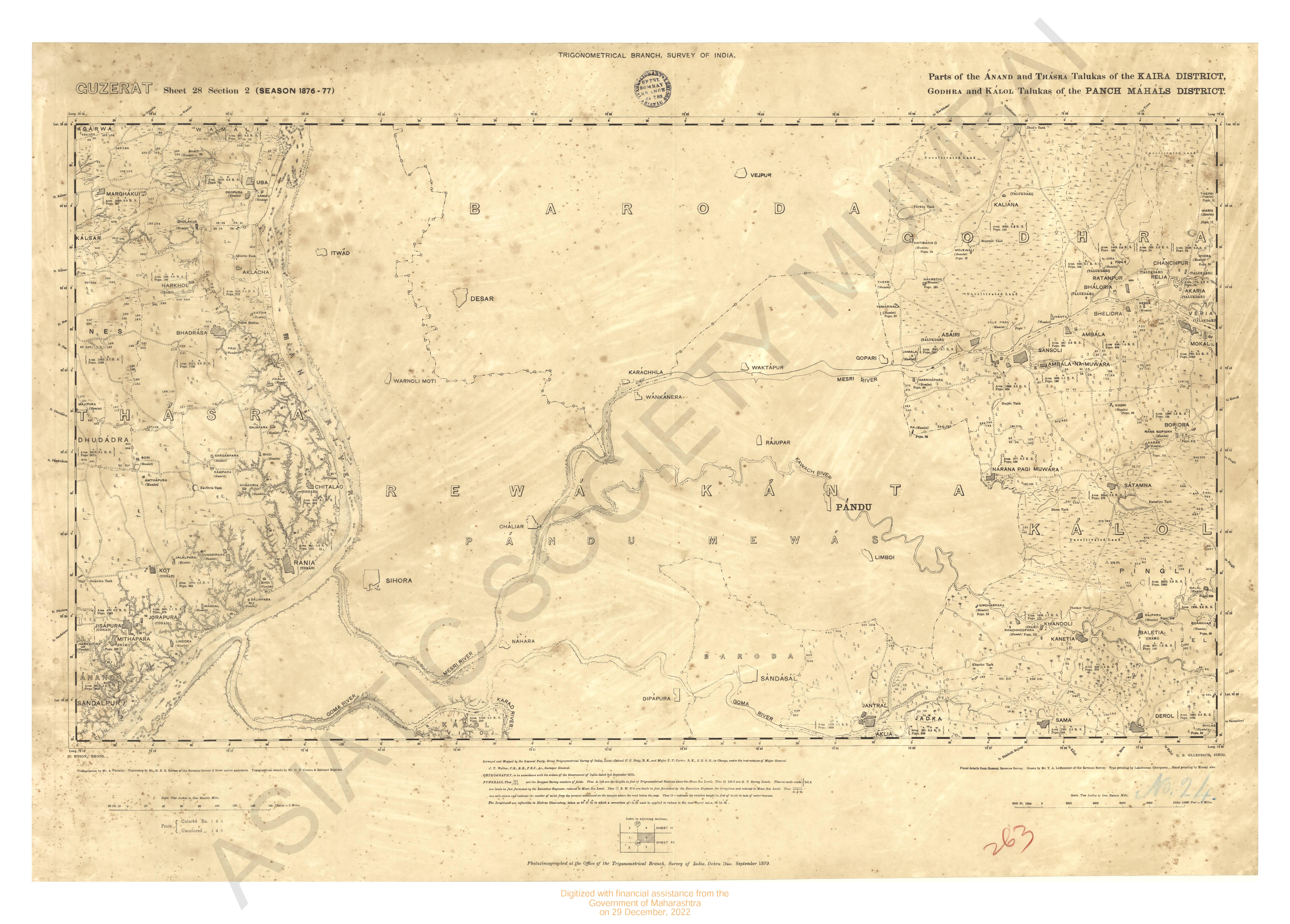
Gujarat Sheet 40 Section 3 : Part of the Godhra Taluka of the Panch Mahals Collectorate (Season 1882-83)
| Resource Type | : | Map |
| Author | : | Smith, T.M. Hodgson, G.B. |
| Year/Date of Publication | : | 1885 |
| Subject | : | Resource Map |
| Publisher | : | Dehradun Office of the Trignometrical branch. Surevy Of India 1885 |
| Place of Publication | : | Dehradun |
| Language | : | English |
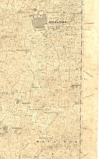
| Notes/Description | : | Orthography, is in Accordance with Bombay Government Official List (Bombay Places and Common Official Words.) Numerals, Thus▲146 ft.○ 123 ft. •144 ft. are the heights in feet of Trigonometrical Stations and Points above mean sea level. Thus r Indicate the relative heights in feet of banks to beds of water courses. Thus ○ 1200 indicate the heights of contours. The Vertical interval between the contours of this map surveyed by the water level is 25 feet. The longitude are referrible to Madras Observatory taken as 80°-17'-21 to which a correction of -2'-30 must be applied to reduce to the most recent value 80°-14'-51 |
| Pages/Folios | : | 1 |
| Identifier | : | MAP_0271C |
| Digitization Sponsor | : | Government of Maharashtra |
Other Similar Items
-
- 27 Views
- Gujarat Sheet 40 Section 2 : Part of the Godhra Taluka ...
- Year: 1885
- Author: Hodgson, G.B.
-
- 21 Views
- Gujarat Sheet 40 Section 1 : Part of the Godhra Taluka ...
- Year: 1885
- Author: Bhao G.
-
- 2 Views
-
- 32 Views
- Gujarat No.40 : Parts of the Panch Mahals Collectorate, ...
- Year: 1885
- Author: Hennessey, J.B.N.; Walker, J.T.
-
- 42 Views
-
- 2 Views
-
- 2 Views
-
- 2 Views
-
- 4 Views
-
- 27 Views
-
- 25 Views
-
- 68 Views
- Guzerat, Sheet 80 Section 16 : Part of Dholka Taluka of ...
- Year: 1877
- Author: Haig, C.T.