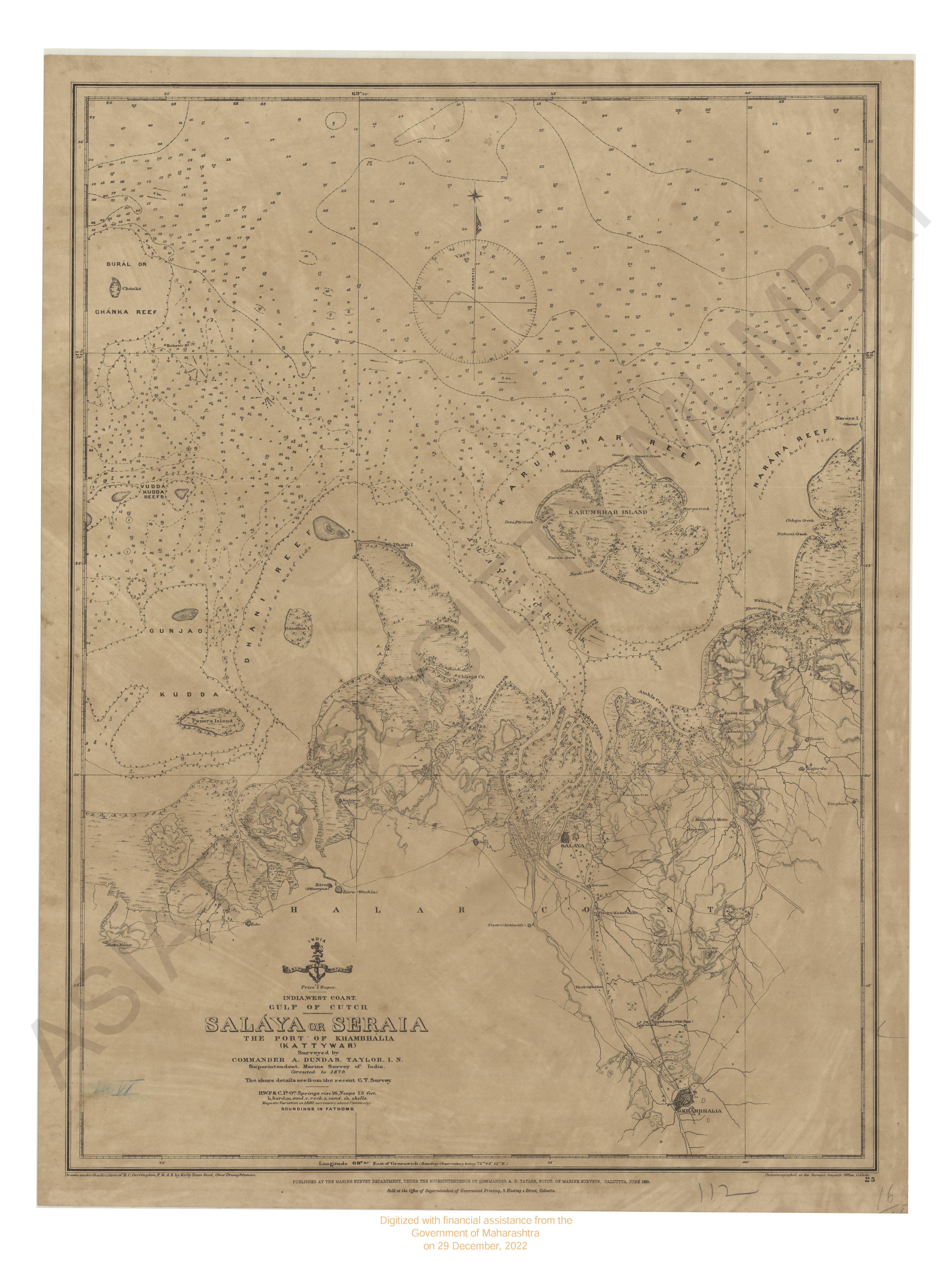
India West Coast - Tarapur to Murud-Janjira compiled from various Hydrogarphic surveys to 1967. (No.255)
| Resource Type | : | Map |
| Year/Date of Publication | : | 1968 |
| Publisher | : | Dehradun Naval Hydrographic Office 1968 |
| Place of Publication | : | Dehradun |
| Language | : | English |
| Notes/Description | : | CAUTIONS 1. Fishing stakes marked on the chart indicate their approximate positions. These are liable to be found in other areas where the depths are less than 25 metres, even in the approaches to Bombay Harbour. 2. Submarines exercise frequently in the area indicated. A good lookout is to be kept for them when passing through these waters. See Notice to Marines No.10 each year. 3. Certain lights have been omitted from this chart; for details of these, the larger scale charts and the Admiralty List of Lights should be consulted. CURRENTS The currents are of monsoonal origin, but tend to follow the trend of the coast. In December and January sets are north-westerly with rates of up to 1 knot. In July and August, when the S.W.Monsoon is well established, south-easterly sets with rates of up to 2 knots are experienced during the N.E.Monsoon and upto 3 knots during the S.W.Monsoon. For further information see also Admiralty Sailing Directions, Current Atlases etc. |
| Pages/Folios | : | 1 |
| Identifier | : | MAP_0600 |
| Digitization Sponsor | : | Government of Maharashtra |
Other Similar Items
-
- 6 Views
-
- 11 Views
-
- 52 Views
- An Account of the Empire of Marocco and the Districts o ...
- Year: 1811
- Author: Jackson, James Grey
-
- 3 Views
-
- 222 Views
- Sketches of the Native States under the Political Agenc ...
- Year: 1856
- Author: Wallace, R. Maj.; Fulljames, G. Maj.; Malet, A.
-
- 101 Views
- Voyages made in the Years 1788 and 1789 from China to t ...
- Year: 1790
- Author: Meares, John
-
- 80 Views
- The Indian Amateur Gardener, Practical hints on the Cul ...
- Year: 1902
- Author: Landolicus
-
- 119 Views
- Report showing the relations of the British Government ...
- Year: 1856
- Author: India. Foreign Department
-
- 3 Views
-
- 30 Views
- Account of a Voyage of Discovery to the West Coast of C ...
- Year: 1818
- Author: Hall, Basil Capt.; Clifford, H. J.
-
- 59 Views
- Correspondence relating to the Queen's Jurisdiction on ...
- Year: 1875
- Author: Great Britain. House of Commons
-
- 47 Views
- A Manual of the Geology of India; chiefly compiled from ...
- Year: 1893
- Author: Oldham, R. D. (Ed.)