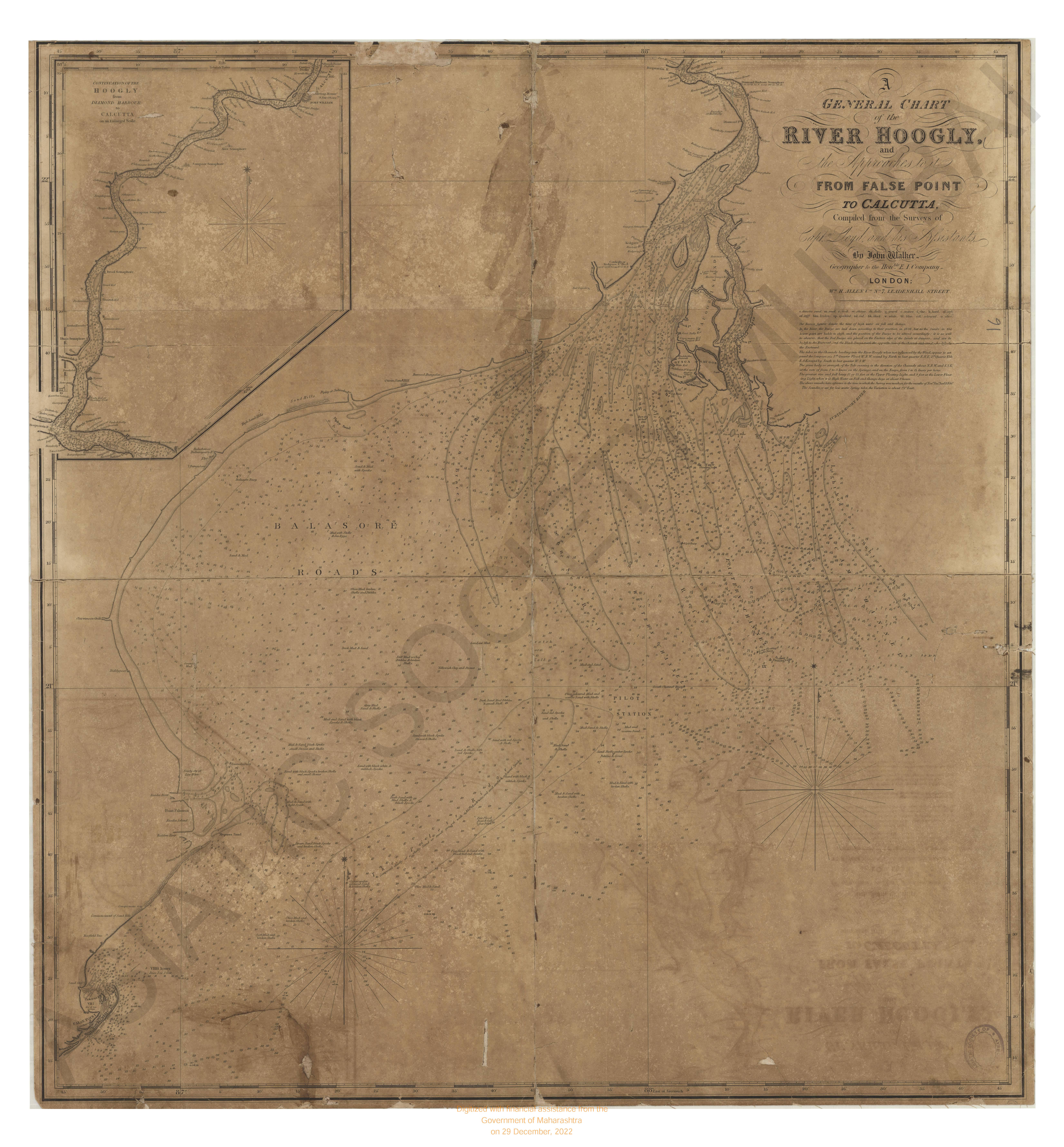
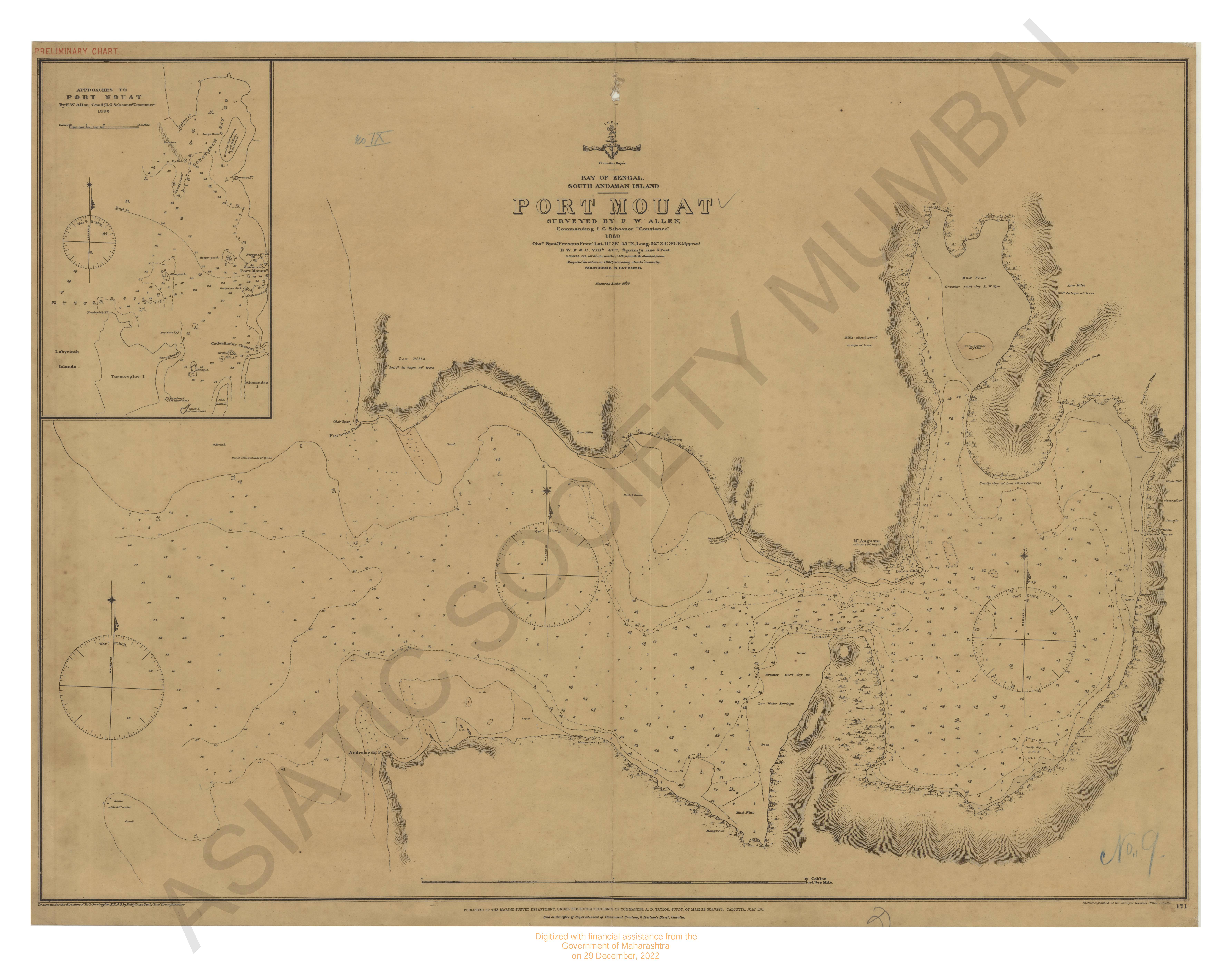
Bay of Bengal : False Point Anchorage
| Resource Type | : | Map |
| Year/Date of Publication | : | 1877 |
| Subject | : | Hydographic Map |
| Publisher | : | Calcutta Marine Survey Dpeartment 1877 |
| Place of Publication | : | Calcutta |
| Language | : | English |
| Notes/Description | : | The Rise and Fall of the Tide in the Harbour is Greatly influenced by the Water Out of the Different Rivers, & Creeks, and by the Prevailing Winds. It is Reported that a Further Reduction of One Foot May Be Made About the Month of May. The Tides set Fairly Through the Channels, Average Rate During the Springs 2 Knots Per Hour, Outside the Anchorage the Flood Sets to the N.E. ebb to the S.W. The Positions of the Buoys Are Not to be Depended Upon as They Are Shifted as the Banks Extend Seaward. |
| Pages/Folios | : | 1 |
| Identifier | : | MAP_0007 |
| Digitization Sponsor | : | Government of Maharashtra |
Other Similar Items
-
- 3 Views
-
- 3 Views
-
- 3 Views
-
- 54 Views
- A Voyage from Calcutta to the Mergui Archipelago, lying ...
- Year: 1792
- Author: Forrest, Thomas
-
- 35 Views
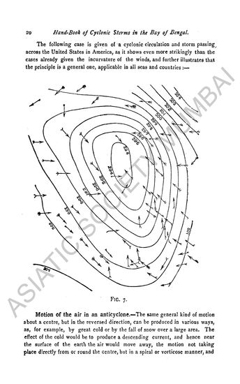
- Handbook of Cyclonic Storms in the Bay of Bengal for th ...
- Year: 1900
- Author: Eliot, John
-
- 38 Views
- Handbook of Cyclonic Storms in the Bay of Bengal for th ...
- Year: 1890
- Author: Eliot, John
-
- 21 Views
- Handbook of Cyclonic Storms in the Bay of Bengal for th ...
- Year: 1901
- Author: Eliot, John
-
- 63 Views
- A Chart of the Northern Part of the Bay of Bengal
- Year: 1840
- Author: Lloyde, J.N. Richard
-
- 5 Views
- Bay of Bengal.
- Year: 1844
-
- 5 Views
- India, Bay of Bengal
- Year: 1878
-
- 5 Views
-
- 4 Views