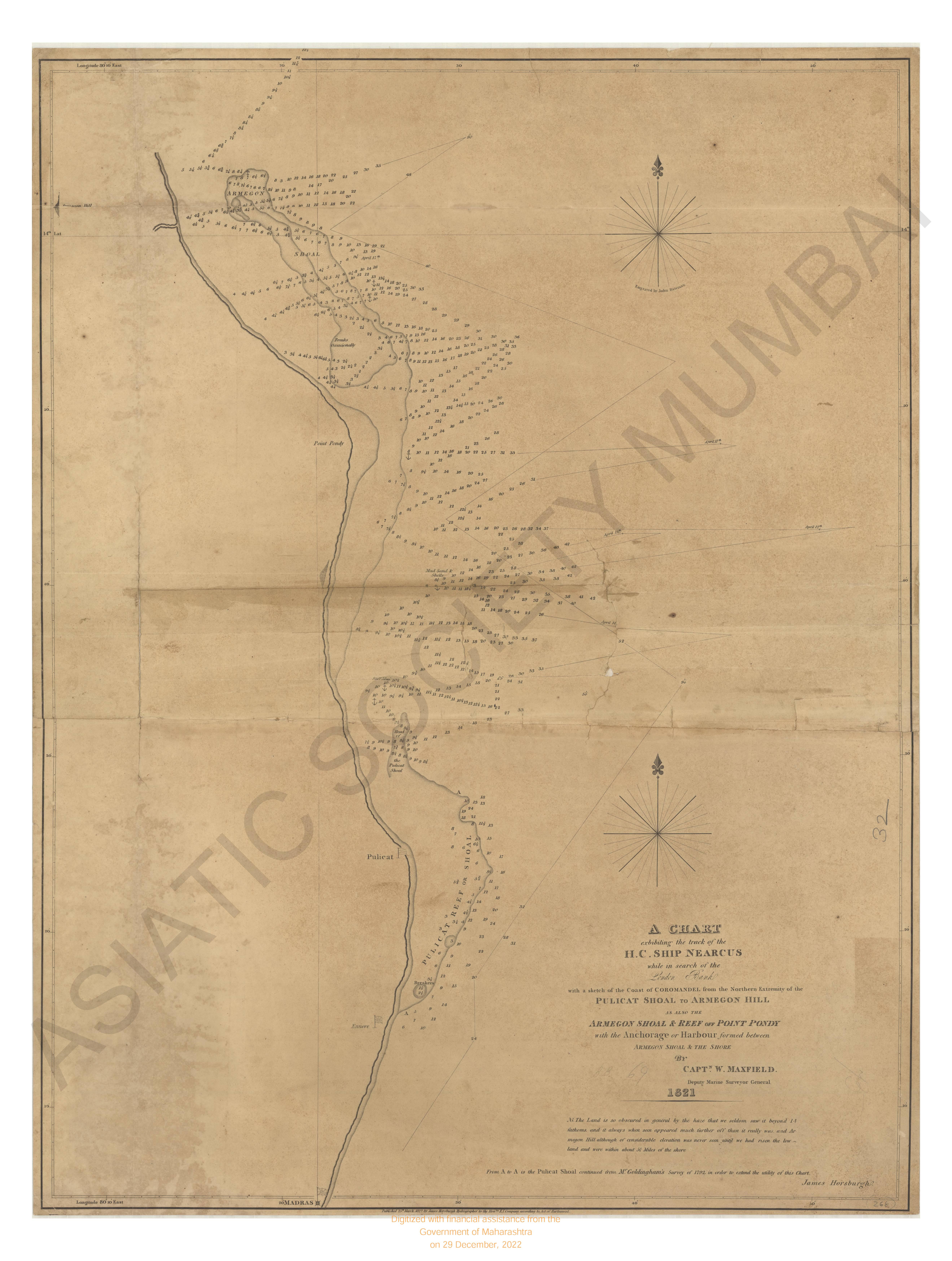
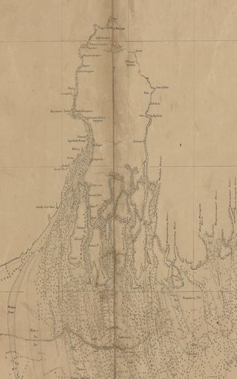
A Chart of the Northern Part of the Bay of Bengal
| Resource Type | : | Map |
| Author | : | Lloyde, J.N. Richard |
| Year/Date of Publication | : | 1840 |
| Subject | : | Topographic Map |
| Publisher | : | Calcutta Marine Survey Department 1840 |
| Place of Publication | : | Calcutta |
| Language | : | English |
| Notes/Description | : | The Roman Numbers Show the Actual Time of High Water on Full and Change Days, From Observation: the Flood Tide However Continues to Run About an Hour Afterwards. This Mark, Above the Figures Denotes no Ground at that Depth. The Sounding are for Low Water, Spring Tides, those Which are Written Transversely to the Rest, are Inserted Upon Rather Doubtful Authority. The Tides at the Head of Bay Appear to a Circular Motion: The First Quarter of the Flood Running From W.N.W Round by North, to the Last Quarter E.N.E and the First Quarter of the Ebb. Round by South, to the Last Quarter W.S.W the Great Body or Strength of the Flood Including to the Westward or Eastward of North According to the Direction of the Channels and the Ebb in the Opposite Direction The Sea Face of the Soonderbunds, From Saugor Islands to Chittagong is Taken From the Surveys Made Under my Superintendance, and Assisted Chiefly by Lieutenants J.A.Young and Full,During the Seasons of 1837-38-39 and 40 . The Coast from Chittagong to the Arrcan River is From the Surveys of Captain Ross and Myself |
| Pages/Folios | : | 1 |
| Identifier | : | MAP_0009 |
| Digitization Sponsor | : | Government of Maharashtra |
Other Similar Items
-
- 45 Views
- A Voyage round the World in the years MDCCXI, I, II, II ...
- Year: 1768
- Author: Anson, George Lord; Walter, Richard (Comp.)
-
- 47 Views
- A Journey from Prince of Wales's Fort in Hudson's Bay t ...
- Year: 1795
- Author: Hearne, Samuel
-
- 50 Views
- A Journey from Bengal to England, through the Northern ...
- Year: 1798
- Author: Forster, George
-
- 44 Views
- A Journey from Bengal to England, through the Northern ...
- Year: 1798
- Author: Forster, George
-
- 25 Views
- Bengal in the Sixteenth Century, A. D.
- Year: 1914
- Author: Gupta, J. N. Das
-
- 42 Views
- A Narrative of Travels in Northern Africa, in the Years ...
- Year: 1821
- Author: Lyon, G. F. Capt.
-
- 61 Views
- Scandinavian Adventures, during a Residence of Upwards ...
- Year: 1854
- Author: Lloyd, L.
-
- 40 Views
- Scandinavian Adventures; during a Residence of Upwards ...
- Year: 1854
- Author: Lloyd, L.
-
- 2 Views
-
- 30 Views
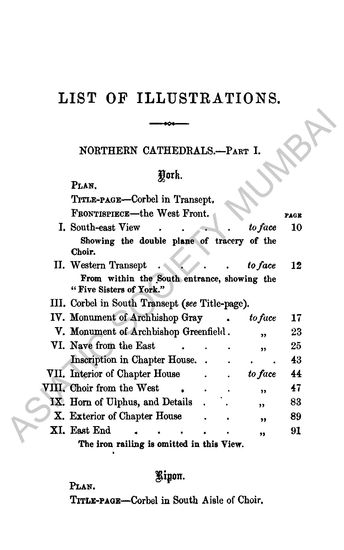
- Handbook to the Northern Cathedrals of England, Norther ...
- Year: 1869
- Author: King, Richard John
-
- 29 Views
- Handbook to the Northern Cathedrals of England, Norther ...
- Year: 1869
- Author: King, Richard John
-
- 4 Views