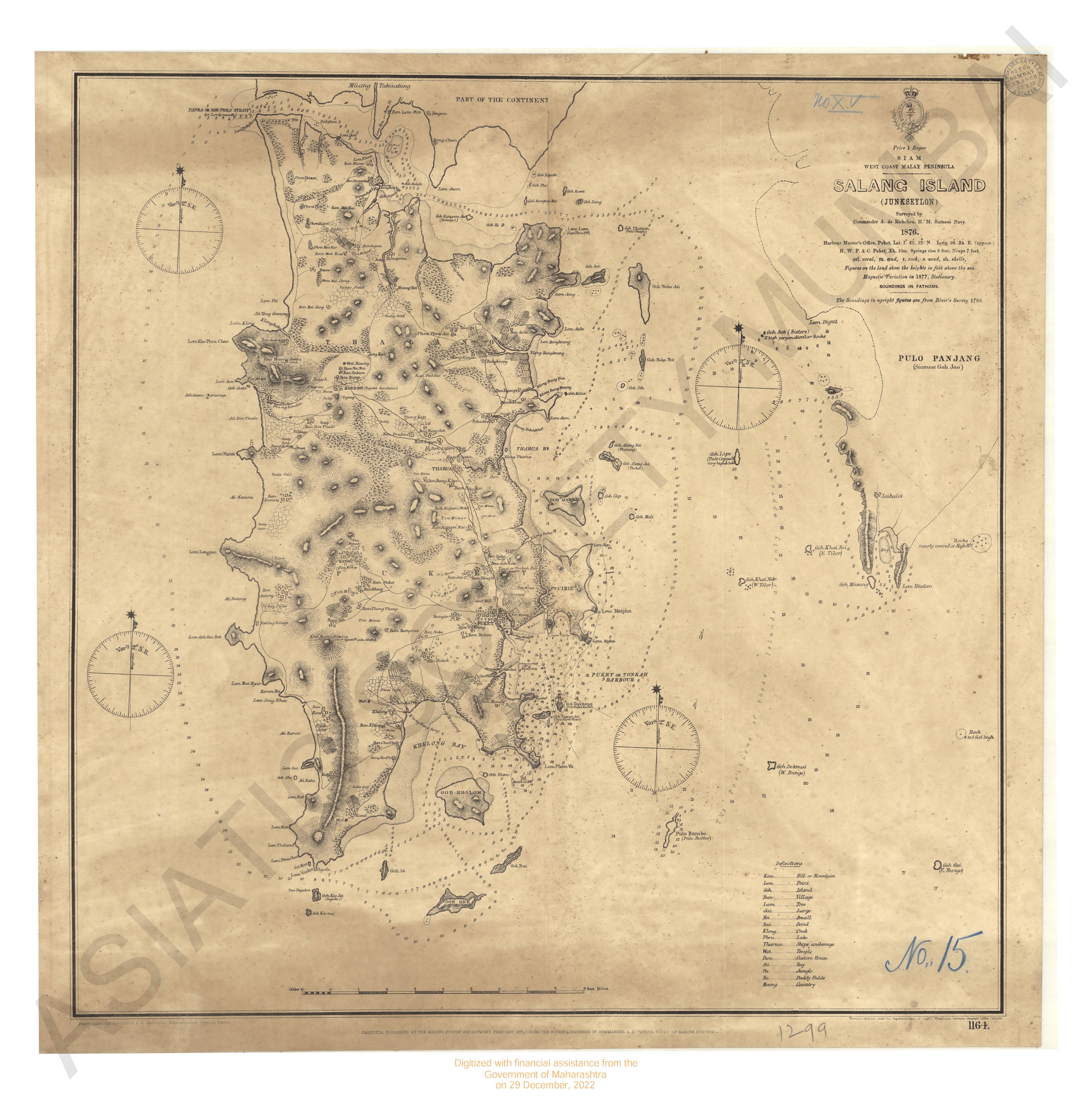
Sketch of the East coast of the Malay penisula 1820.
| Resource Type | : | Map |
| Year/Date of Publication | : | 1820 |
| Subject | : | Topographic Map |
| Language | : | English |
| Pages/Folios | : | 1 Map |
| Identifier | : | MAP_01316 |
| Digitization Sponsor | : | Government of Maharashtra |
| File Size | : | 1.6 M.B. |
Other Similar Items
-
- 2 Views
-
- 56 Views
- Mission to the East Coast of Sumatra, in M.DCCC.XXIII, ...
- Year: 1826
- Author: Anderson, John
-
- 2 Views
-
- 4 Views
-
- 69 Views
- A Voyage of Discovery to the North Pacific Ocean; in wh ...
- Year: 1804
- Author: Broughton, William Robert
-
- 59 Views
- European Settlements in the Far East; China, Japan, Cor ...
- Year: 1900
- Author: Smith, D. Warres
-
- 114 Views
- A New Voyage round the World describing particulary the ...
- Year: 1729
- Author: Dampier, William Capt.
-
- 2 Views
-
- 36 Views

- Extracts from a Journal written on the Coasts of Chilli ...
- Year: 1824
- Author: Hall, Basil Capt.
-
- 37 Views
- Extracts from a Journal written on the Coasts of Chilli ...
- Year: 1824
- Author: Hall, Basil Capt.
-
- 163 Views
- A True and Exact Description of the most Celebrated Eas ...
- Year: 1703
- Author: Baldaeus, Philip
-
- 18 Views
- Travels into Chile, over the Andes, in the years 1820 a ...
- Year: 1824
- Author: Schmidtmeyer, Peter