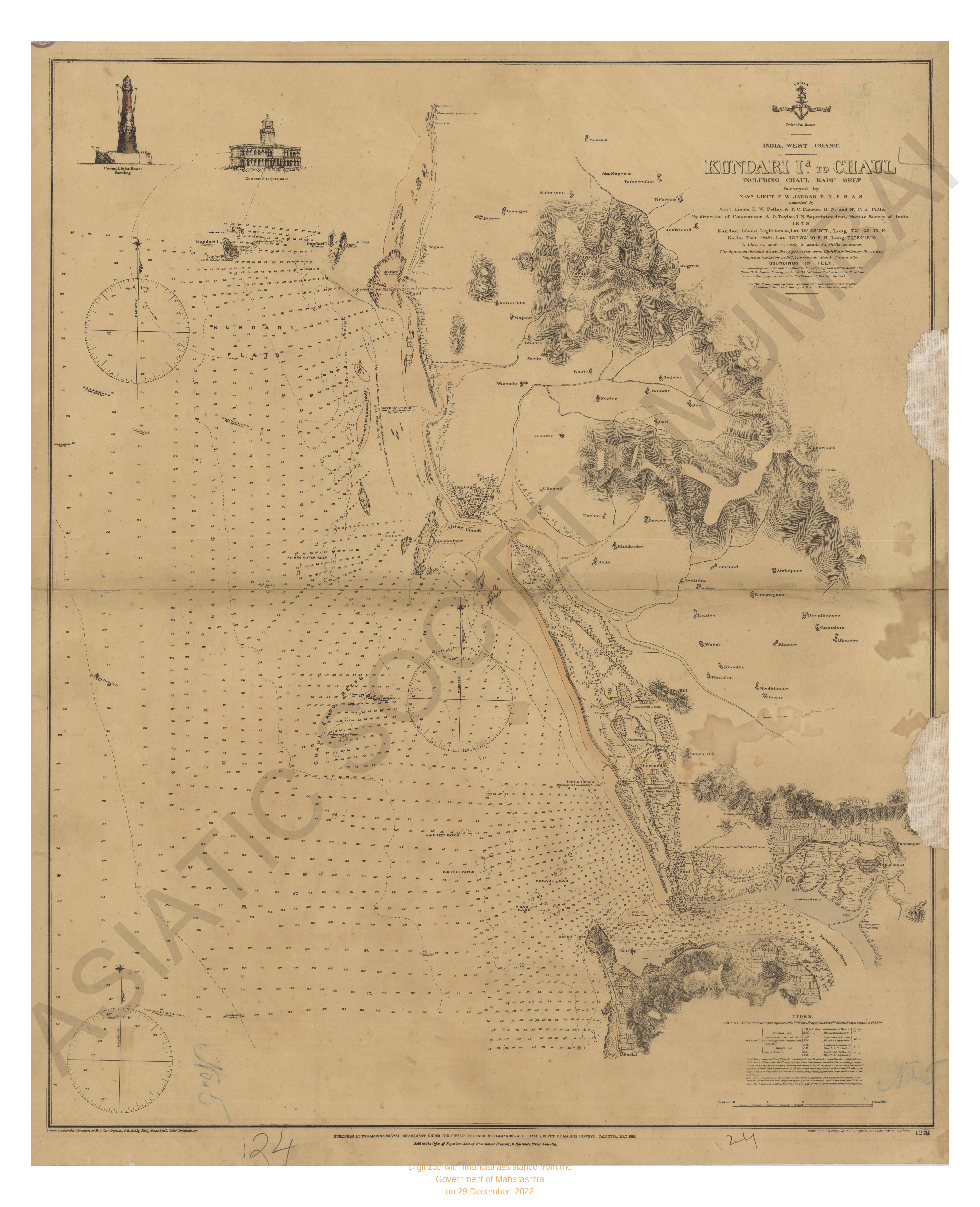
Chart of the Coast of Arracan from Akyab to long 70° 50' N,1833.
| Resource Type | : | Map |
| Year/Date of Publication | : | 1842 |
| Subject | : | Topographic Map |
| Publisher | : | James Horsburgh |
| Language | : | English |
| Pages/Folios | : | 1 Map |
| Identifier | : | MAP_0018 |
| Digitization Sponsor | : | Government of Maharashtra |
| File Size | : | 5.8 M.B. |
Other Similar Items
-
-
- Records of Fort St. George; James Strange's Journal and ...
- Year: 1928
- Author: India. Fort St. George Records; Strange, James
-
- Voyage to Abyssinia and Travels into the interior of th ...
- Author: Salt Henry
-
- A Particular Chart of the Coast of Iceland from Kiarlda ...
- Author: Bayly John
-
- A Voyage to Abyssinia and Travels into the Interior of ...
- Author: Salt, Henry
-
-
-

- A Reply to the Misrepresentations and Aspersions on the ...
- Year: 1832
- Author: Long, Charles Edward; Long, Charles Edward
-
-
- Chart of Part of the West Coast of Ceylan
- Year: 1798
-
-