-
-
-
-
-
-
-
-
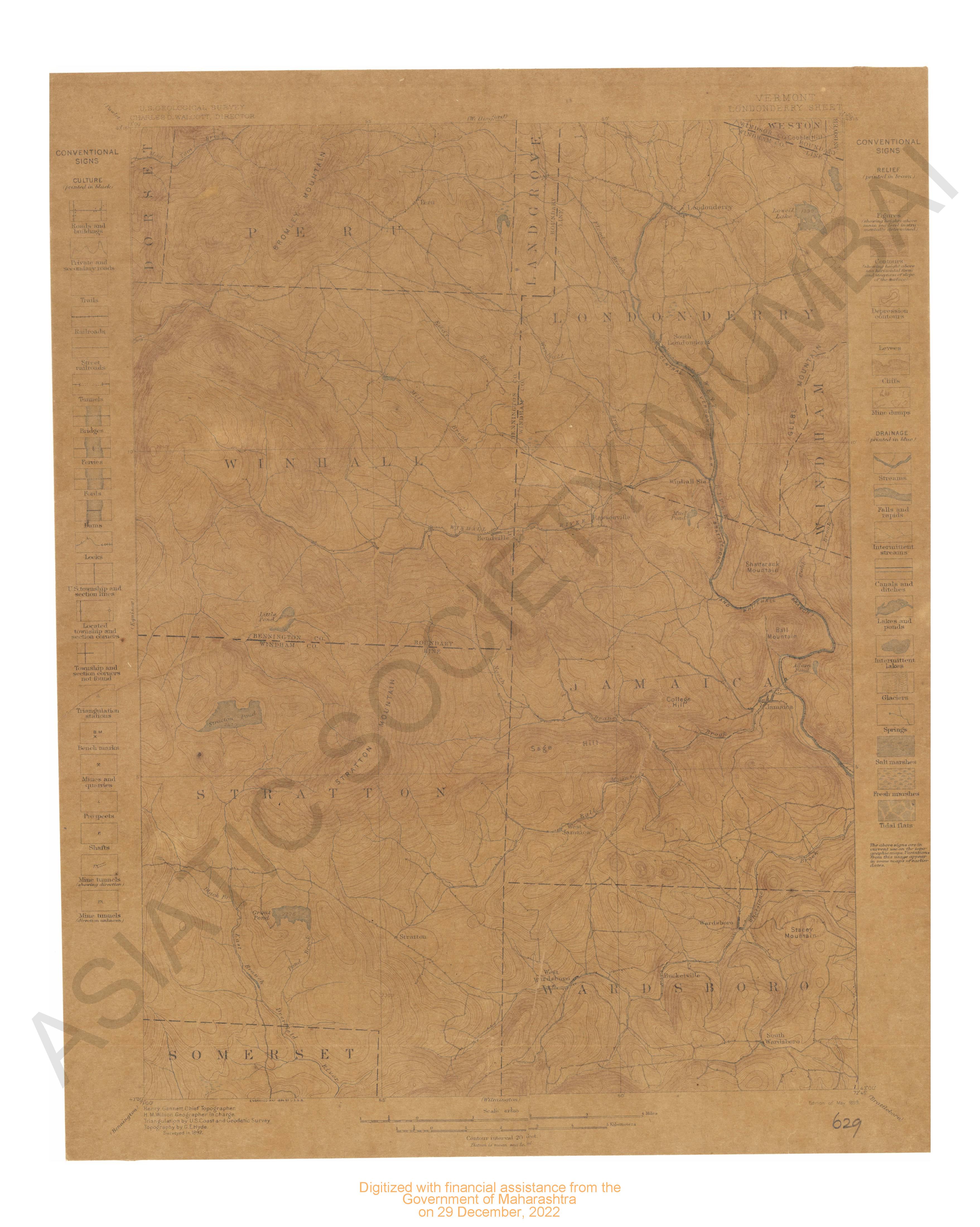
- Vermont Londonderry Sheet surveyed in 1892.
- Year: 1899
-
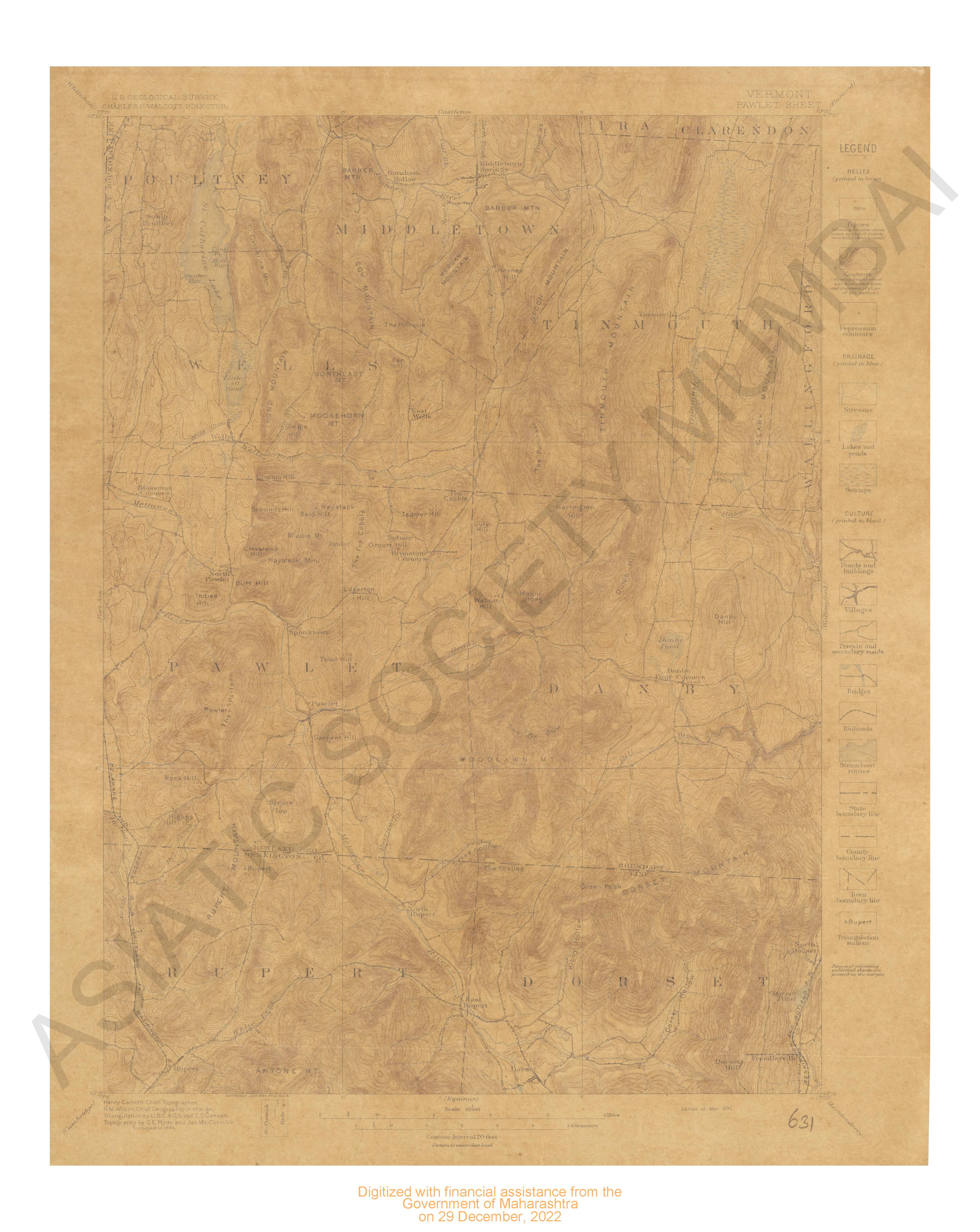
- Vermont Pawlet sheet surveyed in 1894.
- Year: 1897
-

-
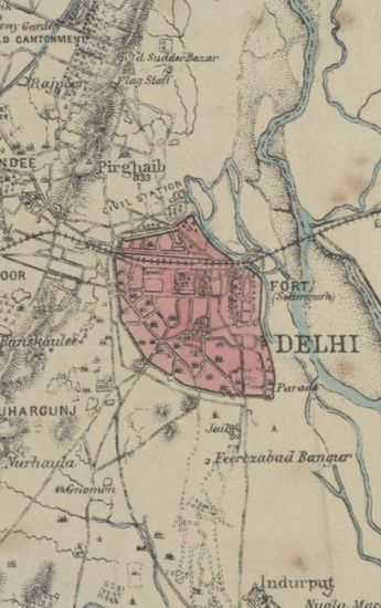
- Map of the Country Round Delhi to illustrate the History of the Imperial Assemblage, 1st January 1877
- Year: 1877
- Subject: History
- Publisher: Surveyor Generals Office, Calcutta
- Language: English
- Place of Publication: Calcutta
-
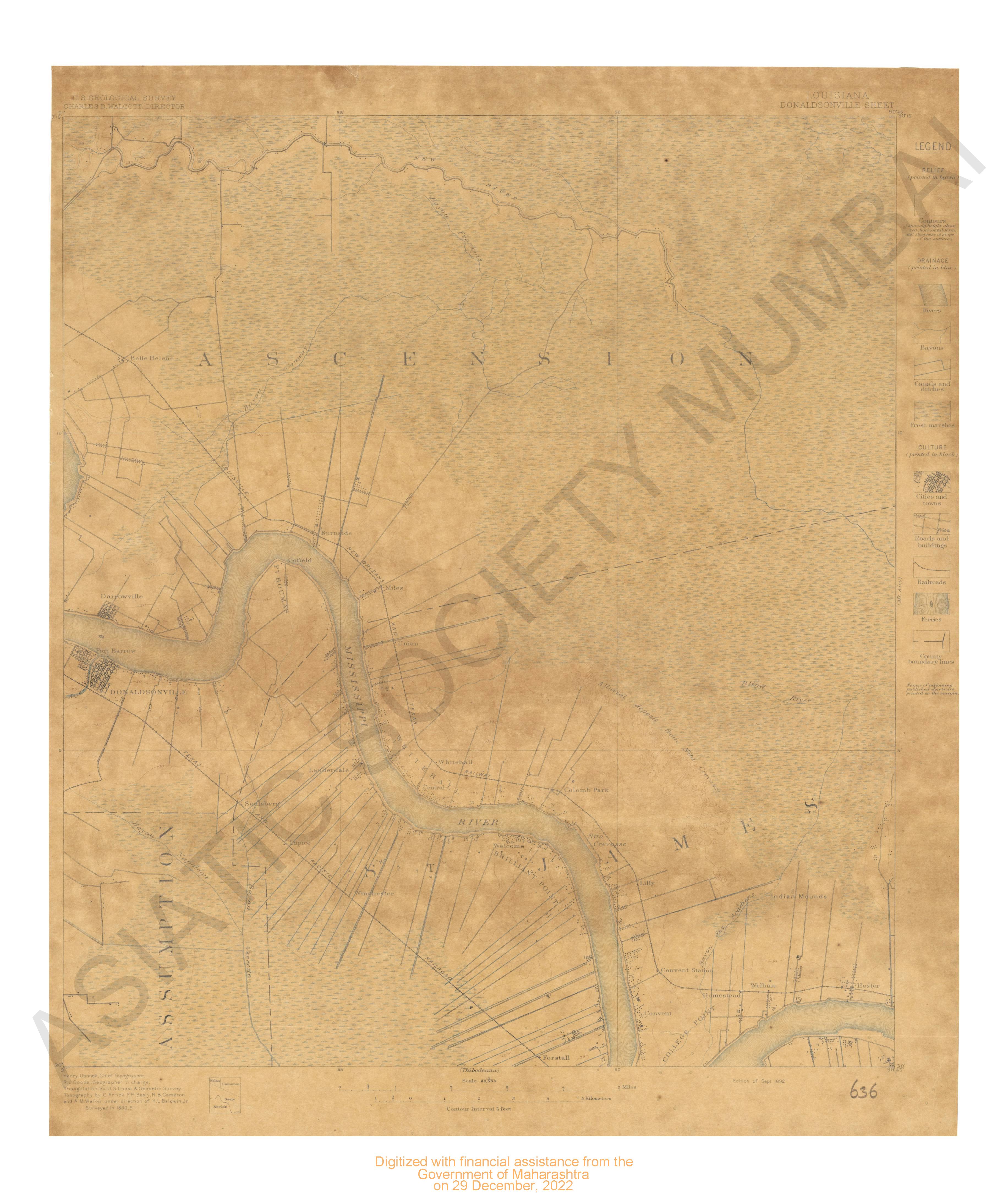
- Lousisana Donaldsonville Sheet surveyed in 1890
- Year: 1892
- Subject: USGS topography
- Publisher: US geogological survey
- Language: English
- Place of Publication: Washinton
-
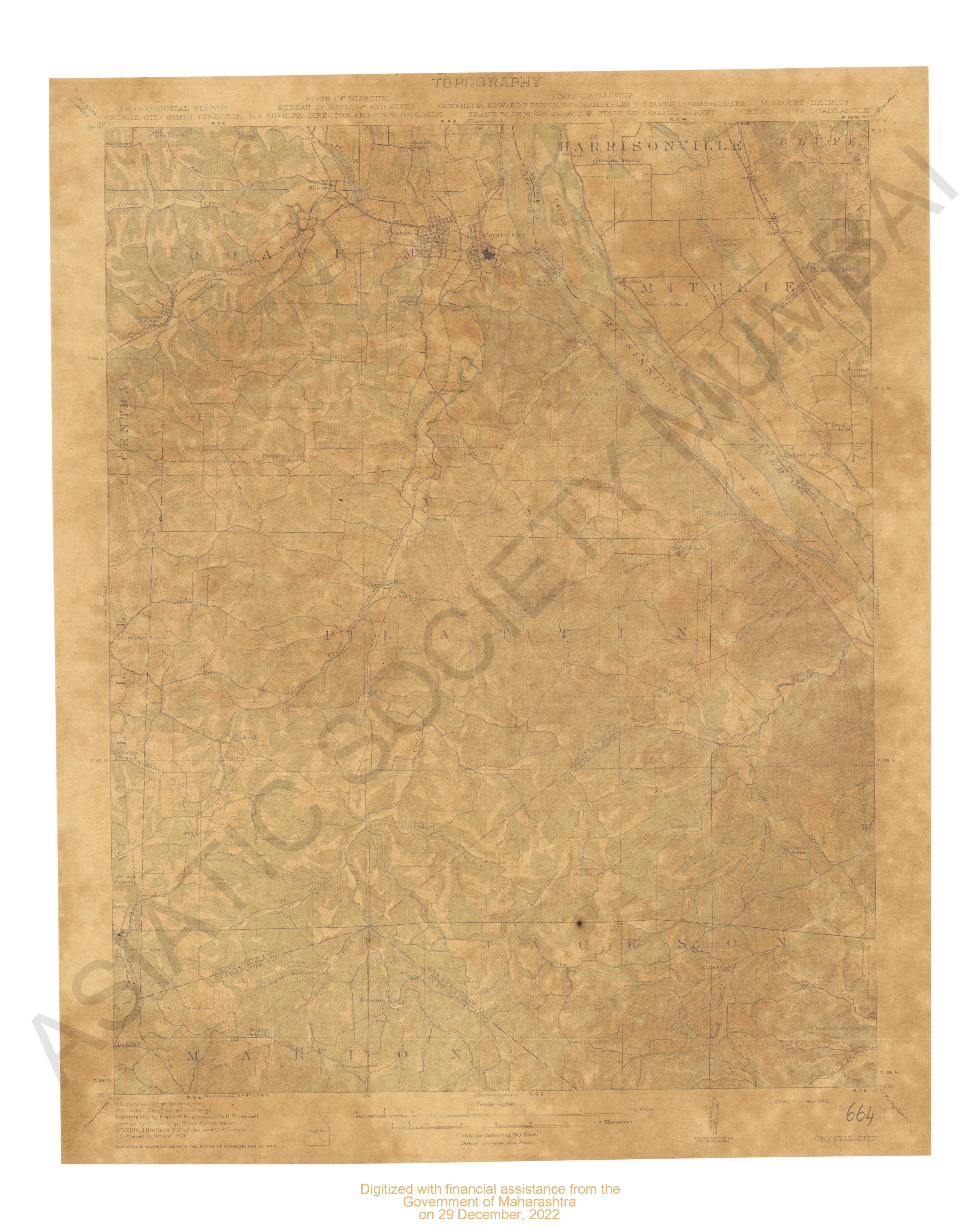
- Missouri-Illinois Crystal city quadrangle surveyed in 1911-13 in cooperation with the state of Missouri & Illionois.
- Year: 1915
- Subject: USGS topography
- Publisher: US geogological survey
- Language: English
- Place of Publication: Washinton
-
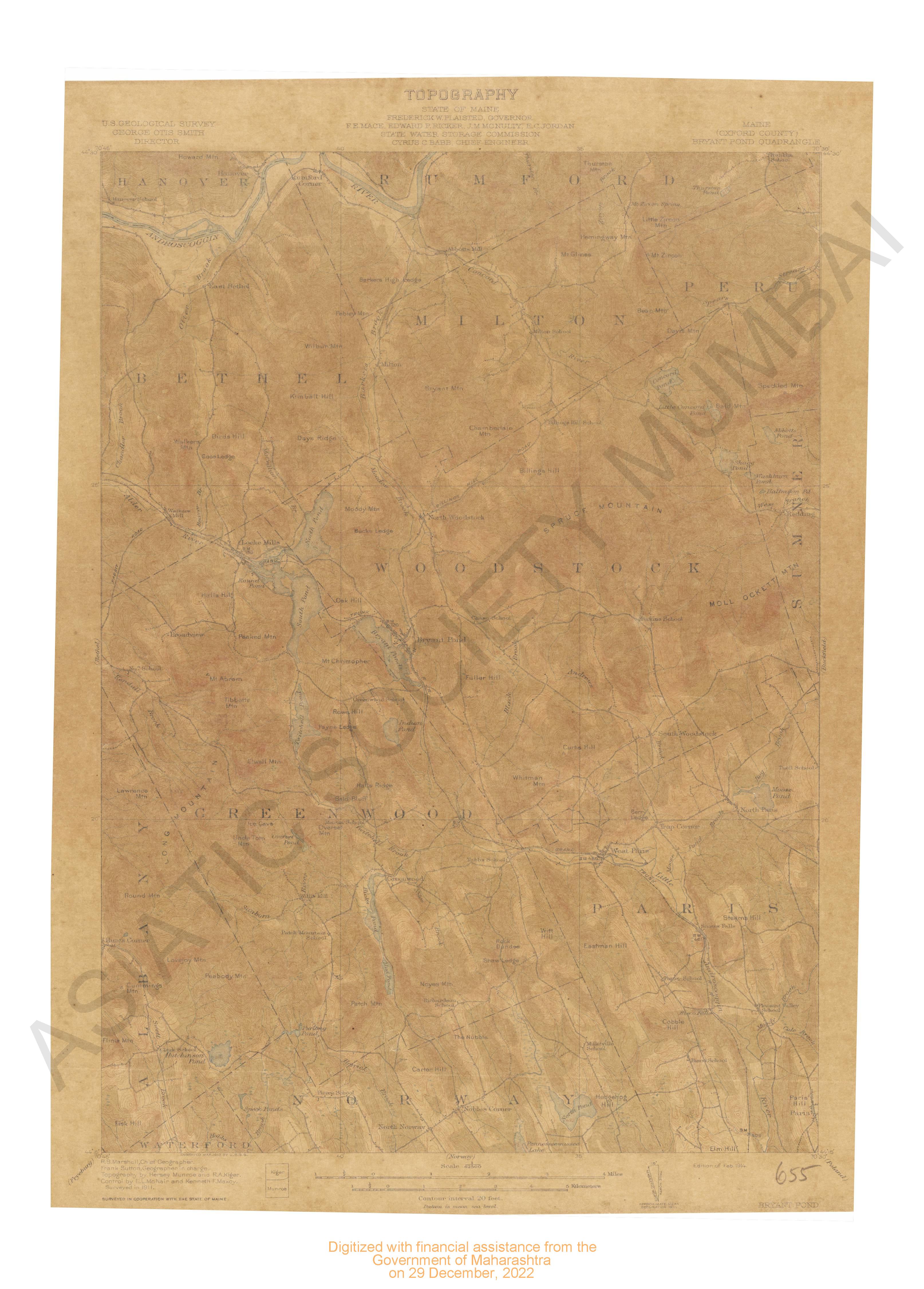
- Maine (Oxford county) Bryant pond quadrangle surveyed in 1911 in cooperation with the state of Maine.
- Year: 1914
- Subject: USGS topography
- Publisher: US geogological survey
- Language: English
- Place of Publication: Washinton
-
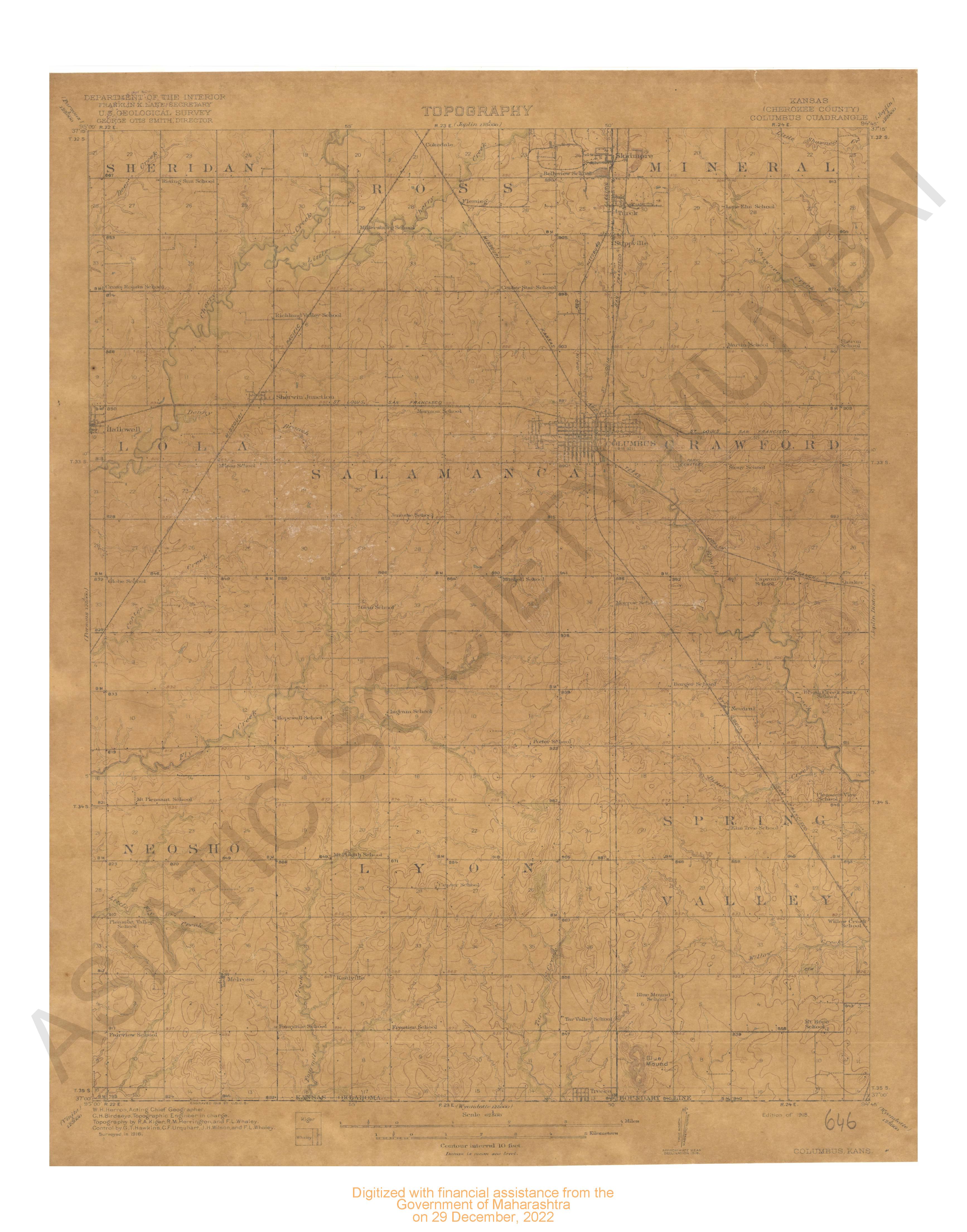
- Kansas (Cherokee county) Columbua quadrangle surveyed in 1916.
- Year: 1918
- Subject: USGS topography
- Publisher: US geogological survey
- Language: English
- Place of Publication: Washinton
-
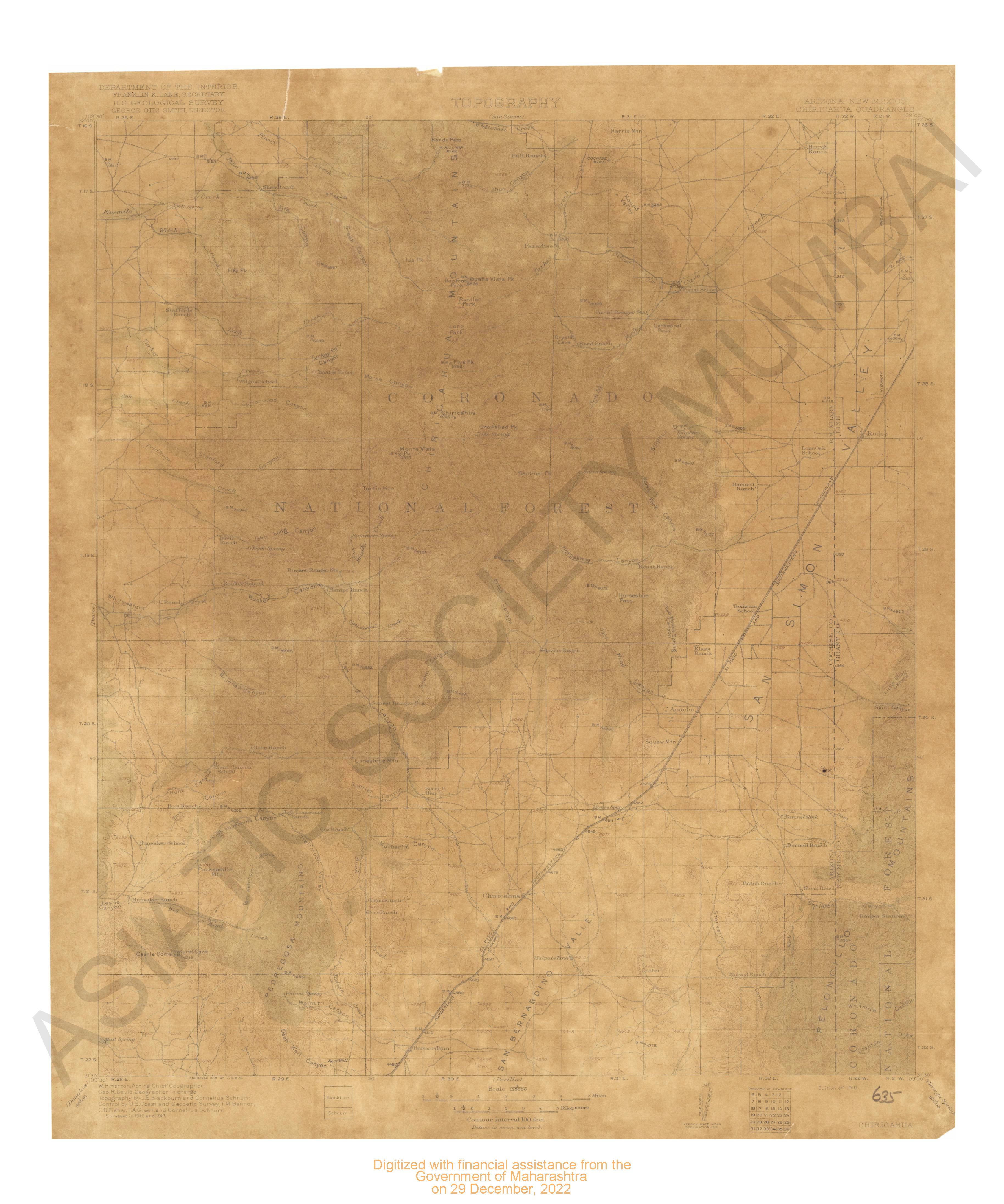
- Arizona New Mexico Chiricahua quadrangle 1916 & 1917.
- Year: 1919
- Subject: USGS topography
- Publisher: US geogological survey
- Language: English
- Place of Publication: Washinton
-
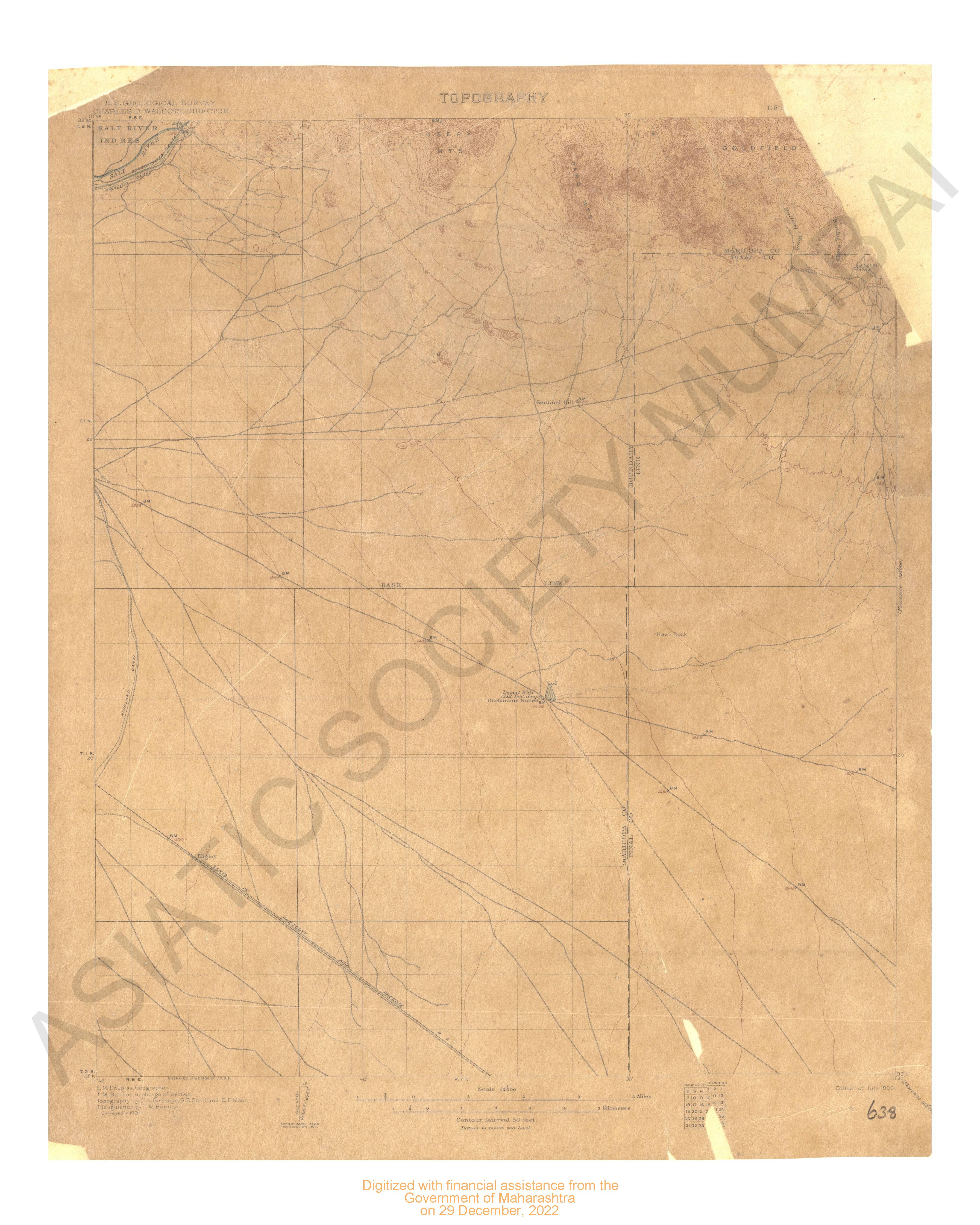
- Arizona Desert Well quadrangle surveyed in 1904
- Year: 1906
- Subject: USGS topography
- Publisher: US geogological survey
- Language: English
- Place of Publication: Washinton
-
- Vermont Londonderry Sheet surveyed in 1892.
- Year: 1899
- Subject: USGS topography
- Publisher: US geogological survey
- Language: English
- Place of Publication: Washinton
-
- Vermont Pawlet sheet surveyed in 1894.
- Year: 1897
- Subject: USGS topography
- Publisher: US geogological survey
- Language: English
- Place of Publication: Washinton
-
- Illinois-Missouri Campbell Hill Quadrangle Surveyed 1915-16 in Cooperation with the state of Illinois & Missouri
- Year: 1918
- Subject: Topographic Map
- Publisher: Washington US Geological Survey 1918
- Language: English
- Place of Publication: Washington