-
-
-
-

-
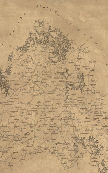
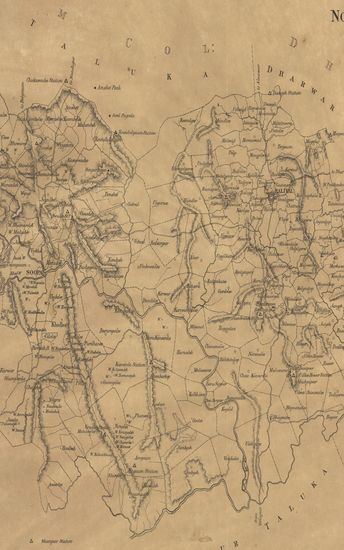
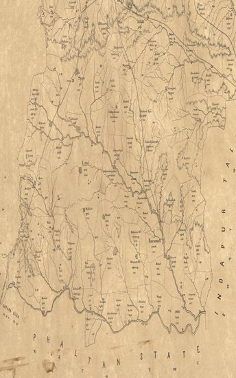
- Map of the Basim Taluka : west berar.
- Year: 1878
-
- Map of the Supa Taluka of North Kanara.
- Year: 1877
-
-
-
-
-
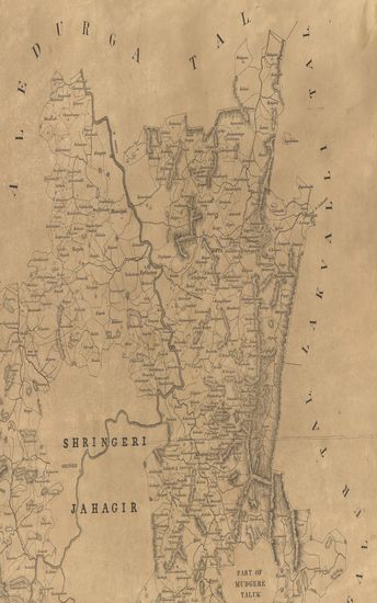
- Sketch map of the Koppa taluka of Kadur district, Nagar division Mysore - 1878
- Year: 1878
- Publisher: Poona (Pune) Photozincographed Government Office 1878
- Language: English
- Place of Publication: Poona (Pune)
-
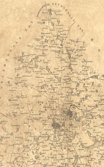
- Map of the Banglore Taluka of the Banagalore District, Nundydroog Divison Mysore.
- Year: 1878
- Publisher: Poona (Pune) Photozincographed Government Office 1878
- Language: English
- Place of Publication: Poona (Pune)
-
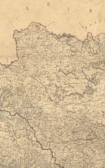
- District Nagpoor & Wardah 1858-60. Surveyor General of India.
- Year: 1864
- Publisher: Calcutta Surveyor General's Office 1864
- Language: English
- Place of Publication: Calcutta
-
- Map of the Alibagh Talook of the Tana Zilla.
- Subject: Topographic Map
- Publisher: Poona (Pune) Government Photozincographic Office
- Language: English
- Place of Publication: Poona (Pune)
-
- Map of the Basim Taluka : west berar.
- Year: 1878
- Publisher: Poona (Pune) Photozincographed Government Office 1878
- Language: English
- Place of Publication: Poona (Pune)
-
- Map of the Supa Taluka of North Kanara.
- Year: 1877
- Subject: Topographic Map
- Publisher: Poona (Pune) Government Photozincographic Office 1877
- Language: English
- Place of Publication: Poona (Pune)
-
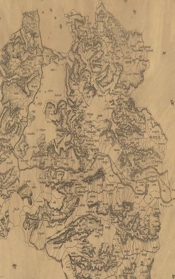
- नकाशा तालुके पाटण जिल्हा सातारा . - Map of the Patan Taluka Satara District.
- Year: 1875
- Subject: Topographic Map
- Publisher: Poona (Pune) Government Photozincographic Office 1875
- Language: English
- Place of Publication: Poona (Pune)
-
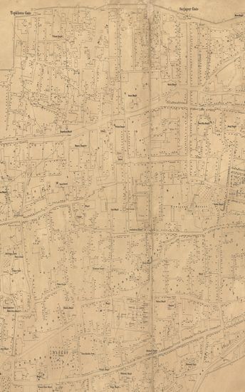
- Plan of Ahmednagar City, Surveyed in Season 1877- 78. Deccan Topographical Survey.
- Year: 1879
- Subject: Topographic Map
- Publisher: Poona (Pune) Government Photozincographic Office 1879
- Language: English
- Place of Publication: Poona (Pune)
-
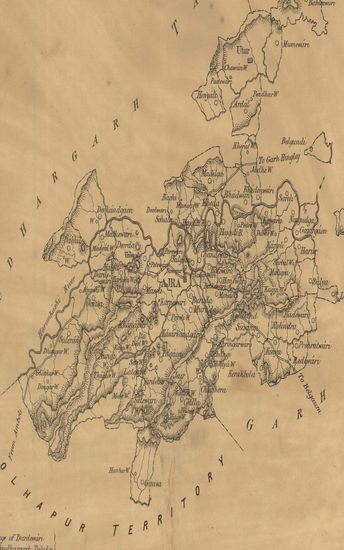
- Map of the Ajra taluka of the Inchalkaranji Jaghir of the Kolhapur State.
- Year: 1880
- Subject: Topographic Map
- Publisher: Poona (Pune) Government Photozincographic Office 1880
- Language: English
- Place of Publication: Poona (Pune)
-
- Map of the Bhimthadi Taluka of the Poona (Pune) Zilla.
- Year: 1874
- Subject: Topographic Map
- Publisher: Poona (Pune) Government Photozincographic Office 1874
- Language: English
- Place of Publication: Poona (Pune)