-
-
-
- Map of the Yeotmal Taluka, East Berar.
- Year: 1875
-
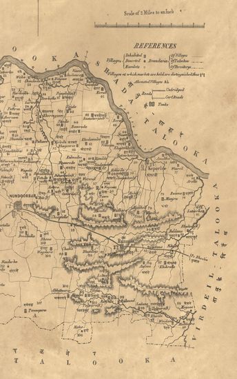
- Map of the Nandurbar taluka: Khandesh
- Year: 1869
-
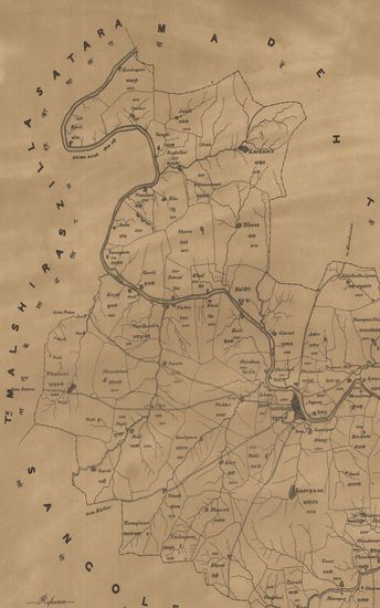
- Map of the Belgaum taluka of the Belgaum
- Year: 1878
-
-
-

-
-
-
- Map of the Pandharpur Taluka of the Sholapur (Solapur) Zilla. - पंढरपूर तालुका जिल्हा सोलापूर .
- Year: 1872
- Subject: Topographic Map
- Publisher: Poona (Pune) Government Photozincographic Office 1872
- Language: English
- Place of Publication: Poona (Pune)
-
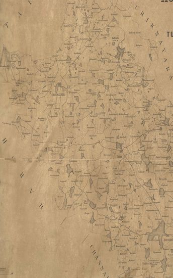
- Sketh Map of the Honnavalli Taluka of the Tumkur District Nandidrug Division, Mysore Territory. 1877
- Year: 1877
- Subject: Topographic Map
- Publisher: Poona (Pune) Government Photozincographic Office 1877
- Language: English
- Place of Publication: Poona (Pune)
-
- Map of the Yeotmal Taluka, East Berar.
- Year: 1875
- Subject: Topographic Map
- Publisher: Poona (Pune) Government Photozincographic Office 1875
- Language: English
- Place of Publication: Poona (Pune)
-
- Map of the Nandurbar taluka: Khandesh
- Year: 1869
- Subject: Topographic Map
- Publisher: Poona (Pune) Government Photozincographic Office 1869
- Language: English
- Place of Publication: Poona (Pune)
-
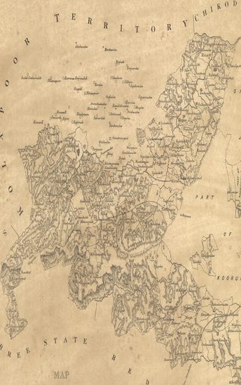
- Map of the Belgaum taluka of the Belgaum
- Year: 1878
- Subject: Topographic Map
- Publisher: Poona (Pune) Government Photozincographic Office 1878
- Language: English
- Place of Publication: Poona (Pune)
-
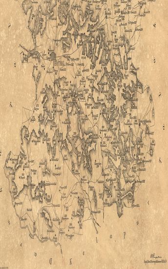
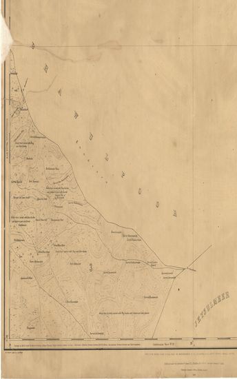
- District Rohree Surveyed in 1856-57. Sind Revenue Survey (Sheet No.6)
- Year: 1869
- Publisher: Calcutta Surveyor General's Office 1869
- Language: English
- Place of Publication: Calcutta
-
- Map of the Chitaldroog District of the Nagar Division, Mysore. 1877.
- Year: 1878
- Publisher: Poona (Pune) Photozincographed Government Office 1878
- Language: English
- Place of Publication: Poona (Pune)
-
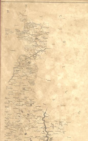
- Map of the Indapur taluka of the Poona (Pune) Zilla.
- Subject: Topographic Map
- Language: English
-
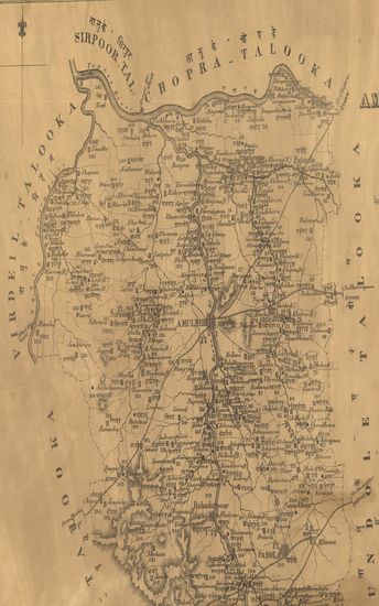
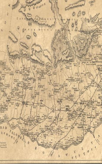
- Map of the Amulneir Taluka, Khandesh including the Petta of Parola. - नकाशा तालुके अमळनेर जिल्हा खानदेश .
- Year: 1869
- Subject: Topographic Map
- Publisher: Poona (Pune) Government Photozincographic Office 1869
- Language: English
- Place of Publication: Poona (Pune)
-
- Map of the Sowda Taluka, Khandesh Collectorate including the Pettas of Ravere & Yawul.
- Year: 1871
- Subject: Topographic Map
- Publisher: Poona (Pune) Government Photozincographic Office 1871
- Language: English
- Place of Publication: Poona (Pune)