-
-

-
-
-
-

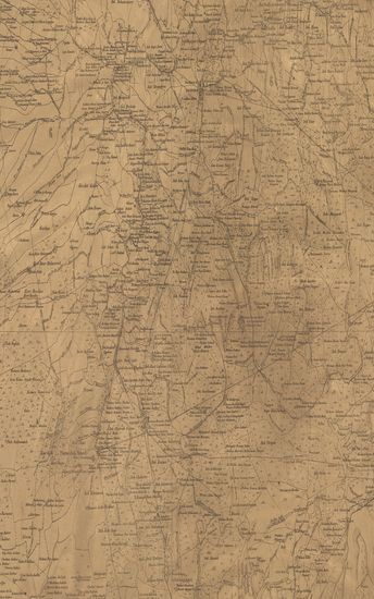
- Map of the Shahpur Taluka, Thana Zilla.
- Year: 1873
-
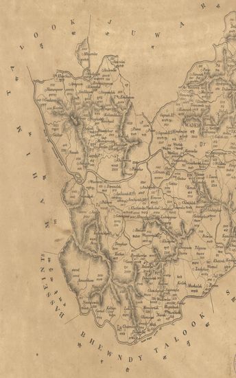
- Map of the Wadeh Talooka, Tana Zilla.
- Year: 1873
-
-
-

-
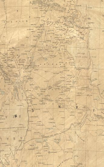
- Turkestan with adjoining portions of the British, Russian and Native Territories. (Sheet No. 3)
- Year: 1873
- Publisher: Dehradun Surveyor General's Office 1873
- Language: English
- Place of Publication: Dehradun
-
- Map of the Nusseerabad (Nussirabad) Taluka, Khandesh Collectorate. - नकाशा तालुके नशीराबाद जिल्हा खानदेश .
- Year: 1868
- Subject: Topographic Map
- Publisher: Poona (Pune) Government Photozincographic Office 1868
- Language: English
- Place of Publication: Poona (Pune)
-
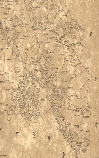
- नकाशा तालुके मंगरूळ जिल्हा वराड . - Map of the Taluka Mangrul District Varad .
- Year: 1875
- Subject: Topographic Map
- Publisher: Poona (Pune) Government Photozincographic Office 1875
- Language: English
- Place of Publication: Poona (Pune)
-
- District Kurrachee (Karachi) & Sehwan Surveyed in 1863-64. Sind Revenue Survey (Sheet No.52)
- Year: 1870
- Subject: Cadastral Map
- Publisher: Calcutta Surveyor General's Office 1870
- Language: English
- Place of Publication: Calcutta
-
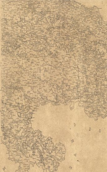
- Map of the Hyderabad Assigned Districts. Eastern Portion
- Year: 1877
- Subject: Topographic Map
- Publisher: Poona (Pune) Government Photozincographic Office 1877
- Language: English
- Place of Publication: Poona (Pune)
-
- Map of the Shahpur Taluka, Thana Zilla.
- Year: 1873
- Subject: Topographic Map
- Publisher: Poona (Pune) Government Photozincographic Office 1873
- Language: English
- Place of Publication: Poona (Pune)
-
- Map of the Wadeh Talooka, Tana Zilla.
- Year: 1873
- Subject: Topographic Map
- Publisher: Poona (Pune) Government Photozincographic Office 1873
- Language: English
- Place of Publication: Poona (Pune)
-
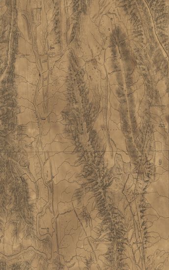
- Districts Mehur, Sehwan, & Naushera Surveyed in 1861-62-63. Sind Revenue Survey (Sheet No.27)
- Year: 1870
- Publisher: Calcutta Surveyor General's Office 1870
- Language: English
- Place of Publication: Calcutta
-
- District Rohuree Surveyed in 1856-57. Sind Revenue Survey (Sheet No.19)
- Publisher: Calcutta Surveyor General's Office
- Language: English
- Place of Publication: Calcutta
-
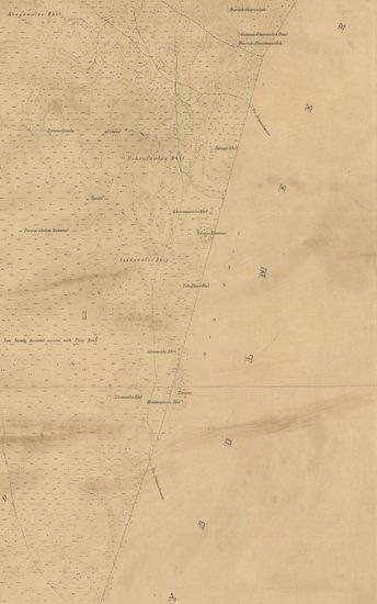
- Trignometrical Survey of the Western Sides of Palk's Straits, 1838.
- Year: 1846
- Language: English