-
-
-
-
- India : Telegraph Map of 1894. (Sheet No. 6)
- Year: 1894
-
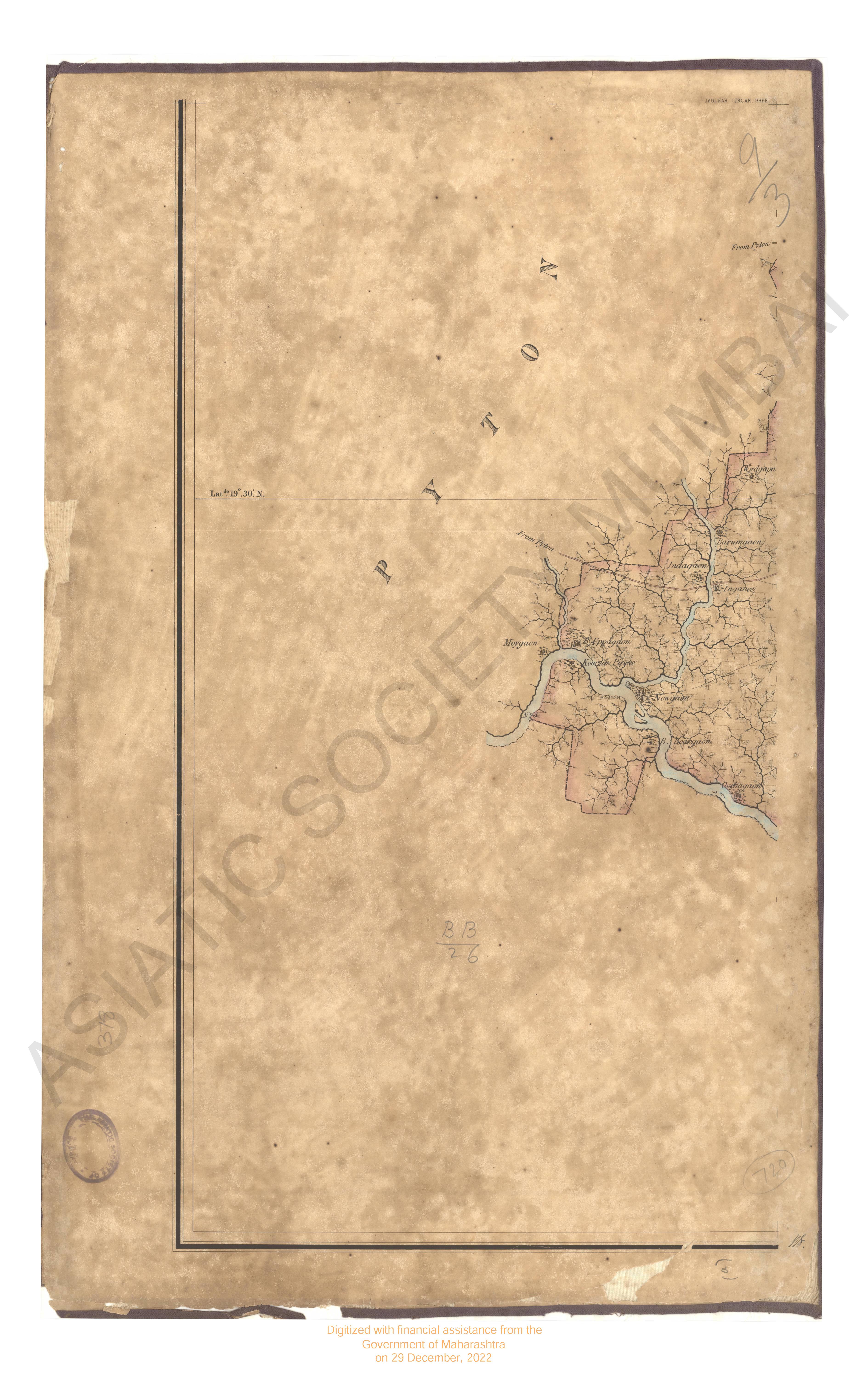
- Map of the Jaulnah Circar in the 1842 & 43
- Year: 1845
-
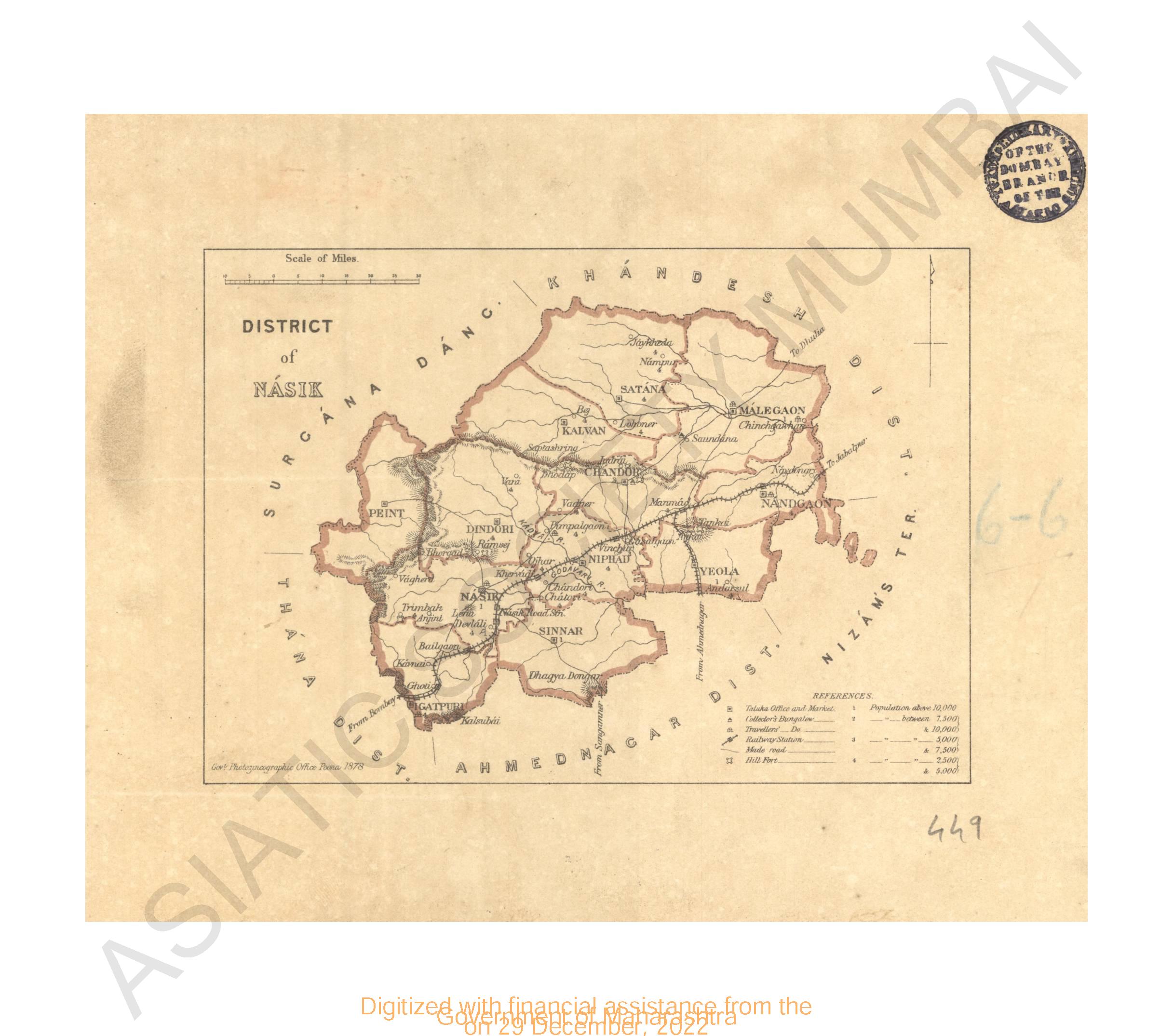
- District of Nasik
- Year: 1878
-
-
-
-
- Allahabad, cantoments, city and environs of
- Year: 1869
-
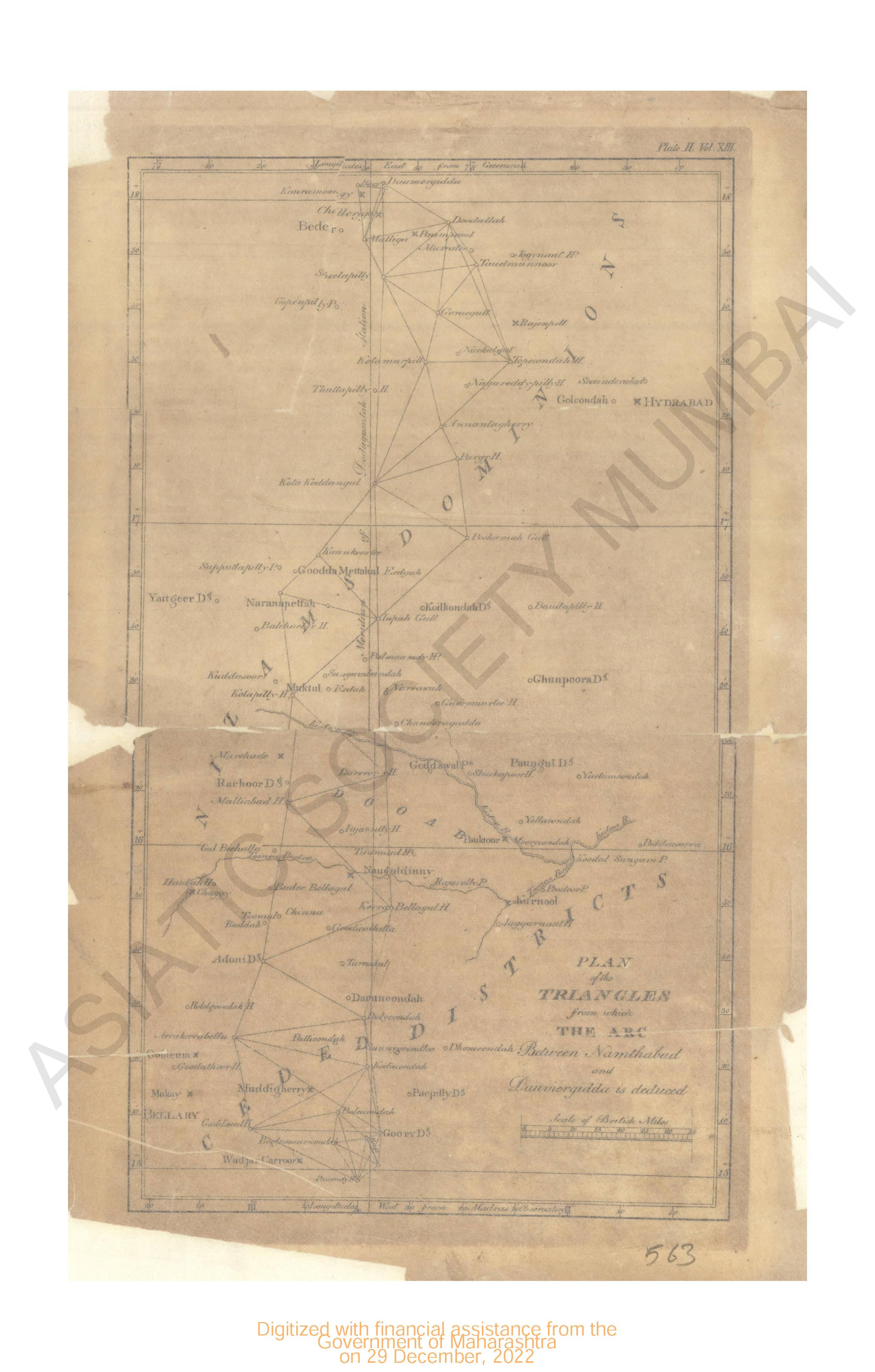
- Plan of the Triangles from which the arc between Lutchapolliam & Namthabad is deduced.
- Year: 1817
- Subject: Topographic Map
- Publisher: John Murray
- Language: English
- Place of Publication: London
-
- Plan of the Triangles from which the arc between Lutchapolliam & Vunnae is deduced.
- Year: 1817
- Subject: Topographic Map
- Publisher: John Murray
- Language: English
- Place of Publication: London
-
- Plan of the Triangles from which the arc between Lutchapolliam & Vunnae is deduced.
- Year: 1817
- Subject: Topographic Map
- Publisher: John Murray
- Language: English
- Place of Publication: London
-
- India : Telegraph Map of 1894. (Sheet No. 6)
- Year: 1894
- Subject: Topographic Map
- Publisher: Surveyor General's office
- Language: English
- Place of Publication: Calcutta
-
- Map of the Jaulnah Circar in the 1842 & 43
- Year: 1845
- Subject: Topographic Map
- Publisher: Surveyors General's
- Language: English
- Place of Publication: Allahabad
-
- District of Nasik
- Year: 1878
- Subject: Topographic Map
- Publisher: Government Photozincographic office
- Language: English
- Place of Publication: Poona (Pune)
-
- Plan of the Triangles from which the Arc between Namthabad & Daumeregidda is deduced.
- Subject: Topographic Map
- Language: English
-
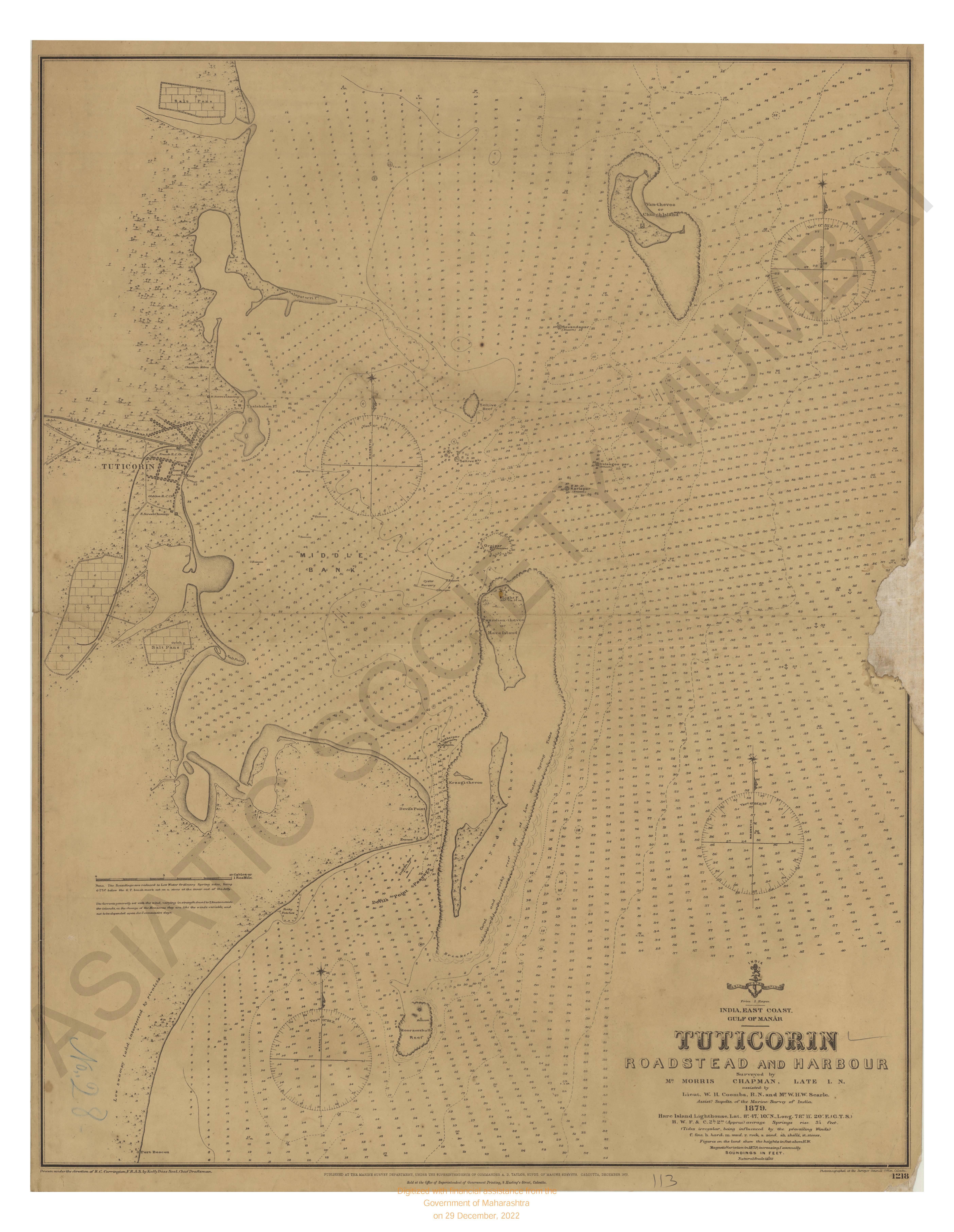
- India East Coast; Gulf of Manar ; Tulicorin roadstead & harbour. Surveyed in 1879.
- Year: 1879
- Subject: Topographic Map
- Publisher: Marine Surveyor Department
- Language: English
- Place of Publication: Calcutta
-
- India- west coast (sheet-1) karanchi to vingorla
- Year: 1887
- Subject: Topographic Map
- Publisher: Marine Surveyor Department
- Language: English
- Place of Publication: Calcutta
-
- Allahabad, cantoments, city and environs of
- Year: 1869
- Subject: Topographic Map
- Publisher: Surveyor General's
- Language: English
- Place of Publication: Calcutta