-
- Plan of the city of Poona
- Year: 1868
-
-
-
-
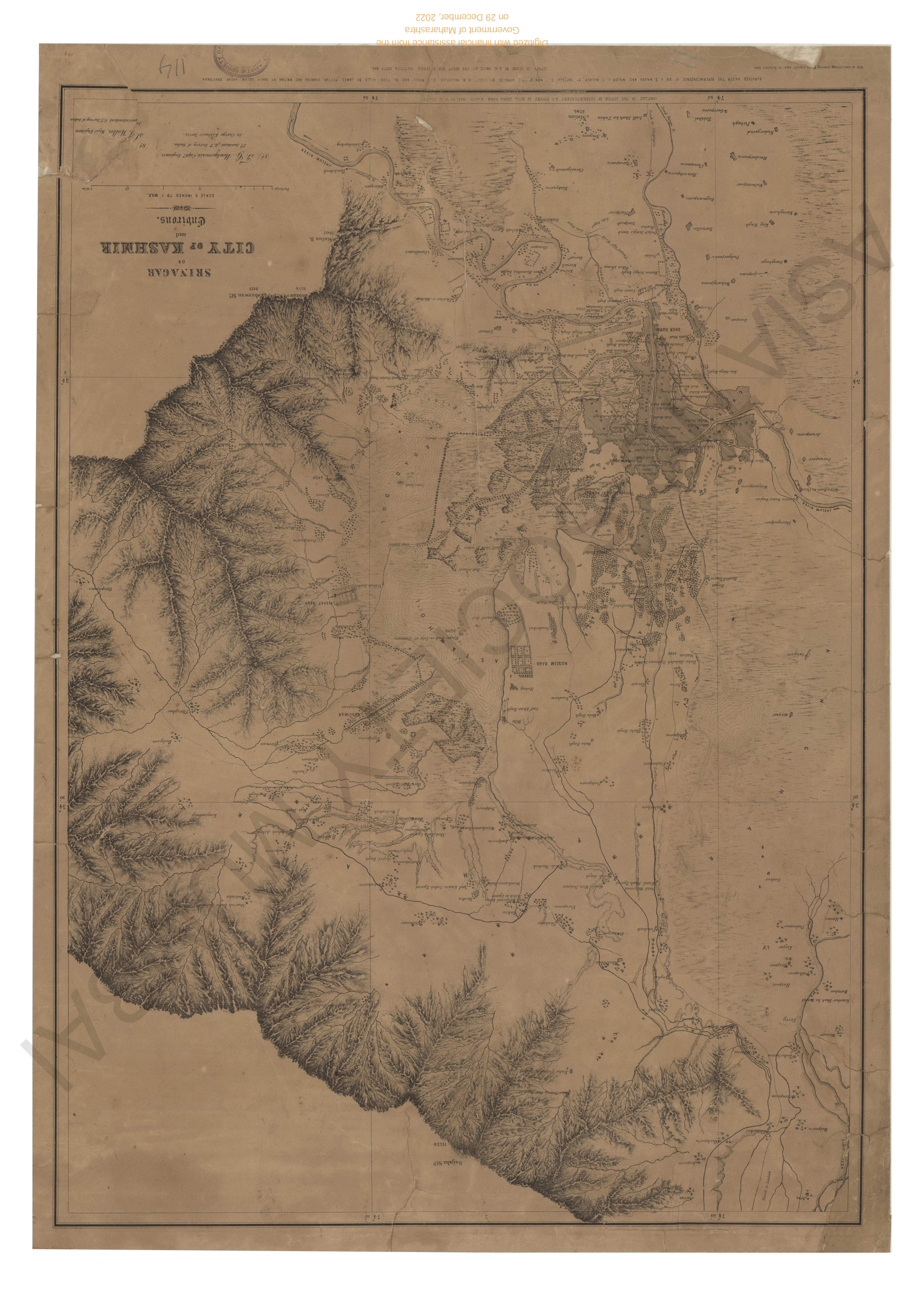
- Srinagar, or city of Kashmir & environs
- Year: 1863
-
-
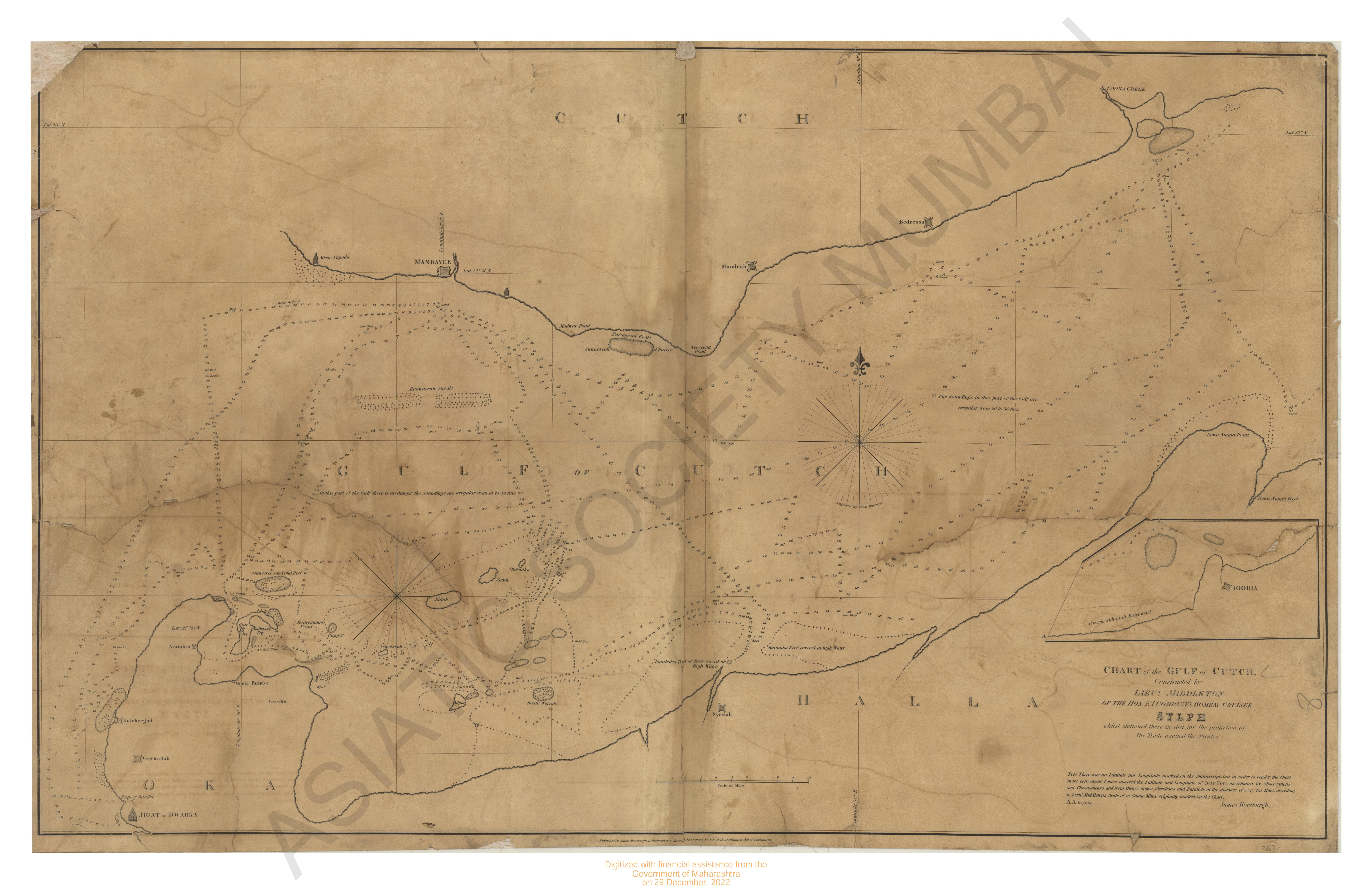
- Chart of Gulf of Cutch.
- Year: 1823
-
-
-
-
- Plan of the city of Poona
- Year: 1868
- Subject: Topographic Map
- Publisher: Surveyor General's
- Language: English
-
- India- East coast. Narsapur point to palmyras point ( the Vizagapatam, Ganjam & orissa coast)
- Year: 1877
- Subject: Topographic Map
- Publisher: Marine Surveyor Department
- Language: English
- Place of Publication: Calcutta
-
- India- west coast; Kundhari id to chart including chart kadu reef.
- Year: 1880
- Subject: Topographic Map
- Publisher: Marine Surveyor Department
- Language: English
- Place of Publication: Calcutta
-
- India- West coast. Rajpur bay and viziadurg with adjacent coast.
- Year: 1879
- Subject: Topographic Map
- Publisher: Marine Surveyor Department
- Language: English
- Place of Publication: Calcutta
-
- Srinagar, or city of Kashmir & environs
- Year: 1863
- Subject: Topographic Map
- Publisher: Surveyor General's
- Language: English
- Place of Publication: Calcutta
-
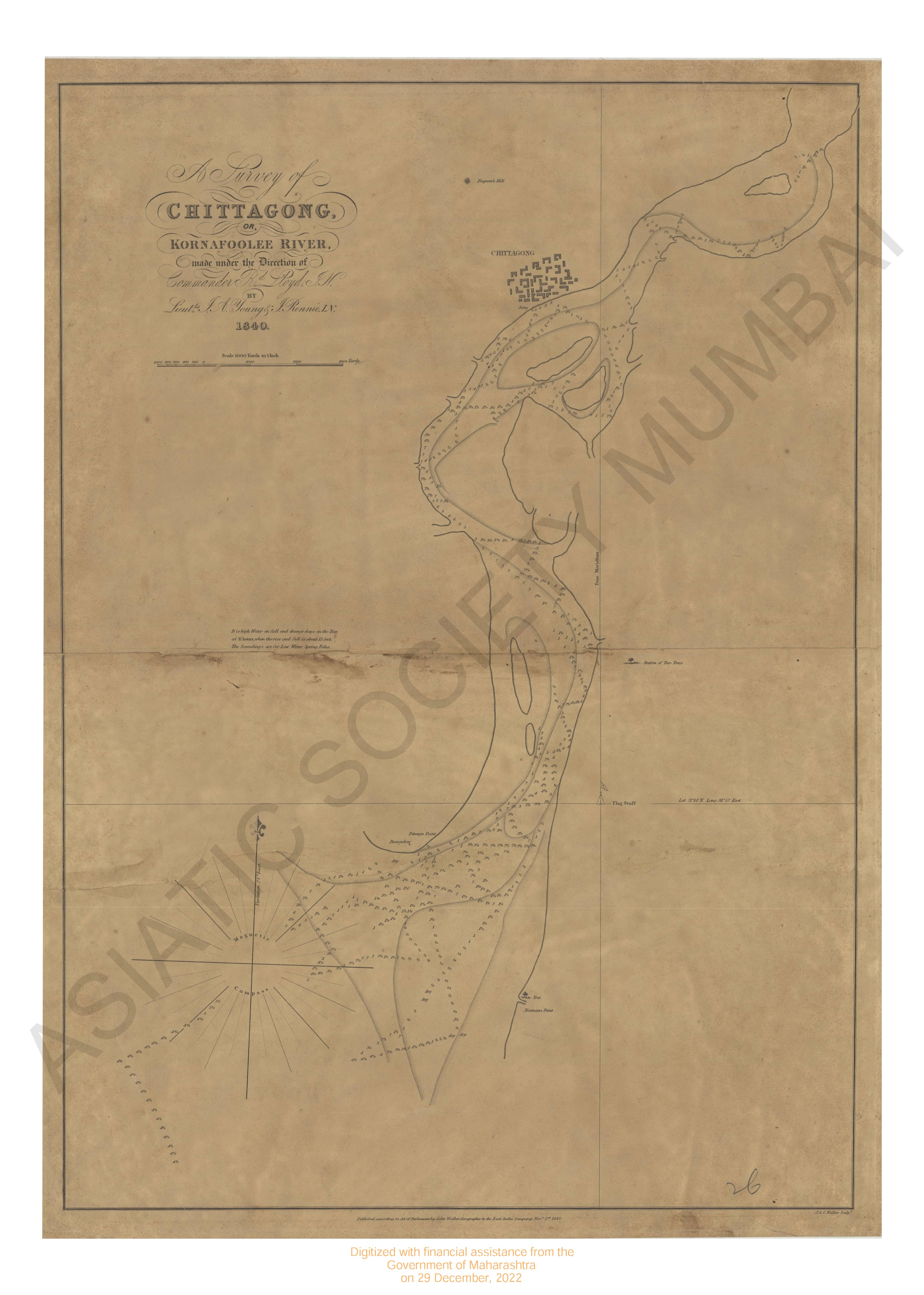
- Chittagong or Komafoolee river, survey of 1840.
- Year: 1842
- Subject: Topographic Map
- Publisher: John Walker
- Language: English
-
- Chart of Gulf of Cutch.
- Year: 1823
- Subject: Topographic Map
- Publisher: James Horsburgh
- Language: English
-
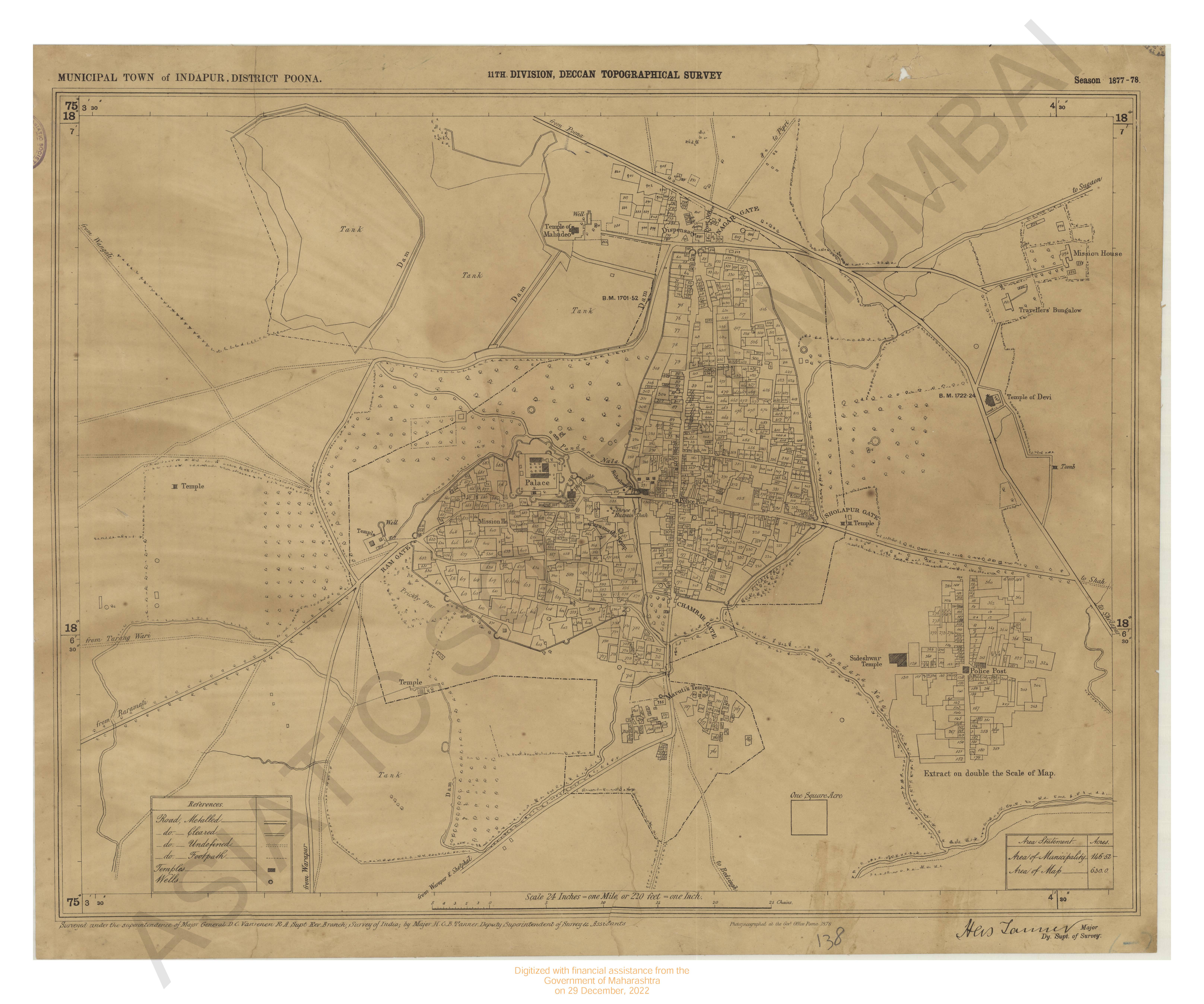
- Poona district, indapur municipal town of 11th division Deccan topographical survey season 1877-78
- Year: 1878
- Subject: Topographic Map
- Publisher: Government Photzincographic office
- Language: English
- Place of Publication: Poona
-
- Sholapur, city & cantoment, Map of Deccan tographical survey surveyed in season 1879
- Year: 1880
- Subject: Topographic Map
- Publisher: Government Photzincographic office
- Language: English
- Place of Publication: Poona
-
- British Burma, Pegu, preparis North channel and entrance to Bassein river, 1879.
- Year: 1879
- Subject: Topographic Map
- Publisher: The Marine Survey dept
- Language: English
- Place of Publication: Calcutta