-
-
-
-
- Environs Calcutta, Sheet No.3
- Year: 1861
-
- Environs Calcutta, Sheet No.4
- Year: 1861
-
-

-
-
-
-
- Map of the plateau of Mount Aboo in Rajpootana,1870.
- Year: 1871
- Subject: Topographic Map
- Publisher: Surveyor General's Office
- Language: English
- Place of Publication: Calcutta
-
- Mount Aboo in Rajpootana; map of the Plateaux of 1870
- Year: 1871
- Subject: Topographic Map
- Publisher: Surveyor General's
- Language: English
- Place of Publication: Calcutta
-
- Map of the Viramgam Taluka, Ahmedabad district
- Year: 1878
- Subject: Topographic Map
- Publisher: Government Office
- Language: English
- Place of Publication: Poona (Pune)
-
- Environs Calcutta, Sheet No.3
- Year: 1861
- Subject: Topographic Map
- Publisher: Surveyor General's
- Language: English
- Place of Publication: Calcutta
-
- Environs Calcutta, Sheet No.4
- Year: 1861
- Subject: Topographic Map
- Publisher: Surveyor General's
- Language: English
- Place of Publication: Calcutta
-
- Turkestan with the adjoining portions of the British and Russina and Native territories, Sheet No.3
- Year: 1868
- Subject: Topographic Map
- Publisher: Office of the Great Trigonometrical survey of India
- Language: English
- Place of Publication: Dehra Doon (Dehradun)
-
- Districts Bunno and Derah Ishmaeel Khan with the kabul kheyl and Mahsood Wuhsood Wuzeree Hills. Upper Derahjat 1856-61.
- Year: 1864
- Subject: Topographic Map
- Publisher: Marine Surveyor Department
- Language: English
- Place of Publication: Calcutta
-
- Turkestan and the countries between the British and the Russian dominions in Asia 4th ed. Sheet No.3
- Year: 1879
- Subject: Topographic Map
- Publisher: Office of the Great Trigonometrical survey of India
- Language: English
- Place of Publication: Dehradun
-
- Turkestan with the adjoining portions of the British, Russina and Native territories, Sheet No.1
- Year: 1873
- Subject: Topographic Map
- Publisher: Office of the Great Trigonometrical survey of India
- Language: English
- Place of Publication: Dehradun
-
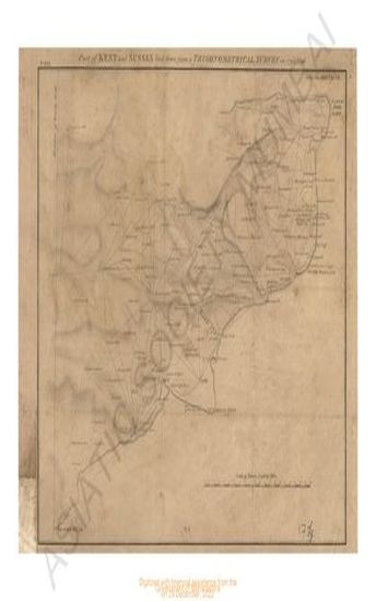
- Kent and sussex part of; land down from a trigonometrical survey in 1795-96.
- Year: 1796
- Subject: Topographic Map
- Publisher: Surveyor general office
- Language: English