-
- Trigonometrical survey of Pauban Pass
- Year: 1839
-
-
-
-
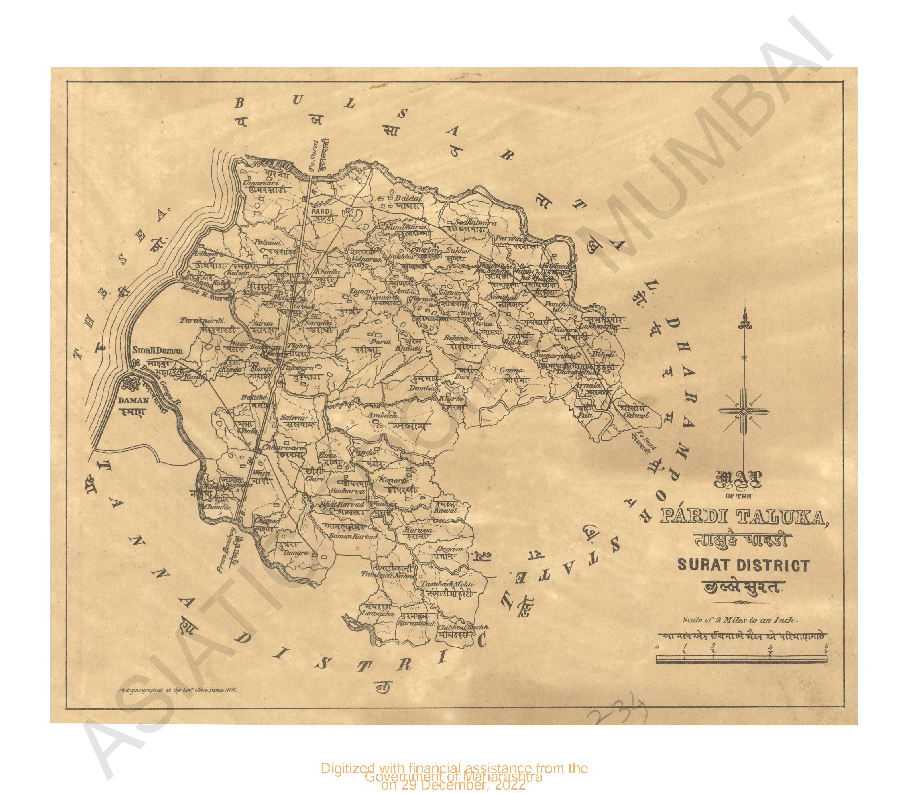
- Map of the Pardi taluka, Surat district
- Year: 1876
-
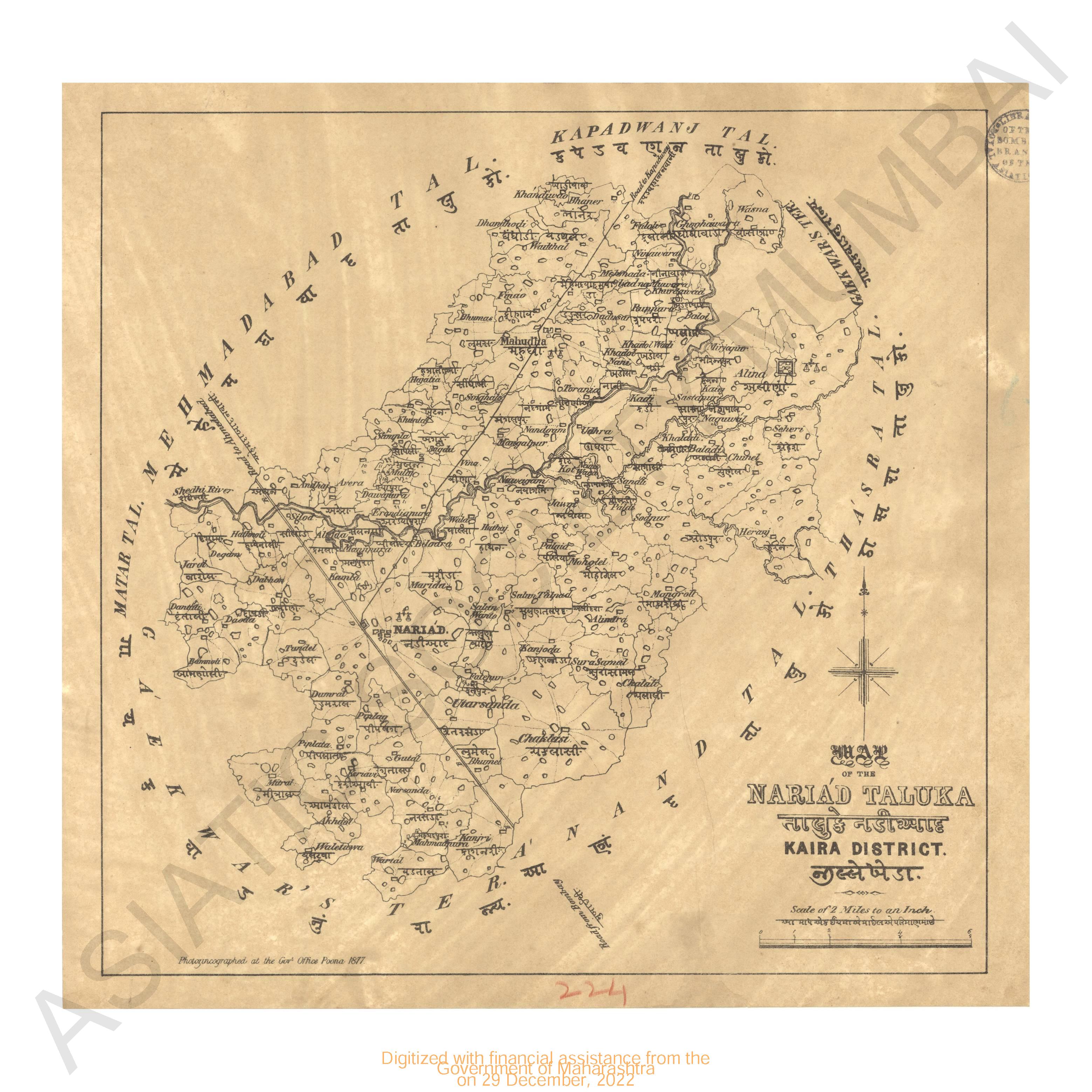
- Map of Nariad Taluka, Kaira district
- Year: 1877
-
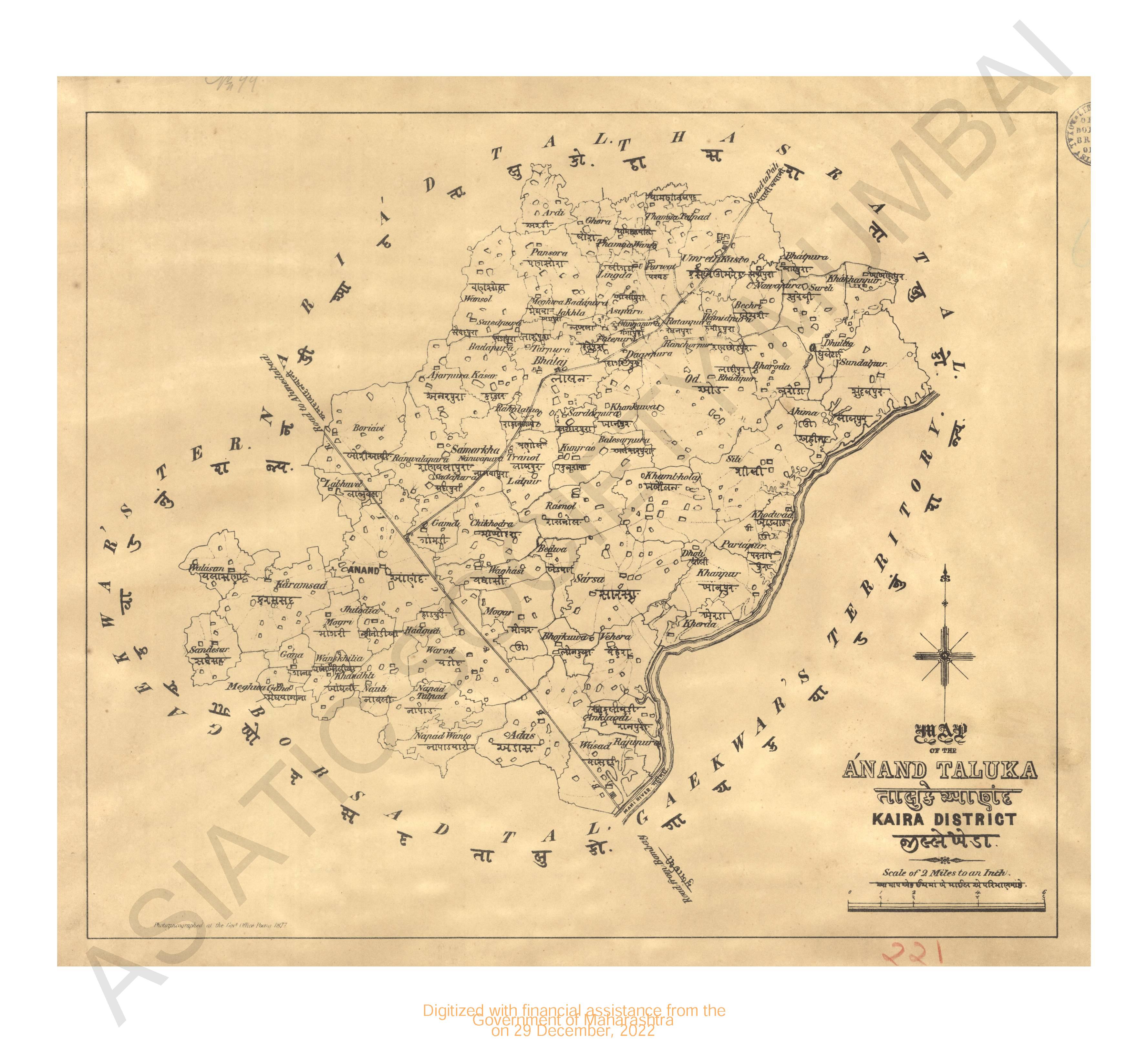
- Map of Anand Taluka, Kaira district
- Year: 1877
-
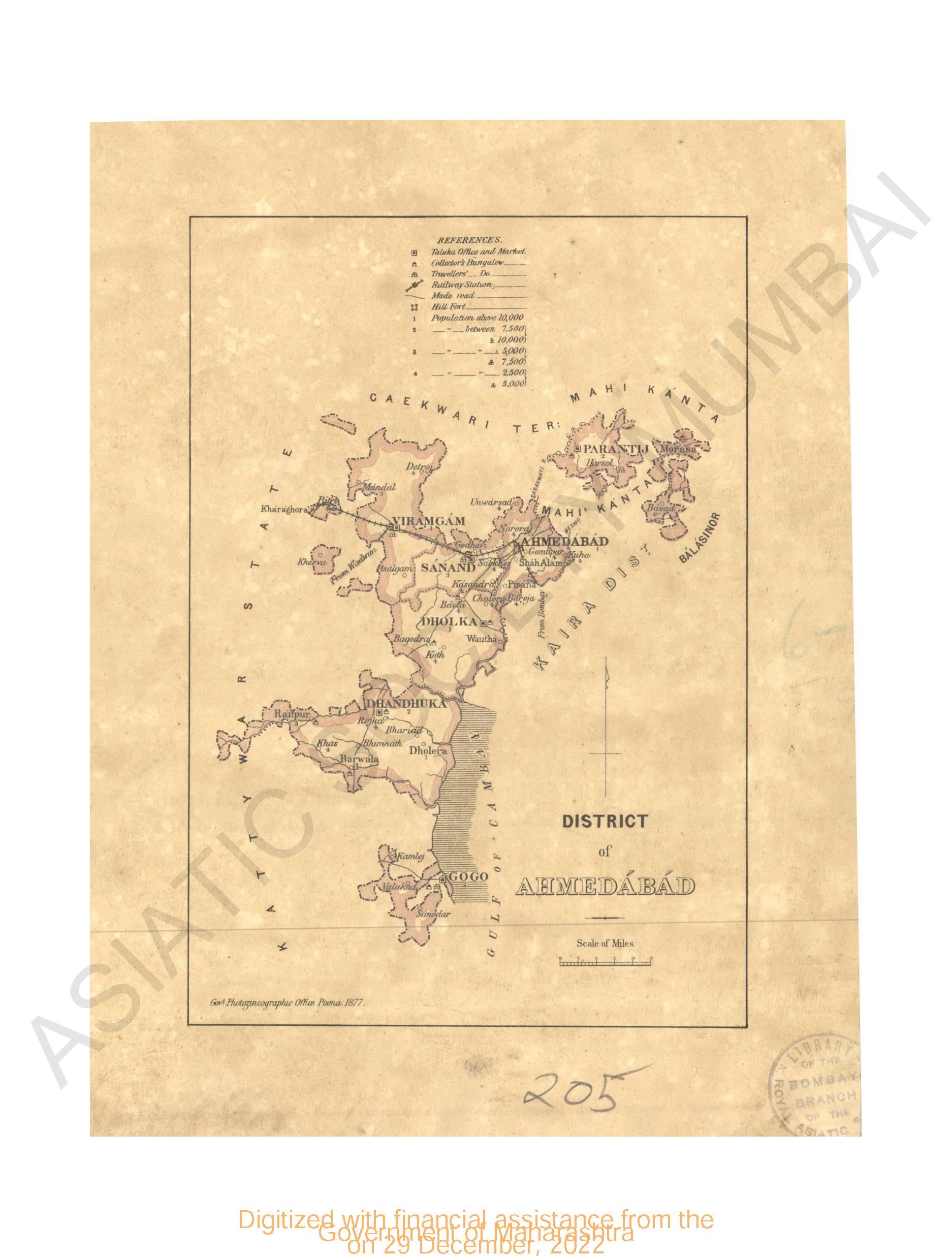
- District of Ahmedabad
- Year: 1877
-
-
- City of Nagpoor 1865
- Year: 1870
-
- Trigonometrical survey of Pauban Pass
- Year: 1839
- Subject: Topographic Map
- Publisher: John Walker
- Language: English
-
- Map of the Ahmedabad district, province Gujarat compiled from the village maps of the Gujarat Revenue surved ; part II Dhandhuka & Gogo Talukas.
- Year: 1878
- Subject: Topographic Map
- Publisher: Government Office
- Language: English
- Place of Publication: Poona (Pune)
-
- Map of the Surat collectorate, Gujarat province compiled from the village maps of the Gujarat Revenue Surve A. D. 1871
- Year: 1871
- Subject: Topographic Map
- Publisher: Government Office
- Language: English
- Place of Publication: Poona (Pune)
-
- Map of Panch Mahal district, province Gujarat compiled from the village maps of the Gujarat Revenue survey
- Year: 1878
- Subject: Topographic Map
- Publisher: Government Office
- Language: English
- Place of Publication: Poona (Pune)
-
- Map of the Pardi taluka, Surat district
- Year: 1876
- Subject: Topographic Map
- Publisher: Government Office
- Language: English
- Place of Publication: Poona (Pune)
-
- Map of Nariad Taluka, Kaira district
- Year: 1877
- Subject: Topographic Map
- Publisher: Government Office
- Language: English
- Place of Publication: Poona (Pune)
-
- Map of Anand Taluka, Kaira district
- Year: 1877
- Subject: Topographic Map
- Publisher: Government Office
- Language: English
- Place of Publication: Poona (Pune)
-
- District of Ahmedabad
- Year: 1877
- Subject: Topographic Map
- Publisher: Government Photozincographic Office
- Language: English
- Place of Publication: Poona (Pune)
-
- Trigonometrical survey of Kuranchee harbour on the coast of Sinde 1838
- Year: 1844
- Subject: Topographic Map
- Publisher: John Walker
- Language: English
-
- City of Nagpoor 1865
- Year: 1870
- Subject: Topographic Map
- Publisher: Surveyor General's
- Language: English
- Place of Publication: Calcutta