-
-
-
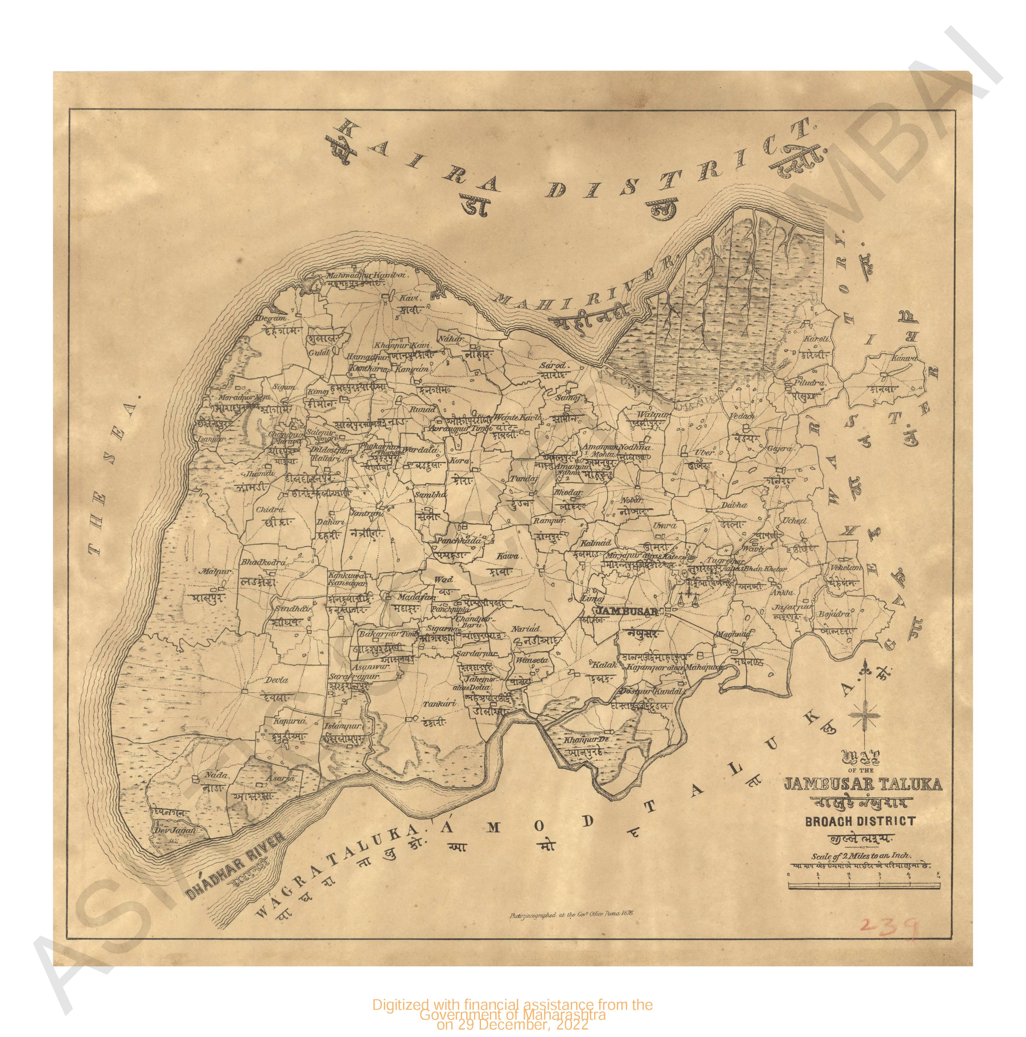
- Map of the Jambusar taluka, Broach district
- Year: 1876
-
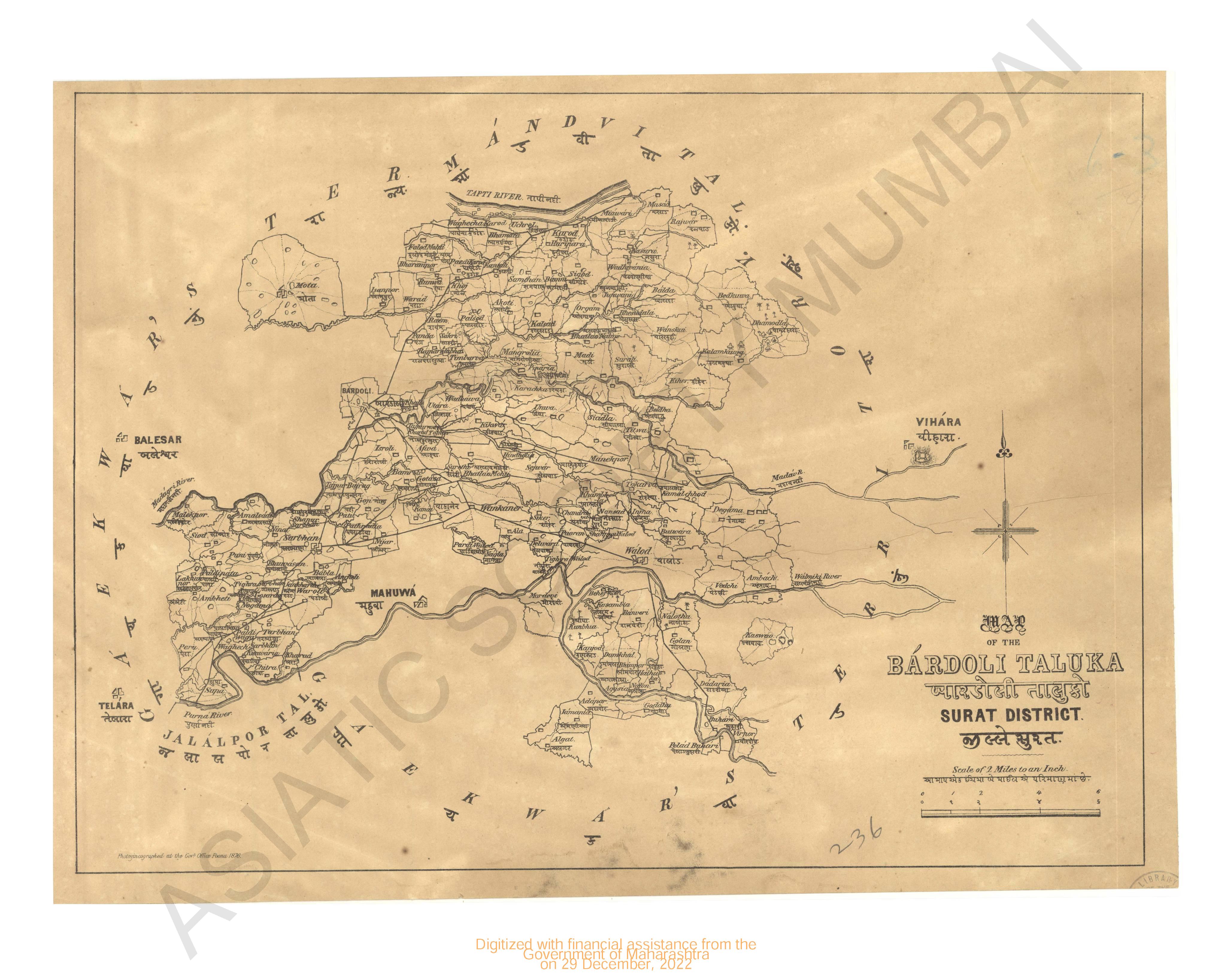
- Map of the Bardoli taluka, Surat district
- Year: 1876
-
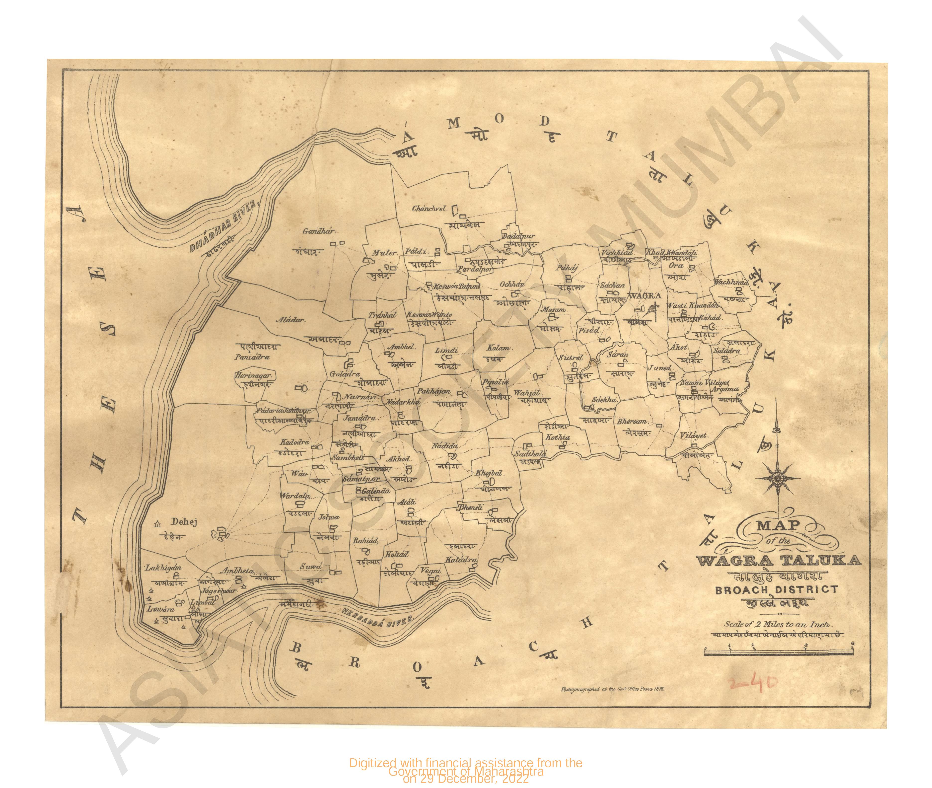
- Map of the Wagra taluka, Broach district
- Year: 1876
-
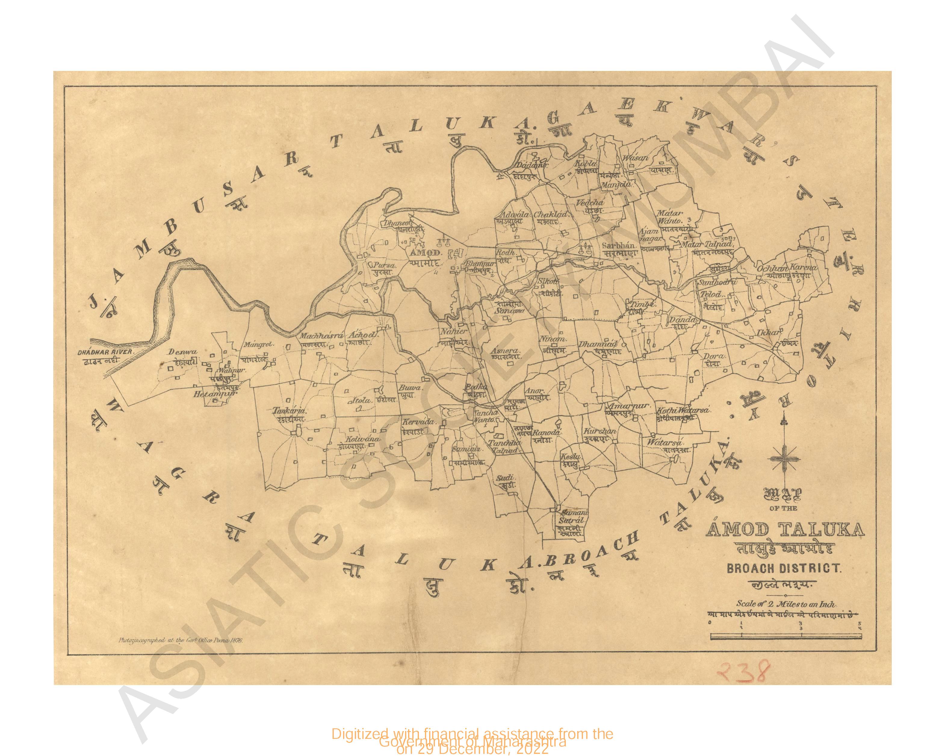
- Map of the Amod taluka; Broach district
- Year: 1876
-
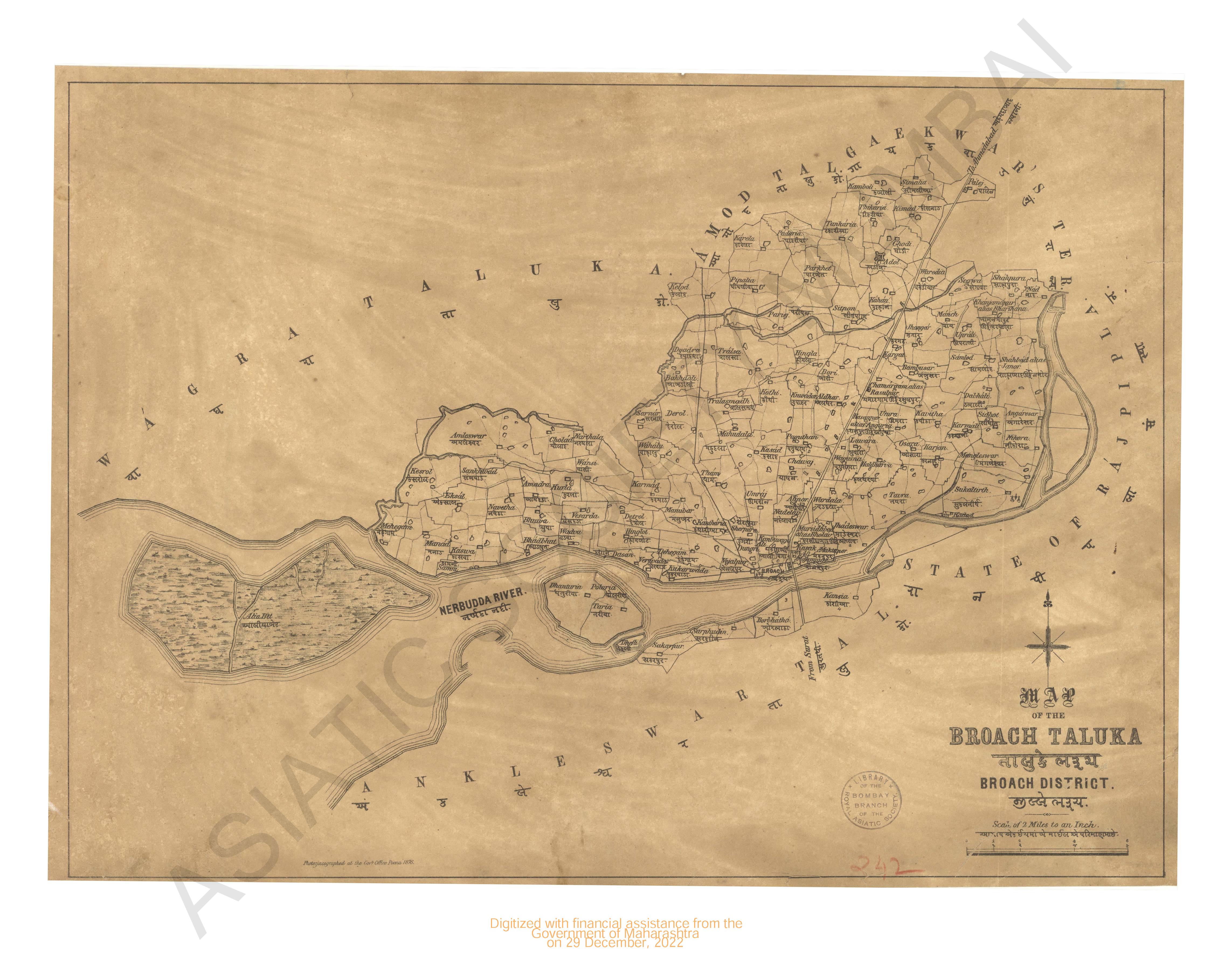
- Map of the Broach taluka, Broach district
- Year: 1876
-
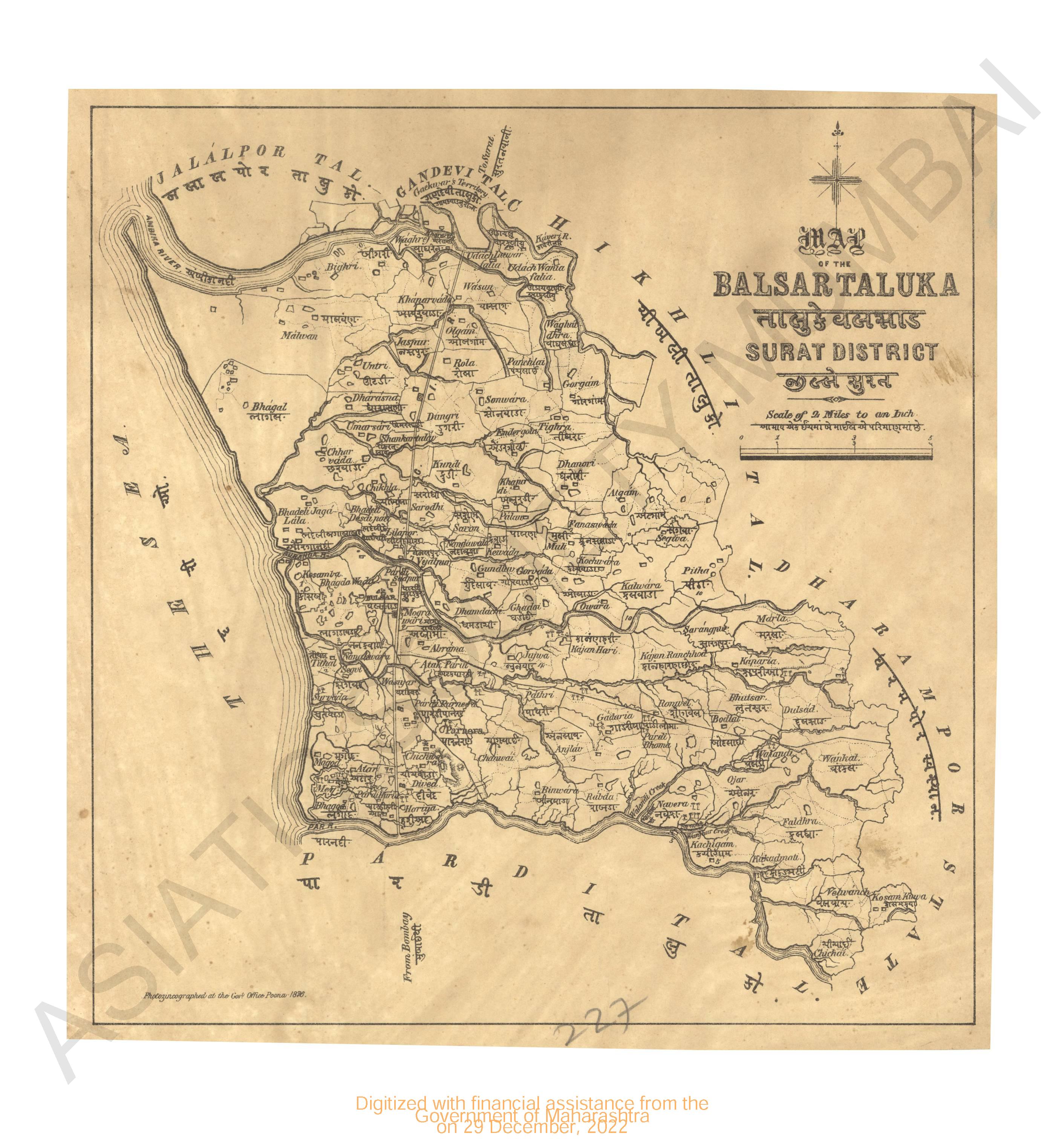
- Map of Balsar Taluka, Surat district
- Year: 1876
-
- Malacca Banks, Chart of 1837
- Year: 1845
-
-
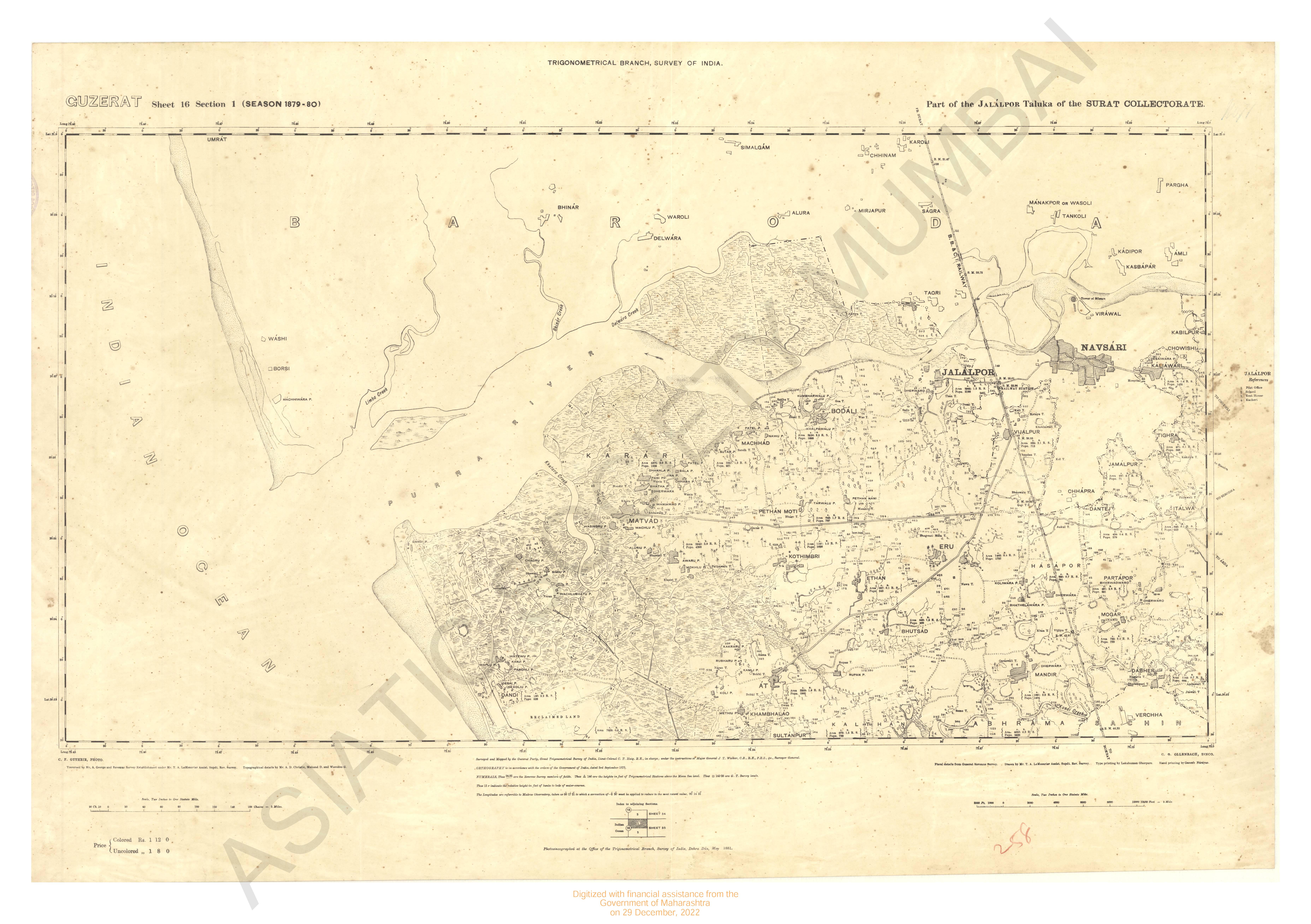
- Gujarat : parts of the Jalalpor taluka of the Surat collectorate season 1879-80.
- Year: 1881
- Subject: Topographic Map
- Publisher: Office of the Trigonometrical Branch, Survey of India
- Language: English
- Place of Publication: Dehradun
-
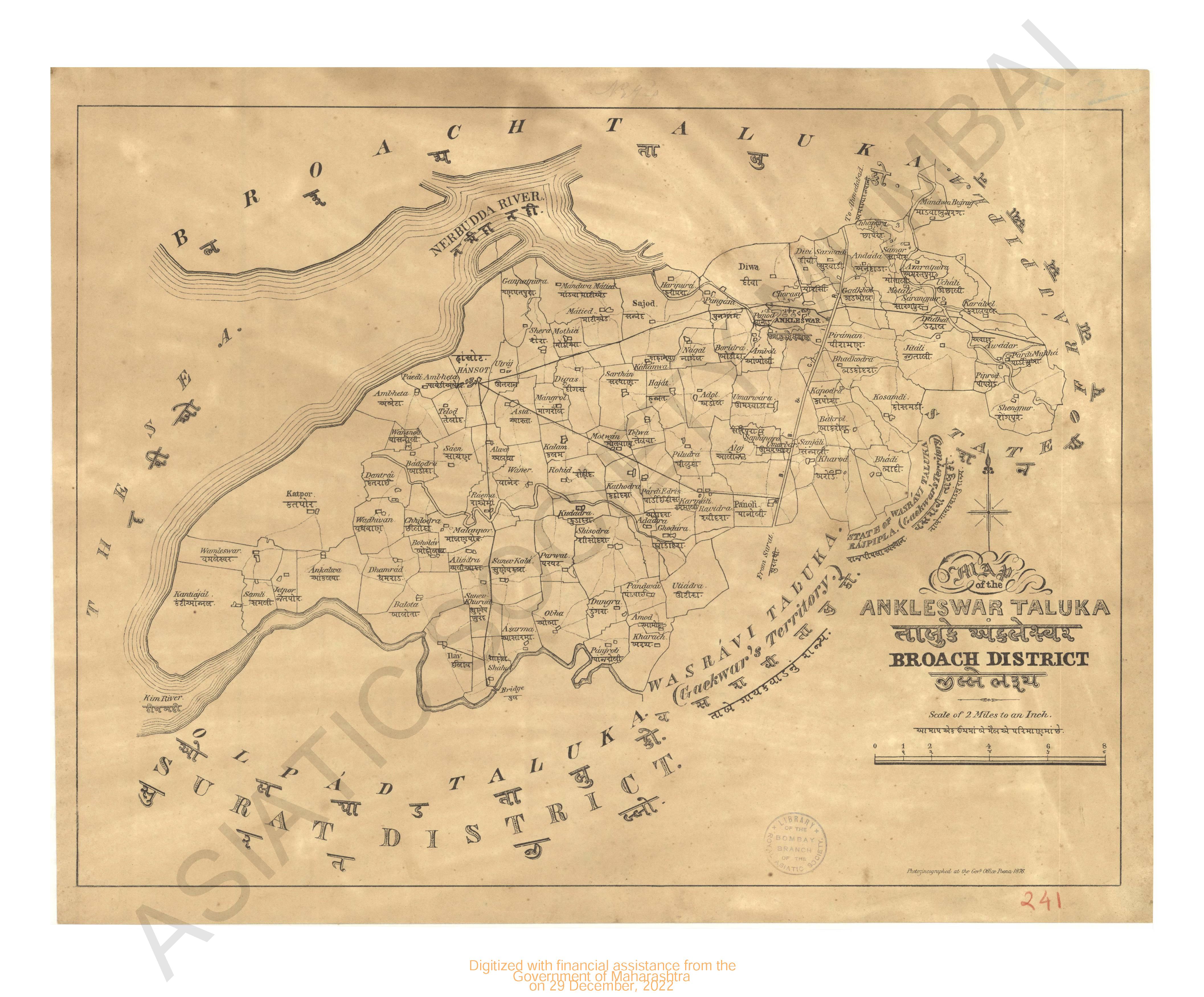
- Map of the Ankleshwar taluka, Broach district
- Year: 1876
- Subject: Topographic Map
- Publisher: Government Office
- Language: English
- Place of Publication: Poona (Pune)
-
- Map of the Jambusar taluka, Broach district
- Year: 1876
- Subject: Topographic Map
- Publisher: Government Office
- Language: English
- Place of Publication: Poona (Pune)
-
- Map of the Bardoli taluka, Surat district
- Year: 1876
- Subject: Topographic Map
- Publisher: Government Office
- Language: English
- Place of Publication: Poona (Pune)
-
- Map of the Wagra taluka, Broach district
- Year: 1876
- Subject: Topographic Map
- Publisher: Government Office
- Language: English
- Place of Publication: Poona (Pune)
-
- Map of the Amod taluka; Broach district
- Year: 1876
- Subject: Topographic Map
- Publisher: Government Office
- Language: English
- Place of Publication: Poona (Pune)
-
- Map of the Broach taluka, Broach district
- Year: 1876
- Subject: Topographic Map
- Publisher: Government Office
- Language: English
- Place of Publication: Poona (Pune)
-
- Map of Balsar Taluka, Surat district
- Year: 1876
- Subject: Topographic Map
- Publisher: Government Office
- Language: English
- Place of Publication: Poona (Pune)
-
- Malacca Banks, Chart of 1837
- Year: 1845
- Subject: Topographic Map
- Publisher: John Walker
- Language: English
-
- Gujarat : parts of the Surat collectorate of the territory and of the Rewakanta states season 1879-80 & 1880-81. trigonometrical branch survey of India
- Year: 1882
- Subject: Topographic Map
- Publisher: Office of the Trigonometrical Branch, Survey of India
- Language: English
- Place of Publication: Dehradun