-
-
-
-
-
-
-
-
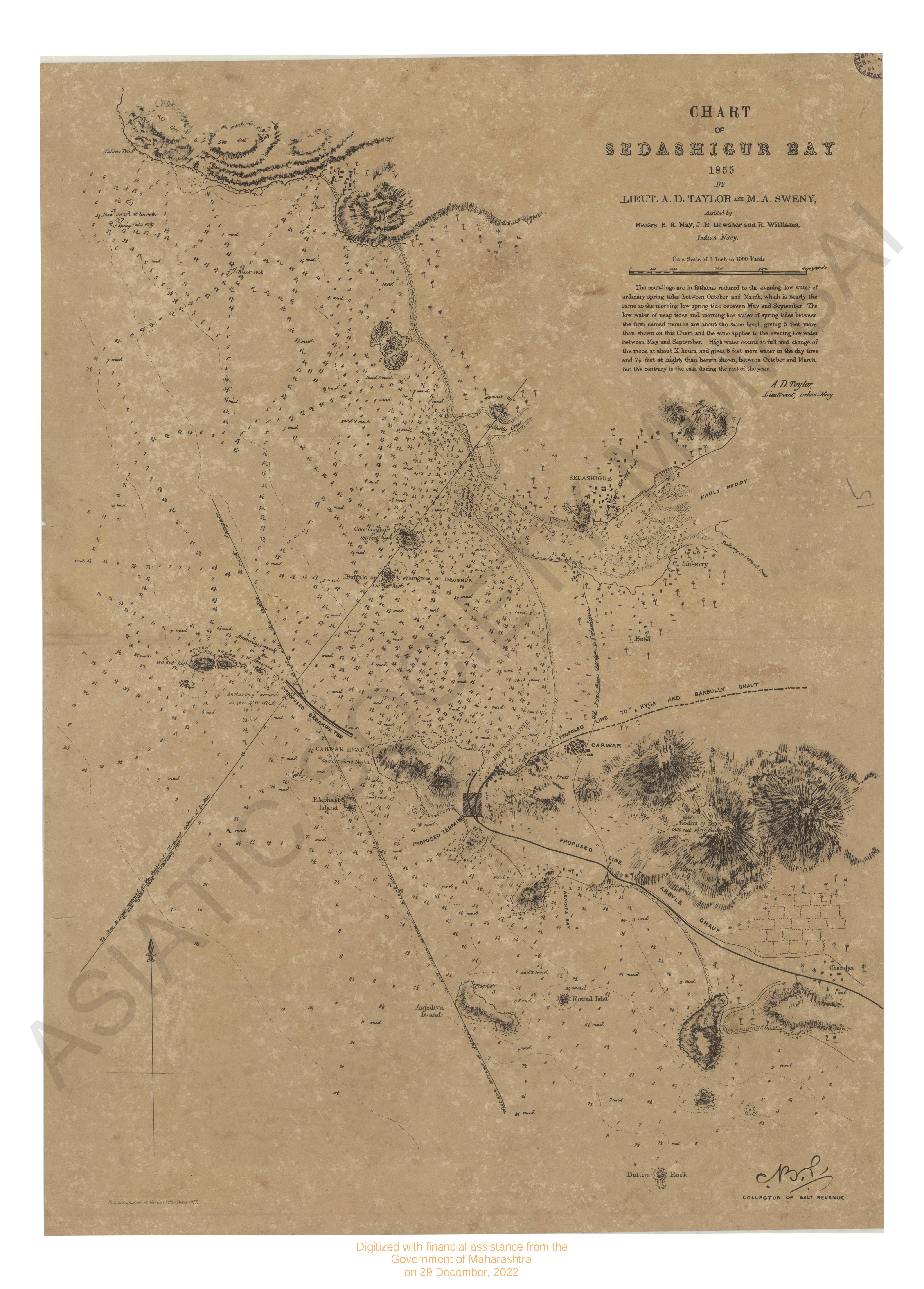
- Chart of Shadashivgasd bay 1855.
- Year: 1877
-
-
-
- Colorado Ouray quadrangle surveyed in 1901-02.
- Year: 1904
- Subject: USGS topography
- Publisher: US geogological survey
- Language: English
- Place of Publication: Washinton
-
- West Virginia-Pennsylvania Bruston quadrangle surveyed in 1902 in cooperation with the state of W.Virginia & Pennsylvania.
- Year: 1904
- Subject: USGS topography
- Publisher: US geogological survey
- Language: English
- Place of Publication: Washinton
-
- India East coast. Approaches to Hubli river from by the Hubli river survey service 1964 with addition 1968.
- Year: 1969
- Subject: Topographic Map
- Publisher: Naval hydrographic
- Language: English
- Place of Publication: Dehradun
-
- North-West Frontiers Punjab revenue survey, district Huzarub 1865-69. Sheet No.7
- Year: 1870
- Subject: Topographic Map
- Publisher: Surveyor General's Office
- Language: English
- Place of Publication: Calcutta
-
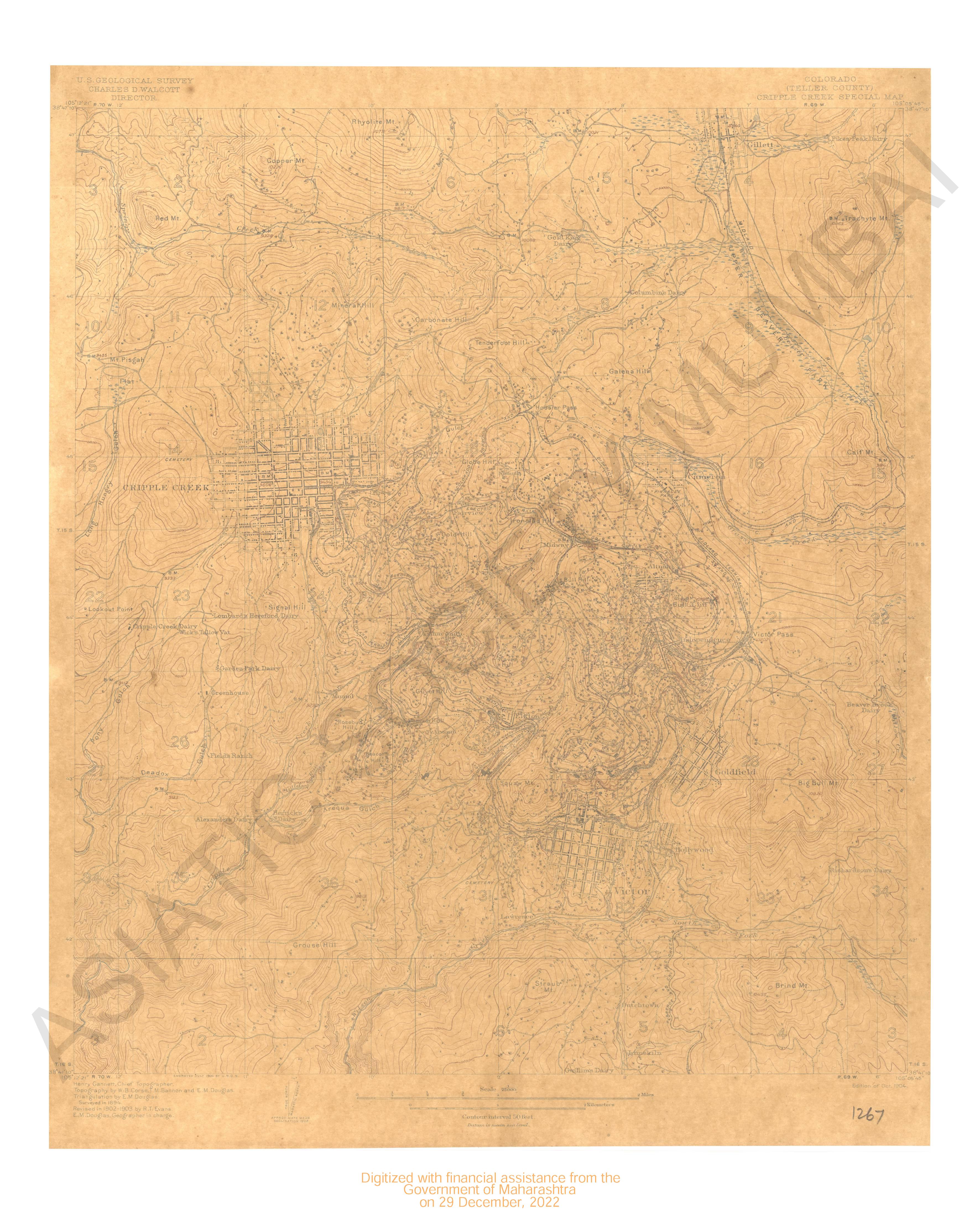
- Colorado (Teller county) Cripple creek special map surveyed in 1894, rev in 1902-03.
- Year: 1904
- Subject: USGS topography
- Publisher: US geogological survey
- Language: English
- Place of Publication: Washinton
-
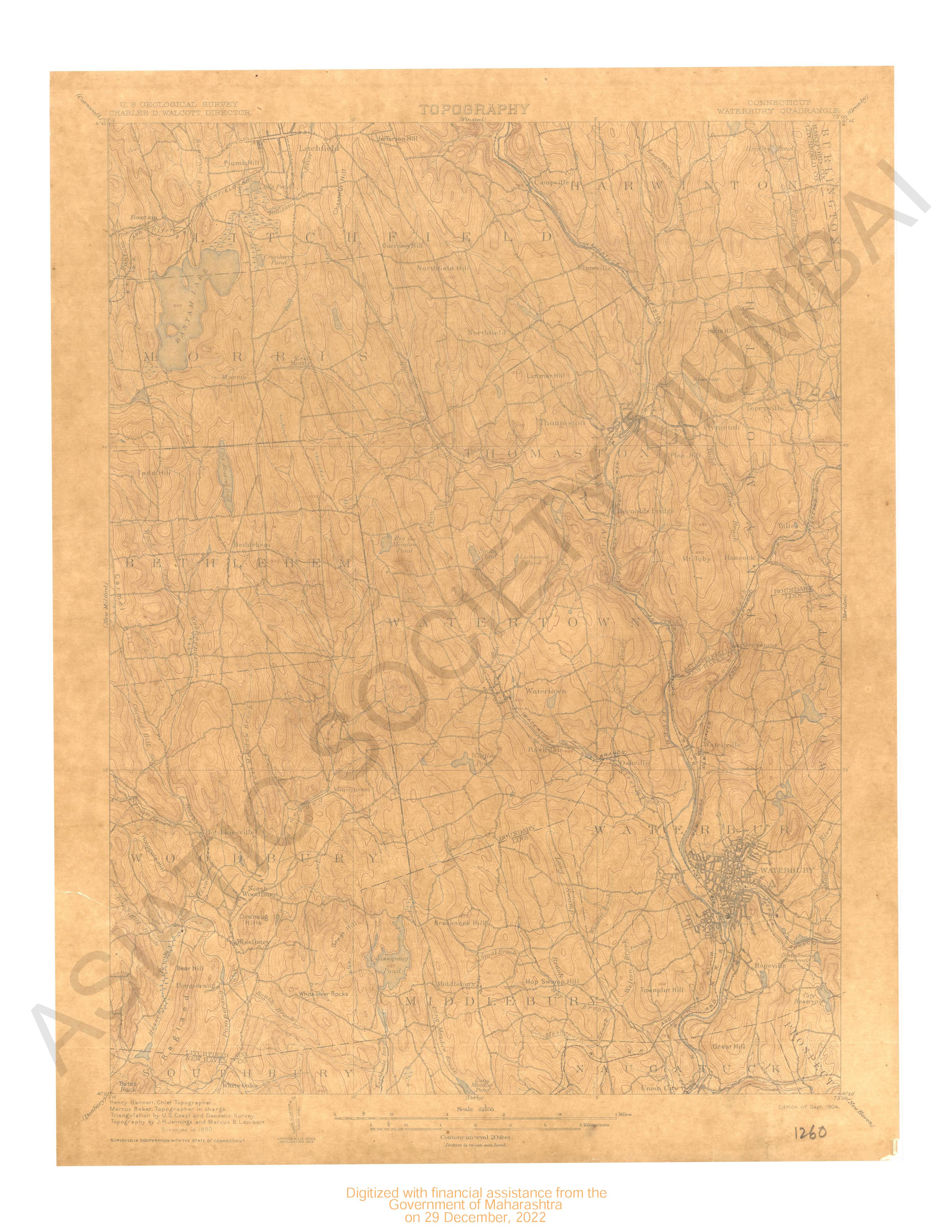
- Connecticut Waterbury quadrangle surveyed in 1890 in cooperation with the state of Connecticut.
- Year: 1904
- Subject: USGS topography
- Publisher: US geogological survey
- Language: English
- Place of Publication: Washinton
-
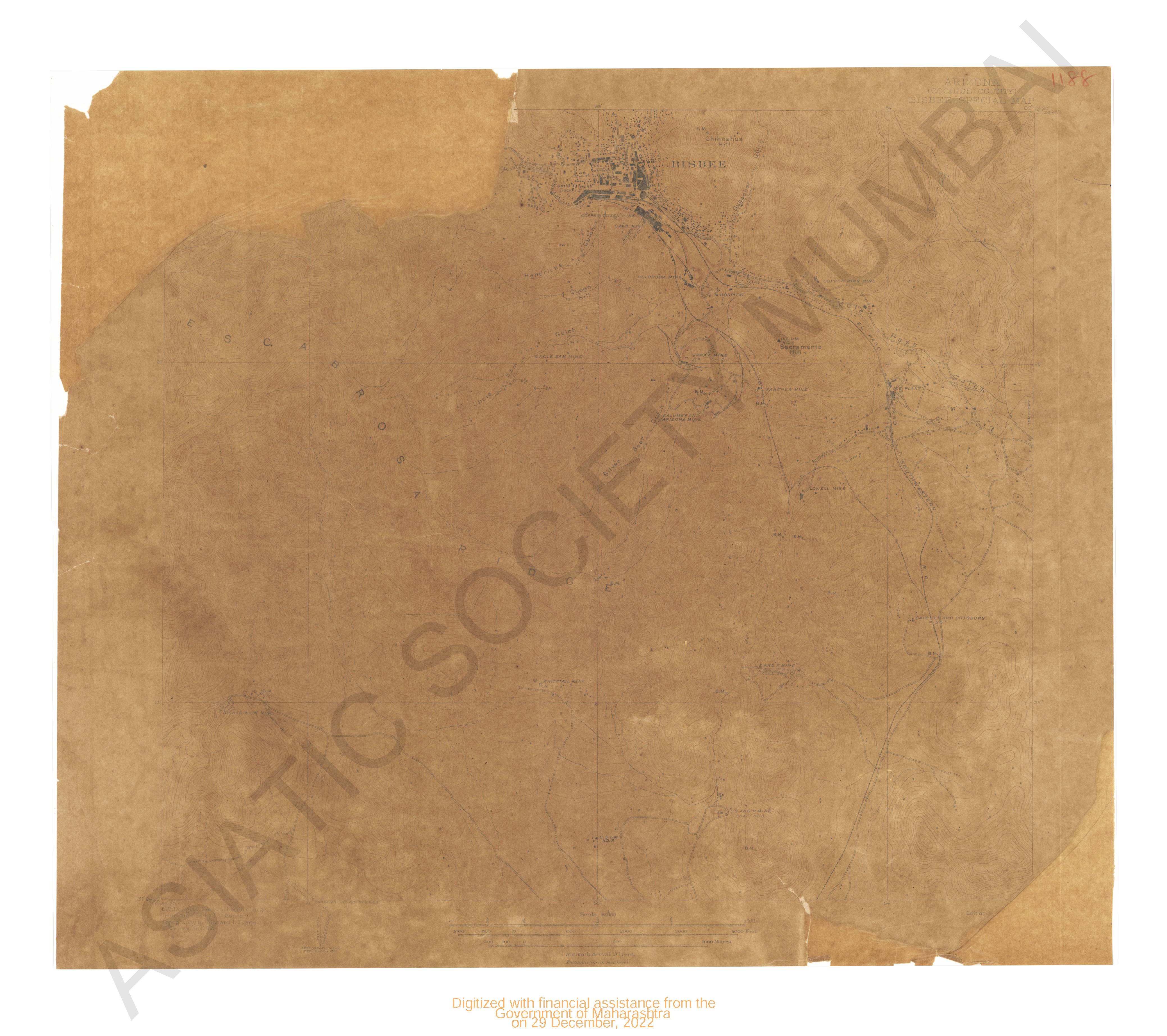
- Arizona (Cochise county) Bisbee special map surveyed in 1902.
- Year: 1906
- Subject: USGS topography
- Publisher: US geogological survey
- Language: English
- Place of Publication: Washinton
-
- Chart of Shadashivgasd bay 1855.
- Year: 1877
- Subject: Topographic Map
- Publisher: Government Office
- Language: English
- Place of Publication: Poona
-
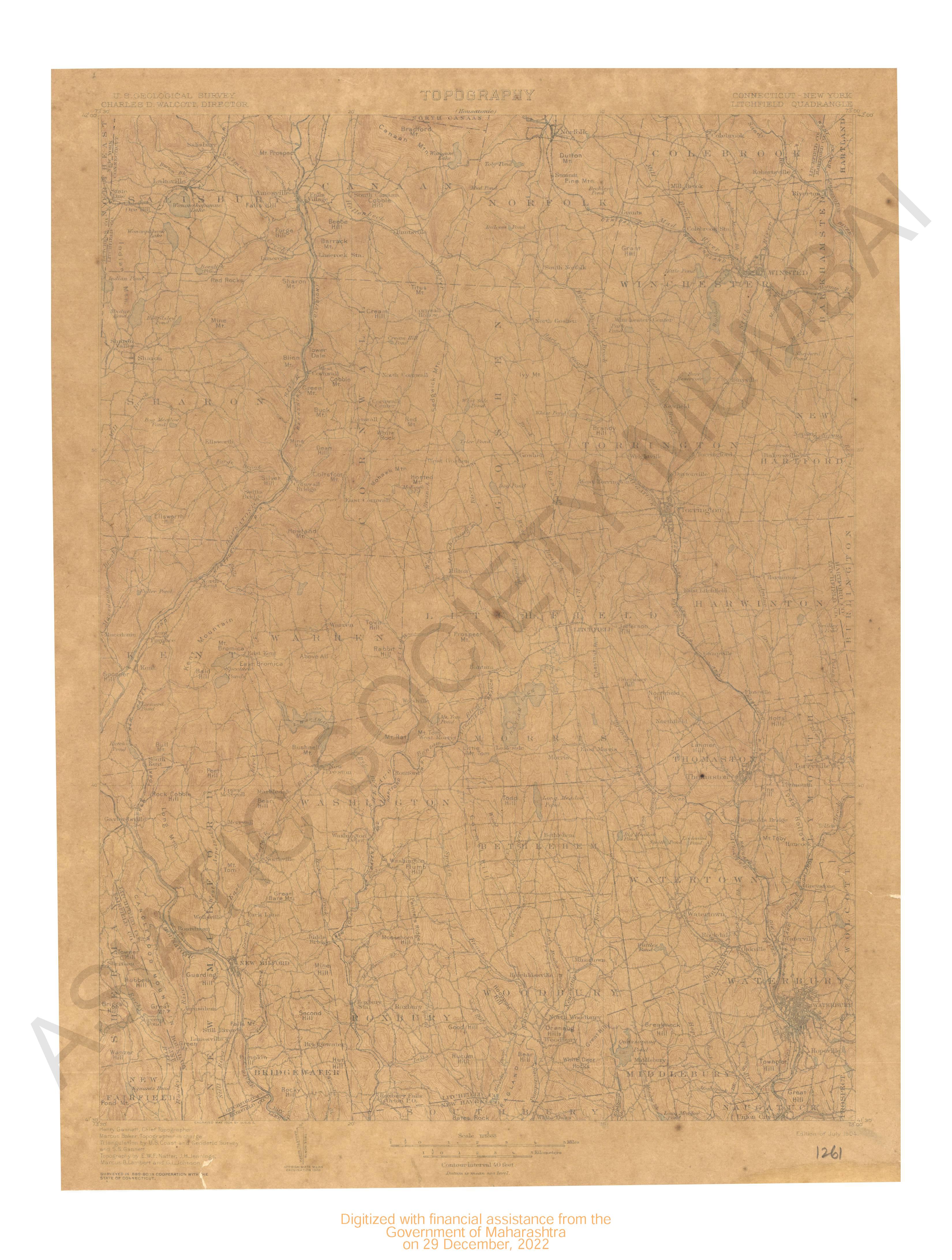
- Connecticut-New York Litchfield quadrangle surveyed in 1889-90 in cooperation with the state of Connecticut.
- Year: 1904
- Subject: USGS topography
- Publisher: US geogological survey
- Language: English
- Place of Publication: Washinton
-
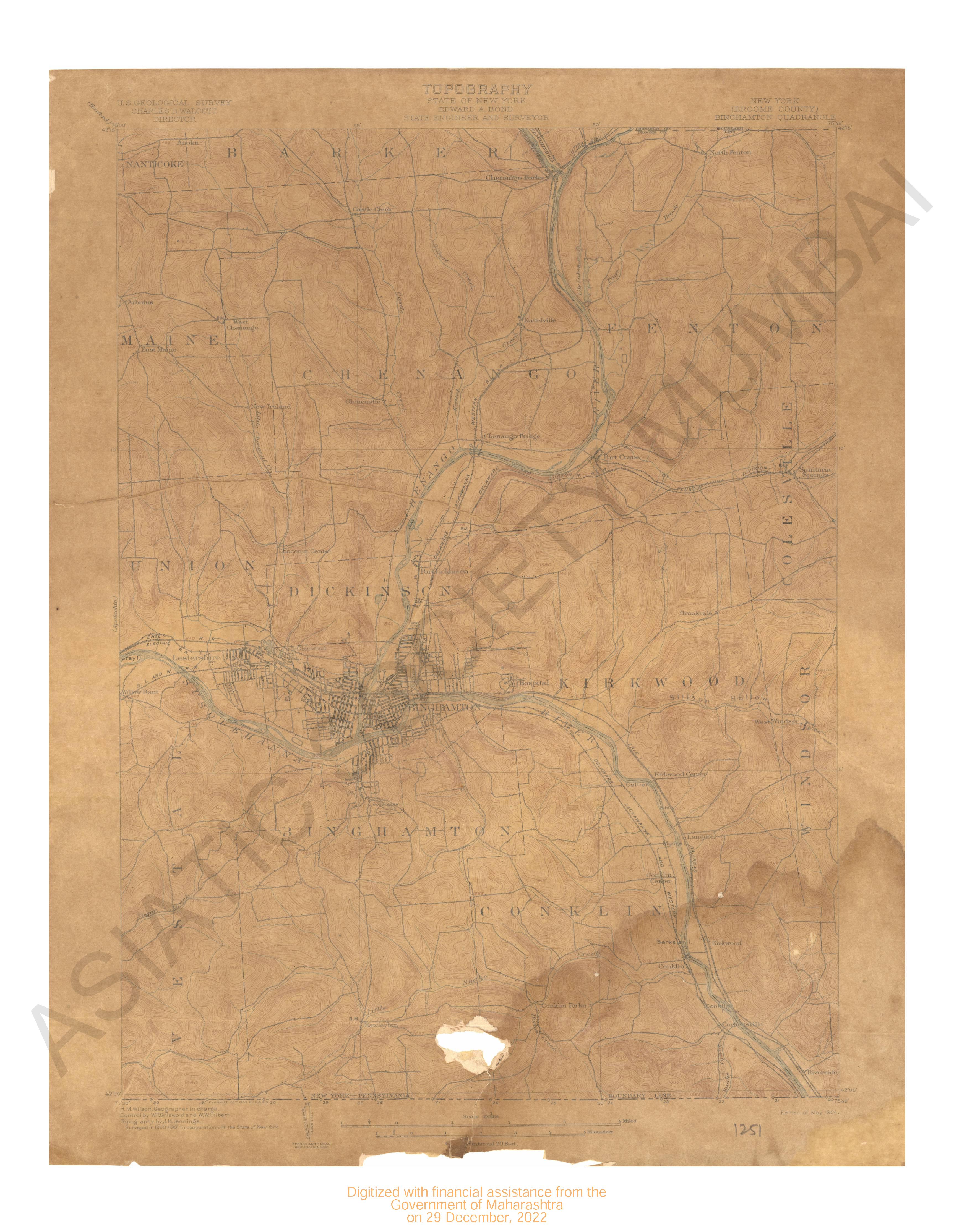
- New York (Broome county) Binghamton quadrangle surveyed in 1900-01 in cooperation with the state of New York.
- Year: 1904
- Subject: USGS topography
- Publisher: US geogological survey
- Language: English
- Place of Publication: Washinton