-
- Tapti; mouth of the River
- Year: 1870
-
-
-
-
-
- Deoli in Rajpootana; cantonment of 1868
- Year: 1869
-
-
-
-
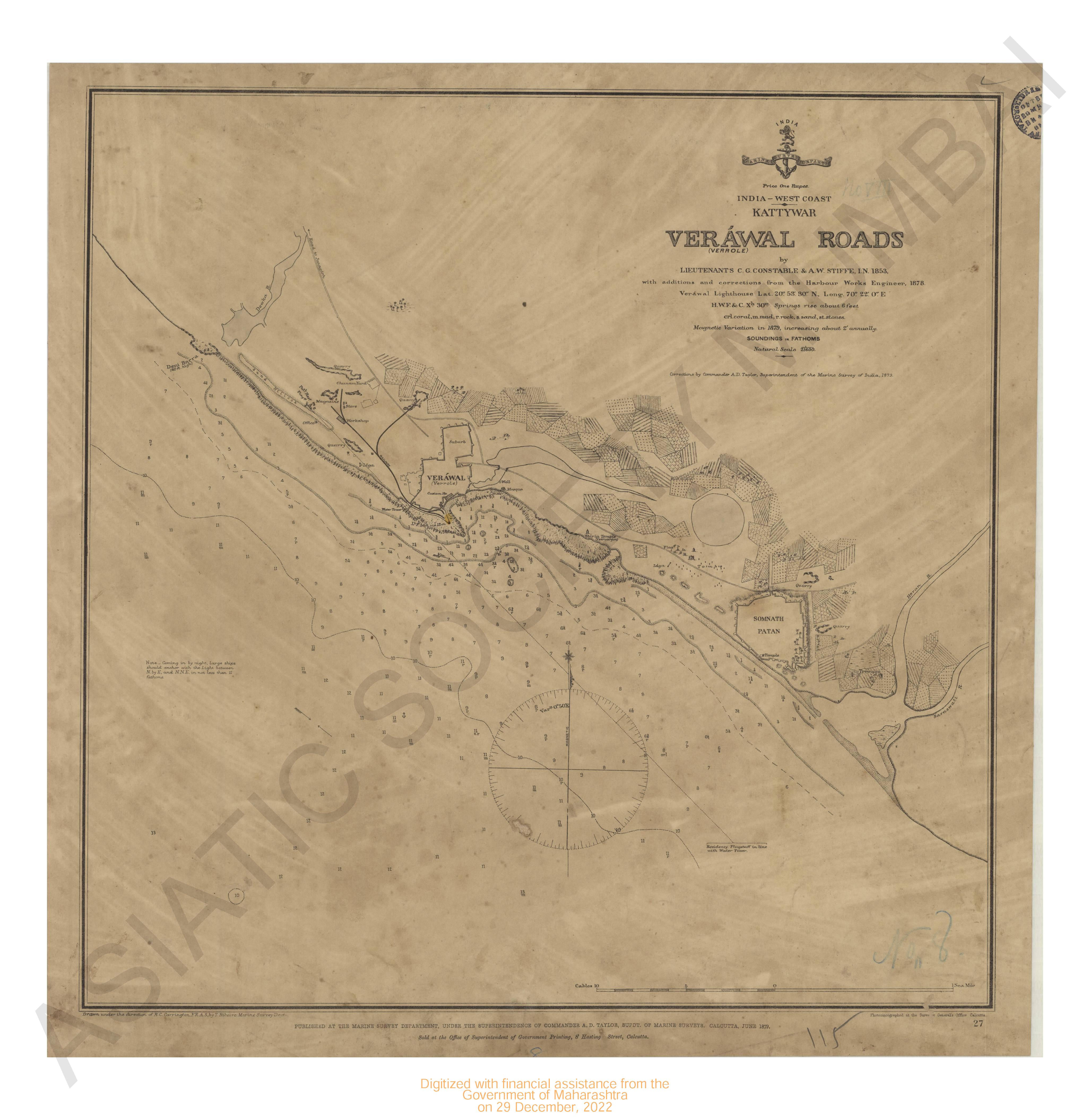
- India - west coast . Kattywar Verawal roads
- Year: 1879
-
- Tapti; mouth of the River
- Year: 1870
- Subject: Topographic Map
- Language: English
-
- India west coast Ratnagiri including Mirya & Kaldadevie & bays
- Year: 1879
- Subject: Topographic Map
- Publisher: Marine Surveyor Department
- Language: English
- Place of Publication: Calcutta
-
- India, west coast; Bankot and entrance to Mhar or Savitri river. 1880
- Year: 1880
- Subject: Topographic Map
- Publisher: The Marine Survey dept
- Language: English
- Place of Publication: Calcutta
-
- India- west coast chart & entrance to kundalika river
- Year: 1880
- Subject: Topographic Map
- Publisher: Marine Surveyor Department
- Language: English
- Place of Publication: Calcutta
-
- India West coast (sheet-2) vingrola to cape Comorin
- Year: 1877
- Subject: Topographic Map
- Publisher: Marine Surveyor Department
- Language: English
- Place of Publication: Calcutta
-
- Deoli in Rajpootana; cantonment of 1868
- Year: 1869
- Subject: Topographic Map
- Publisher: Surveyor General's
- Language: English
-
- India - West coast Gulf of Cutch, Salaya or Seraia. The Port of Khambhalia (katlywar) Surveyed & corrected in 1879.
- Year: 1880
- Subject: Topographic Map
- Publisher: Marine Surveyor Department
- Language: English
- Place of Publication: Calcutta
-
- Jalindhur, cantoments and city of 1868-69. Punjab Revenue Survey
- Year: 1870
- Subject: Topographic Map
- Publisher: Surveyor General's
- Language: English
- Place of Publication: Calcutta
-
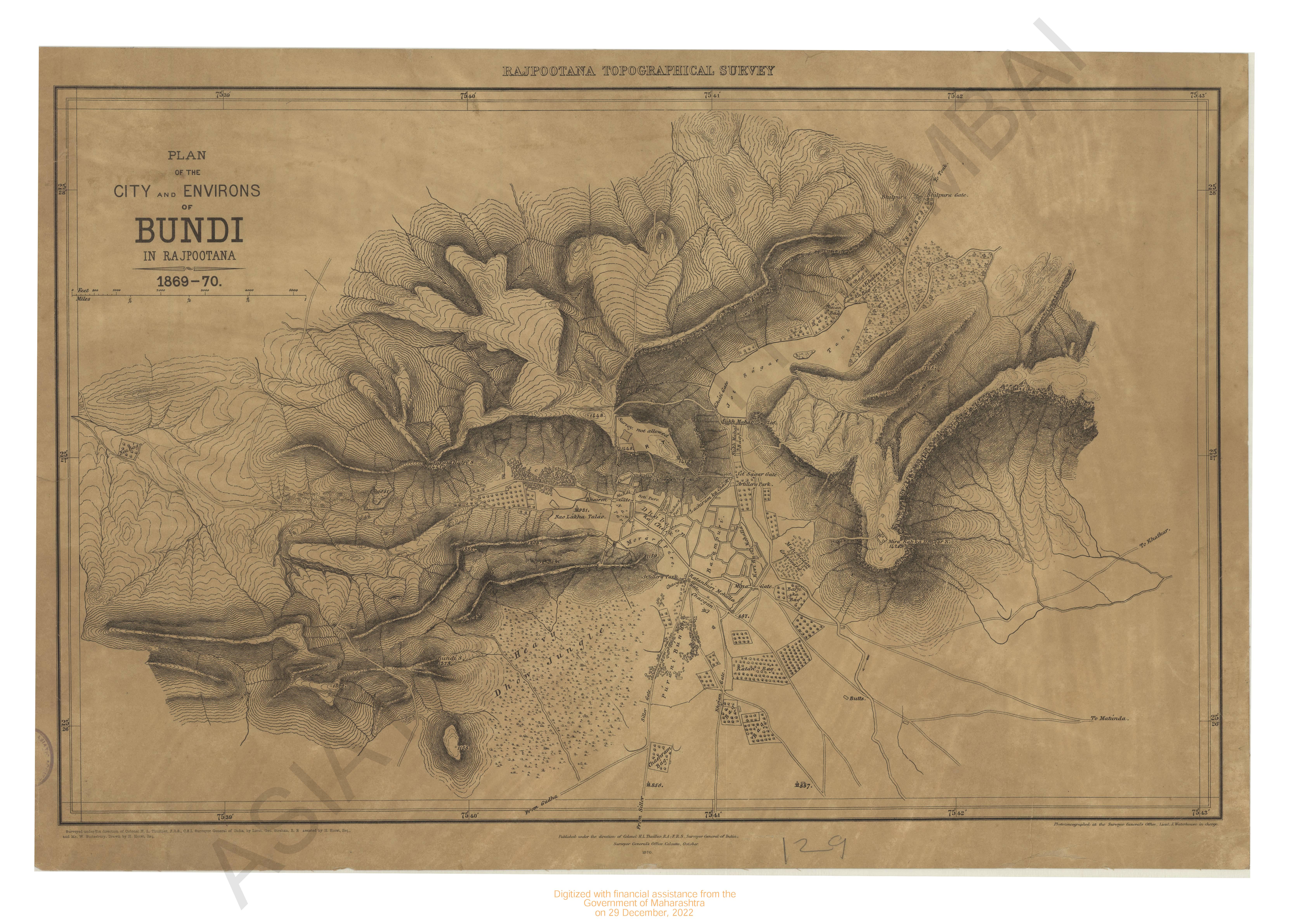
- Bundi Rajpootana; plan of the city and environs of 1869 -70. Rajpootana topographical Survey.
- Year: 1870
- Subject: Topographic Map
- Publisher: Surveyor General's
- Language: English
-
- India - west coast . Kattywar Verawal roads
- Year: 1879
- Subject: Topographic Map
- Publisher: Marine Surveyor Department
- Language: English
- Place of Publication: Calcutta