-
-
-

-
-
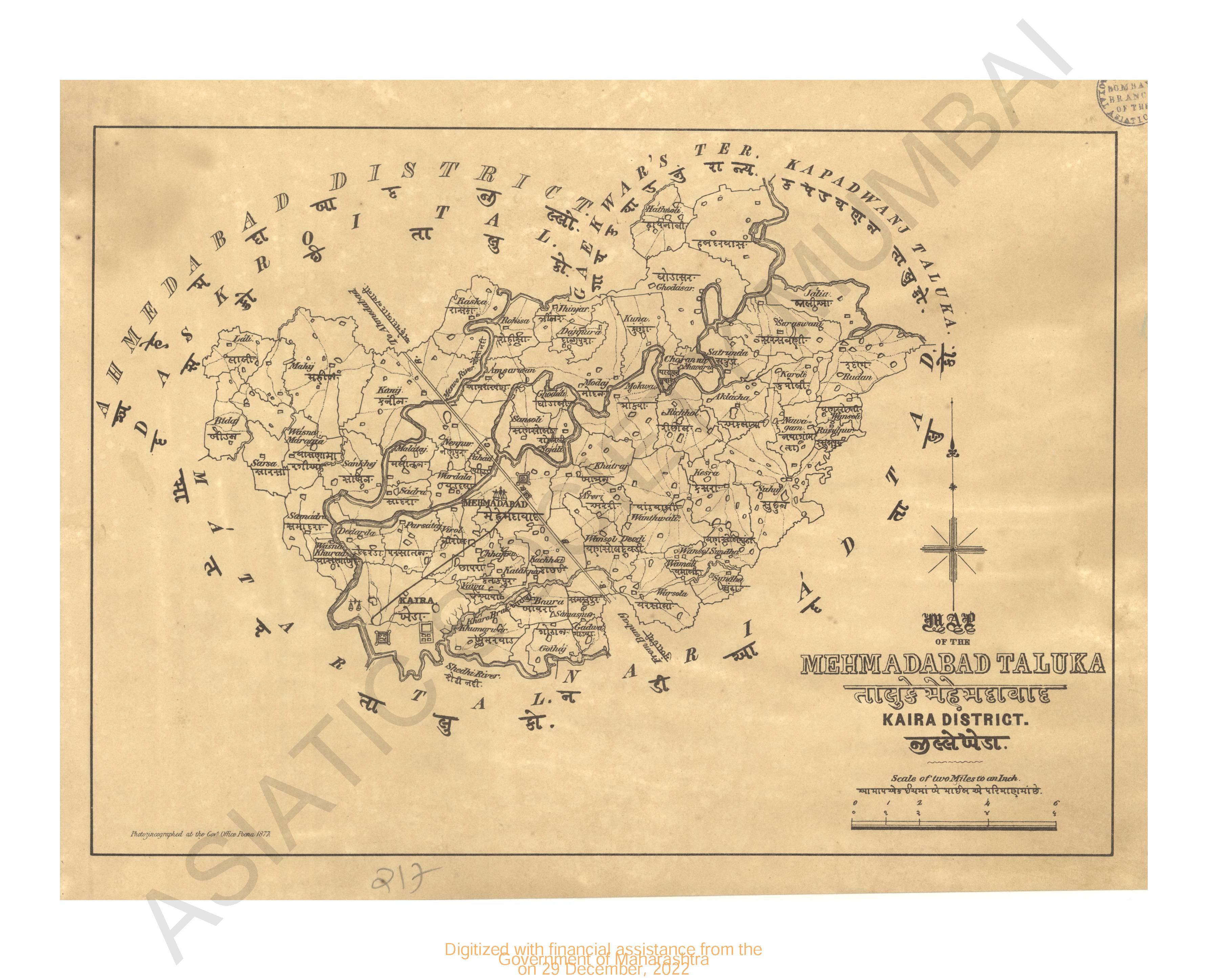
- Map of Mehmadabad Taluka, Kaira district
- Year: 1877
-
- Kolhapur water works; general plan
- Year: 1877
-
- Trigonometrical survey of Dio harbour
- Year: 1834
-
- Tuticorin ; plan of 1796
- Year: 1798
-
-
-
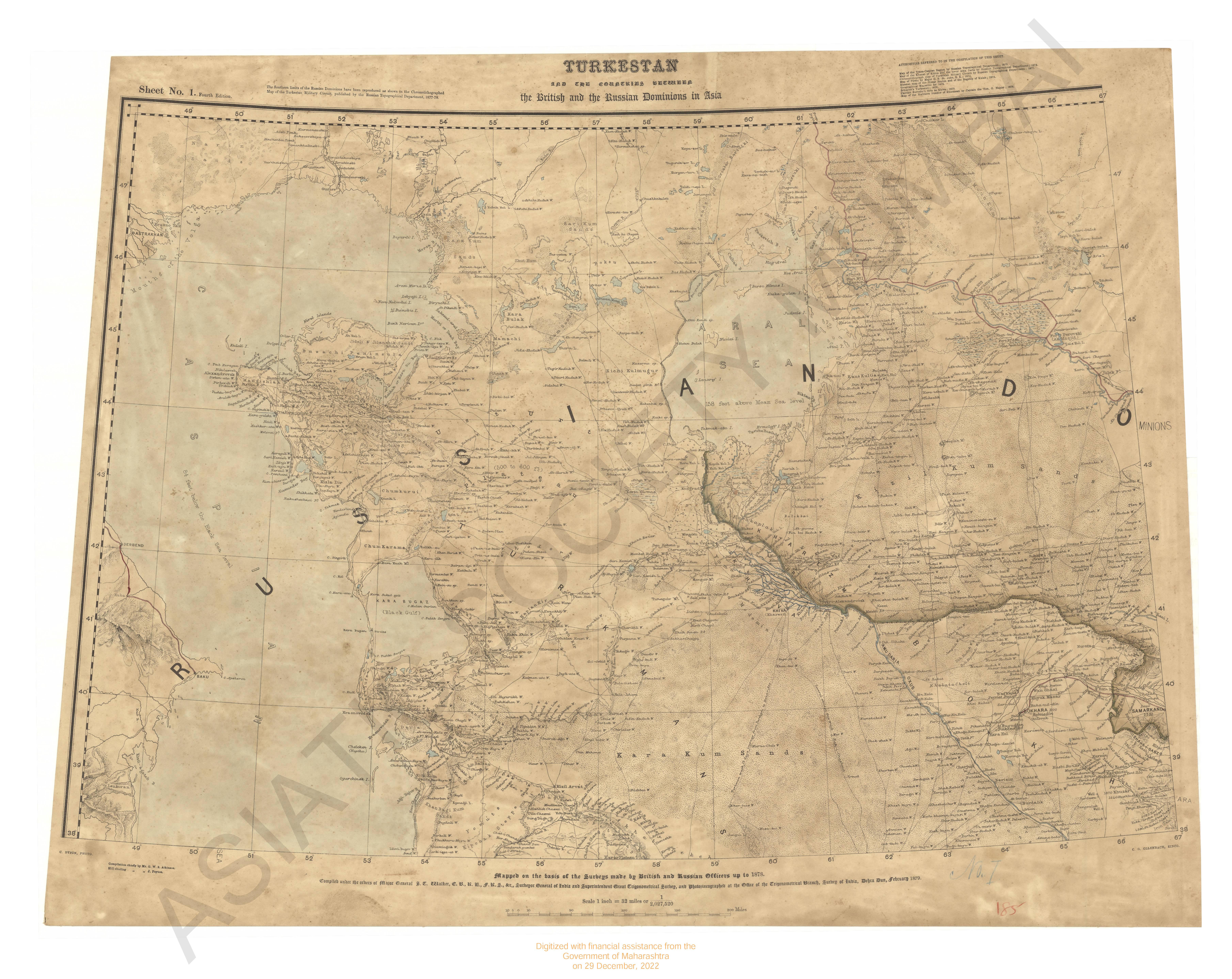
- Turkestan and the countries between the British and the Russian dominions in Asia 4th ed.
- Year: 1879
- Subject: Topographic Map
- Publisher: Office of the Great Trigonometrical survey of India
- Language: English
- Place of Publication: Dehradun
-
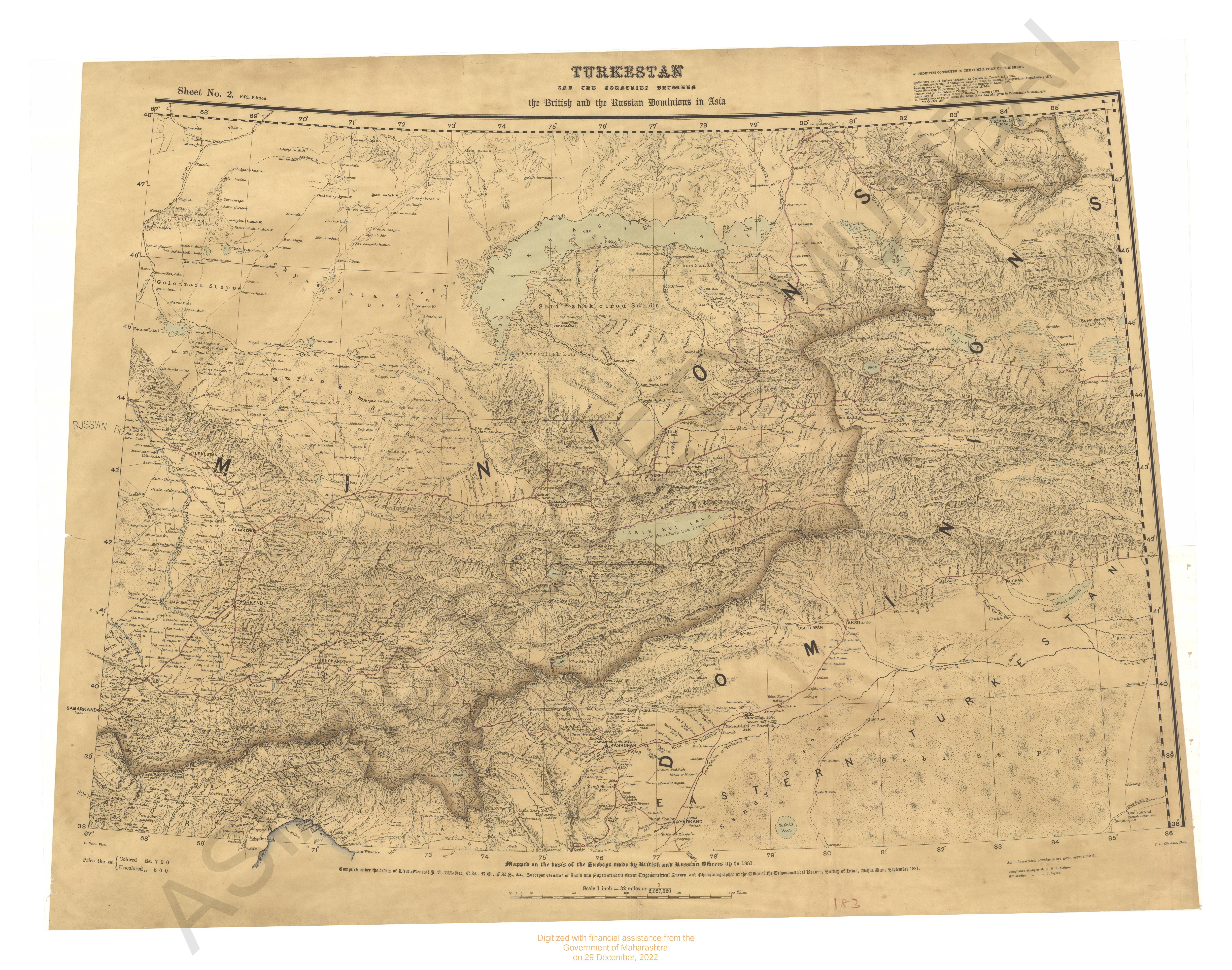
- Turkestan and the countries between the British and the Russian dominions in Asia. 5th ed. Sheet No.2.
- Year: 1881
- Subject: Topographic Map
- Publisher: Survey of India Offices
- Language: English
- Place of Publication: Dehradun
-
- South konkan meridionial series; preliminary chart of; Great trigonometrical survey of India. Season 1842-44 & 1864-66.
- Year: 1871
- Subject: Topographic Map
- Publisher: Surveyor general office
- Language: English
-
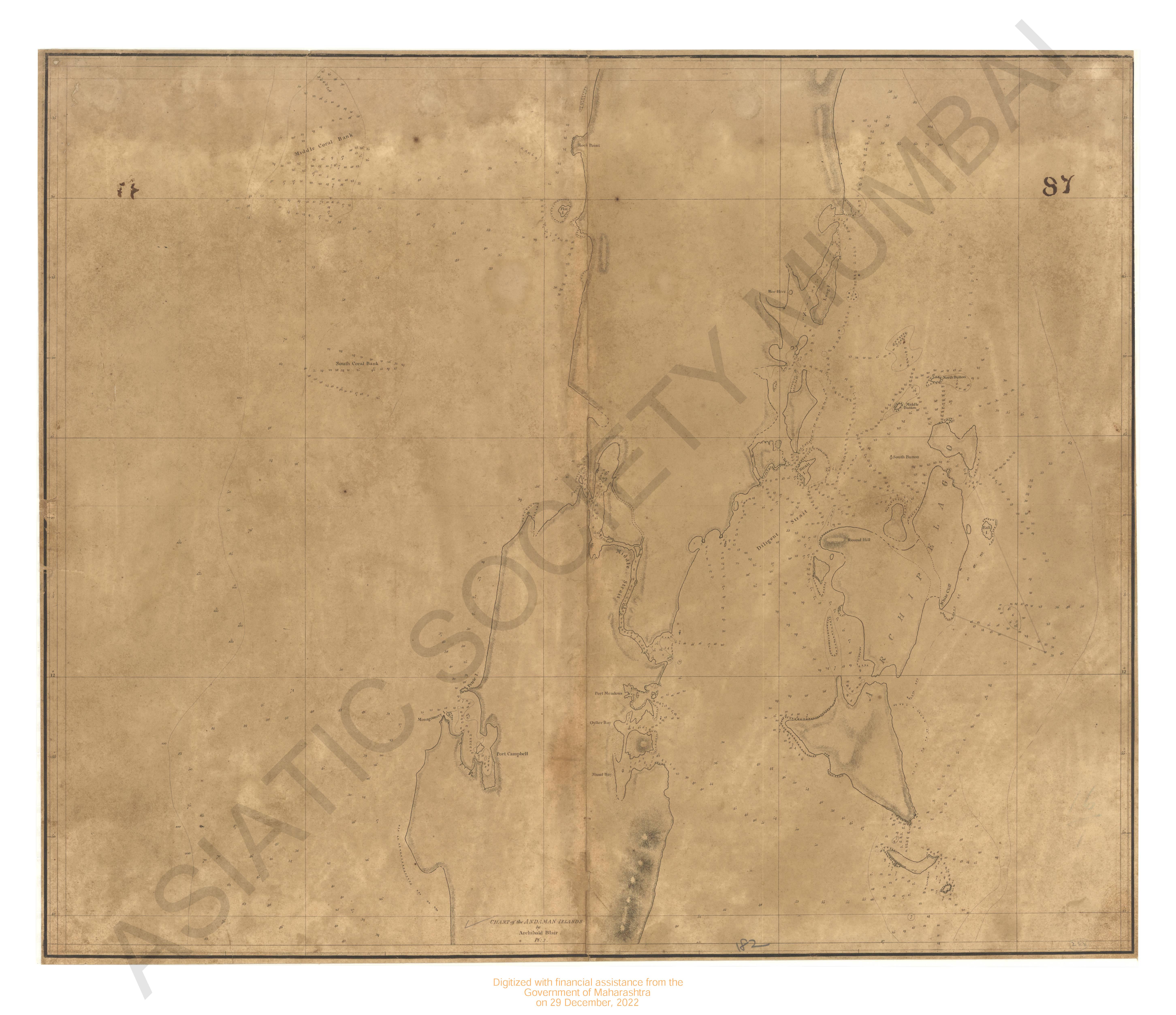
- Andaman islands; chart of the : 1789-1790; (chart of the coast of the Great Andaman and adjacent islands. 1789)
- Year: 1790
- Subject: Topographic Map
- Publisher: A.Dalrymple
- Language: English
-
- Map of Mehmadabad Taluka, Kaira district
- Year: 1877
- Subject: Topographic Map
- Publisher: Government Office
- Language: English
- Place of Publication: Poona (Pune)
-
- Kolhapur water works; general plan
- Year: 1877
- Subject: Topographic Map
- Publisher: Government Photozinco office
- Language: English
- Place of Publication: Poona
-
- Trigonometrical survey of Dio harbour
- Year: 1834
- Subject: Topographic Map
- Publisher: James Horsburgh
- Language: English
-
- Tuticorin ; plan of 1796
- Year: 1798
- Subject: Topographic Map
- Publisher: A.Dalrymple
- Language: English
-
- Turkestan with the adjoining portions of the British and Russina and Native territories, Sheet No.4
- Year: 1868
- Subject: Topographic Map
- Publisher: Office of the Great Trigonometrical survey of India
- Language: English
- Place of Publication: Dehra Doon (Dehradun)
-
- Turkestan with the adjoining portions of the British, Russina and Native territories, 2nd ed. Sheet No.3
- Year: 1873
- Subject: Topographic Map
- Publisher: Office of the Great Trigonometrical survey of India
- Language: English
- Place of Publication: Dehradun