-
-
-
-
- Map of Dholka Taluka, Ahmedabad district
- Year: 1878
-
- Map of Kapadwanj taluka, Kaira district
- Year: 1877
-
- India; Telegraphy of 1894
- Year: 1894
-
-

-
-
-
- Turkestan and the countries between the British and the Russian dominions in Asia 4th ed. Sheet No.2
- Year: 1879
- Subject: Topographic Map
- Publisher: Office of the Great Trigonometrical survey of India
- Language: English
- Place of Publication: Dehradun
-
- Ceylon S.W. coastm approaches to point De Galle Harbour; including the Gindurah & Bellows rocks.
- Year: 1877
- Subject: Topographic Map
- Publisher: Marine Surveyor Department
- Language: English
- Place of Publication: Calcutta
-
- Turkestan and the countries between the British and the Russian dominions in Asia. 5th ed. Sheet No.3.
- Year: 1881
- Subject: Topographic Map
- Publisher: Survey of India Offices
- Language: English
- Place of Publication: Dehradun
-
- Map of Dholka Taluka, Ahmedabad district
- Year: 1878
- Subject: Topographic Map
- Publisher: Government Office
- Language: English
- Place of Publication: Poona (Pune)
-
- Map of Kapadwanj taluka, Kaira district
- Year: 1877
- Subject: Topographic Map
- Publisher: Government Office
- Language: English
- Place of Publication: Poona (Pune)
-
- India; Telegraphy of 1894
- Year: 1894
- Subject: Topographic Map
- Publisher: Survey of India Offices
- Language: English
- Place of Publication: Calcutta
-
- Chart of Part of the Coast of the Great Andaman and Adjacent Islands.
- Subject: Topographic Map
- Language: English
-
- Turkestan with the adjoining portions of the British and Russina and Native territories, Sheet No.2
- Year: 1867
- Subject: Topographic Map
- Publisher: Office of the Great Trigonometrical survey of India
- Language: English
- Place of Publication: Dehra Doon (Dehradun)
-
- Survey of the Coast of AVA from the Calventuras to Diamond. I is respedfully dedicated to the Honorable the court of directors, 1826
- Year: 1826
- Subject: Topographic Map
- Publisher: James Horsburgh
- Language: English
-
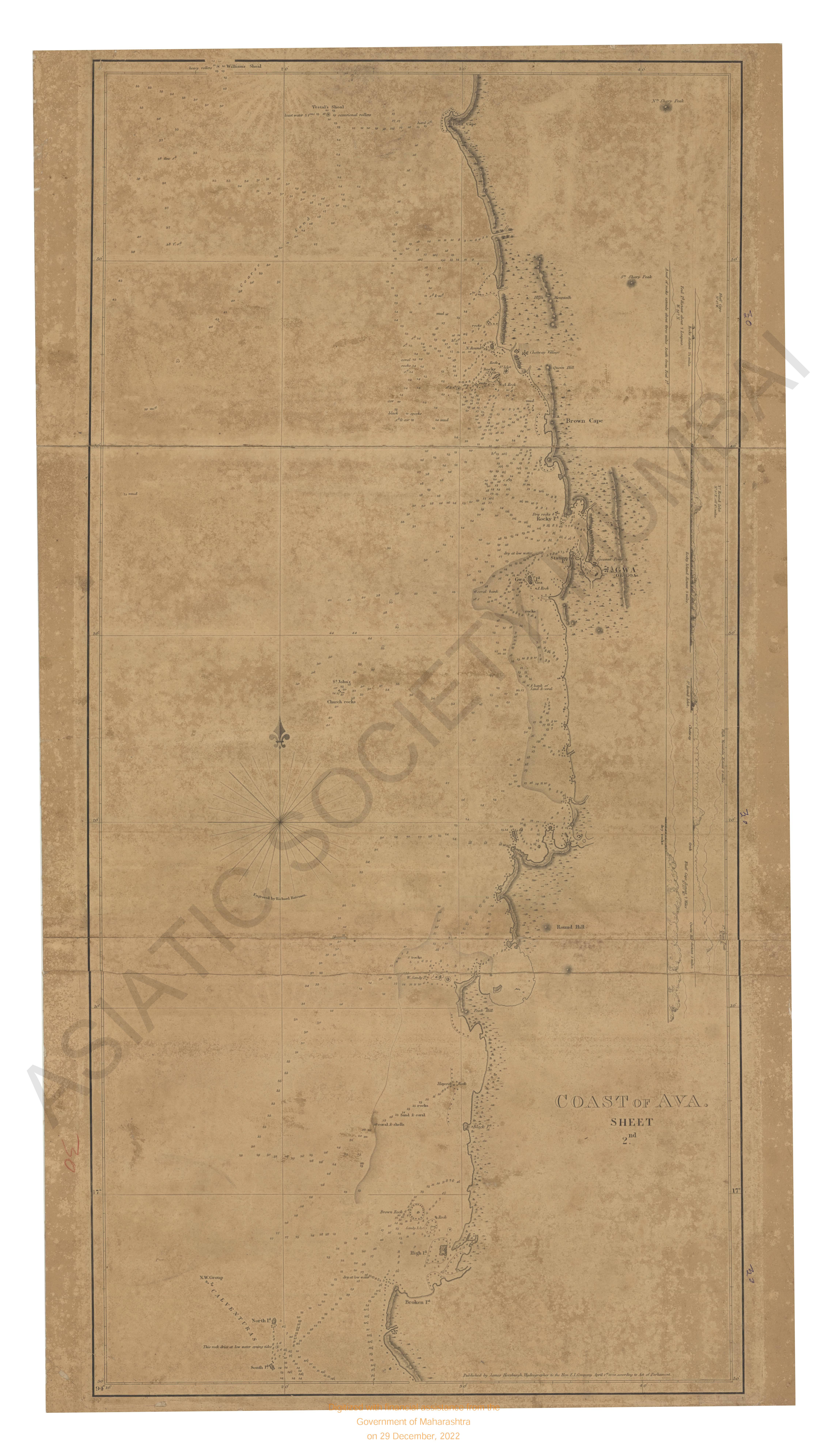
- Coast of Ava. Sheet 2nd, the survey of from the Calventures to Diamond I 1826.
- Year: 1826
- Subject: Topographic Map
- Publisher: James Horsburgh
- Language: English