-
-

- Chart of Choo Keang or Canton river.
- Year: 1831
-
-
-
-
-
-

-
- India, Bay of Bengal
- Year: 1878
-
-
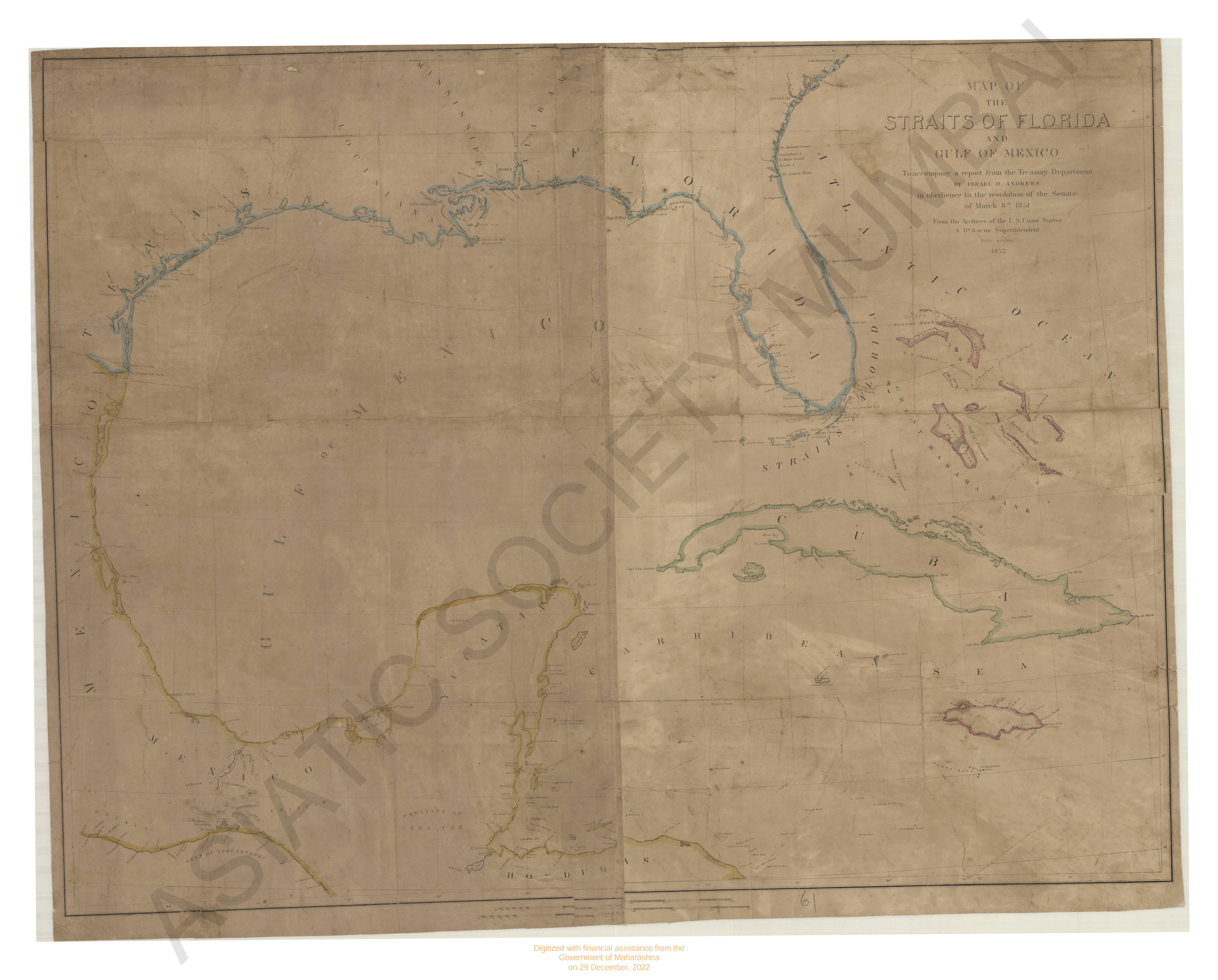
- Map of the Straits of Florida and Gulf of Mexico.
- Year: 1852
- Subject: Topographic Map
- Publisher: Israel D. Andrews
- Language: English
-
- Chart of Choo Keang or Canton river.
- Year: 1831
- Subject: Topographic Map
- Publisher: James Harsburg
- Language: English
-
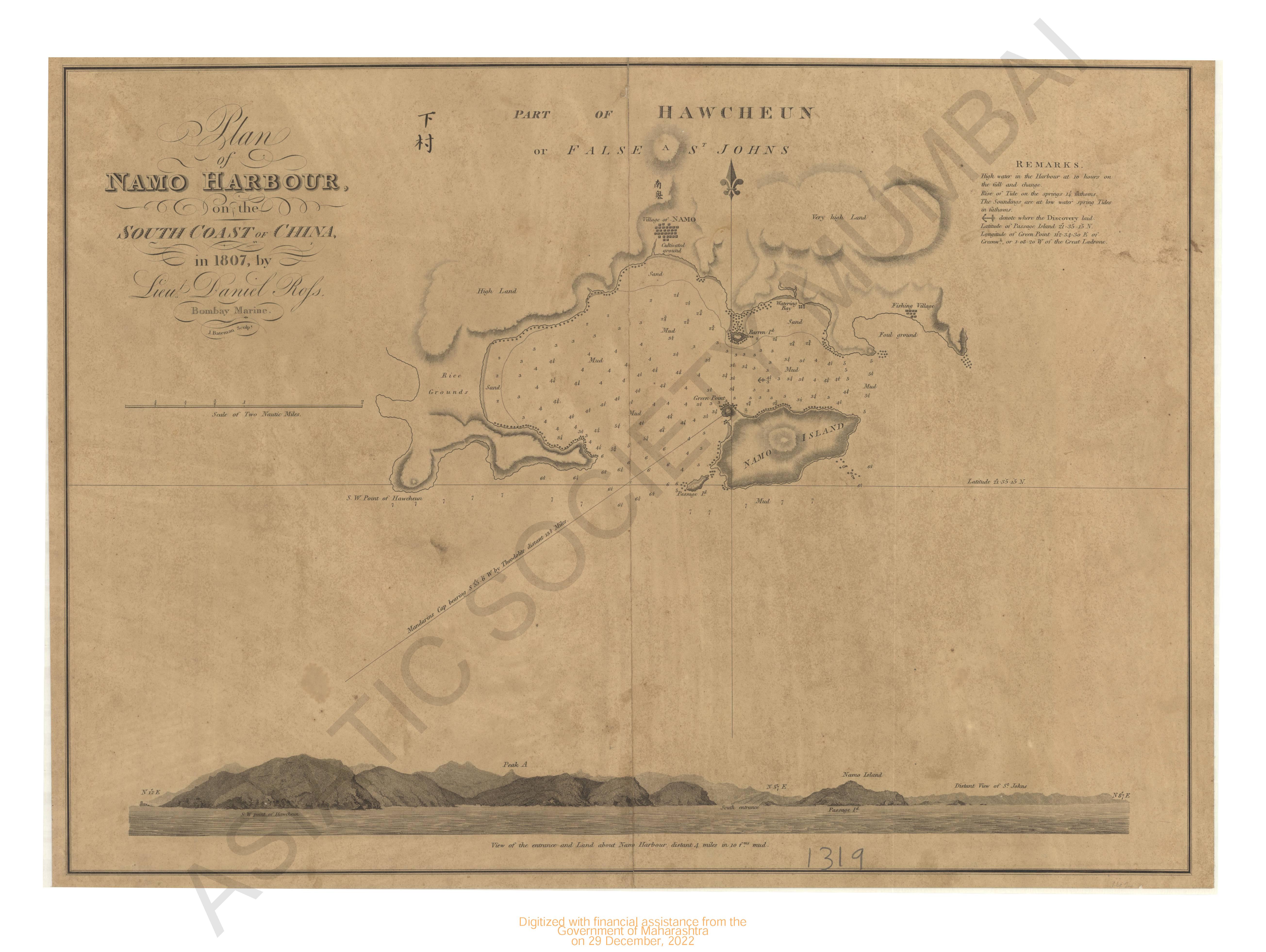
- Plan of Nano Harbour on the South coast of China 1807.
- Subject: Topographic Map
- Language: English
- Place of Publication: London
-
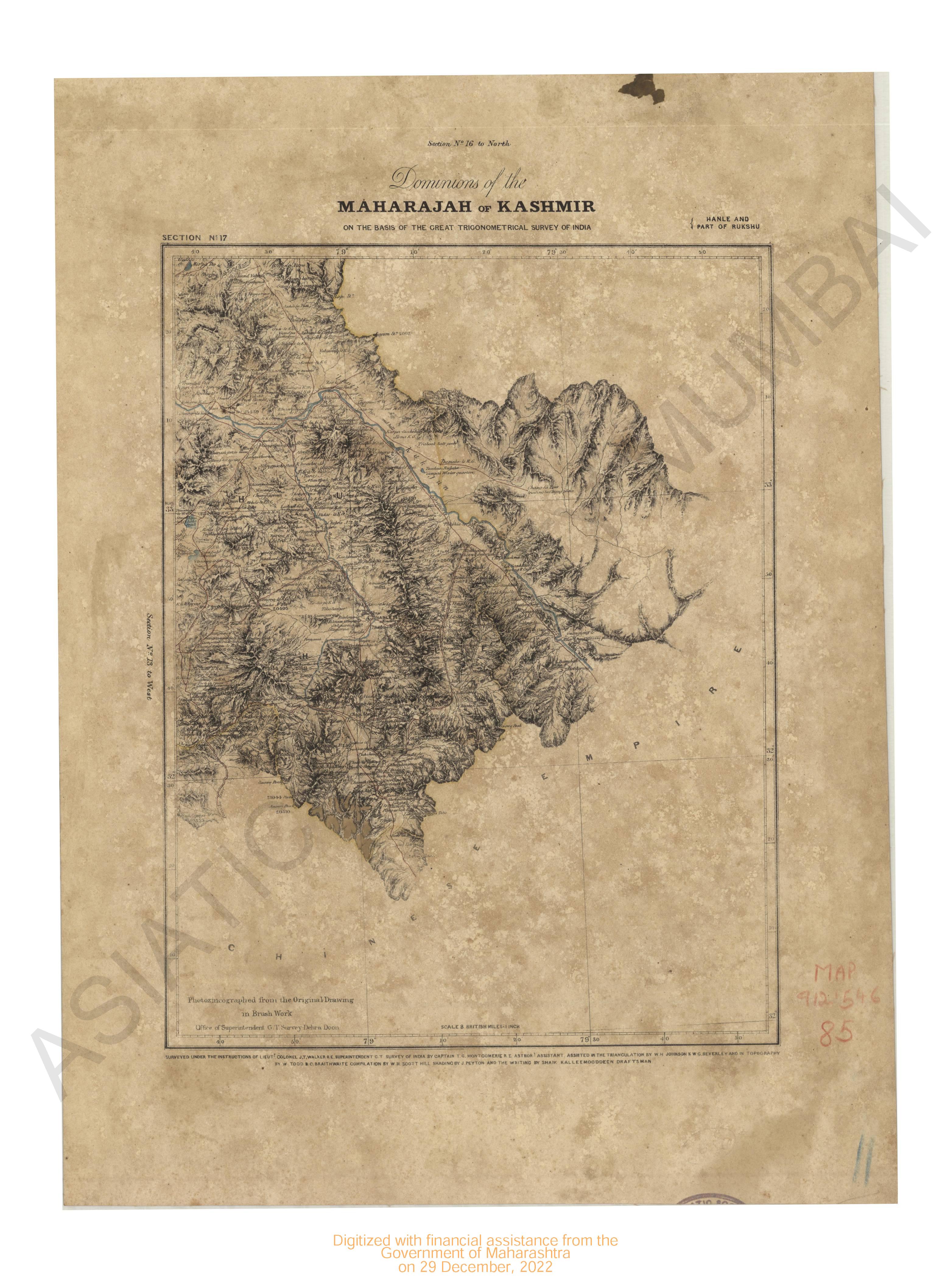
- Dominions of the Maharajah of Kashmir on the basis of the great trigonomentrical survey of India, Hanle and Part of Rukshu. Section no.17
- Year: 1868
- Subject: Topographic Map
- Publisher: G.T. survey office
- Language: English
- Place of Publication: Dehra Doon (Dehradun)
-
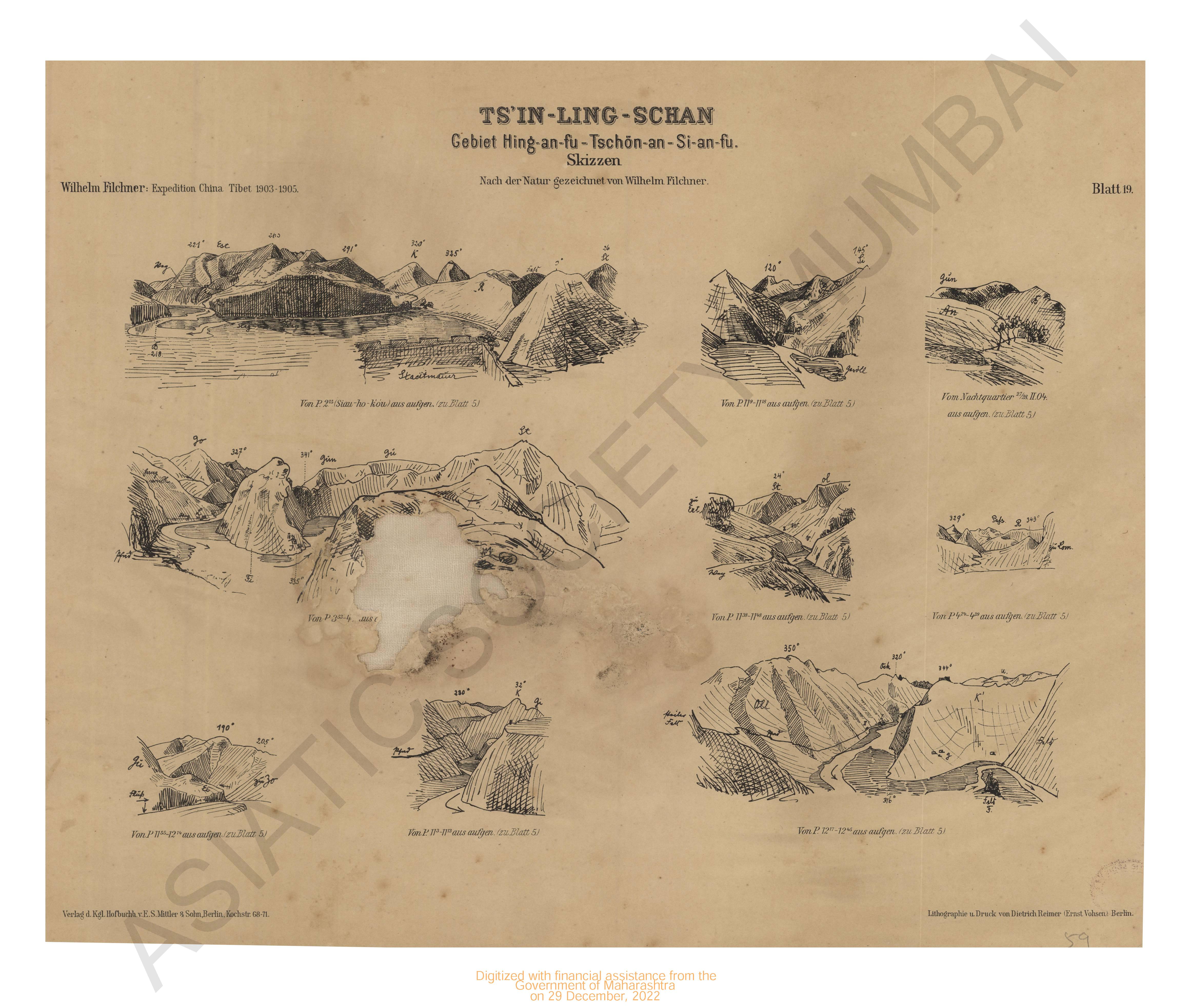
- Ts'in-Ling schan, Gebiet Hing-an-fu-Tschon An-si-an-fu. Skizzen Expedition China- Tibet 1903-1905. Blatt 19.
- Year: 1905
- Subject: Topographic Map
- Publisher: V.E.S.Mittler & Sons
- Language: English
- Place of Publication: Berlin
-
- North-West Frontiers Punjab revenue survey, district Huzarub 1865-69. Sheet No.12
- Year: 1870
- Subject: Topographic Map
- Publisher: Surveyor General's Office
- Language: English
- Place of Publication: Calcutta
-
- Map of the Salvankuppam about 3 miles North of the seven pagodas.
- Year: 1878
- Subject: Topographic Map
- Publisher: Surveyor Office
- Language: English
- Place of Publication: Washinton
-
- California Kaiser quadrangle surveyed in 1901.
- Year: 1904
- Subject: USGS topography
- Publisher: US geogological survey
- Language: English
- Place of Publication: Washinton
-
- India, Bay of Bengal
- Year: 1878
- Subject: Topographic Map
- Publisher: The Marine Survey dept
- Language: English
- Place of Publication: Calcutta
-
- Dominions of the Maharajah of Kashmir on the basis of the great trigonomentrical survey of India, Part of Ladak. Section no.11
- Year: 1868
- Subject: Topographic Map
- Publisher: G.T. survey office
- Language: English
- Place of Publication: Dehra Doon (Dehradun)