-
-
-
-
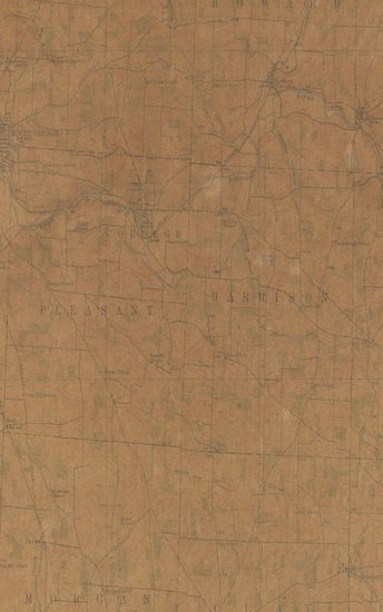
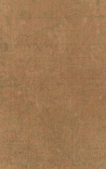
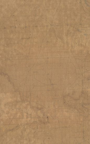
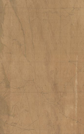
- Ohio Gambier Quadrangle Surveyed in 1912 in Cooperation ...
- Year: 1914
- Author: Marshall, R.B.
-
-
-
-
-
-
-
-
-
-
-
-
-
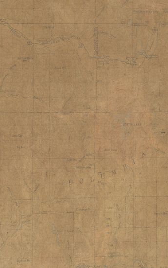
- Wyoming Crandall Quadrangle Surveyed in 1893
- Year: 1899
-
-
-
-
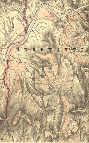
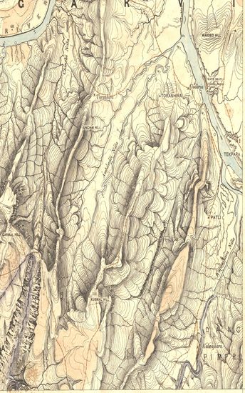
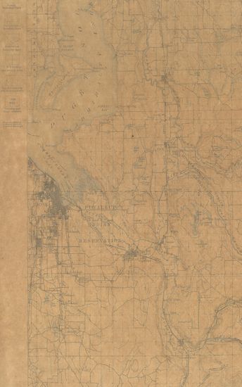
- Guzerat, Section No.1 of Sheet No. 49 (Dang Forests) : Part of Dang Garvi State, 1878-79
- Year: 1880
- Subject: Topographic Map
- Publisher: Deharadun Office of the Trignometrical branch. Survey Of India 1880
- Language: English
- Place of Publication: Deharadun
-
- Guzerat, Sheet 80 Section14 : Parts of the Sanand And Dholka Talukas of the Ahmedabad Collectorate (Season 1873-74)
- Year: 1876
- Publisher: Dehradun G.T.S. Office 1876
- Language: English
- Place of Publication: Dehradun
-
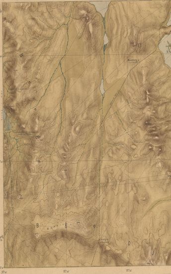
- Nord-ost Tibet. II. Teil (Gebiet Tosson-nōr-Oring-nōr) Lager XIX bis XXXIII Expedition Tibet 1903 To 1905. (Blatt 21)
- Year: 1905
- Subject: Topographic Map
- Publisher: Berlin E.S.Mittler & Sons 1905
- Language: English
- Place of Publication: Berlin
-
- Ohio Gambier Quadrangle Surveyed in 1912 in Cooperation with the State of Ohio
- Year: 1914
- Author: Marshall, R.B.
- Subject: Topographic Map
- Publisher: Washington US Geological Survey 1914
- Language: English
- Place of Publication: Washington
-
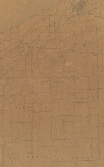
- Ohio-Pennsylvania conneaut Quadrangle Surveyed in 1904 in Cooperation with the State of Ohio
- Year: 1906
- Subject: Topographic Map
- Publisher: Washington US Geological Survey 1906
- Language: English
- Place of Publication: Washington
-
- Ohio Londonville Quadrangle Surveyed in 1912 in Cooperation with the State of Ohio
- Year: 1914
- Subject: Topographic Map
- Publisher: Washington US Geological Survey 1914
- Language: English
- Place of Publication: Washington
-
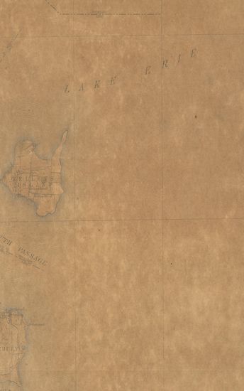
- Ohio Kelleys Island Quadrangle Surveyed in 1916 in Cooperation with the State of Ohio
- Year: 1918
- Subject: Topographic Map
- Publisher: Washington US Geological Survey 1918
- Language: English
- Place of Publication: Washington
-
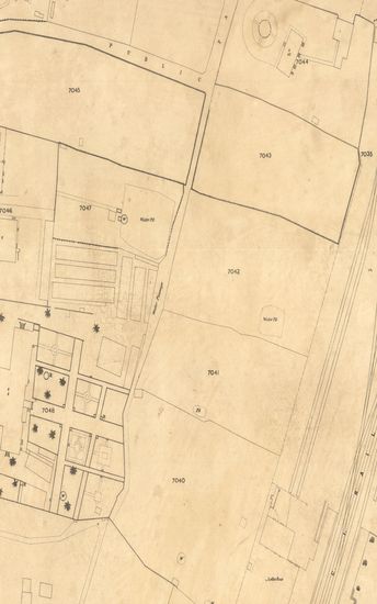
- Tardeo Surveyed in 1868-69 corrected upto 1st June 1871 Bombay Revenue Survey. (Sheet No.LXXXIII).
- Year: 1873
- Publisher: Poona (Pune) Photozincographical Government Office 1873
- Language: English
- Place of Publication: Poona (Pune)
-
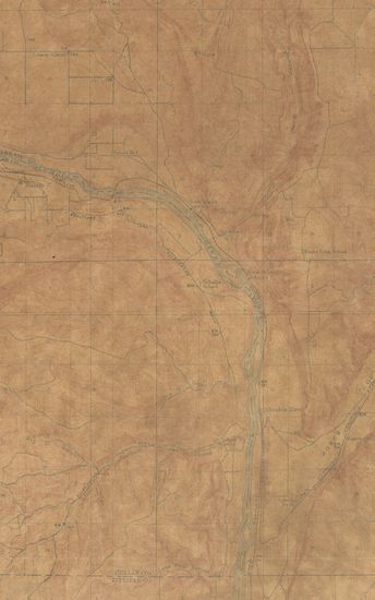
- Guzerat, Section No.2 of Sheet No. 49 (Dang Forests) : Part of Dang Garvi State, 1878-79 & 1880-81
- Year: 1883
- Subject: Topographic Map
- Publisher: Deharadun Office of the Trignometrical branch. Survey Of India 1883
- Language: English
- Place of Publication: Deharadun
-
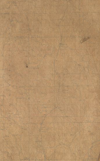
- Wyoming Nbebraska Goshen Hole Quadrangle Surveyed in 1895
- Year: 1899
- Subject: Topographic Map
- Publisher: Washington US Geological Survey 1899
- Language: English
- Place of Publication: Washington
-
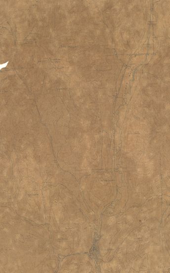
- Colorado (La Plata county) Durango Quadrangle Surveyed in1896
- Year: 1914
- Publisher: Washington US Geological Survey 1914
- Language: English
- Place of Publication: Washington
-
- Washington Tacoma Quadrangle Surveyed in 1894-95
- Year: 1897
- Subject: Topographic Map
- Publisher: Washington US Geological Survey 1897
- Language: English
- Place of Publication: Washington
-
- Washington Malaga Quadrangle Surveyed in 1911-12 in Coooperation with the State of Washington
- Year: 1914
- Subject: Topographic Map
- Publisher: Washington US Geological Survey 1914
- Language: English
- Place of Publication: Washington
-
- New Mexico (Grant county) Antelope Wells Quadrangle Surveyed in 1917 in Cooperation with War Department
- Year: 1919
- Subject: Topographic Map
- Publisher: Washington US Geological Survey 1919
- Language: English
- Place of Publication: Washington
-
- Washington Mt. St. Helens Quadrangle Surveyed in 1913-14 & 1916
- Year: 1919
- Subject: Topographic Map
- Publisher: Washington US Geological Survey 1919
- Language: English
- Place of Publication: Washington
-
- South Dakota Northville Quadrangle Surveyed in 1898-99
- Year: 1901
- Subject: Topographic Map
- Publisher: Washington US Geological Survey 1901
- Language: English
- Place of Publication: Washington
-
- Wyoming Crandall Quadrangle Surveyed in 1893
- Year: 1899
- Subject: Topographic Map
- Publisher: Washington US Geological Survey 1899
- Language: English
- Place of Publication: Washington
-
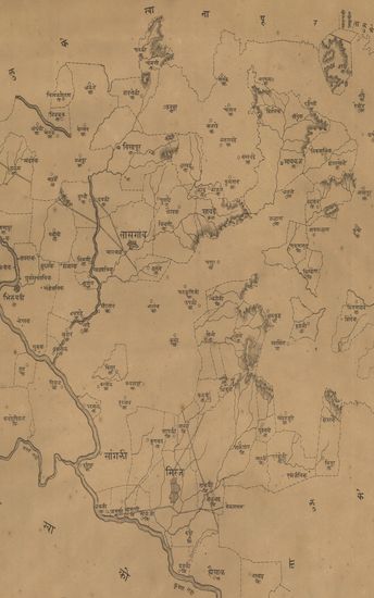
- नकाशा तालुके तासगांव जिल्हा सातारा मिरज जाहागीर आणि सांगली जाहगीर ; यैकीकाहिगावे दाखल केले आहेत . - Map of the Taluka Tasgaon District Satara Miraj Jahagir and Sangli Jahagir ; some of these villages have been filed.
- Year: 1875
- Subject: Topographic Map
- Publisher: Poona (Pune) Government Photozincographic Office 1875
- Language: English
- Place of Publication: Poona (Pune)
-
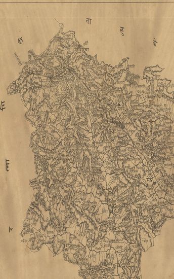
- Map of the Sangole (Sangola) Taluka of the Sholapur (Solapur) Zilla. - नकाशा सांगोले तालुका जिल्हा सोलापूर .
- Year: 1872
- Subject: Topographic Map
- Publisher: Poona (Pune) Government Photozincographic Office 1872
- Language: English
- Place of Publication: Poona (Pune)
-
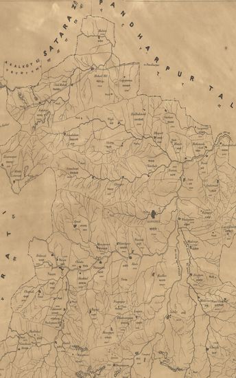
- नकाशा तालुके जावलि जिल्हा सातारा . - Map of the Javali Taluka Satara District.
- Year: 1875
- Subject: Topographic Map
- Publisher: Poona (Pune) Government Photozincographic Office 1875
- Language: English
- Place of Publication: Poona (Pune)