-
-
-
-
-

-
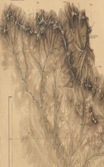
- Map of Jalgaon Taluka, West Berar.
- Year: 1874
-

-
-
-
-
-
-
-
-
-
-
-
-
-
-
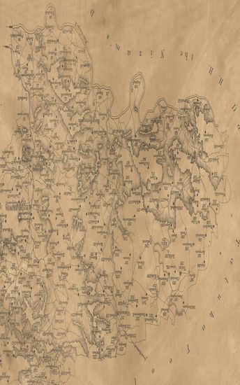
- District Sehwan and (Kohistan) Surveyed in 1863-64 Sind Revenue Survey (Sheet No.39)
- Year: 1870
- Subject: Cadastral Map
- Publisher: Calcutta Surveyor General's Office 1870
- Language: English
- Place of Publication: Calcutta
-
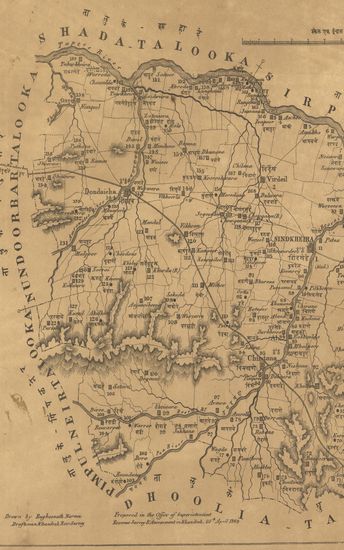
- Map of the Virdeil (Virdel) Taluka, Khandesh Collectorate.
- Year: 1869
- Subject: Topographic Map
- Publisher: Poona (Pune) Government Photozincographic Office 1869
- Language: English
- Place of Publication: Poona (Pune)
-
- District Jacobabad, Shikarpoor (Shikarpur) and Larkana Surveyed in 1857-58-59 and 60. Sind Revenue Survey (Sheet No.10)
- Subject: Cadastral Map
- Publisher: Calcutta Surveyor General's Office
- Language: English
- Place of Publication: Calcutta
-
- Map of the Kelapur (Khalapur) Taluka, East Berar.
- Year: 1876
- Subject: Topographic Map
- Publisher: Poona (Pune) Government Photozincographic Office 1876
- Language: English
- Place of Publication: Poona (Pune)
-
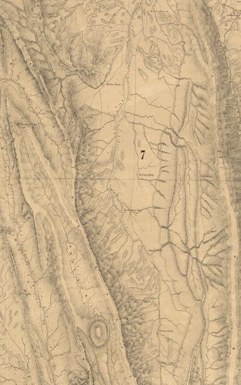
- Map of the Moorbad Talooka, Tanna Collectorate.
- Year: 1868
- Subject: Topographic Map
- Publisher: Poona (Pune) Photozincographic Press 1868
- Language: English
- Place of Publication: Poona (Pune)
-
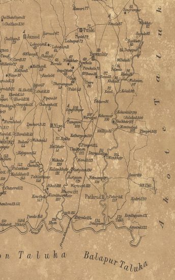
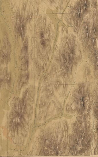
- Map of Jalgaon Taluka, West Berar.
- Year: 1874
- Subject: Topographic Map
- Publisher: Poona (Pune) Government Photozincographic Office 1874
- Language: English
- Place of Publication: Poona (Pune)
-
- Thana (Thane) District.
- Subject: Topographic Map
- Language: English
-
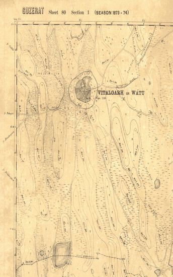
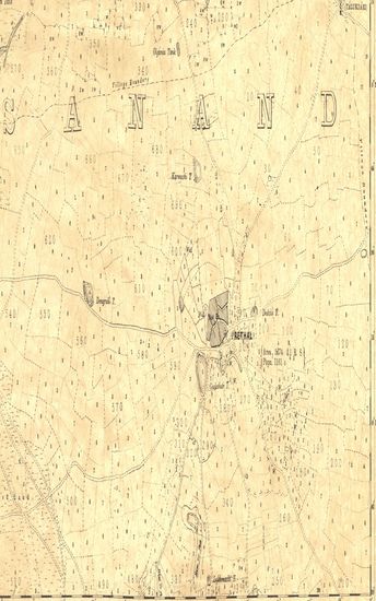
- Gujerat, Sheet No.80 : Parts of the Ahmedabad district, and of Kattywar (Season 1873-74)
- Year: 1878
- Subject: Topographic Map
- Publisher: Dehradun G.T.S. Office 1878
- Language: English
- Place of Publication: Dehradun
-
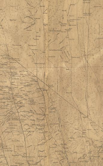
- Portions of Baitool Chindwara & Hoshungabad - ( Betul Chhindwara & Hoshangabad ). Season 1867-68-69. Central Provinces Topographical Survey. (Sheet No.12)
- Year: 1870
- Subject: Topographic Map
- Publisher: Calcutta Surveyor General's Office 1870
- Language: English
- Place of Publication: Calcutta
-
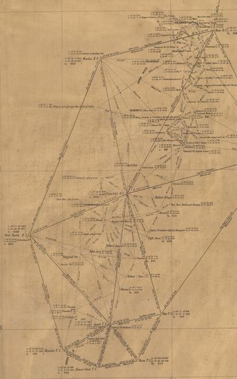
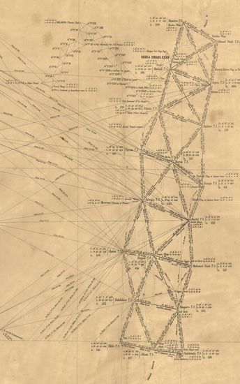
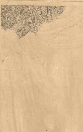
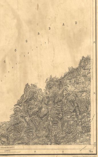
- Great Trigonometrical of India: Preliminary chart the great Indus series. Season(2) 1856-57 - (Sheet No. 2- 12 Maps ) .
- Year: 1871
- Publisher: Dehra Doon (Dehradun) Government Photozincographic Office 1871
- Language: English
- Place of Publication: Dehra Doon (Dehradun)
-
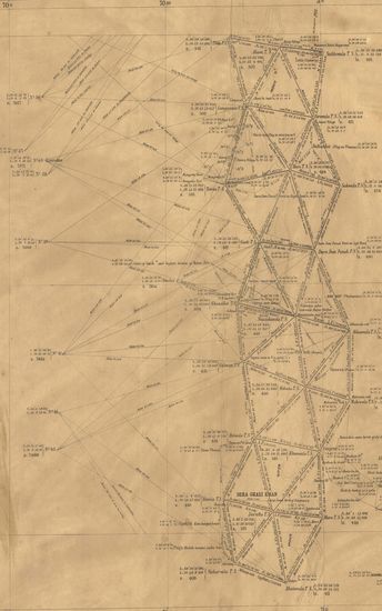
- Great Trigonometrical of India: Preliminary chart the great Indus series. Season(2) 1856-57 - (Sheet No. 2- 12 Maps ) .
- Year: 1871
- Publisher: Dehra Doon (Dehradun) Government Photozincographic Office 1871
- Language: English
- Place of Publication: Dehra Doon (Dehradun)
-
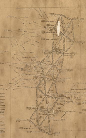
- Great Trigonometrical of India: Preliminary chart the great Indus series. Season(2) 1856-57 - (Sheet No. 2- 12 Maps ) .
- Year: 1871
- Publisher: Dehra Doon (Dehradun) Government Photozincographic Office 1871
- Language: English
- Place of Publication: Dehra Doon (Dehradun)
-
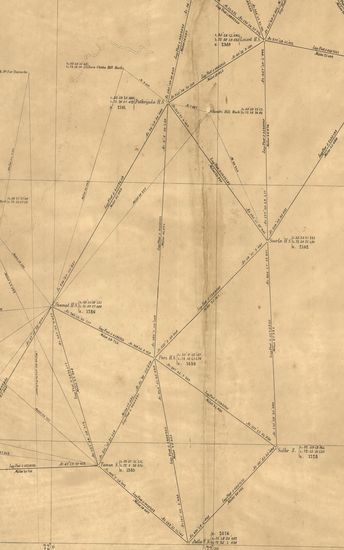
- Great Trigonometrical of India: Preliminary chart the great Indus series. Season(2) 1856-57 - (Sheet No. 2- 12 Maps ) .
- Year: 1871
- Publisher: Dehra Doon (Dehradun) Government Photozincographic Office 1871
- Language: English
- Place of Publication: Dehra Doon (Dehradun)
-
- Great Trigonometrical of India: Preliminary chart the great Indus series. Season(2) 1856-57 - (Sheet No. 2- 12 Maps ) .
- Year: 1871
- Publisher: Dehra Doon (Dehradun) Government Photozincographic Office 1871
- Language: English
- Place of Publication: Dehra Doon (Dehradun)
-
- Portion of Baitool (Betul). Season 1867-68-69-70. Central Provinces Topographical Survey. (Sheet No.14)
- Year: 1871
- Subject: Topographic Map
- Publisher: Calcutta Surveyor General's Office 1871
- Language: English
- Place of Publication: Calcutta
-
- Portion of Hoshungabad (Hoshangabad). Season 1868-69. Central Provinces Topographical Survey. (Sheet No.11)
- Year: 1871
- Subject: Topographic Map
- Publisher: Calcutta Surveyor General's Office 1871
- Language: English
- Place of Publication: Calcutta
-
- Guzerat, Sheet 80 Section 3 : Part of the Viramgam Taluka of the Ahmedabad Collectorate with portions of the Lagtar & Limri States (Season 1873-74)
- Year: 1874
- Subject: Topographic Map
- Publisher: Dehradun G.T.S. Office 1874
- Language: English
- Place of Publication: Dehradun
-
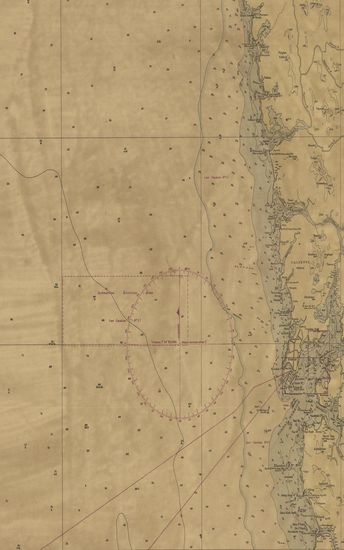
- India West Coast - Tarapur to Murud-Janjira compiled from various Hydrogarphic surveys to 1967. (No.255)
- Year: 1968
- Publisher: Dehradun Naval Hydrographic Office 1968
- Language: English
- Place of Publication: Dehradun
-
- Nord-ost Tibet. II. Teil (Gebiet Tosson-nōr-Oring-nōr) Lager XIX bis XXXIII Expedition Tibet 1903 To 1905. (Blatt 14)
- Year: 1905
- Subject: Topographic Map
- Publisher: Berlin E.S.Mittler & Sons 1905
- Language: English
- Place of Publication: Berlin
-
- Nord-ost Tibet. II. Teil (Gebiet Tosson-nōr-Oring-nōr) Lager XIX bis XXXIII Expedition Tibet 1903 To 1905. (Blatt 19)
- Year: 1905
- Subject: Topographic Map
- Publisher: Berlin E.S.Mittler & Sons 1905
- Language: English
- Place of Publication: Berlin