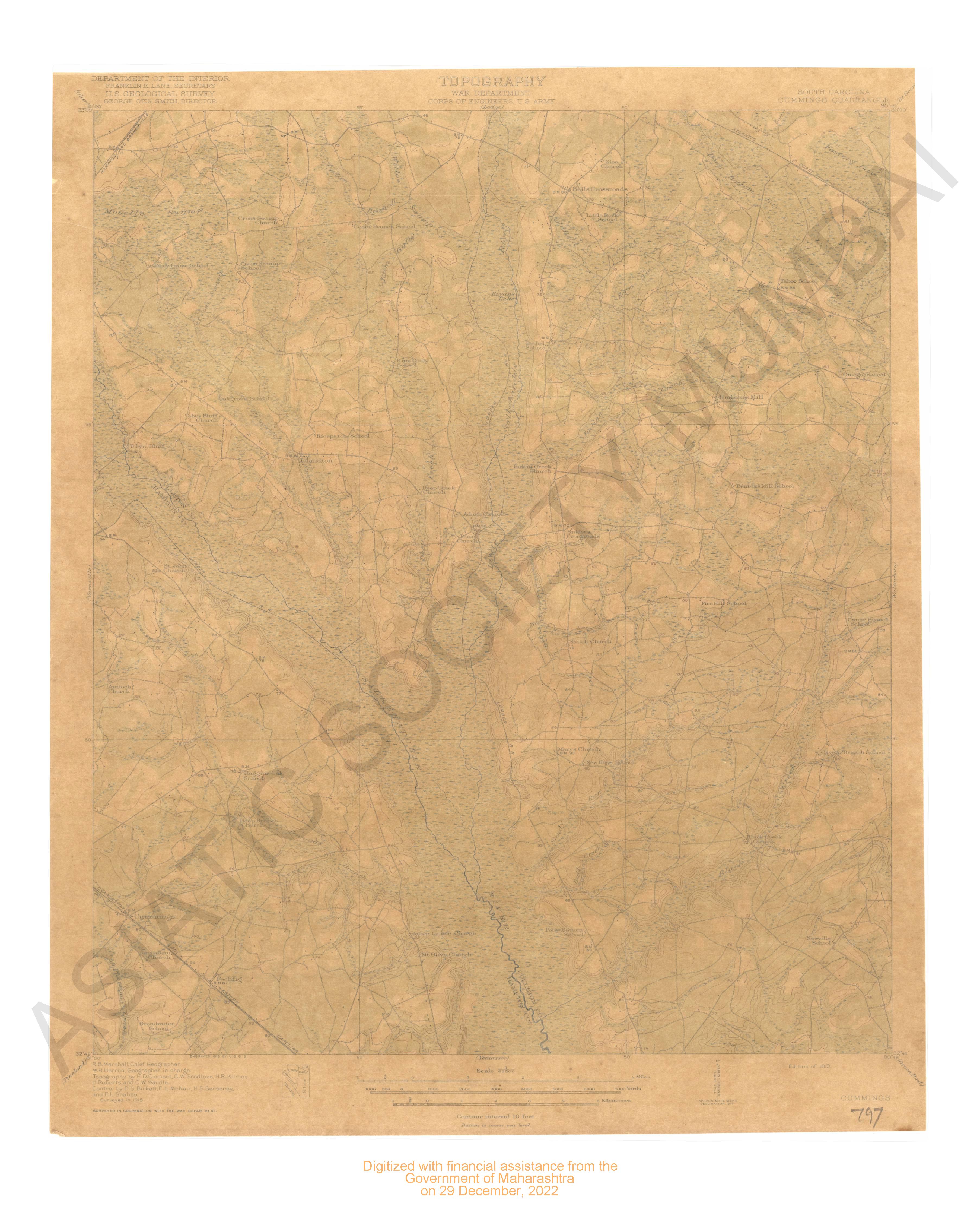
-
- 10 Views
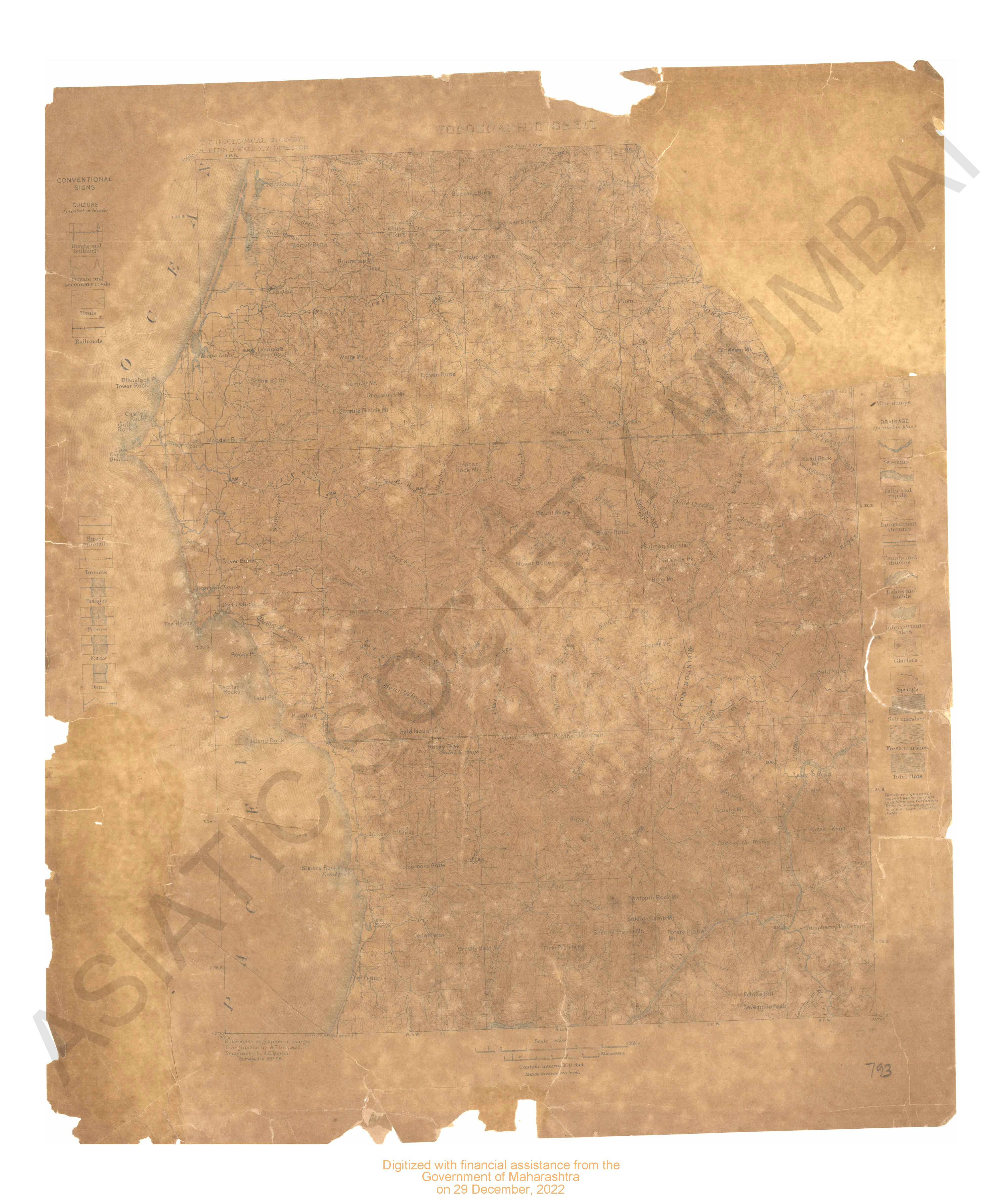
-
- 3 Views
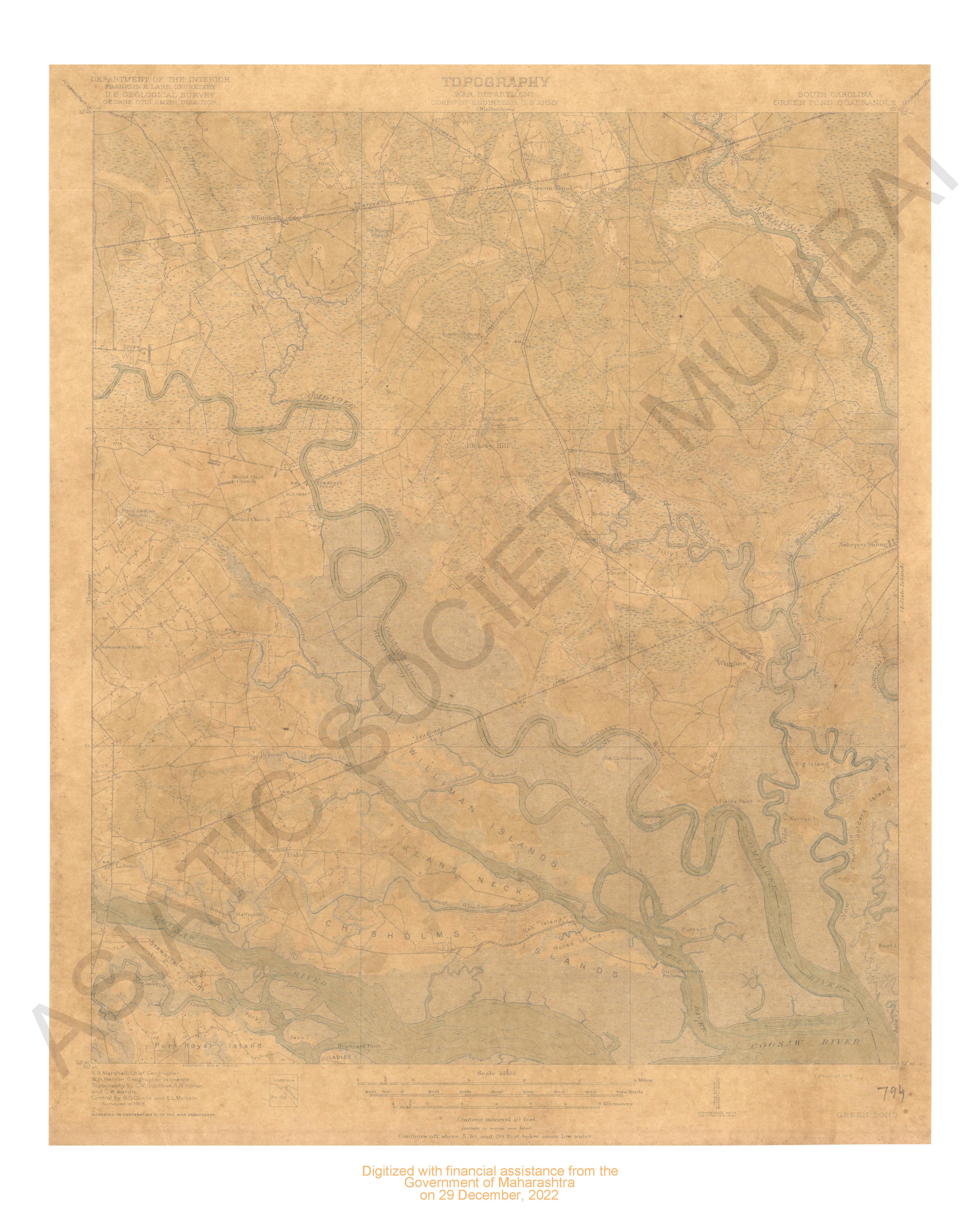
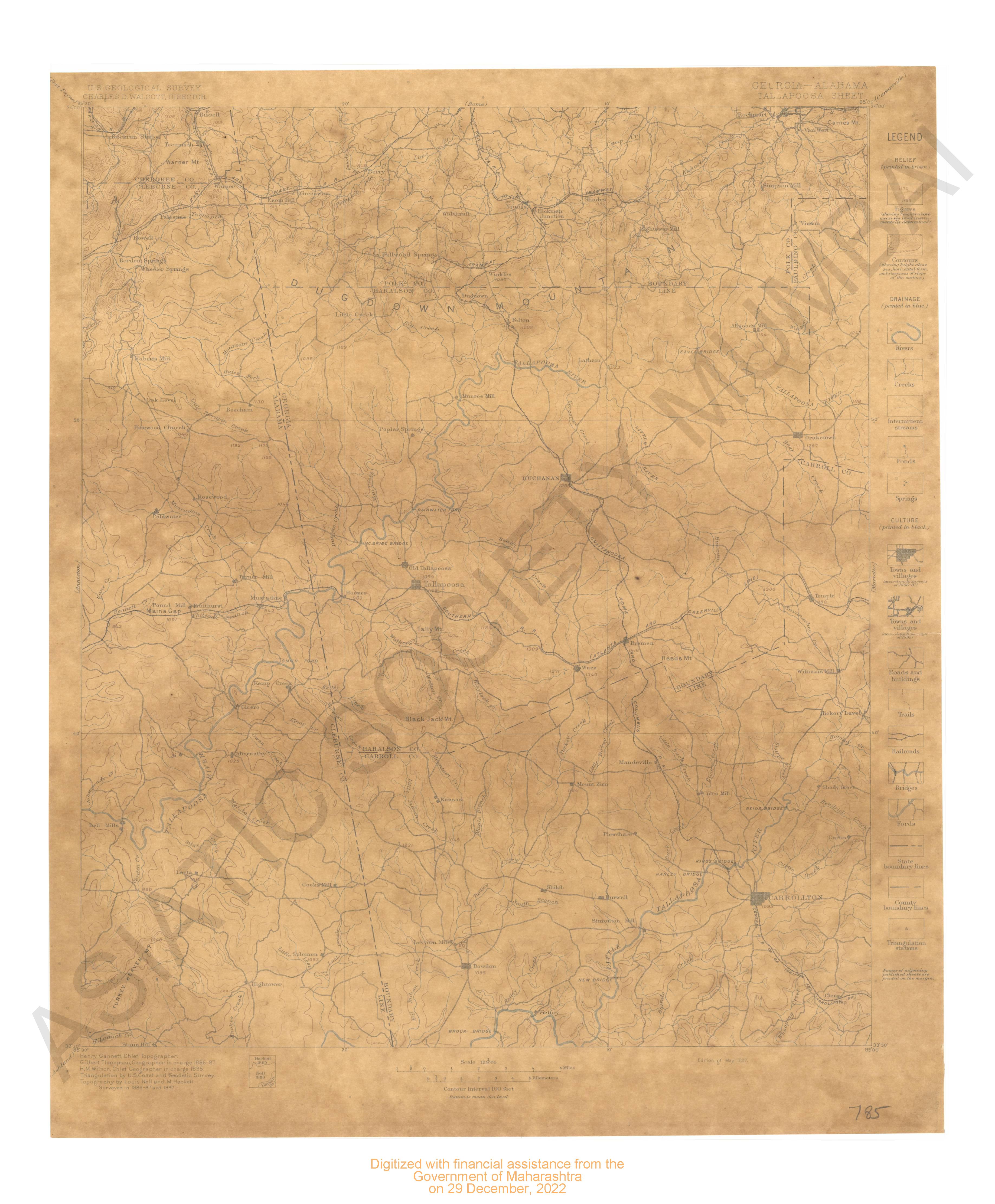
- Pilot chart of the south Atlantic.
- Year: 1850
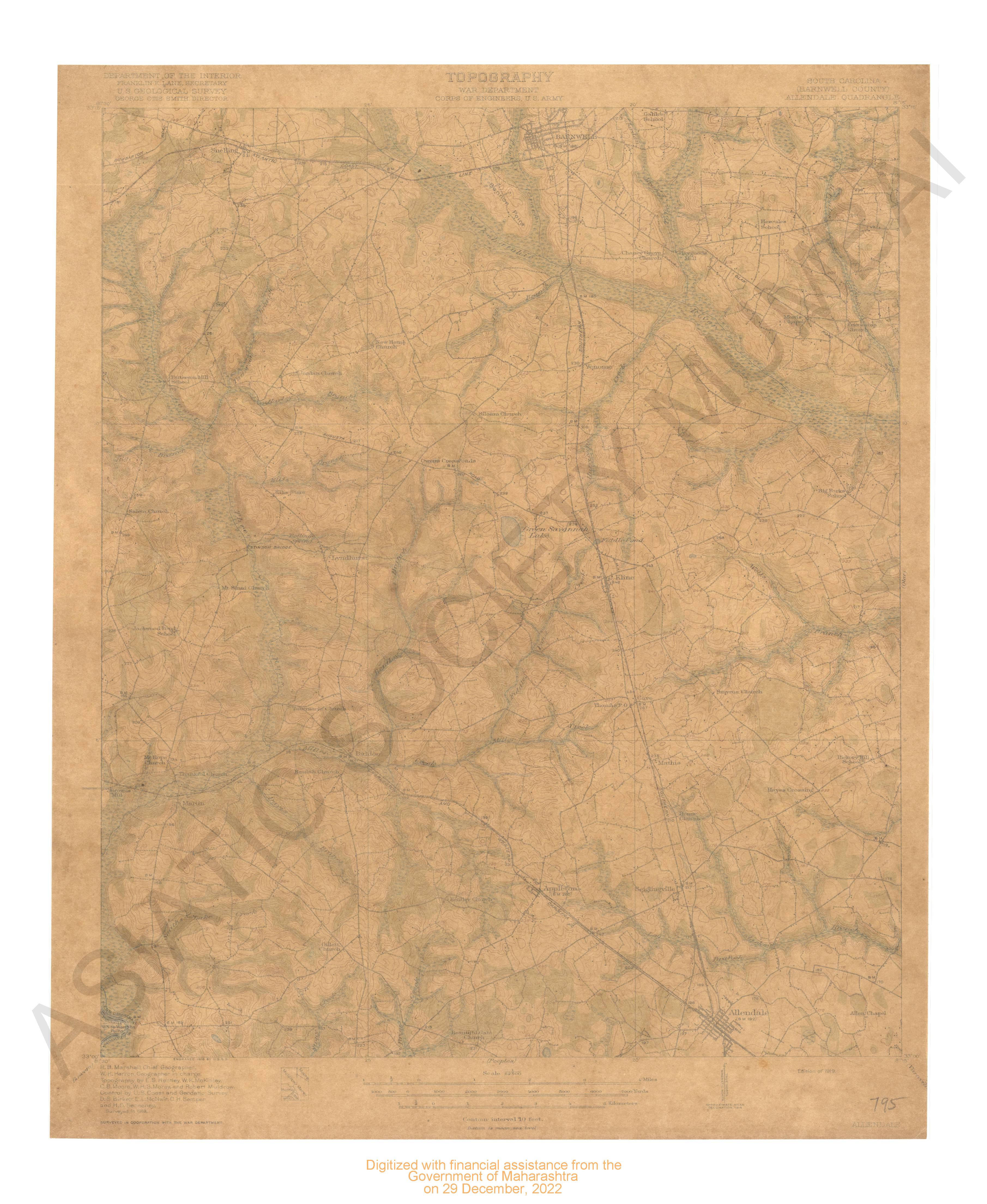
-
- 3 Views
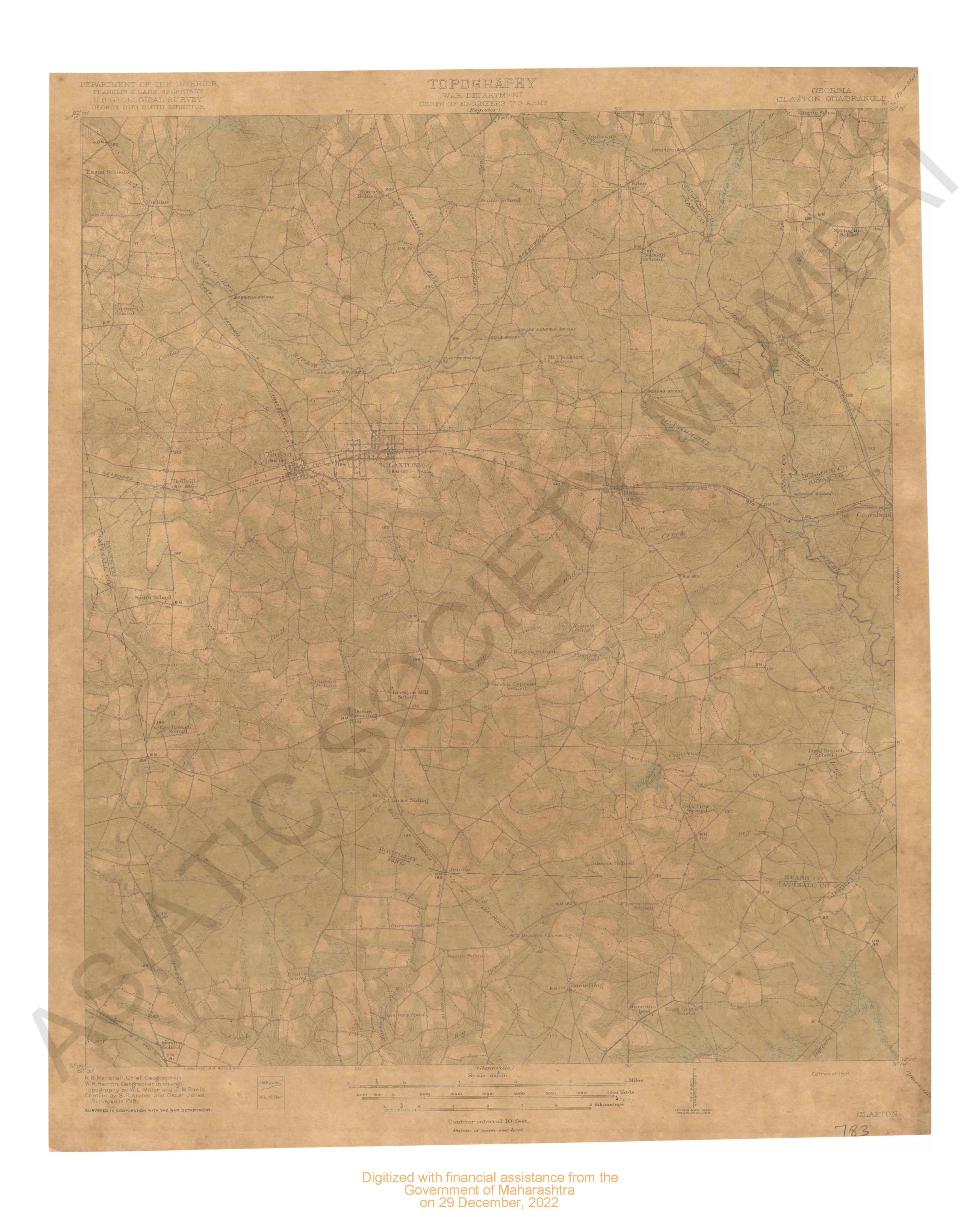
- Montana Braockton Quadrangle in 1910-1911
- Year: 1914
-
- 9 Views
-
- 9 Views
-
- 3 Views
-
- 9 Views
-
- 10 Views
-
- 10 Views
-
- 13 Views
-
- 9 Views
-
- 9 Views
-
- 9 Views
-
- 2 Views
-
- 2 Views
-
- 2 Views
-
- 9 Views
-
- 9 Views
-
- 9 Views

-
- 9 Views
-
- Montana (Choutea county) Kremlin Quadrangle Surveyed in 1904
- Year: 1906
- Subject: Topographic Map
- Publisher: Washignton US Geological Survey 1906
- Language: English
- Place of Publication: Washignton
- 10 Views
-
- Pilot chart of the south Atlantic.
- Year: 1850
- Subject: Topographic Map
- Publisher: National Observatory
- Language: English
- Place of Publication: Washington
- 3 Views
-
- Montana Braockton Quadrangle in 1910-1911
- Year: 1914
- Subject: Topographic Map
- Publisher: Washington US Geological Survey 1914
- Language: English
- Place of Publication: Washington
- 3 Views
-
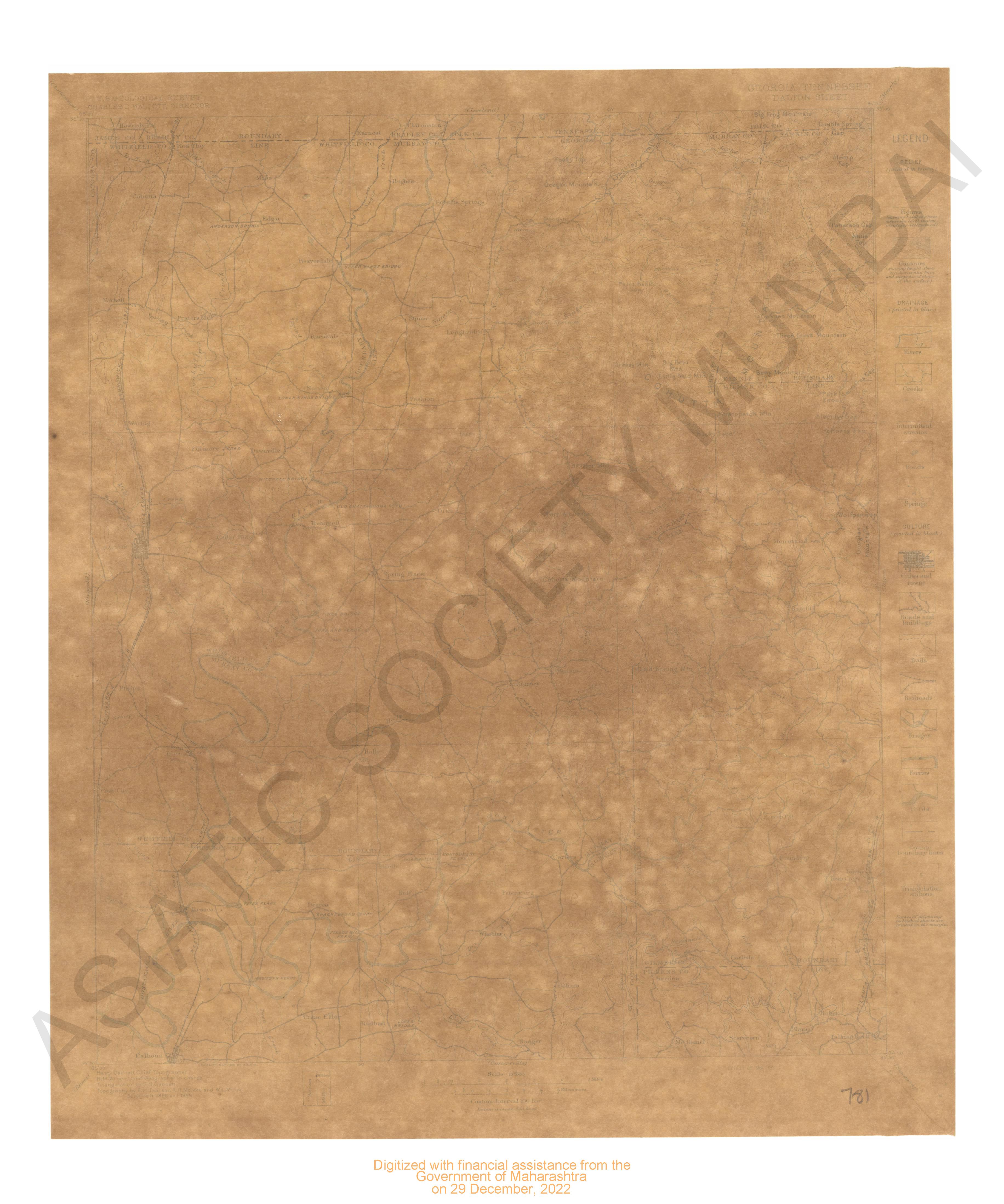
- Montana-Idaho St.Regis Quadrangle Surveyed in 1912 and 1914-1916
- Year: 1919
- Subject: Topographic Map
- Publisher: Washinton US Geological Survey 1919
- Language: English
- Place of Publication: Washinton
- 9 Views
-
- Montana ( Valley county) porcupine valley surveyed in 1909-1910
- Year: 1918
- Subject: Topographic Map
- Publisher: Washinngton US Geological Survey 1918
- Language: English
- Place of Publication: Washinngton
- 9 Views
-
- Michigan Baycity Quadrangle Surveyed in 1916 in Cooperation With the State of Michigan
- Year: 1919
- Subject: Topographic Map
- Publisher: Washington US Geological Survey 1919
- Language: English
- Place of Publication: Washington
- 3 Views
-
- Michigan (Iron Co.) Crystal Fall Quadrangle Surveyed in 1891 & 1895
- Year: 1899
- Subject: Topographic Map
- Publisher: Washington US Geological Survey 1899
- Language: English
- Place of Publication: Washington
- 9 Views
-
- Montana ( Flatehead county) Nyack Quadrangle in 1907 & 1910-912
- Year: 1914
- Subject: Topographic Map
- Publisher: Washingron US Geological Survey 1914
- Language: English
- Place of Publication: Washingron
- 10 Views
-
- Michigan (Houghton county) Houghton Quadrangle Surveyed in 1908, 1909, 1911 & 1912
- Year: 1915
- Subject: Topographic Map
- Publisher: Washington US Geological Survey 1915
- Language: English
- Place of Publication: Washington
- 10 Views
-
- Michigan Saginaw Quadrangle Surveyed in 1916 in Cooperation with the State of Michigan
- Year: 1919
- Subject: Topographic Map
- Publisher: Washington US Geological Survey 1919
- Language: English
- Place of Publication: Washington
- 13 Views
-
- Michigan Gand Rapids Quadrangle Surveyed in Cooperation with the State of Michigan
- Year: 1914
- Subject: Topographic Map
- Publisher: Washington US Geological Survey 1914
- Language: English
- Place of Publication: Washington
- 9 Views
-
- Michigan Kalamazoo Quadrangle Surveyed in 1916
- Year: 1918
- Subject: Topographic Map
- Publisher: Washington US Geological Survey 1918
- Language: English
- Place of Publication: Washington
- 9 Views
-
- Michingan (Isabella county) Mount Pleasant Surveyed Cooperation with the state of Michigan
- Year: 1919
- Subject: Topographic Map
- Publisher: Washington US Geological Survey 1919
- Language: English
- Place of Publication: Washington
- 9 Views
-
- Michigan Perrinton Quadrangle Surveyed in 1915-16 Cooperation with the State Of Michigan
- Year: 1918
- Subject: Topographic Map
- Publisher: Washington US Geological Survey 1918
- Language: English
- Place of Publication: Washington
- 2 Views
-
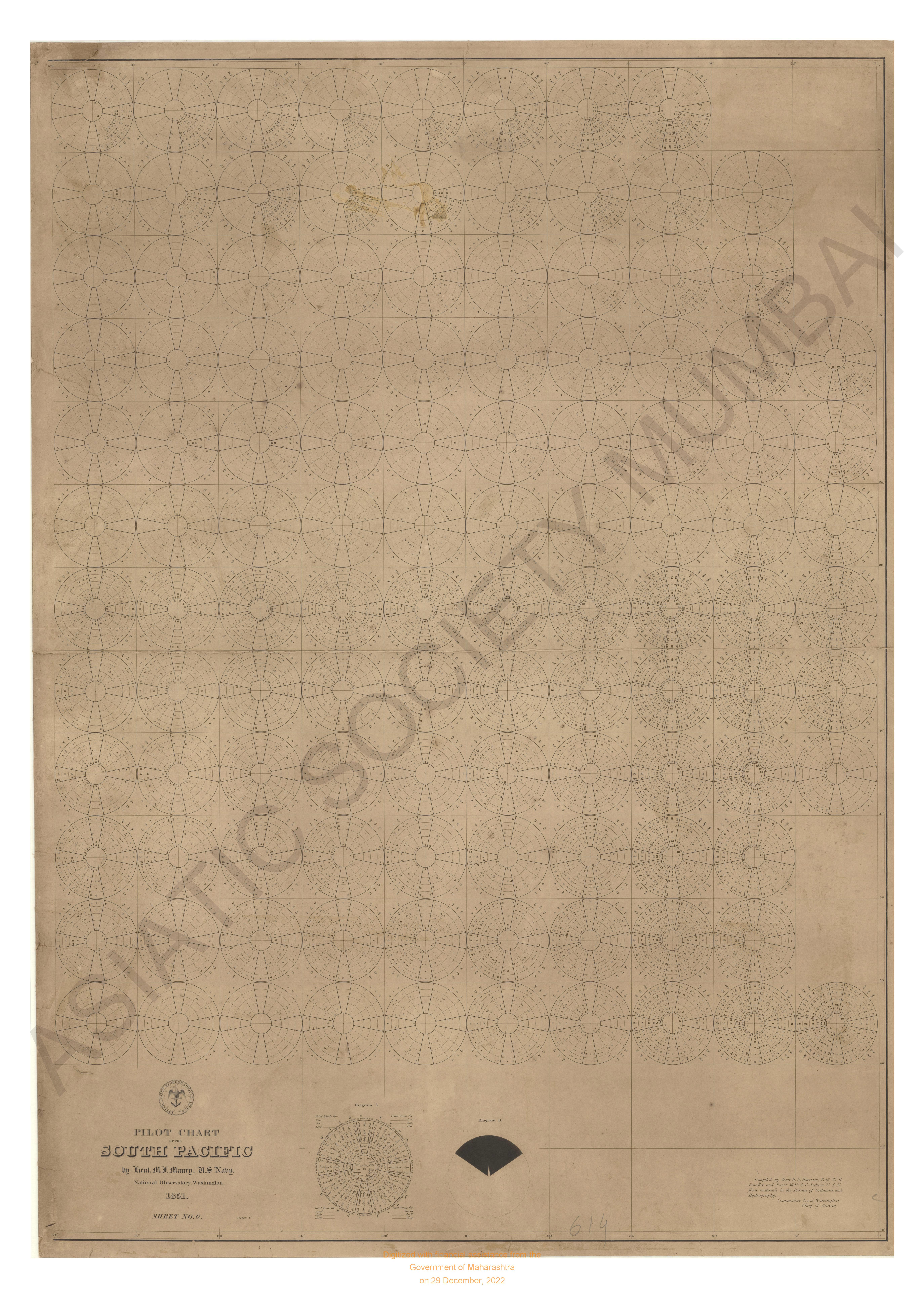
- Pilot chart of the south pacific compiled in the of ordinanace & Hydrography.
- Year: 1851
- Subject: Topographic Map
- Publisher: National Observatory
- Language: English
- Place of Publication: Washington
- 2 Views
-
- Iowa Madrid Quadrangle Surveyed in 1911 in Cooperation with the State of Iowa
- Year: 1914
- Subject: Topographic Map
- Publisher: Washington US Geological Survey 1914
- Language: English
- Place of Publication: Washington
- 2 Views
-
- Iowa Chariton Quadrangle Surveyed in 1915 in Cooperation with the State of Iowa
- Year: 1918
- Subject: Topographic Map
- Publisher: Washington US Geological Survey 1918
- Language: English
- Place of Publication: Washington
- 9 Views
-
- Michigan Witbeck Quadrangle Surveyed in 1891-96
- Year: 1899
- Subject: Topographic Map
- Publisher: Washington US Geological Survey 1899
- Language: English
- Place of Publication: Washington
- 9 Views
-
- Illinois-Missouri Campbell Hill Quadrangle Surveyed 1915-16 in Cooperation with the state of Illinois & Missouri
- Year: 1918
- Subject: Topographic Map
- Publisher: Washington US Geological Survey 1918
- Language: English
- Place of Publication: Washington
- 9 Views
-
- Illinois Centralia Quadrangle Surveyed in 1908 & Cooperation with the State of Illinois
- Year: 1914
- Subject: Topographic Map
- Publisher: Washington US Geological Survey 1914
- Language: English
- Place of Publication: Washington
- 9 Views