-
- 2 Views
-
- 4 Views

-
- 2 Views

-
- 2 Views
-
- 2 Views
-
- 2 Views
-
- 4 Views
-
- 4 Views
-
- 14 Views
-
- 11 Views
-
- Montana (Choteau county) Havre quadrangle surveyed in 1902.
- Year: 1904
- Subject: USGS topography
- Publisher: US geogological survey
- Language: English
- Place of Publication: Washinton
- 2 Views
-
- California Venture quadrangle surveyed in 1901.
- Year: 1904
- Subject: USGS topography
- Publisher: US geogological survey
- Language: English
- Place of Publication: Washinton
- 4 Views
-
- California Kaiser quadrangle surveyed in 1901.
- Year: 1904
- Subject: USGS topography
- Publisher: US geogological survey
- Language: English
- Place of Publication: Washinton
- 2 Views
-
- (India) Gulf of Siam. East coast of Malay Penninsula. Lacon Bight to Lem Chong P'ra surveyed in 1872.
- Year: 1879
- Subject: Topographic Map
- Publisher: Marine Survey Department
- Language: English
- Place of Publication: Washinton
- 2 Views
-
- Siam. West coast Malay Penninsula Hayes Id to the pilgrims including Kopah inlet & Junkseylon 1877.
- Year: 1878
- Subject: Topographic Map
- Publisher: Marine Survey Department
- Language: English
- Place of Publication: Washinton
- 2 Views
-
- Missouri-Illinois Saint Louis quadrangle surveyed in … in cooperation with the state of Missouri.
- Year: 1904
- Subject: USGS topography
- Publisher: US geogological survey
- Language: English
- Place of Publication: Washinton
- 2 Views
-
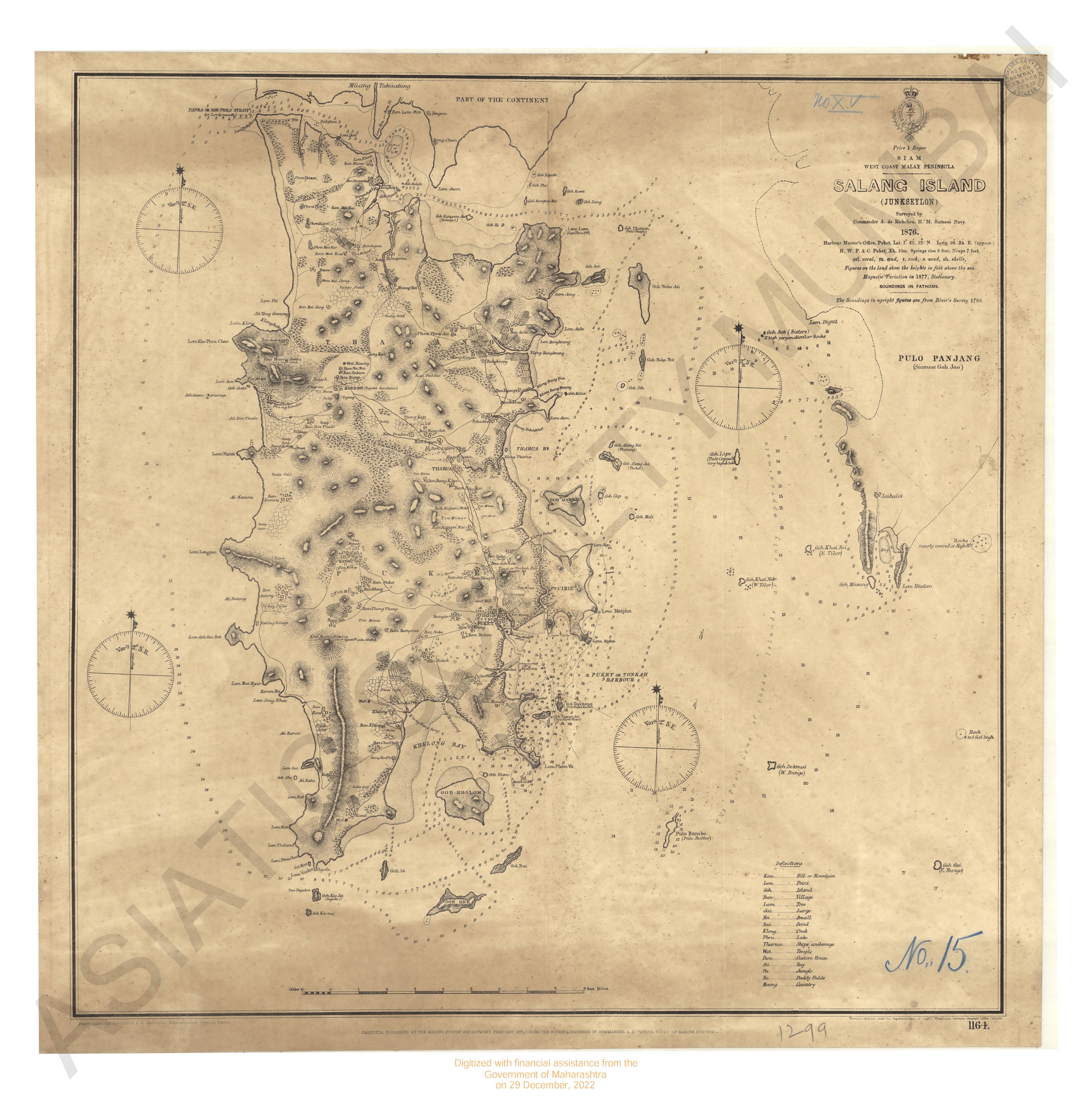
- Siam. West coast Malay Penninsula Salang island (Junkseylon) surveyed in 1876.
- Year: 1877
- Subject: Topographic Map
- Publisher: Marine Survey Department
- Language: English
- Place of Publication: Washinton
- 4 Views
-
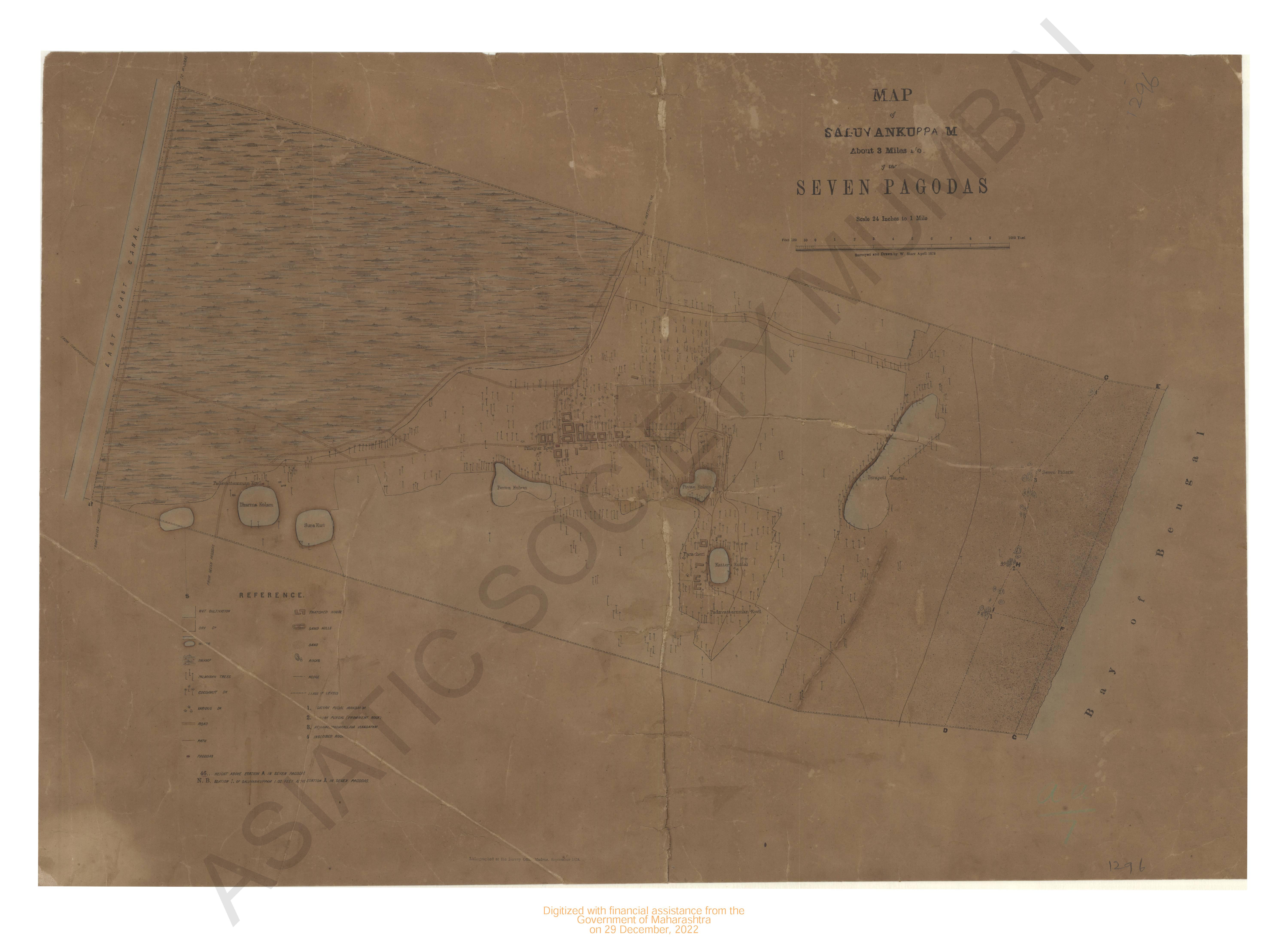
- Map of the Salvankuppam about 3 miles North of the seven pagodas.
- Year: 1878
- Subject: Topographic Map
- Publisher: Surveyor Office
- Language: English
- Place of Publication: Washinton
- 4 Views
-
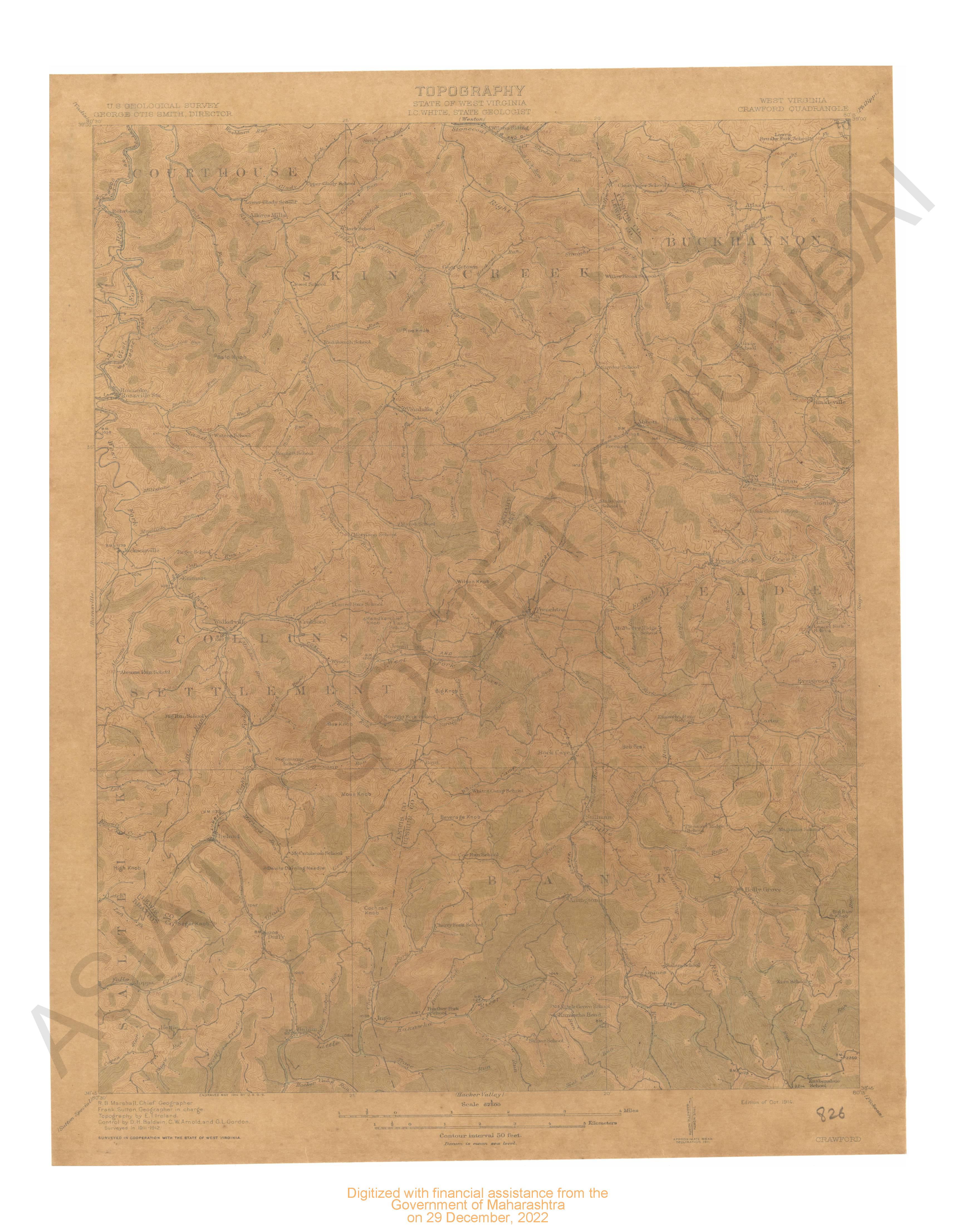
- West Virginia Crawford quadrangle surveyed 1911-12 in cooperation with state of West Virginia.
- Year: 1914
- Subject: USGS topography
- Publisher: US geogological survey
- Language: English
- Place of Publication: Washinton
- 14 Views
-
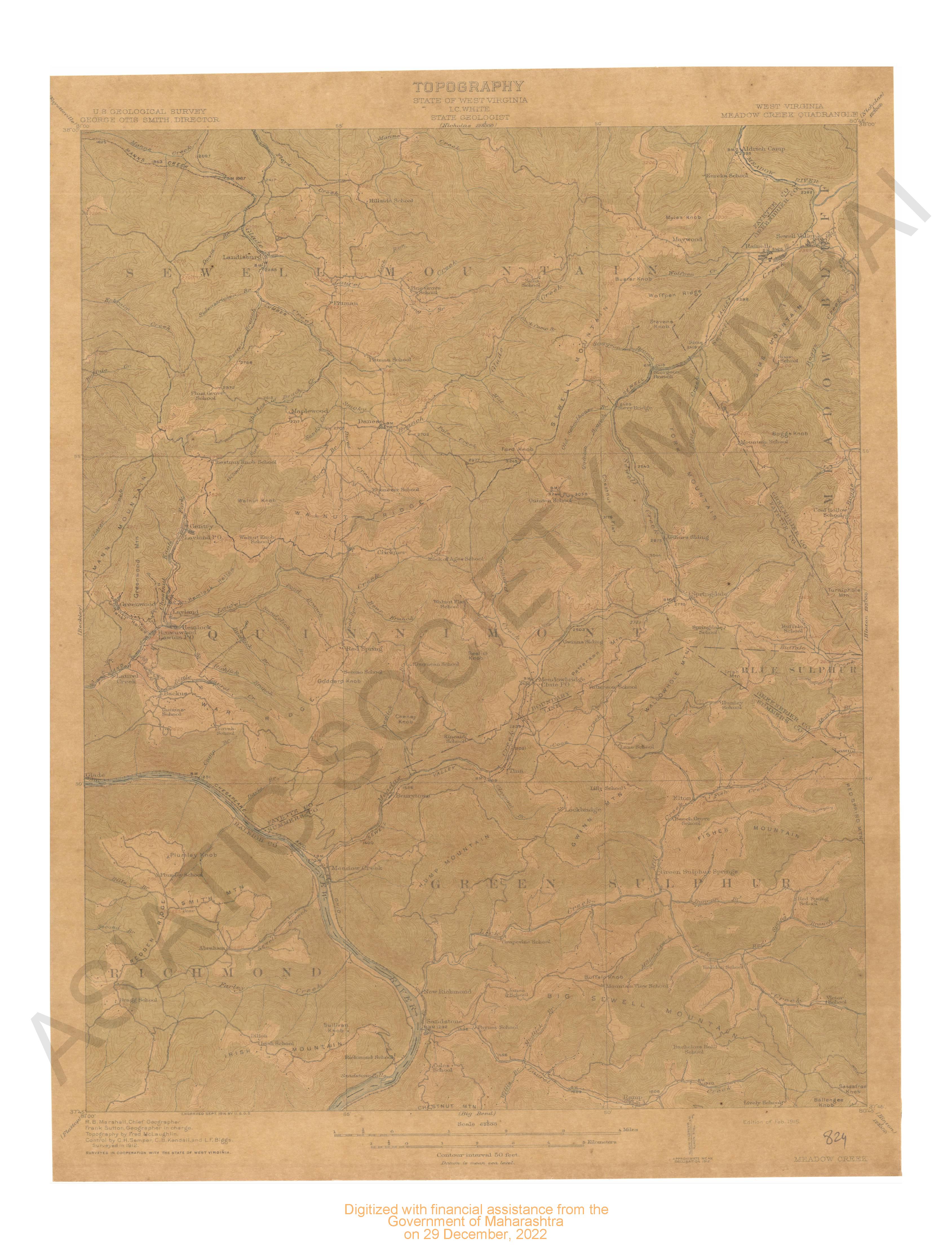
- West Virginia Meadow creek quadrangle surveyed 1912 in cooperation with state of West Virginia.
- Year: 1915
- Subject: USGS topography
- Publisher: US geogological survey
- Language: English
- Place of Publication: Washinton
- 11 Views