-
- 34 Views
-
- 31 Views
-
- 31 Views
-
- 29 Views
-
- 35 Views
-
- 25 Views
-
- 38 Views
-
- 46 Views
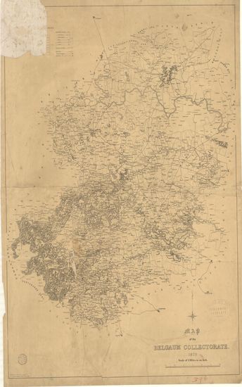
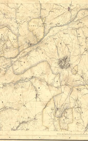
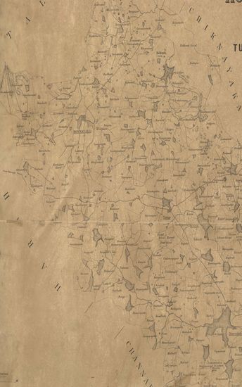
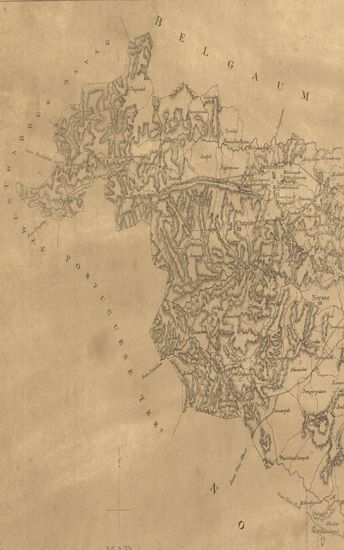
- Map of the Belgaum Collectorate.1879
- Year: 1880
-
- 28 Views
-
- 316 Views
-
- 153 Views
-
- 120 Views

-
- 107 Views
-
- 53 Views
-
- 56 Views
-
- 34 Views
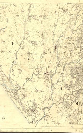
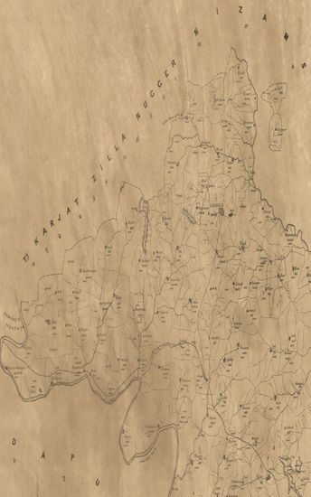
- Map of the Dharwar Collectorate. 1874
- Year: 1875
-
- 54 Views
-
- 17 Views
-
- 22 Views
-
- 14 Views
-
- Kathiawar: Parts of Hallar, and Sorath. Season 1876-77. Great Trigonometrical survey of India.
- Year: 1878
- Subject: Topographic Map
- Publisher: Dehradun Photozincographed at the G.T.S.Office 1878
- Language: English
- Place of Publication: Dehradun
- 34 Views
-
- Kathiawar: Parts of Barda & Sorath. Season 1877-78. Greart Trigonometrical Survey of India.
- Year: 1879
- Subject: Topographic Map
- Publisher: Dehradun Photozincographed at the G.T.S.Office 1879
- Language: English
- Place of Publication: Dehradun
- 31 Views
-
- Kathiawar: Parts of Hallar, Jhalawar & Machukanta. Season 1873- 1874. Great Trigonometrical Survey of India
- Year: 1875
- Subject: Topographic Map
- Publisher: Dehradun Photozincographed at the G.T.S.Office 1875
- Language: English
- Place of Publication: Dehradun
- 31 Views
-
- Kathiawar: Parts of Jhalavad & Machhukanta. Season 1872-73. Trigonometrical Branch survey of India
- Year: 1883
- Subject: Topographic Map
- Publisher: Dehradun Photozincographed at the office of the Trigonometrical Branch, Survey of India. 1883
- Language: English
- Place of Publication: Dehradun
- 29 Views
-
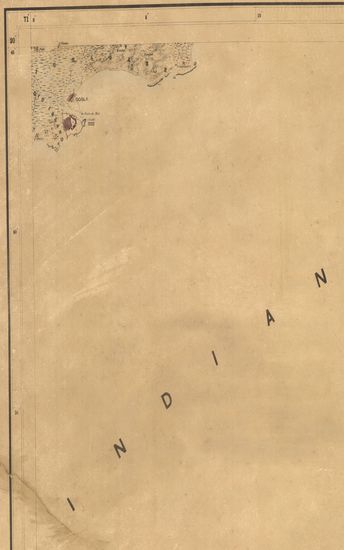
- Kathiawar: Parts of Soruth. Season 1870-71 and 1871-72. Great Trigonometrical Survey of India.
- Year: 1873
- Subject: Topographic Map
- Publisher: Dehradun Photozincographed at the G.T.S.Office 1873
- Language: English
- Place of Publication: Dehradun
- 35 Views
-
- Kathiawar: Part of Hallar. Season 1874-75. Great Trigonometrical Survey of India.
- Year: 1875
- Subject: Topographic Map
- Publisher: Dehradun Photozincographed at the G.T.S.Office 1875
- Language: English
- Place of Publication: Dehradun
- 25 Views
-
- Kathiawar: Part of Sorath. Season 1876-77. Greart Trigonometrical Survey of India.
- Year: 1877
- Subject: Topographic Map
- Publisher: Dehradun Photozincographed at the G.T.S.Office 1877
- Language: English
- Place of Publication: Dehradun
- 38 Views
-
- Map of the Belgaum Collectorate.1879
- Year: 1880
- Subject: Topographic Map
- Publisher: Poona (Pune) Government Photozincographic Office 1880
- Language: English
- Place of Publication: Poona (Pune)
- 46 Views
-
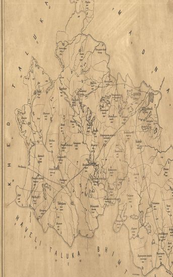
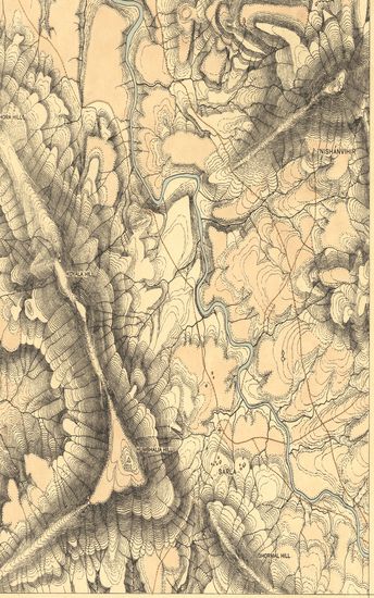
- Sketh Map of the Honnavalli Taluka of the Tumkur District Nandidrug Division, Mysore Territory. 1877
- Year: 1877
- Subject: Topographic Map
- Publisher: Poona (Pune) Government Photozincographic Office 1877
- Language: English
- Place of Publication: Poona (Pune)
- 28 Views
-
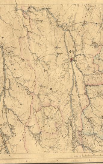
- Map of the Shirur Taluka of the Poona (Pune) Zilla.
- Year: 1875
- Subject: Topographic Map
- Publisher: Poona (Pune) Government Photozincographic Office 1875
- Language: English
- Place of Publication: Poona (Pune)
- 316 Views
-
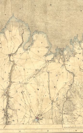
- Map of the Pandharpur Taluka of the Sholapur (Solapur) Zilla. - पंढरपूर तालुका जिल्हा सोलापूर .
- Year: 1872
- Subject: Topographic Map
- Publisher: Poona (Pune) Government Photozincographic Office 1872
- Language: English
- Place of Publication: Poona (Pune)
- 153 Views
-
- Map of the Indapur taluka of the Poona (Pune) Zilla.
- Subject: Topographic Map
- Language: English
- 120 Views
-
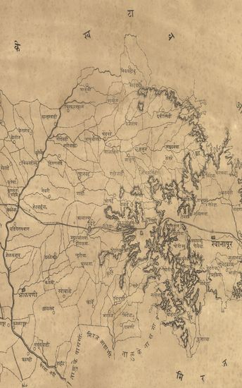
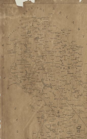
- नकाशा तालुके खानापूर जिल्हा सातारा . - Map of the Khanapur Taluka Satara District .
- Year: 1875
- Subject: Topographic Map
- Publisher: Poona (Pune) Government Photozincographic Office 1875
- Language: English
- Place of Publication: Poona (Pune)
- 107 Views
-
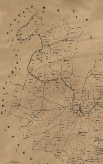
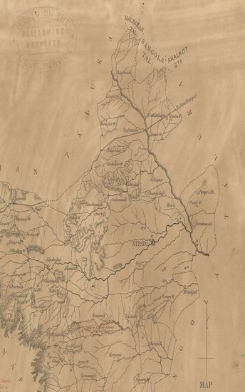
- Map of the Atpadi Taluka of the Pant Pratinidhi State of the Satara Collectorate.
- Year: 1881
- Subject: Topographic Map
- Publisher: Poona (Pune) Government Photozincographic Office 1881
- Language: English
- Place of Publication: Poona (Pune)
- 53 Views
-
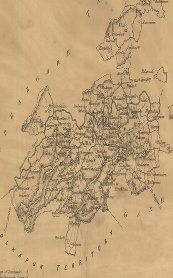
- Map of the Ajra taluka of the Inchalkaranji Jaghir of the Kolhapur State.
- Year: 1880
- Subject: Topographic Map
- Publisher: Poona (Pune) Government Photozincographic Office 1880
- Language: English
- Place of Publication: Poona (Pune)
- 56 Views
-
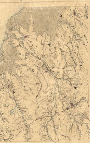
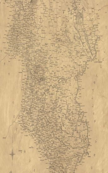
- Map of the Dharwar Collectorate. 1874
- Year: 1875
- Subject: Topographic Map
- Publisher: Poona (Pune) Government Photozincographic Office 1875
- Language: English
- Place of Publication: Poona (Pune)
- 34 Views
-
- Sketch of the Magadi Taluka of the Bangalore District Nandidrug Division, Mysore Territory. 1877
- Year: 1877
- Subject: Topographic Map
- Publisher: Poona (Pune) Government Photozincographic Office 1877
- Language: English
- Place of Publication: Poona (Pune)
- 54 Views
-
- Guzerat, Section No.3 of Sheet No.50 (Dang Forests) : Part of the Dang Wasurna State. 1879-80
- Year: 1881
- Subject: Topographic Map
- Publisher: Dehradun Office of the Trigonometrical Branch. Survey of India 1881
- Language: English
- Place of Publication: Dehradun
- 17 Views
-
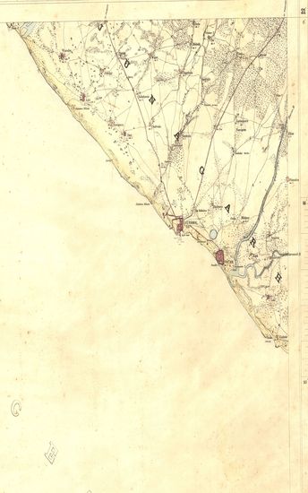
- Map of the Beedee Taluka of the Begaum collectorate.
- Year: 1878
- Subject: Topographic Map
- Publisher: Poona (Pune) Government Photozincographic Office 1878
- Language: English
- Place of Publication: Poona (Pune)
- 22 Views
-
- Map of the Karmale Taluka of the Sholapur Zilla.
- Year: 1873
- Subject: Topographic Map
- Publisher: Poona (Pune) Government Photozincographic Office 1873
- Language: English
- Place of Publication: Poona (Pune)
- 14 Views