-
-
- 3 Views
-
- 1 View
-
- 1 View
-
- 1 View

-
- 1 View
-
- 1 View
- Trigonometrical survey of Pauban Pass
- Year: 1839
-
- 1 View
- Malacca Banks, Chart of 1837
- Year: 1845
-
- 4 Views
-
- 4 Views
-
- 6 Views
-
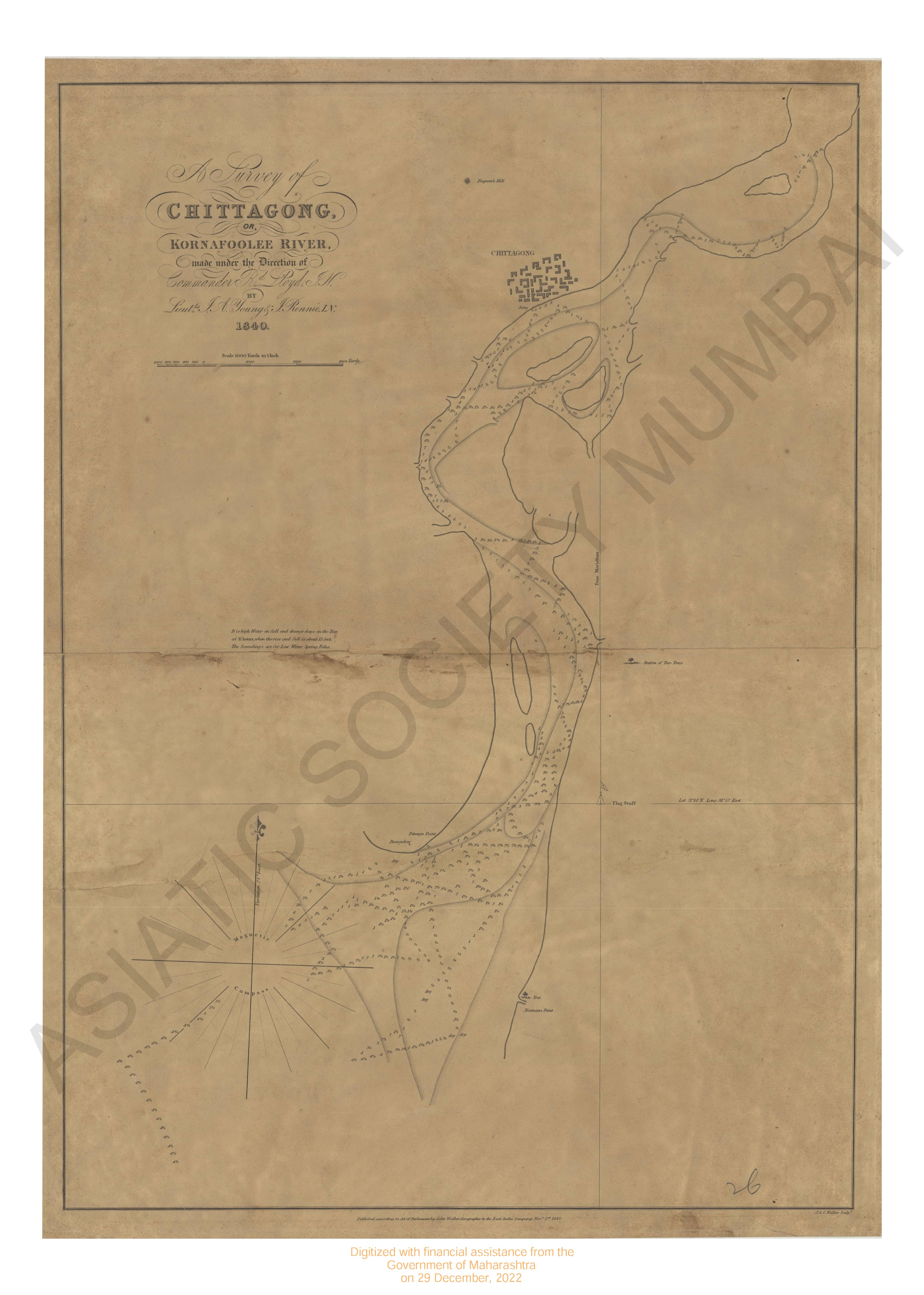
- Chittagong or Komafoolee river, survey of 1840.
- Year: 1842
- Subject: Topographic Map
- Publisher: John Walker
- Language: English
-
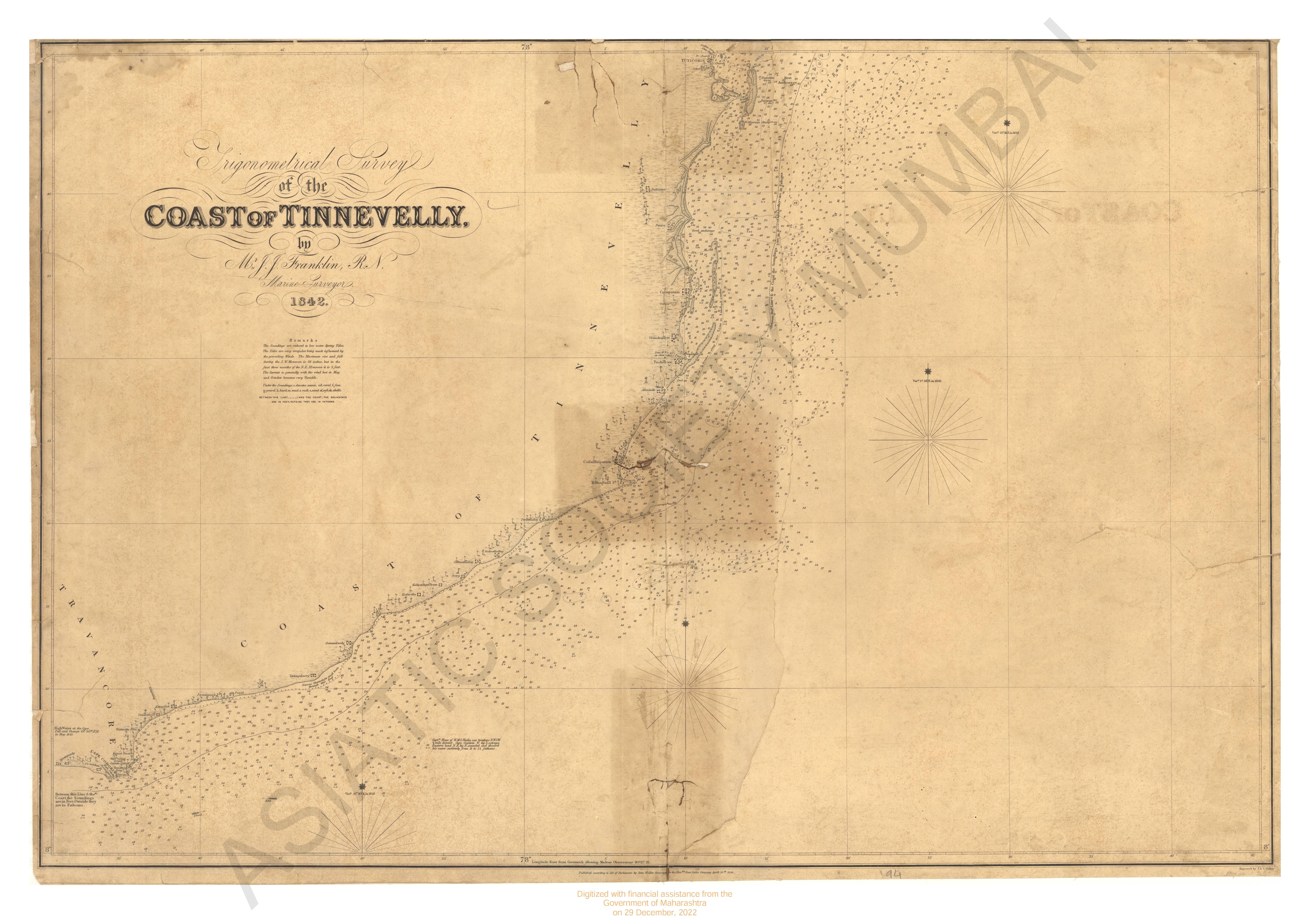
- Trigonometrical survey of Coast of Tinnevelly, 1842
- Year: 1846
- Subject: Topographic Map
- Publisher: John Walker
- Language: English
- 3 Views
-
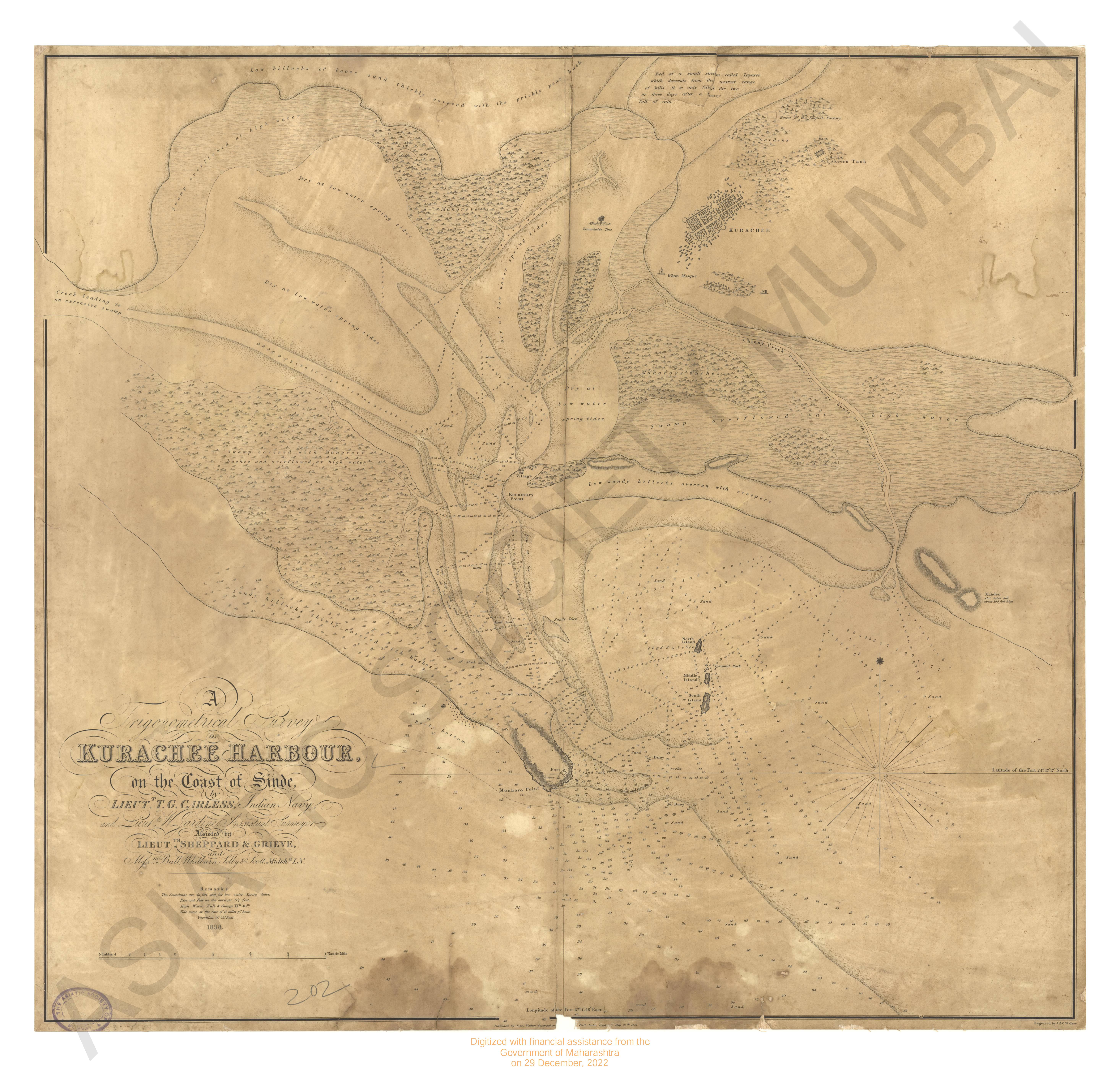
- Trigonometrical survey of Kuranchee harbour on the coast of Sinde 1838
- Year: 1844
- Subject: Topographic Map
- Publisher: John Walker
- Language: English
- 1 View
-
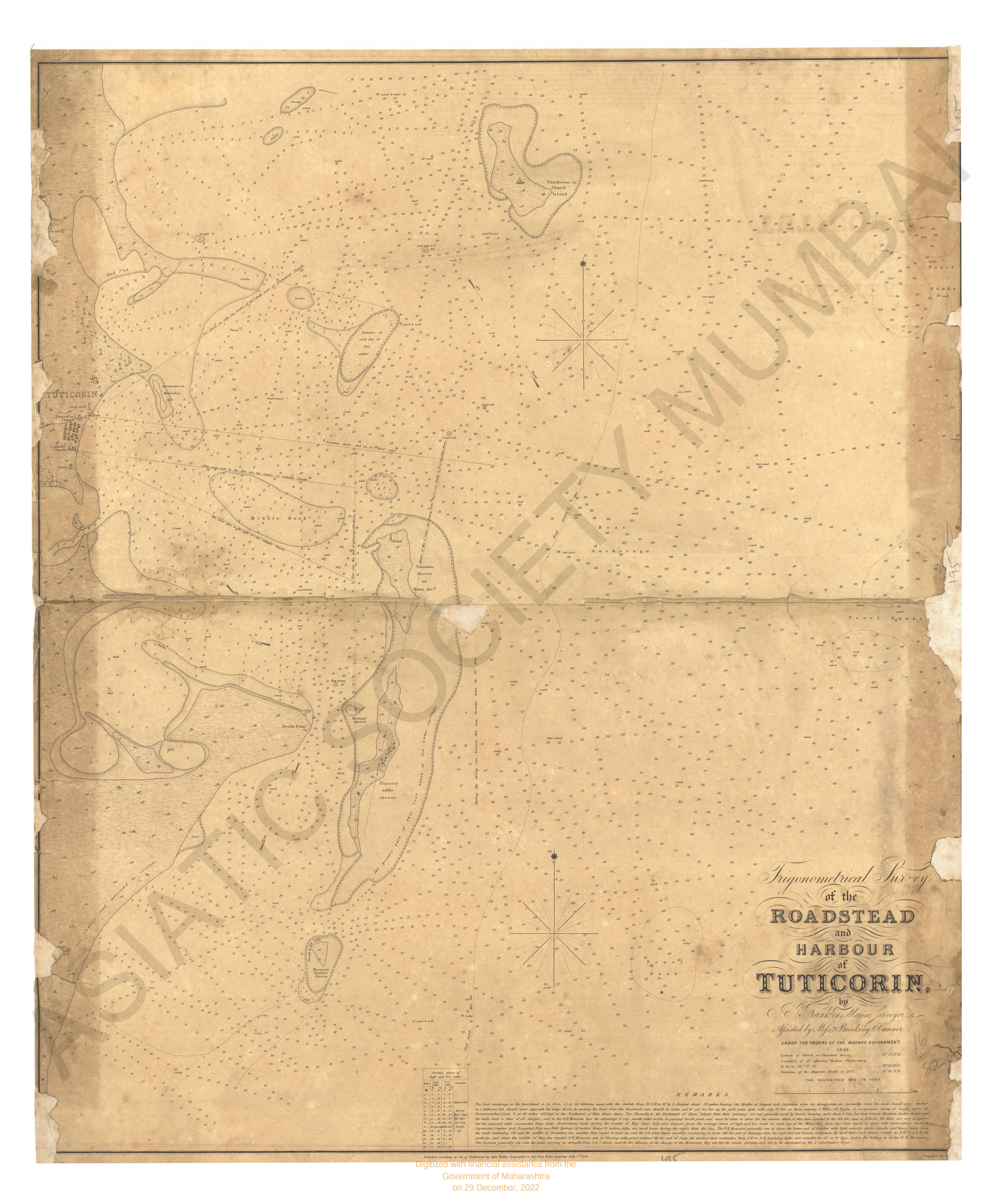
- Trigonometrical survey of Roadstead and Harbour of tutticorin, 1842
- Year: 1846
- Subject: Topographic Map
- Publisher: John Walker
- Language: English
- 1 View
-
- Trigonometrical survey of the Maldiva or Maldeeve islands
- Year: 1839
- Subject: Topographic Map
- Publisher: John Walker
- Language: English
- 1 View
-
- Trigonometrical survey of the Coast of Madura, 1838
- Year: 1846
- Subject: Topographic Map
- Publisher: John Walker
- Language: English
- 1 View
-
- Trigonometrical survey of Pauban Pass
- Year: 1839
- Subject: Topographic Map
- Publisher: John Walker
- Language: English
- 1 View
-
- Malacca Banks, Chart of 1837
- Year: 1845
- Subject: Topographic Map
- Publisher: John Walker
- Language: English
- 1 View
-
- Noulmein river & the Eastern coast of the gulf of Martaban from Anberst point to the entrance of the sitang river 1847.
- Year: 1848
- Subject: Topographic Map
- Publisher: John Walker
- Language: English
- 4 Views
-
- Survey of the River Hoogly, from Calcutta to Saugor Point including baratulla river or channel greek.
- Year: 1839
- Subject: Topographic Map
- Publisher: John Walker
- Language: English
- 4 Views
-
- Sand and channels forming the entrance in to the river Hoogly : including Balasore roads and bank of sounding off point Palmiras survey of
- Year: 1842
- Subject: Topographic Map
- Publisher: John Walker
- Language: English
- 6 Views