-
- 5 Views
- Gos and Murmagoa roads, surveyed in 1812
- Year: 1816
-
- 2 Views
-
- 2 Views
-
- 3 Views
-
- 4 Views
-
- 3 Views
- Trigonometrical survey of Dio harbour
- Year: 1834
-
- 2 Views
-
- 1 View
-
-
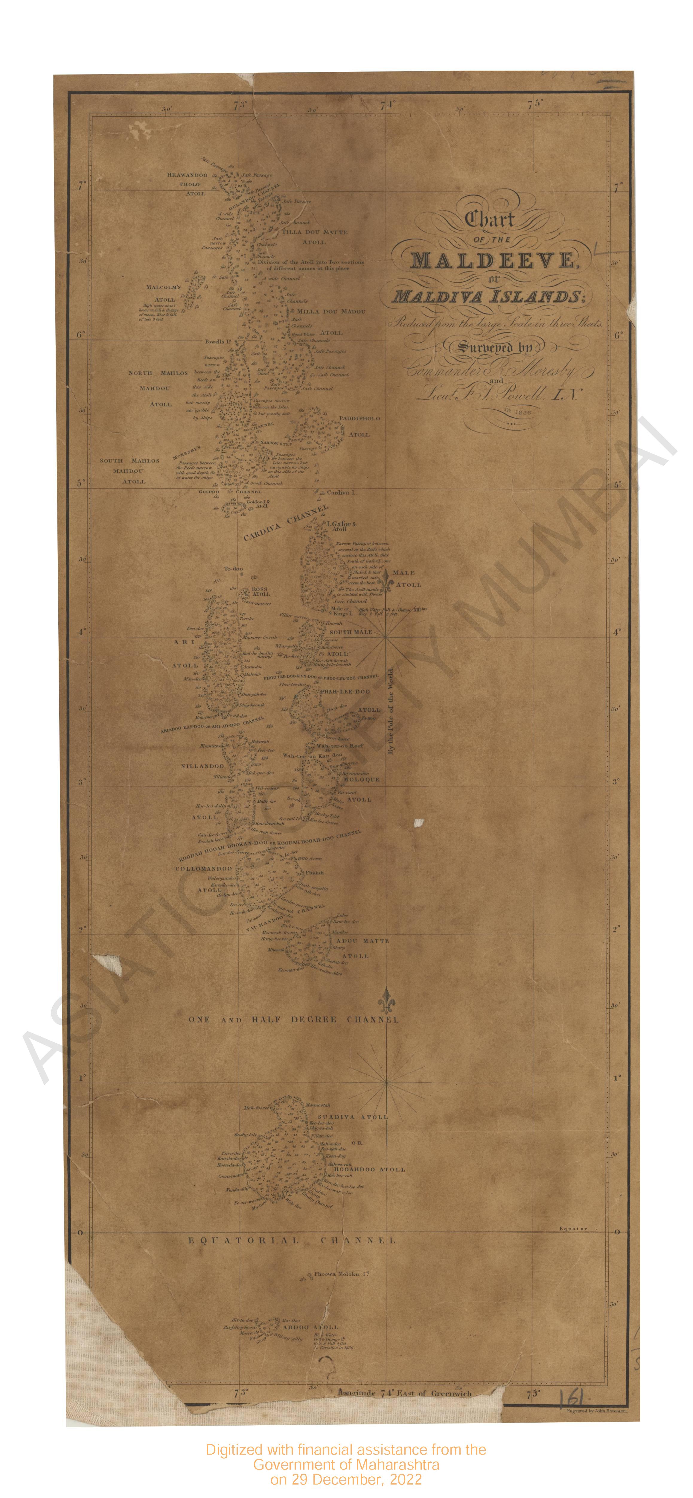
- Maldiva island; chart of the Maldeeve 1836
- Year: 1814
-
- 2 Views
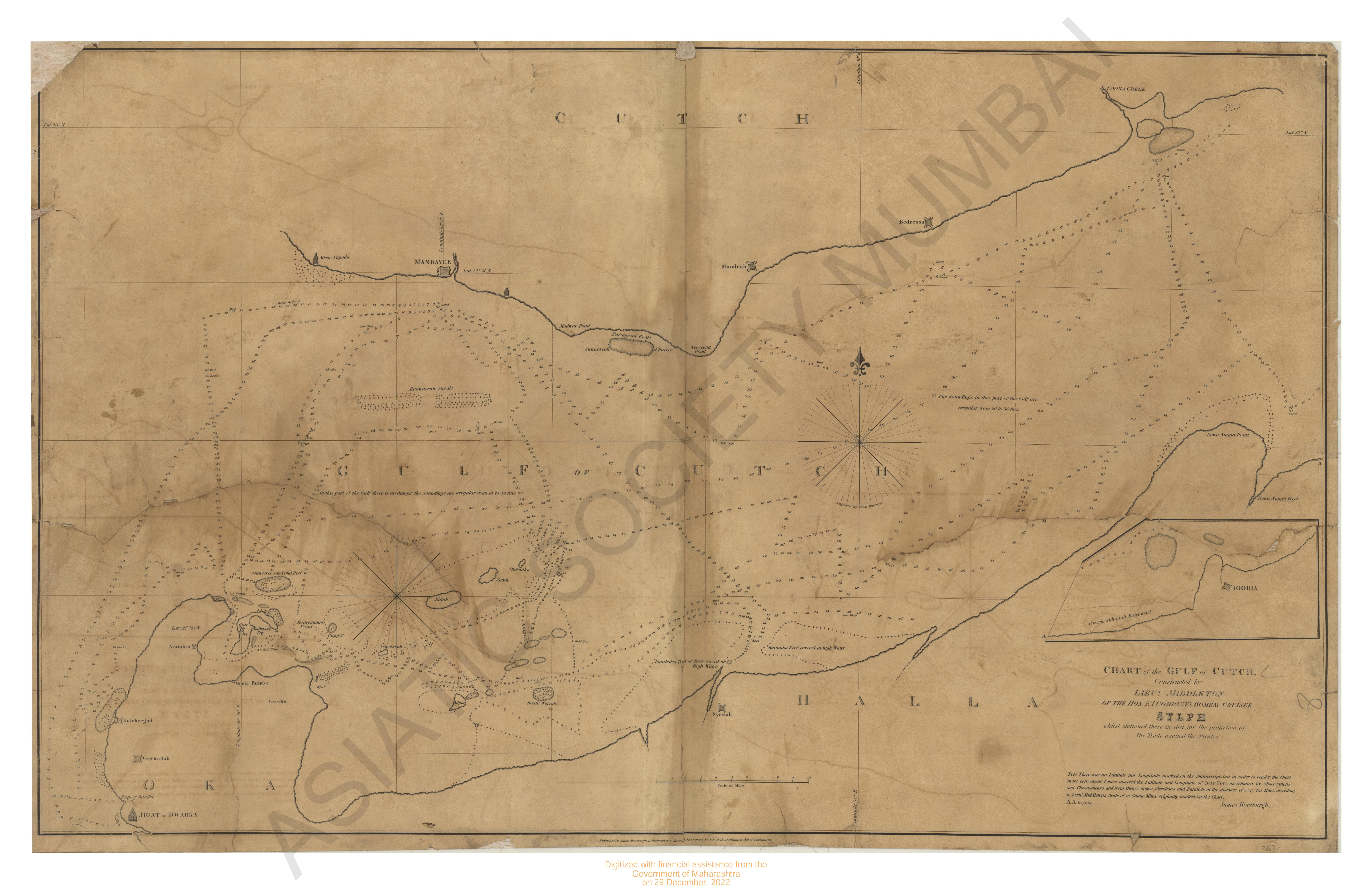
- Chart of Gulf of Cutch.
- Year: 1823
-
- Gos and Murmagoa roads, surveyed in 1812
- Year: 1816
- Subject: Topographic Map
- Publisher: James Horsburgh
- Language: English
- 5 Views
-
- Chart of the Coast of Arracan from Akyab to long 70° 50' N,1833.
- Year: 1842
- Subject: Topographic Map
- Publisher: James Horsburgh
- Language: English
- 2 Views
-
- Reef of point palmiras and the outline of the Coast from that point to Pipley River are taken from captain court's survey.
- Year: 1819
- Subject: Topographic Map
- Publisher: James Horsburgh
- Language: English
- 2 Views
-
- Survey from False point Palmiras to Sauger roads; including the track frequested by ships to the sea reefs and exhibiting the tails of the reef Sauger Sand, the eastern Channel & Lacam's Channel by Capt W. Maxfield.
- Year: 1819
- Subject: Topographic Map
- Publisher: James Horsburgh
- Language: English
- 3 Views
-
- Coast of Coromandel from the Northern extremity of the Pulicat shoal to Armegon Hill as also the Aremegon shoal & reef off point. Pondy with the anchorage or harbour formed between Armegon shoal & the shore with a chart exhibiting the track of the H.C. ship Nercus while in search of the London Bank by Capt W. Max filed 1821.
- Year: 1822
- Subject: Topographic Map
- Publisher: James Horsburgh
- Language: English
- 4 Views
-
- Trigonometrical survey of Dio harbour
- Year: 1834
- Subject: Topographic Map
- Publisher: James Horsburgh
- Language: English
- 3 Views
-
- Trigonometrical survey of the Arracan river, 1832
- Year: 1834
- Subject: Topographic Map
- Publisher: James Horsburgh
- Language: English
- 2 Views
-
- Survey of the Coast of AVA from the Calventuras to Diamond. I is respedfully dedicated to the Honorable the court of directors, 1826
- Year: 1826
- Subject: Topographic Map
- Publisher: James Horsburgh
- Language: English
- 1 View
-
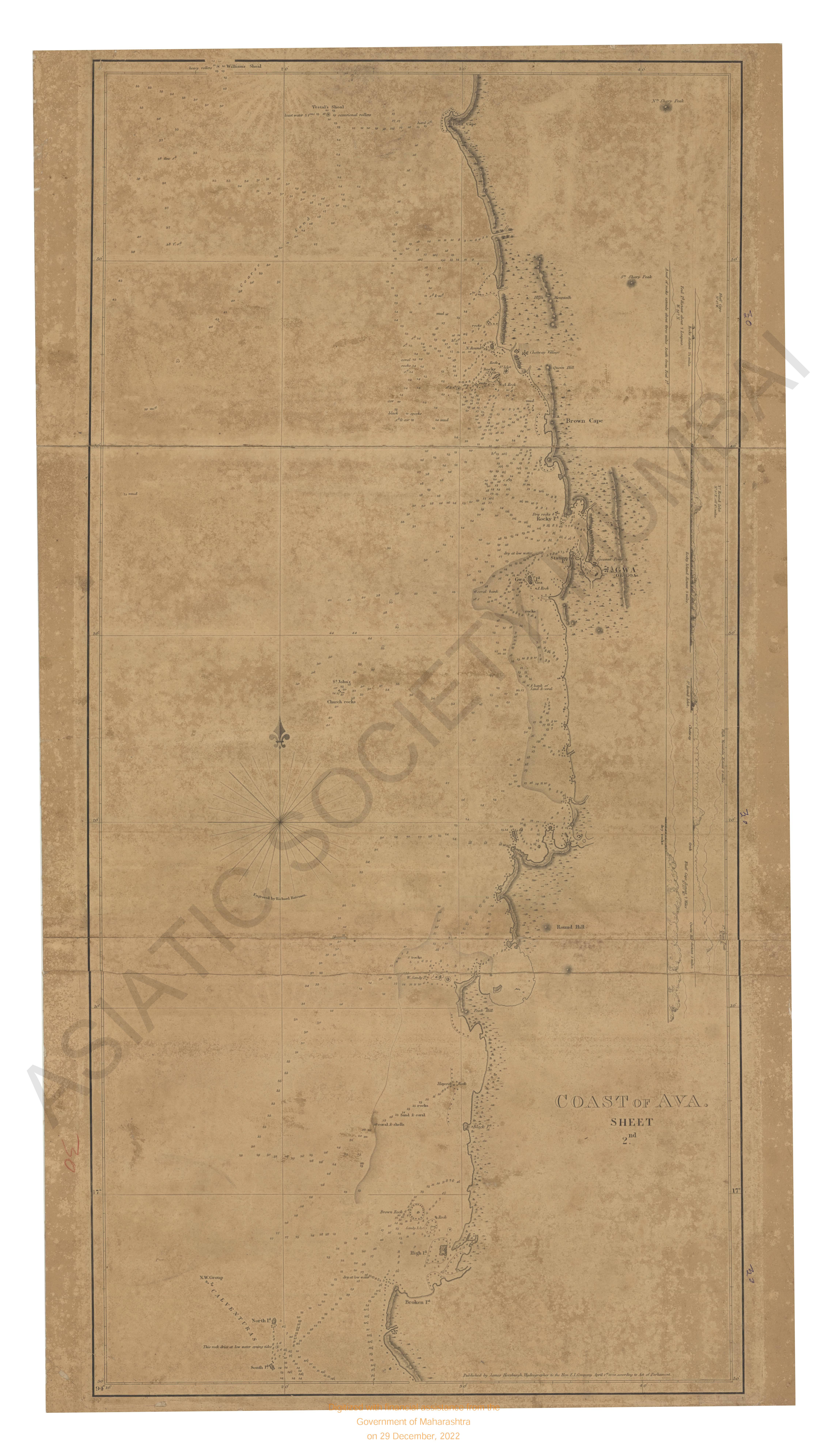
- Coast of Ava. Sheet 2nd, the survey of from the Calventures to Diamond I 1826.
- Year: 1826
- Subject: Topographic Map
- Publisher: James Horsburgh
- Language: English
-
- Maldiva island; chart of the Maldeeve 1836
- Year: 1814
- Subject: Topographic Map
- Publisher: James Horsburgh
- Language: English
-
- Chart of Gulf of Cutch.
- Year: 1823
- Subject: Topographic Map
- Publisher: James Horsburgh
- Language: English
- 2 Views