-
- 8 Views

- Chart of Choo Keang or Canton river.
- Year: 1831
-
- 4 Views
-
- 7 Views
-
- 2 Views
-
- 7 Views
-
- 2 Views
-
- 4 Views
-
- 2 Views
-
- 2 Views
-
- 6 Views
-
- 4 Views
-
- 5 Views
-
- 4 Views
-
- 4 Views
-
- 4 Views
-
- 4 Views
-
- 3 Views
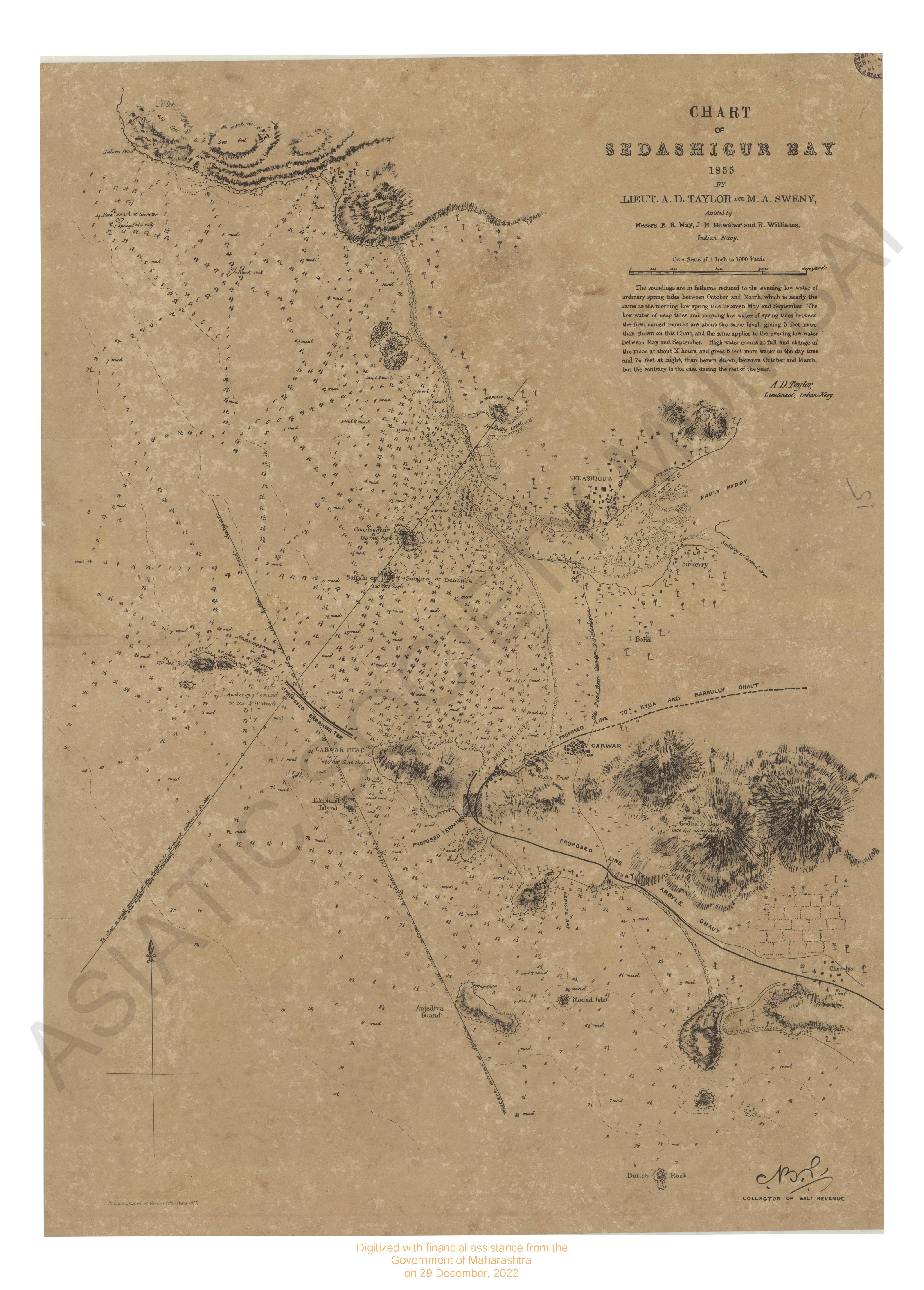
- Chart of Shadashivgasd bay 1855.
- Year: 1877
-
- 4 Views
-
- 3 Views
-
- 7 Views

-
- Chart of Choo Keang or Canton river.
- Year: 1831
- Subject: Topographic Map
- Publisher: James Harsburg
- Language: English
- 8 Views
-
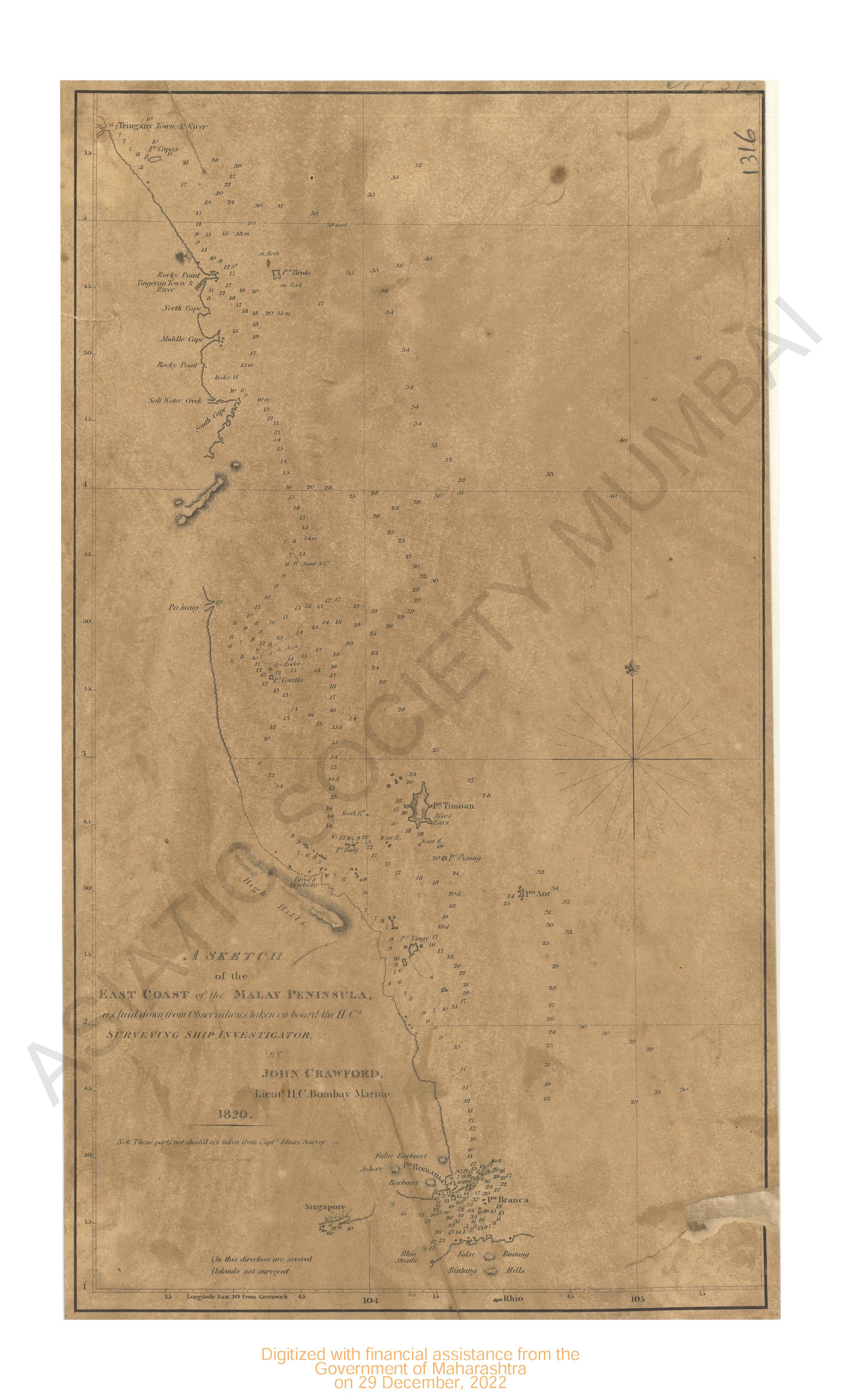
- Sketch of the East coast of the Malay penisula 1820.
- Year: 1820
- Subject: Topographic Map
- Language: English
- 4 Views
-
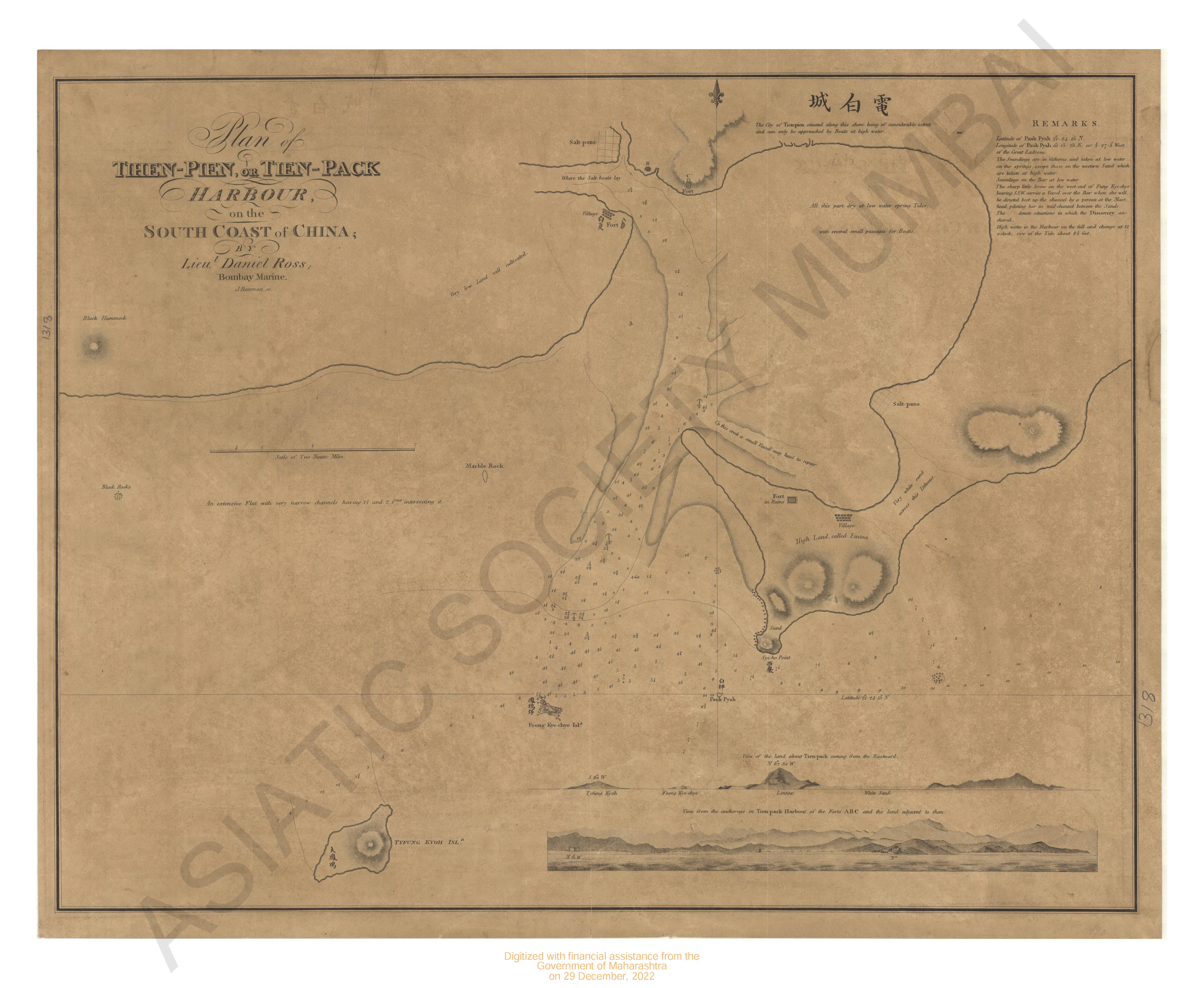
- Plan of then : Pien or Tien : Pack Harbour of the South coast of China.
- Subject: Topographic Map
- Language: English
- 7 Views
-
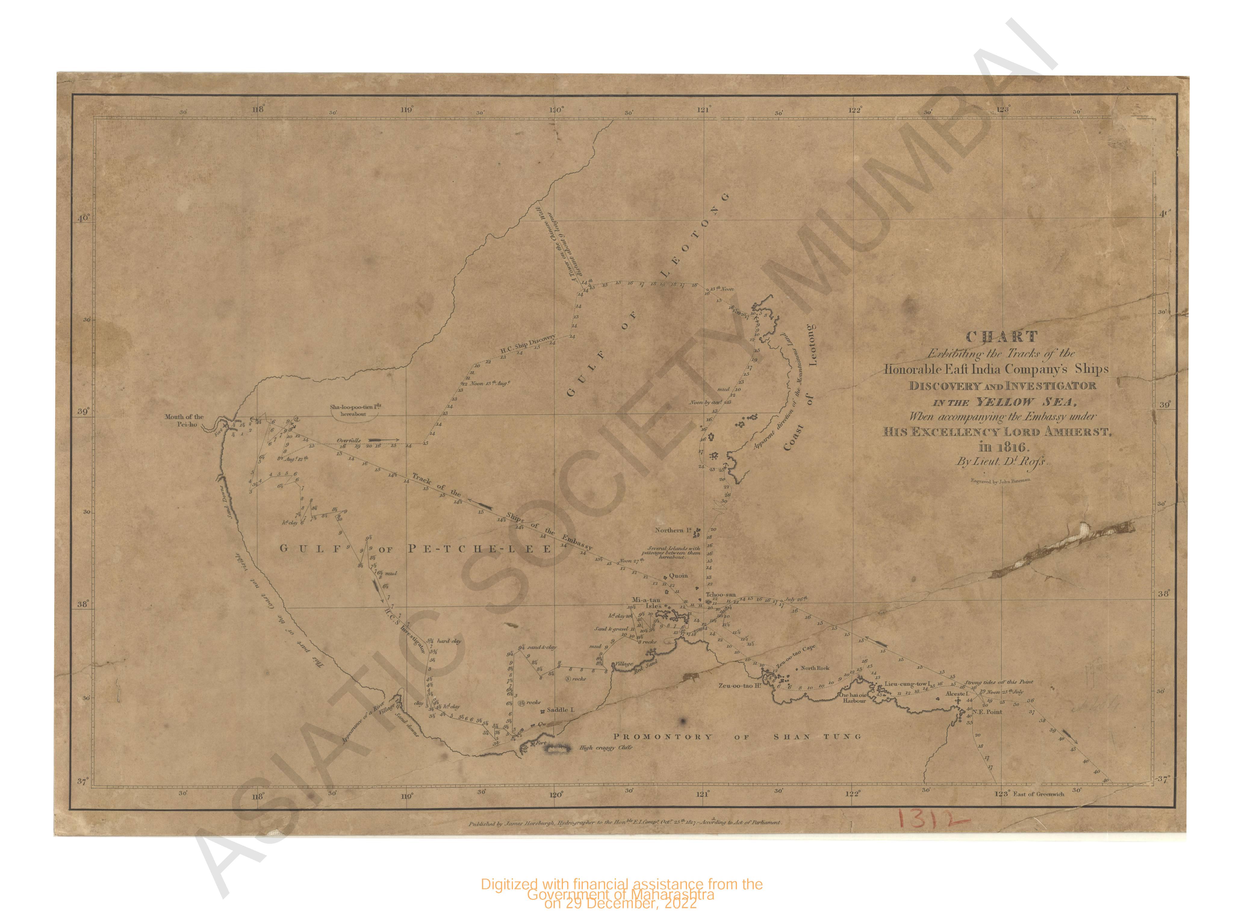
- Chart of discovery and investigation in the Yellow Sea in 1816.
- Year: 1817
- Subject: Topographic Map
- Publisher: James Harsburg
- Language: English
- 2 Views
-
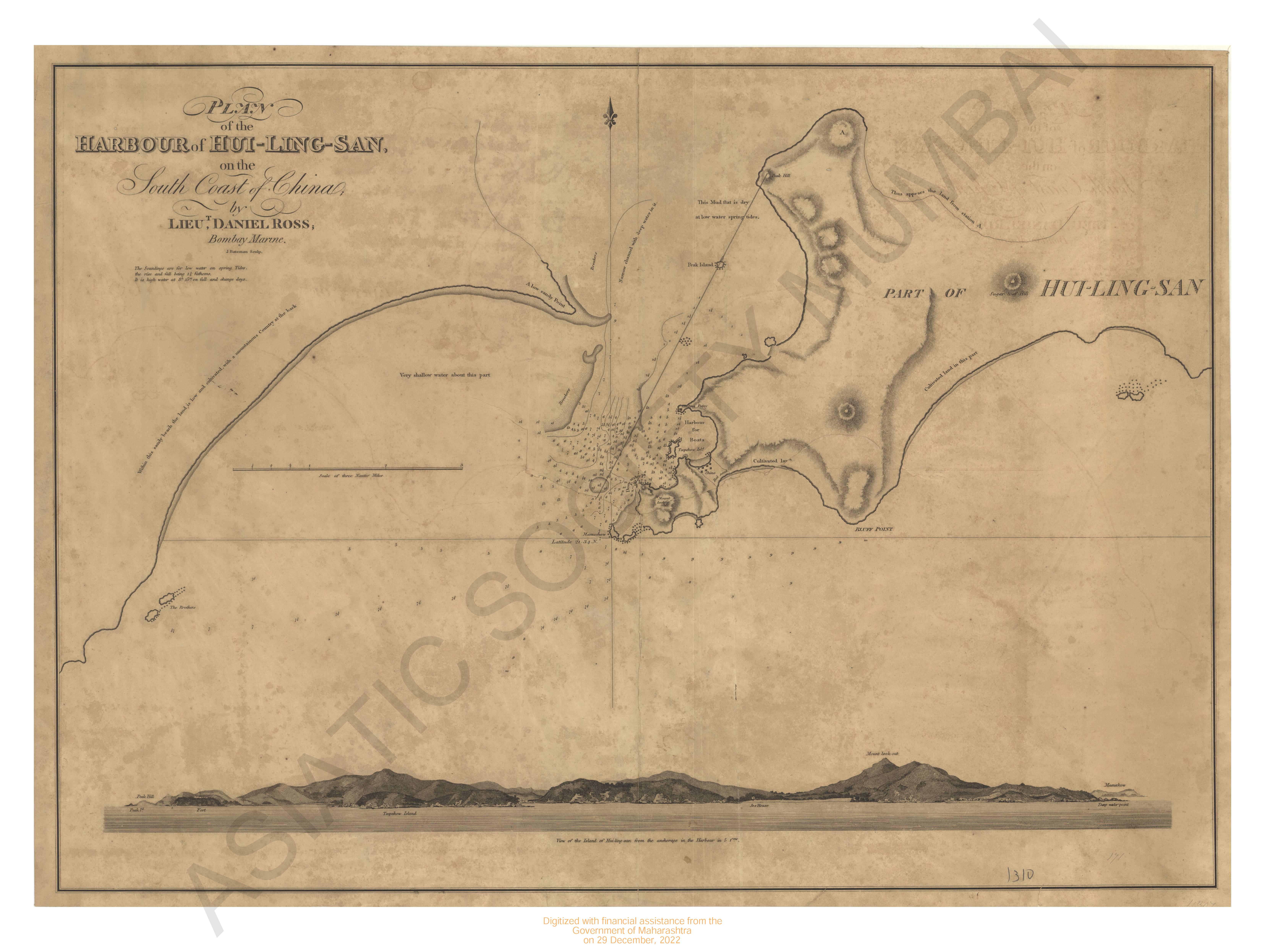
- Plan of the harbour of Hui-Ling-San of the South coast of China (Marine survey).
- Subject: Topographic Map
- Language: English
- 7 Views
-
- Siam. West coast Malay Penninsula Hayes Id to the pilgrims including Kopah inlet & Junkseylon 1877.
- Year: 1878
- Subject: Topographic Map
- Publisher: Marine Survey Department
- Language: English
- Place of Publication: Washinton
- 2 Views
-
- Siam. West coast Malay Penninsula Salang island (Junkseylon) surveyed in 1876.
- Year: 1877
- Subject: Topographic Map
- Publisher: Marine Survey Department
- Language: English
- Place of Publication: Washinton
- 4 Views
-
- Indian Ocean Ceylon; South coast surveyed in 1833.
- Year: 1800
- Subject: Topographic Map
- Publisher: Hydographic office
- Language: English
- Place of Publication: London
- 2 Views
-
- (India) Gulf of Siam. East coast of Malay Penninsula. Lacon Bight to Lem Chong P'ra surveyed in 1872.
- Year: 1879
- Subject: Topographic Map
- Publisher: Marine Survey Department
- Language: English
- Place of Publication: Washinton
- 2 Views
-
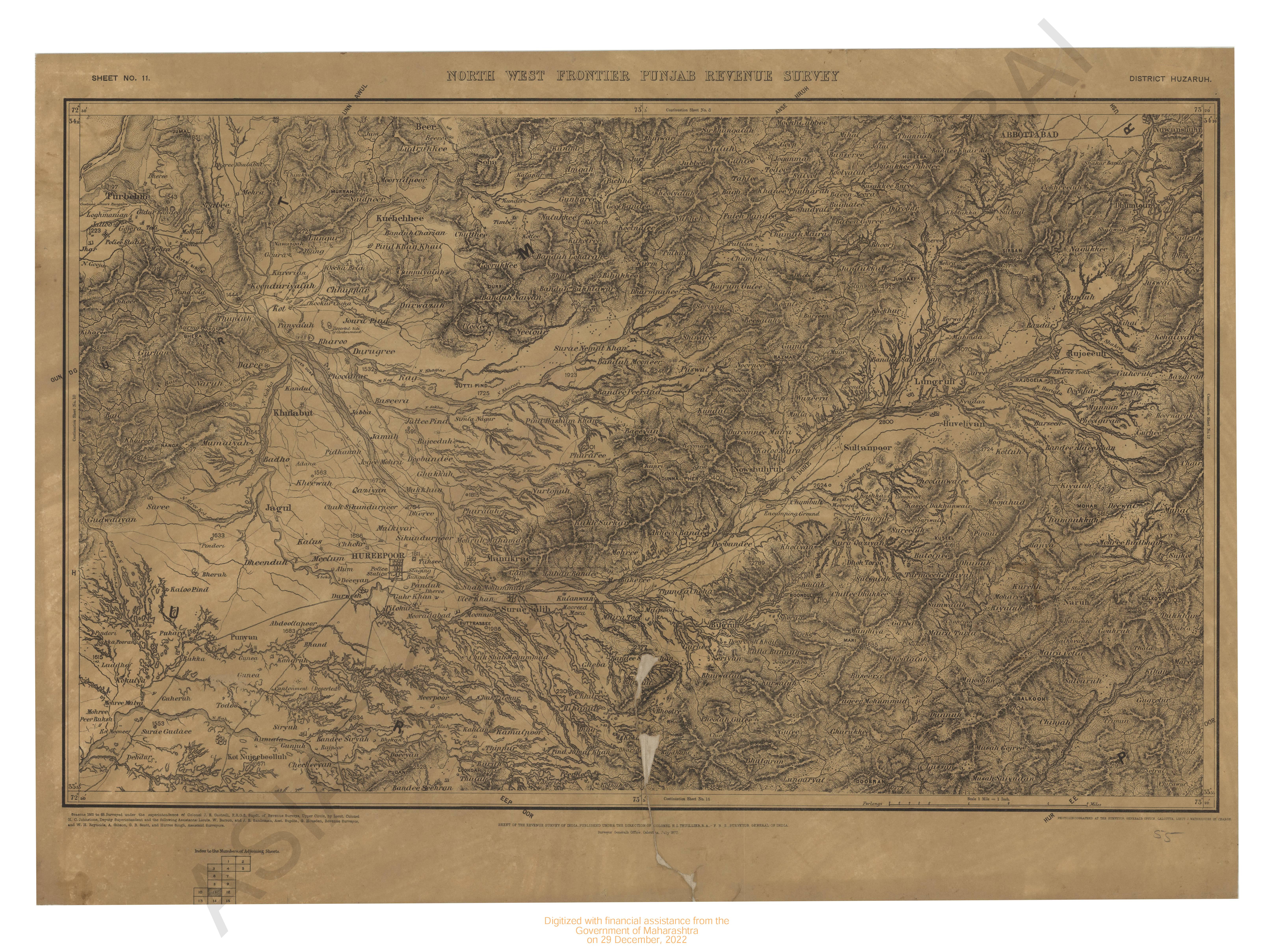
- North-West Frontiers Punjab revenue survey, district Huzarub 1865-69. Sheet No.11
- Year: 1870
- Subject: Topographic Map
- Publisher: Surveyor General's Office
- Language: English
- Place of Publication: Calcutta
- 6 Views
-
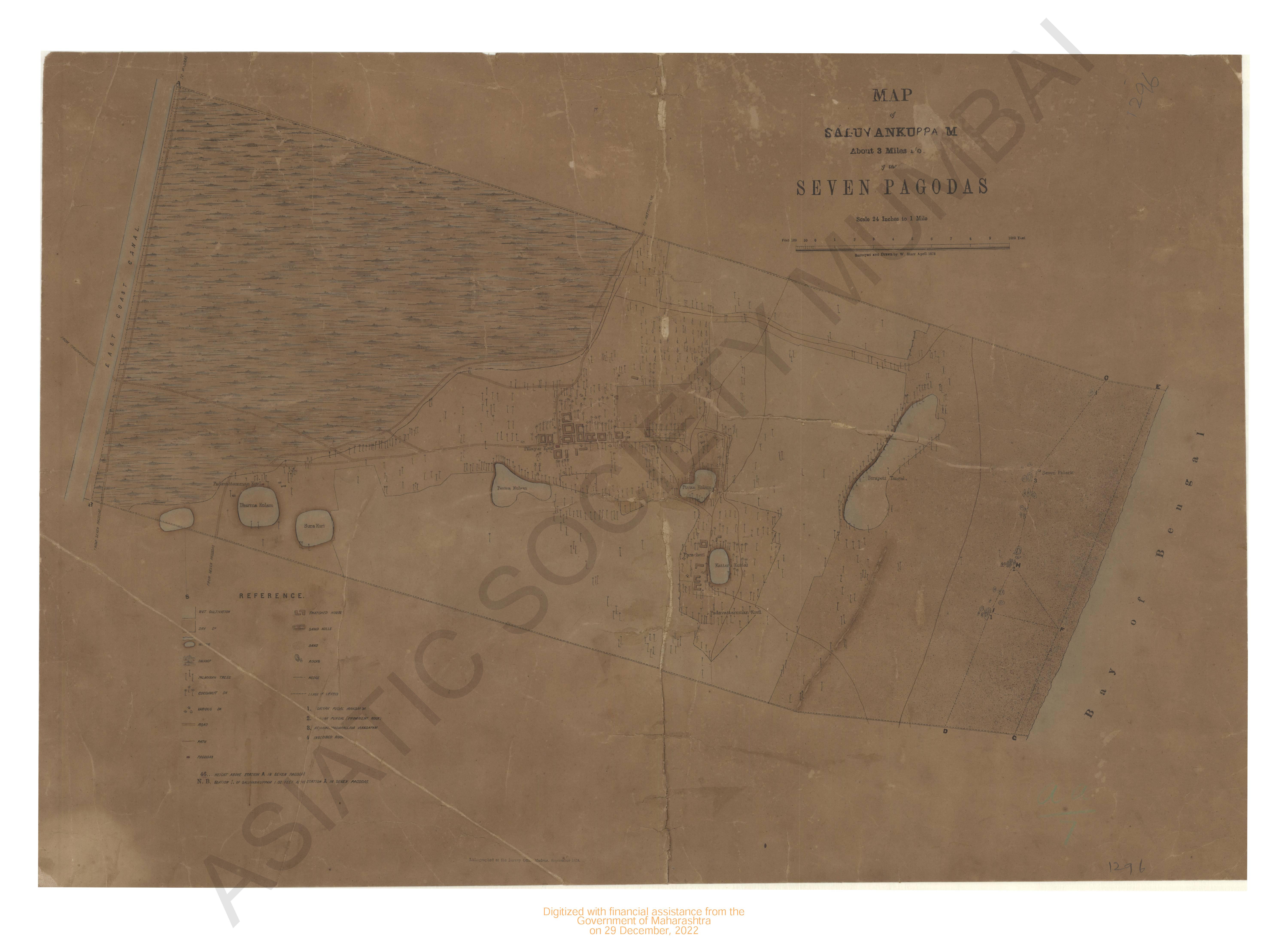
- Map of the Salvankuppam about 3 miles North of the seven pagodas.
- Year: 1878
- Subject: Topographic Map
- Publisher: Surveyor Office
- Language: English
- Place of Publication: Washinton
- 4 Views
-
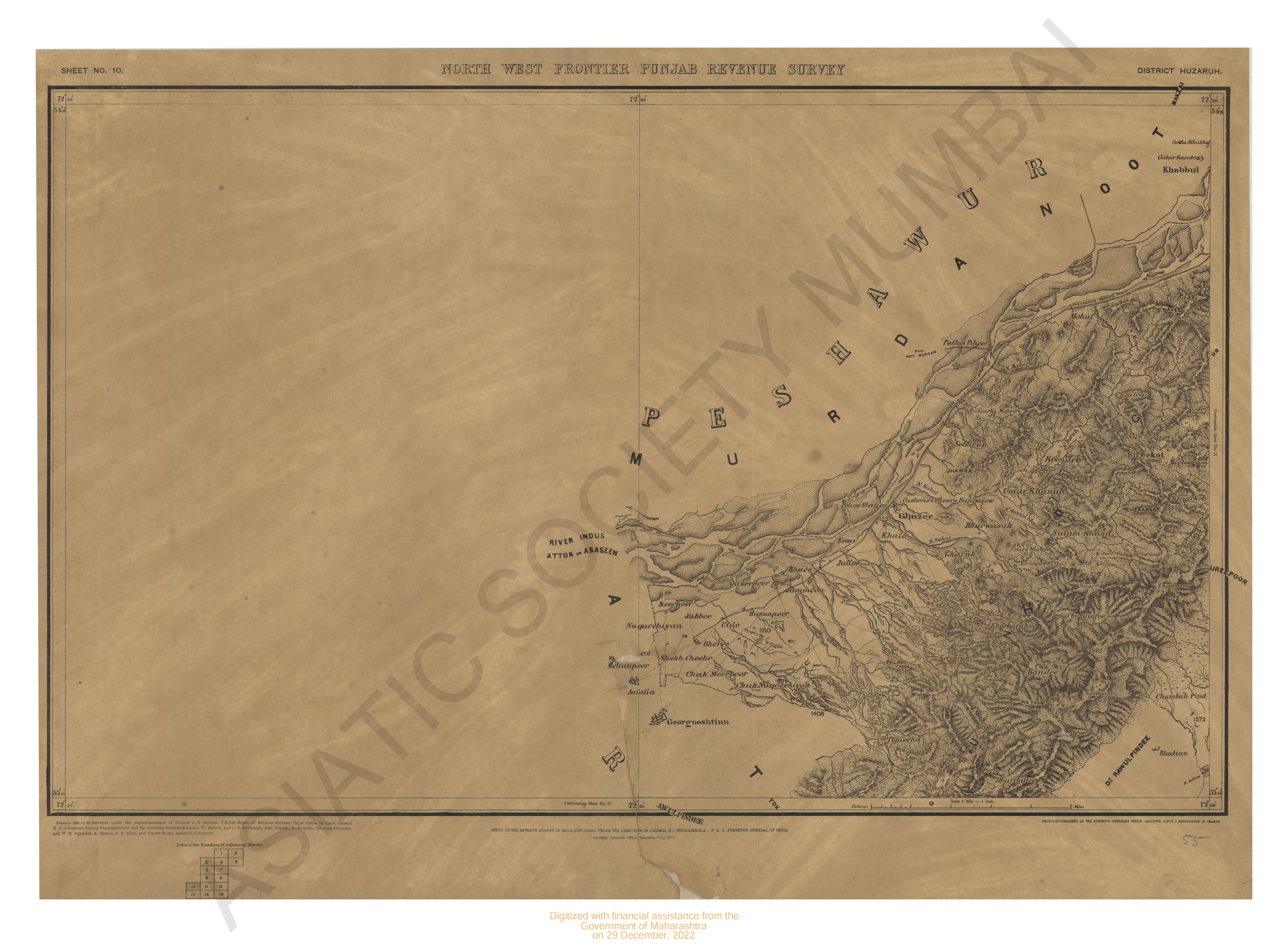
- North-West Frontiers Punjab revenue survey, district Huzarub 1865-69. Sheet No.10
- Year: 1870
- Subject: Topographic Map
- Publisher: Surveyor General's Office
- Language: English
- Place of Publication: Calcutta
- 5 Views
-
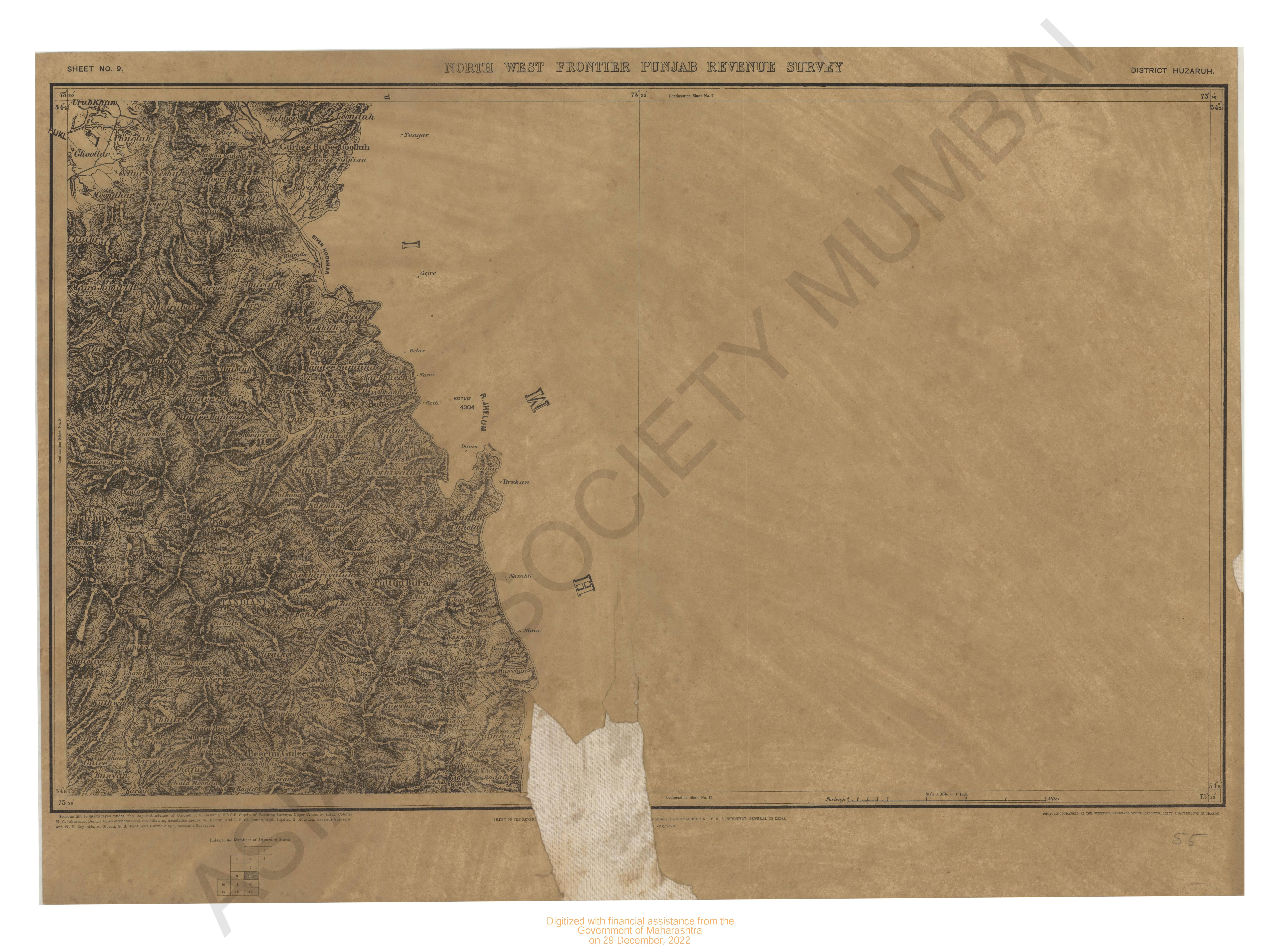
- North-West Frontiers Punjab revenue survey, district Huzarub 1865-69. Sheet No.9
- Year: 1870
- Subject: Topographic Map
- Publisher: Surveyor General's Office
- Language: English
- Place of Publication: Calcutta
- 4 Views
-
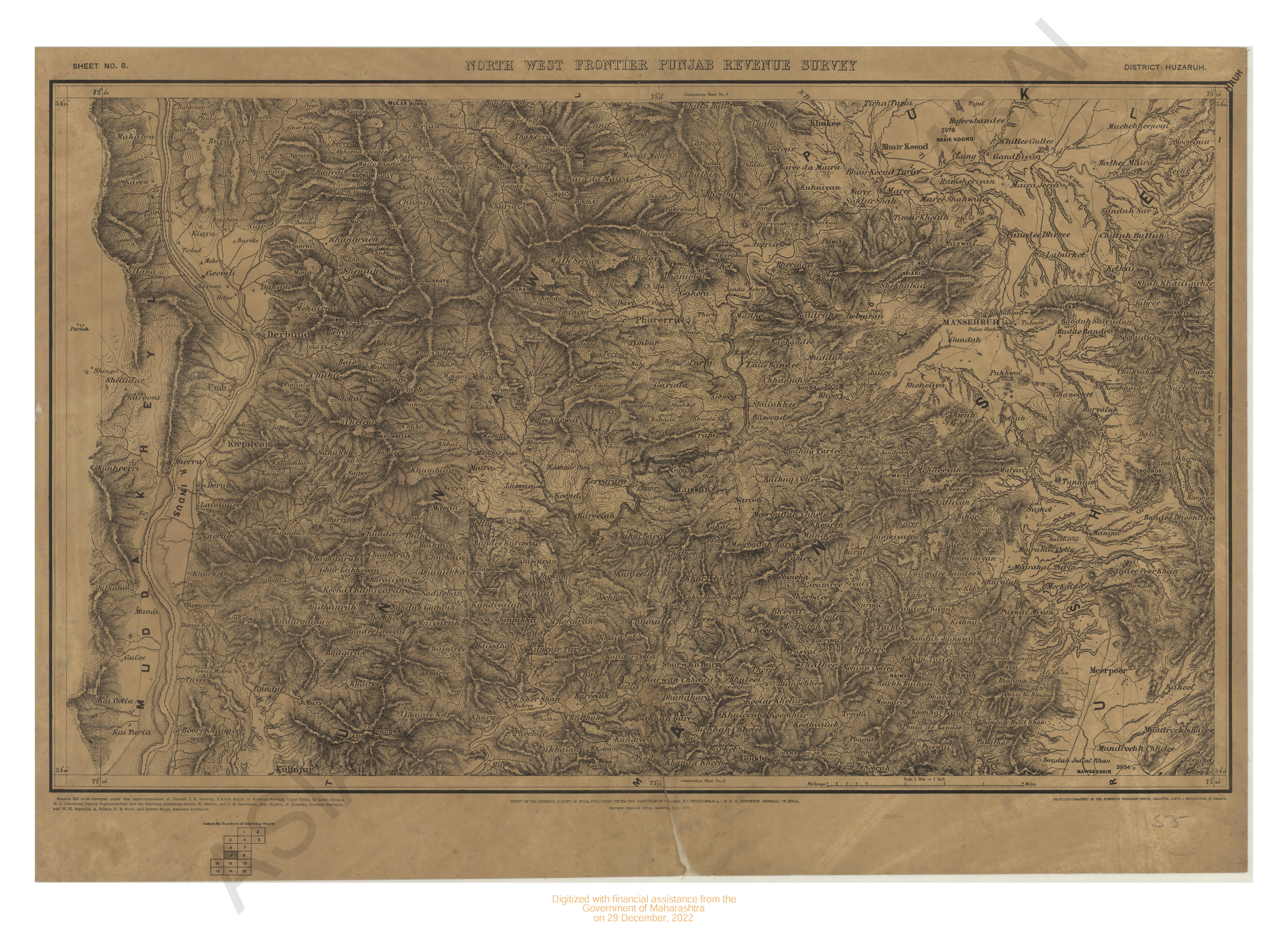
- North-West Frontiers Punjab revenue survey, district Huzarub 1865-69. Sheet No.8
- Year: 1870
- Subject: Topographic Map
- Publisher: Surveyor General's Office
- Language: English
- Place of Publication: Calcutta
- 4 Views
-
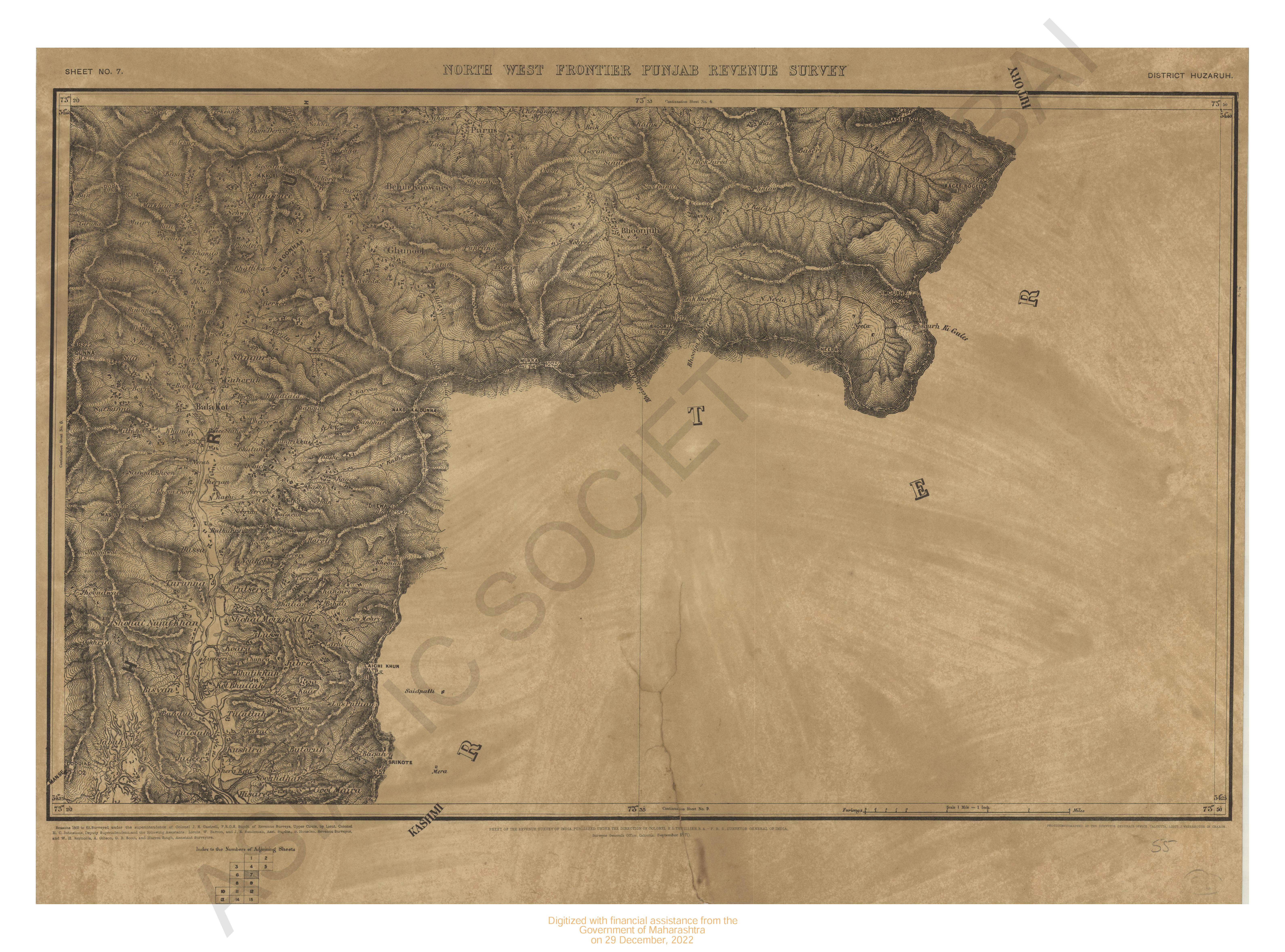
- North-West Frontiers Punjab revenue survey, district Huzarub 1865-69. Sheet No.7
- Year: 1870
- Subject: Topographic Map
- Publisher: Surveyor General's Office
- Language: English
- Place of Publication: Calcutta
- 4 Views
-
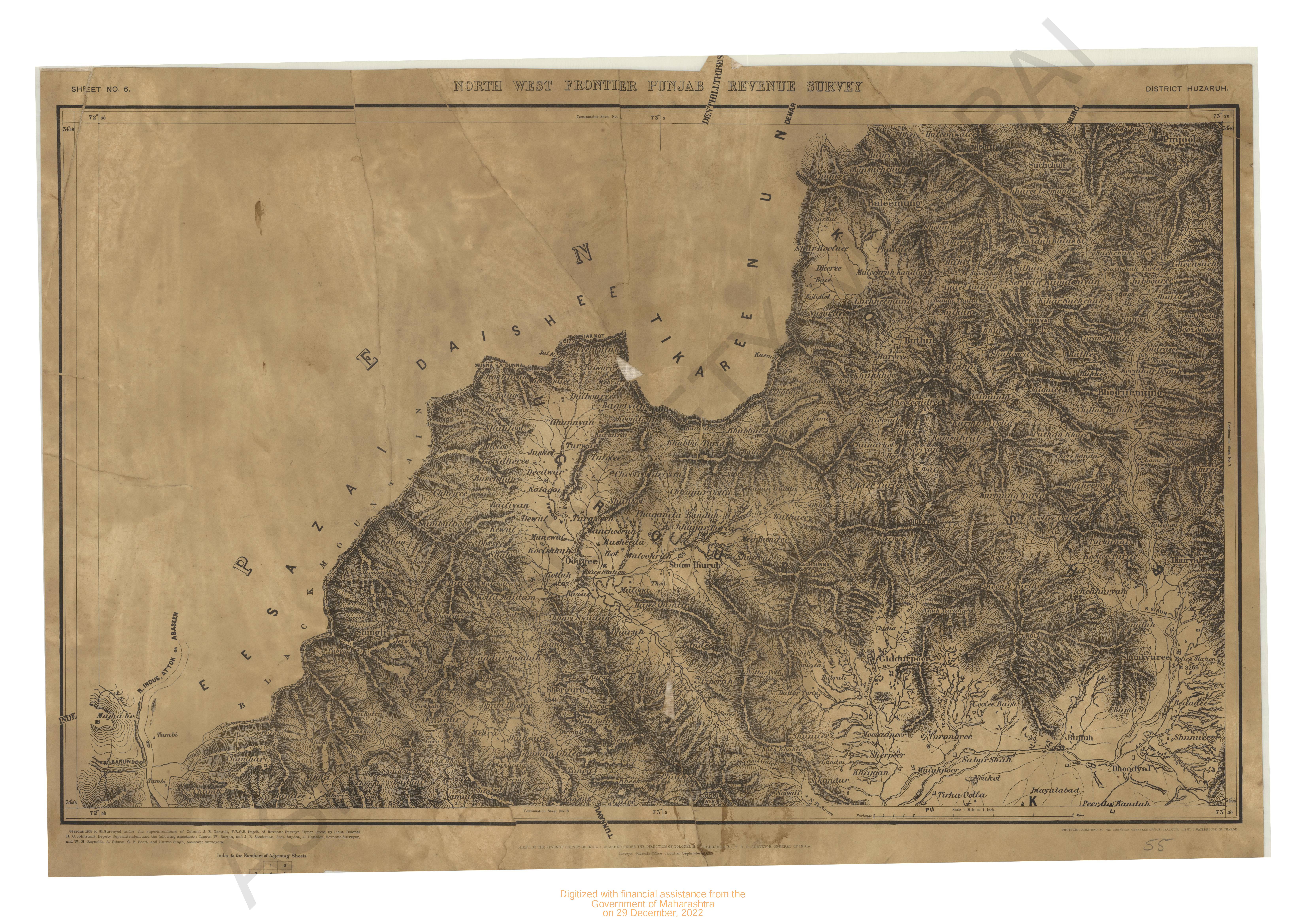
- North-West Frontiers Punjab revenue survey, district Huzarub 1865-69. Sheet No.6
- Year: 1870
- Subject: Topographic Map
- Publisher: Surveyor General's Office
- Language: English
- Place of Publication: Calcutta
- 4 Views
-
- Chart of Shadashivgasd bay 1855.
- Year: 1877
- Subject: Topographic Map
- Publisher: Government Office
- Language: English
- Place of Publication: Poona
- 3 Views
-
- North-West Frontiers Punjab revenue survey, district Huzarub 1865-69. Sheet No.5
- Year: 1870
- Subject: Topographic Map
- Publisher: Surveyor General's Office
- Language: English
- Place of Publication: Calcutta
- 4 Views
-
- India East coast Kakindabay & approaches 1966-67 with addition & corrections to 1968.
- Year: 1968
- Subject: Topographic Map
- Publisher: Naval hydrographic
- Language: English
- Place of Publication: Dehradun
- 3 Views
-
- Mazagaon surveyed in 1869-71 corrected upto 1871 Bombay revenue survey.
- Year: 1872
- Subject: Topographic Map
- Publisher: Government Office
- Language: English
- Place of Publication: Poona
- 7 Views