-
- 6 Views
-
- 6 Views
-
- 6 Views
-
- 7 Views
-
- 6 Views
-
- 5 Views
- Gos and Murmagoa roads, surveyed in 1812
- Year: 1816
-
- 5 Views
- India, Bay of Bengal
- Year: 1878
-
- 9 Views
- Kutch
- Year: 1878
-
- 2 Views
-
- 7 Views
-
- 2 Views
-
- 4 Views
-
- 4 Views
-
- 5 Views
-
- 5 Views
-
- 2 Views
-
- 3 Views
-
- 3 Views
-
- 2 Views
-
- 3 Views
-
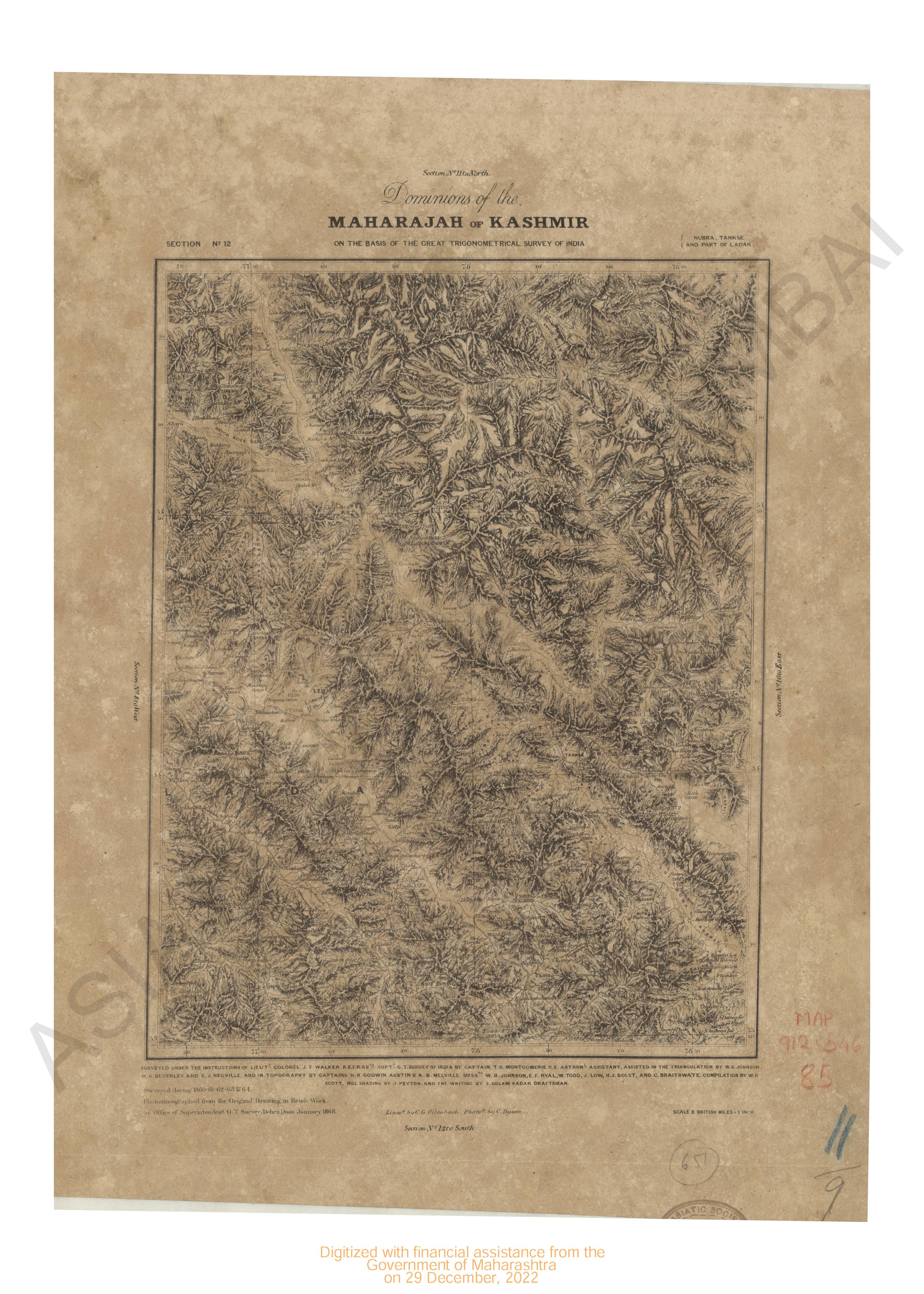
- Dominions of the Maharajah of Kashmir on the basis of the great trigonomentrical survey of India, Part of Nubra, Tankse and part of Ladak. Section no.12
- Year: 1868
- Subject: Topographic Map
- Publisher: G.T. survey office
- Language: English
- Place of Publication: Dehra Doon (Dehradun)
- 6 Views
-
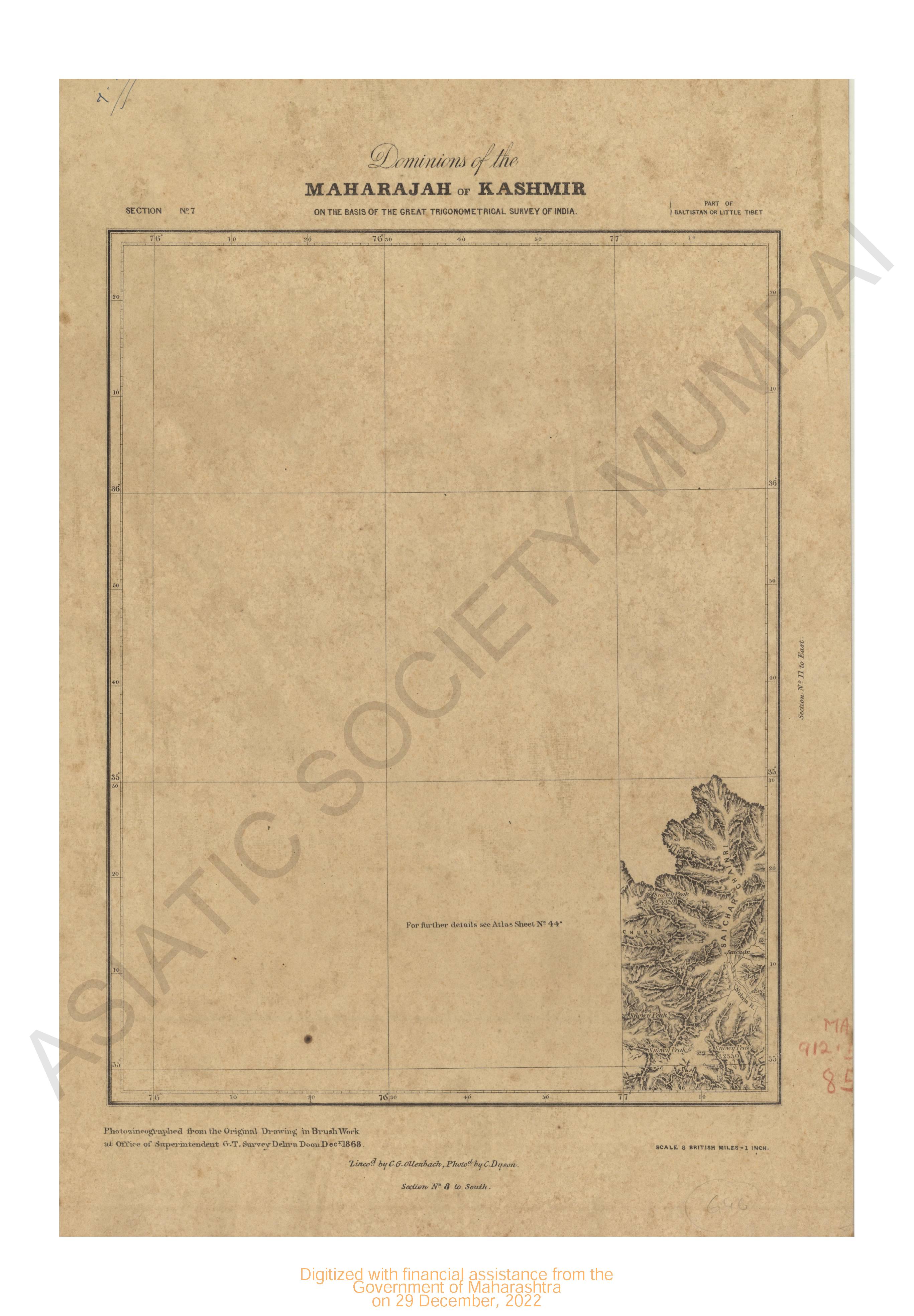
- Dominions of the Maharajah of Kashmir on the basis of the great trigonomentrical survey of India, Part of Baltistan or little tibet . Section no.7
- Year: 1868
- Subject: Topographic Map
- Publisher: G.T. survey office
- Language: English
- Place of Publication: Dehra Doon (Dehradun)
- 6 Views
-
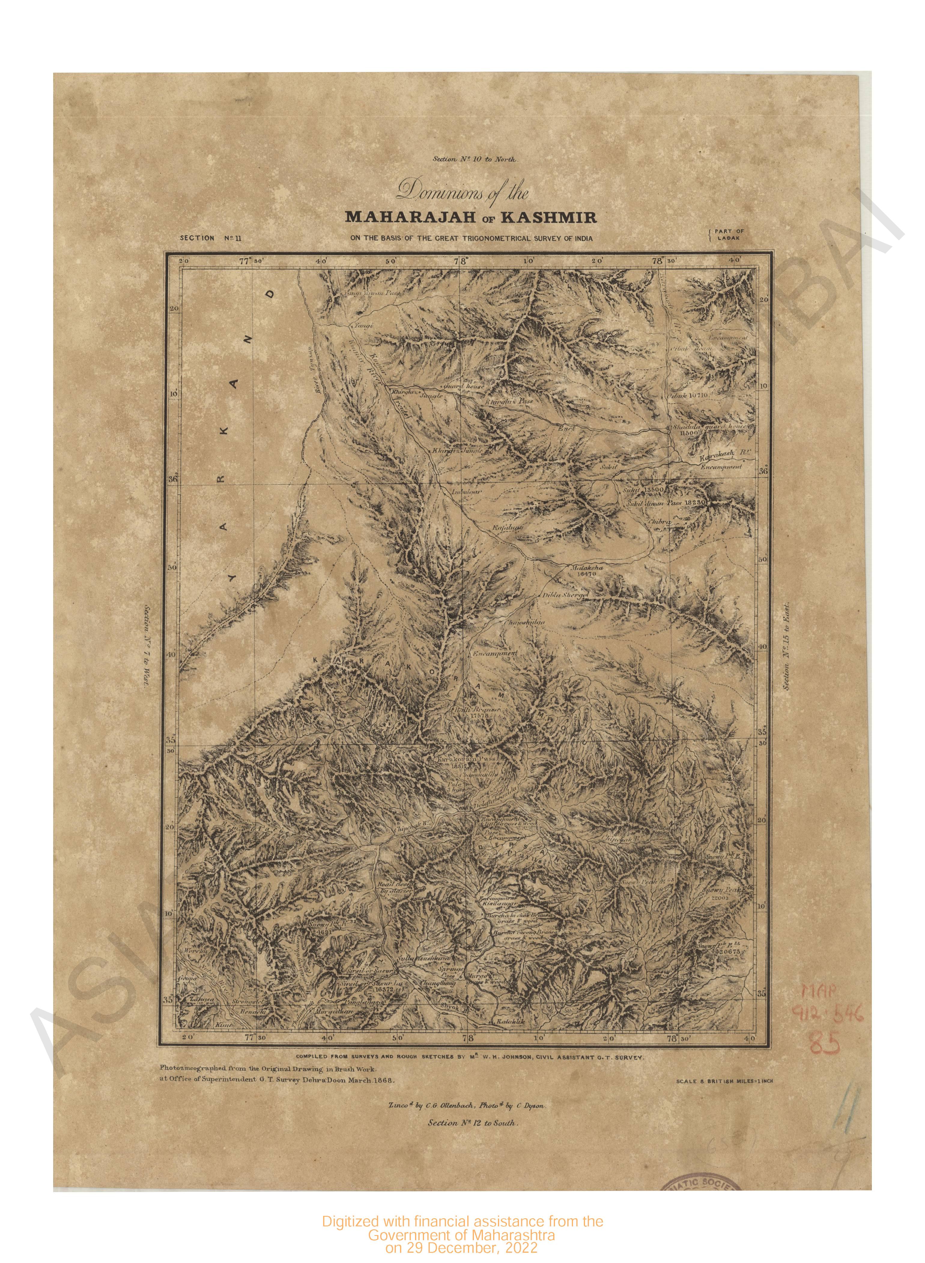
- Dominions of the Maharajah of Kashmir on the basis of the great trigonomentrical survey of India, Part of Ladak. Section no.11
- Year: 1868
- Subject: Topographic Map
- Publisher: G.T. survey office
- Language: English
- Place of Publication: Dehra Doon (Dehradun)
- 6 Views
-
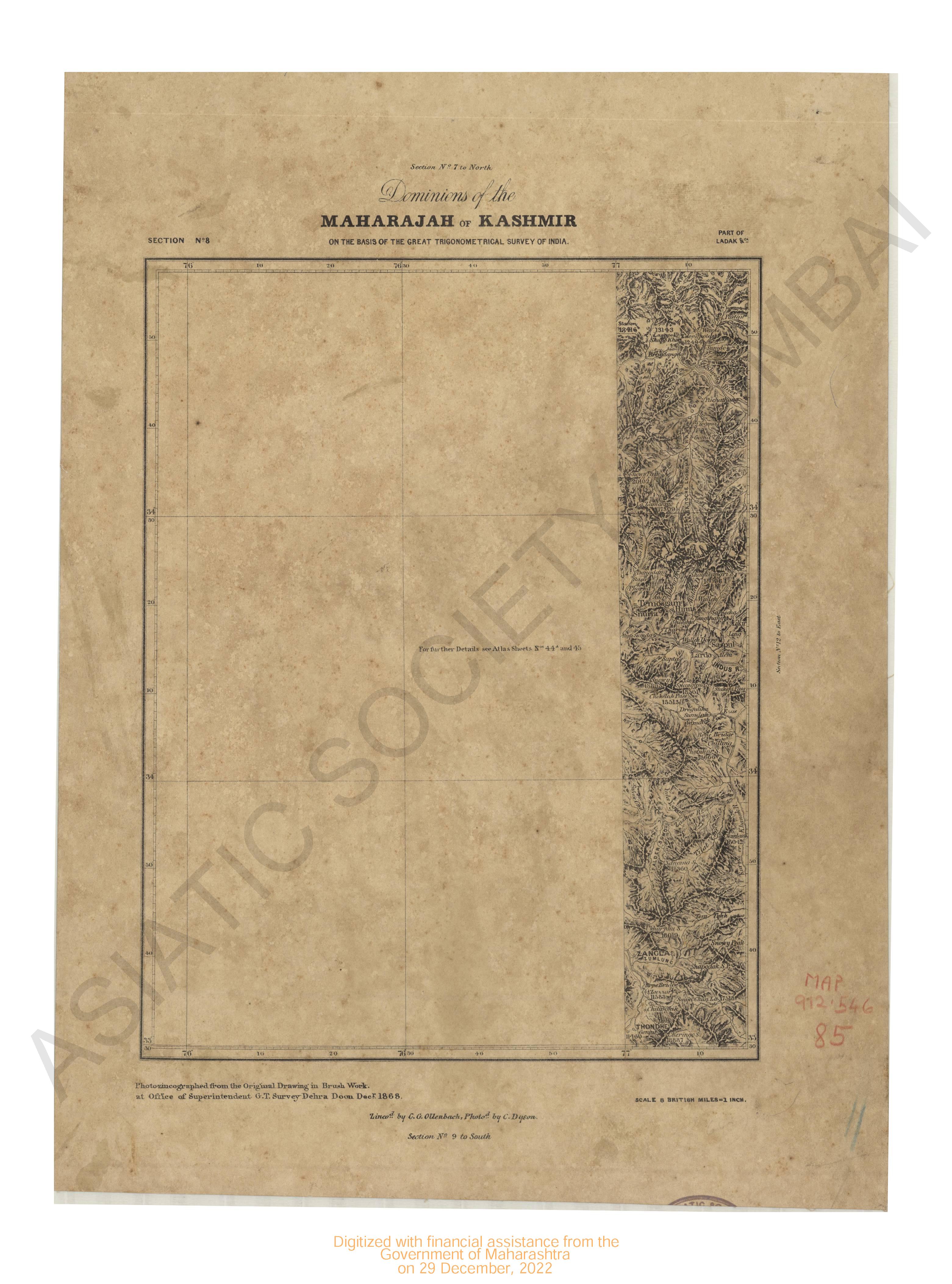
- Dominions of the Maharajah of Kashmir on the basis of the great trigonomentrical survey of India, Part of Ladak . Section no.8
- Year: 1868
- Subject: Topographic Map
- Publisher: G.T. survey office
- Language: English
- Place of Publication: Dehra Doon (Dehradun)
- 7 Views
-
- Sand and channels forming the entrance in to the river Hoogly : including Balasore roads and bank of sounding off point Palmiras survey of
- Year: 1842
- Subject: Topographic Map
- Publisher: John Walker
- Language: English
- 6 Views
-
- Gos and Murmagoa roads, surveyed in 1812
- Year: 1816
- Subject: Topographic Map
- Publisher: James Horsburgh
- Language: English
- 5 Views
-
- India, Bay of Bengal
- Year: 1878
- Subject: Topographic Map
- Publisher: The Marine Survey dept
- Language: English
- Place of Publication: Calcutta
- 5 Views
-
- Kutch
- Year: 1878
- Subject: Topographic Map
- Publisher: Government Photozincograhic
- Language: English
- Place of Publication: Poona
- 9 Views
-
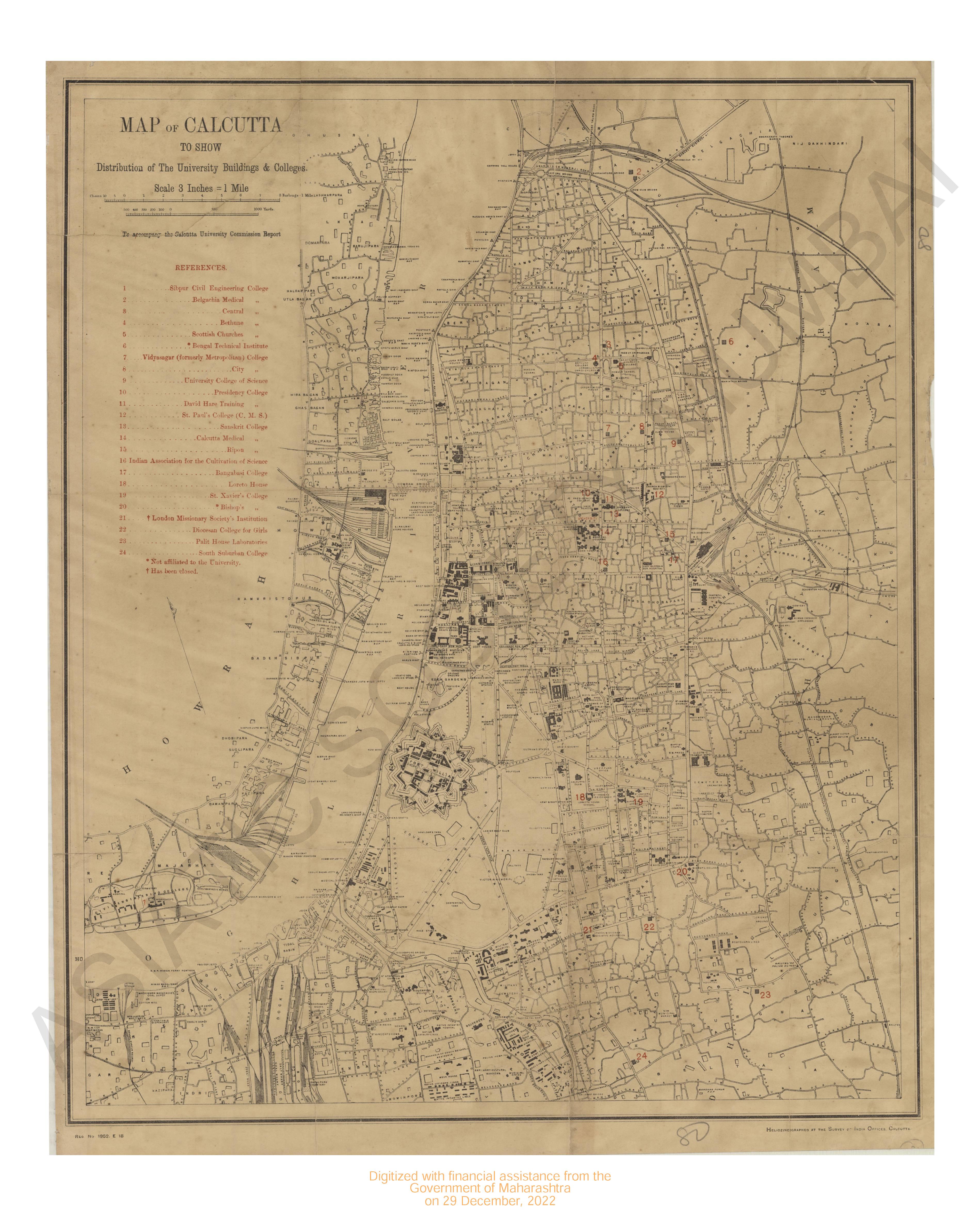
- Calcutta : Map of to show distribution of the University buildings & colleges
- Subject: Topographic Map
- Publisher: The Survey of India offices
- Language: English
- Place of Publication: Calcutta
- 2 Views
-
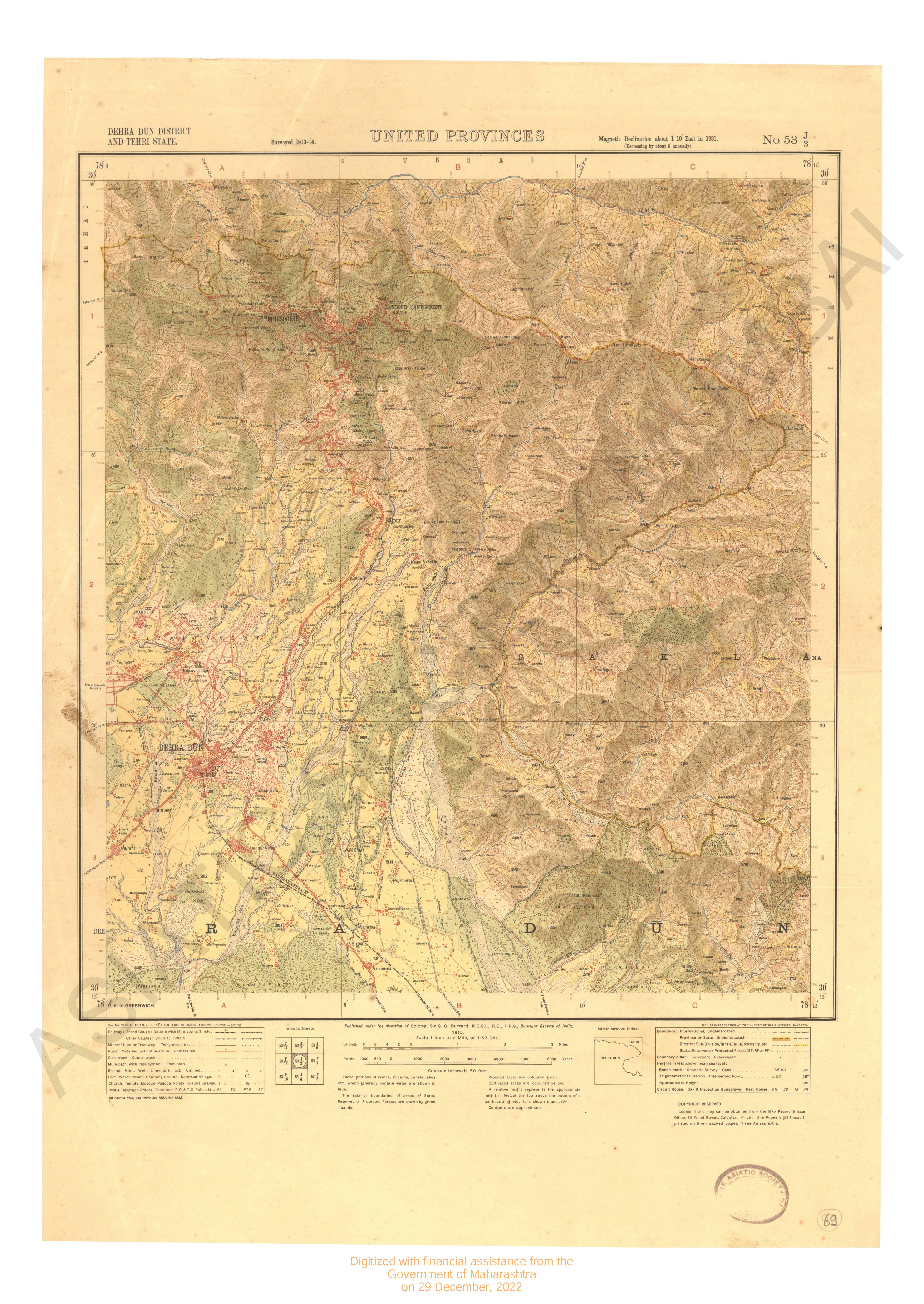
- Dehradun District and Tehri state 1st edn. 1915, 2nd 1925, 3rd 1927, 4th 1932 surveyed in 1913-14
- Year: 1915
- Subject: Topographic Map
- Publisher: Surveyor General's
- Language: English
- 7 Views
-
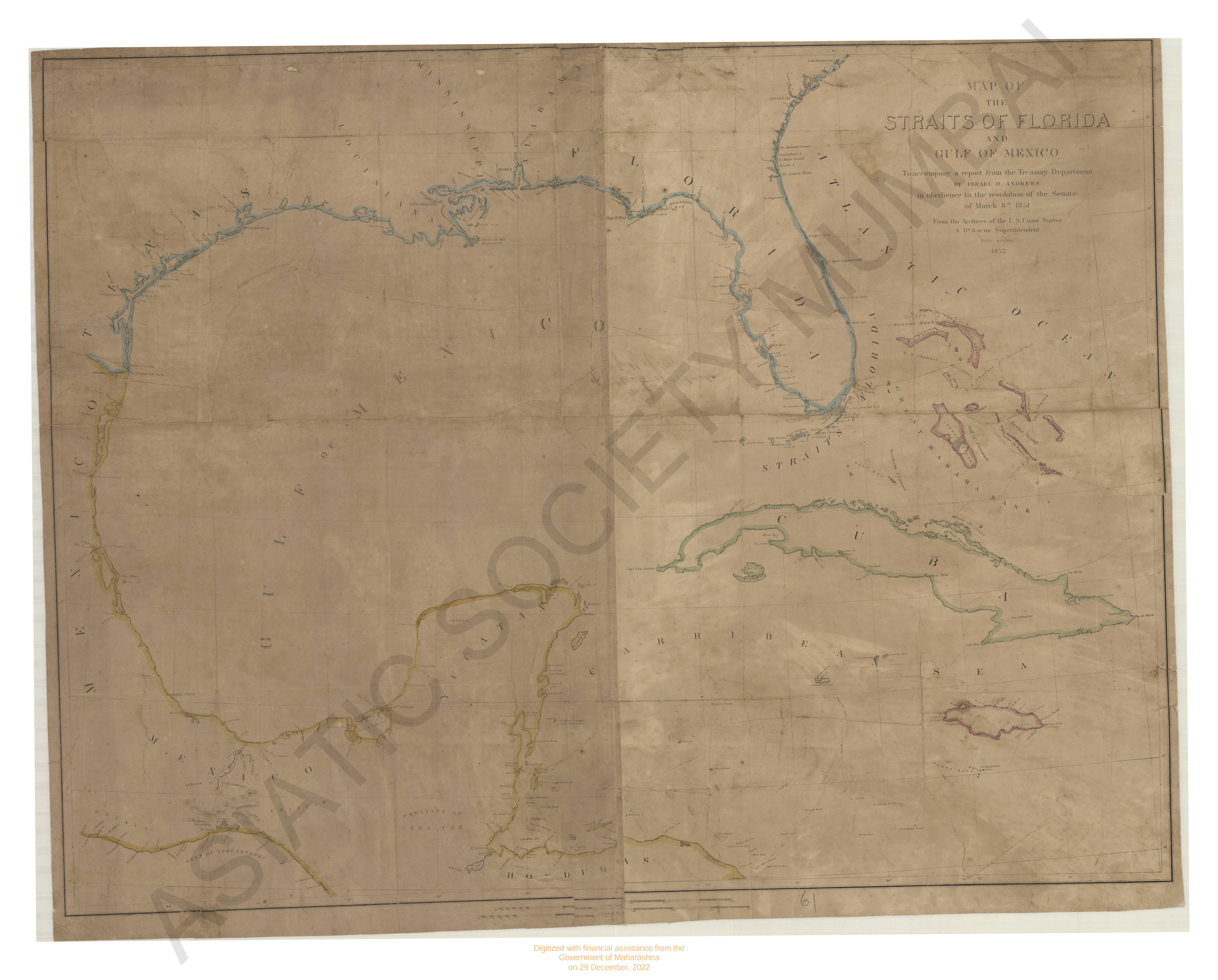
- Map of the Straits of Florida and Gulf of Mexico.
- Year: 1852
- Subject: Topographic Map
- Publisher: Israel D. Andrews
- Language: English
- 2 Views
-
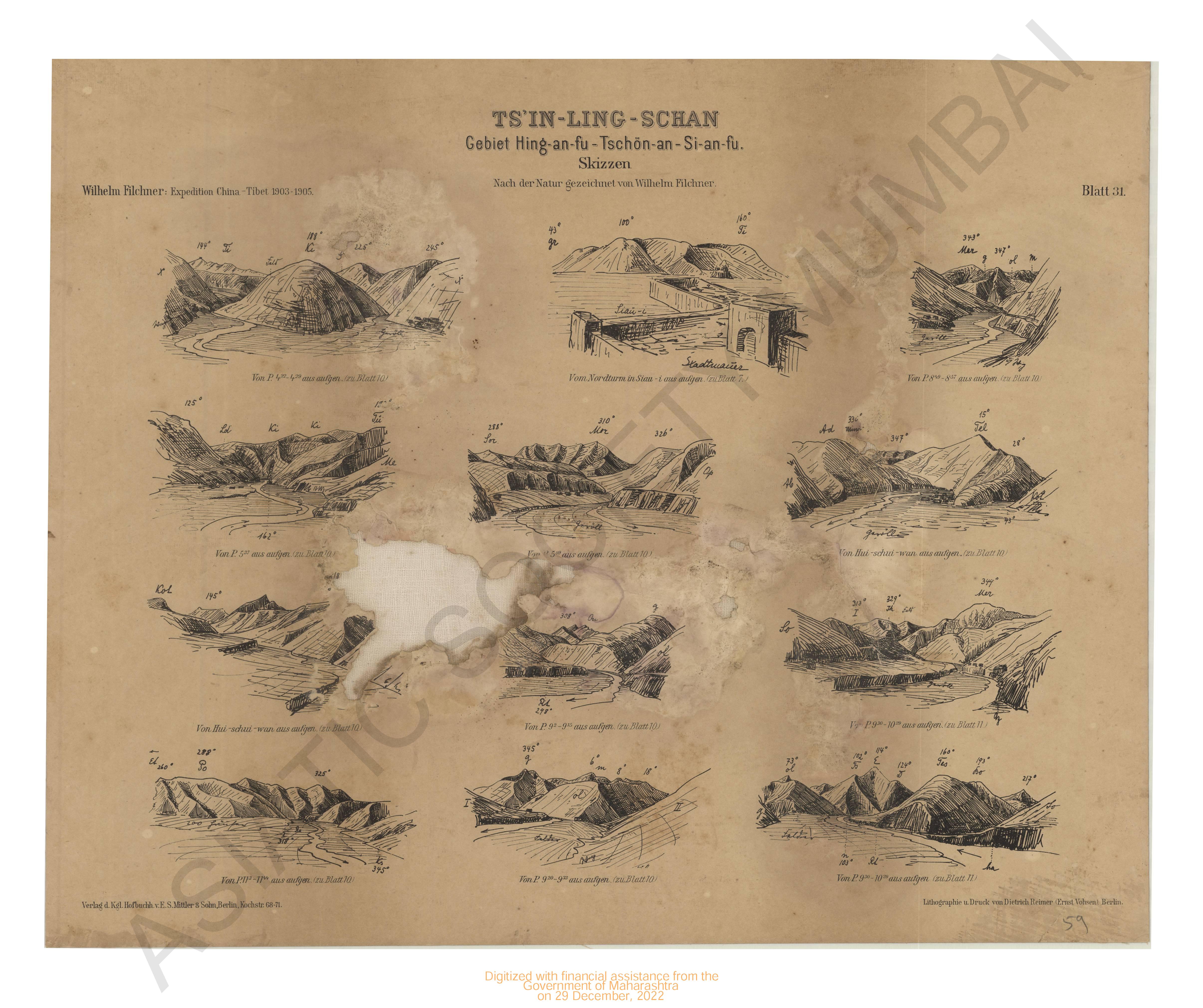
- Ts'in-Ling schan, Gebiet Hing-an-fu-Tschon An-si-an-fu. Skizzen Expedition China- Tibet 1903-1905. Blatt 31.
- Year: 1905
- Subject: Topographic Map
- Publisher: V.E.S.Mittler & Sons
- Language: English
- Place of Publication: Berlin
- 4 Views
-
- Survey of the River Hoogly, from Calcutta to Saugor Point including baratulla river or channel greek.
- Year: 1839
- Subject: Topographic Map
- Publisher: John Walker
- Language: English
- 4 Views
-
- Ts'in-Ling schan, Gebiet Hing-an-fu-Tschon An-si-an-fu. Skizzen Expedition China- Tibet 1903-1905. Blatt 22.
- Year: 1905
- Subject: Topographic Map
- Publisher: V.E.S.Mittler & Sons
- Language: English
- Place of Publication: Berlin
- 5 Views
-
- Ts'in-Ling schan, Gebiet Hing-an-fu-Tschon An-si-an-fu. Skizzen Expedition China- Tibet 1903-1905. Blatt 19.
- Year: 1905
- Subject: Topographic Map
- Publisher: V.E.S.Mittler & Sons
- Language: English
- Place of Publication: Berlin
- 5 Views
-
- Ts'in-Ling schan, Gebiet Hing-an-fu-Tschon An-si-an-fu. Skizzen Expedition China- Tibet 1903-1905. Blatt 19.
- Year: 1905
- Subject: Topographic Map
- Publisher: V.E.S.Mittler & Sons
- Language: English
- Place of Publication: Berlin
- 2 Views
-
- Ts'in-Ling schan, Gebiet Hing-an-fu-Tschon An-si-an-fu. Skizzen Expedition China- Tibet 1903-1905. Blatt 18.
- Year: 1905
- Subject: Topographic Map
- Publisher: V.E.S.Mittler & Sons
- Language: English
- Place of Publication: Berlin
- 3 Views
-
- Ts'in-Ling schan, Gebiet Hing-an-fu-Tschon An-si-an-fu. Skizzen Expedition China- Tibet 1903-1905. Blatt 16.
- Year: 1905
- Subject: Topographic Map
- Publisher: V.E.S.Mittler & Sons
- Language: English
- Place of Publication: Berlin
- 3 Views
-
- Chart of the Coast of Arracan from Akyab to long 70° 50' N,1833.
- Year: 1842
- Subject: Topographic Map
- Publisher: James Horsburgh
- Language: English
- 2 Views
-
- Ts'in-Ling schan, Gebiet Hing-an-fu-Tschon An-si-an-fu Expedition China- Tibet 1903-1905. Blatt 15.
- Year: 1905
- Subject: Topographic Map
- Publisher: V.E.S.Mittler & Sons
- Language: English
- Place of Publication: Berlin
- 3 Views