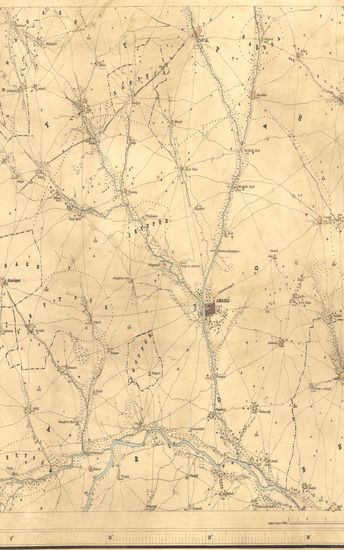
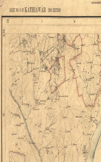
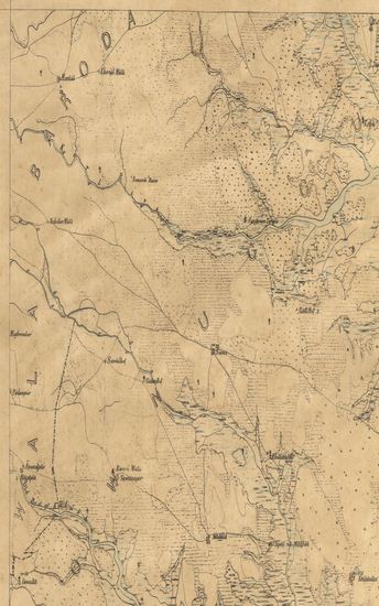
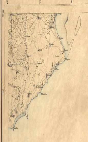
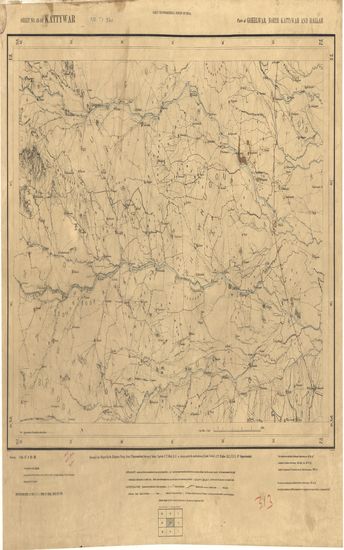
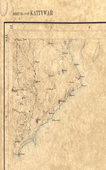
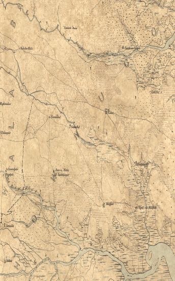
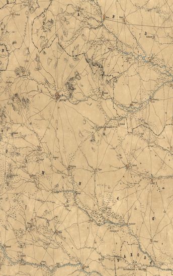
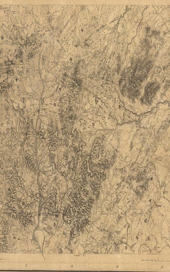
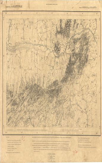
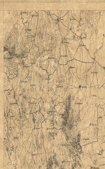
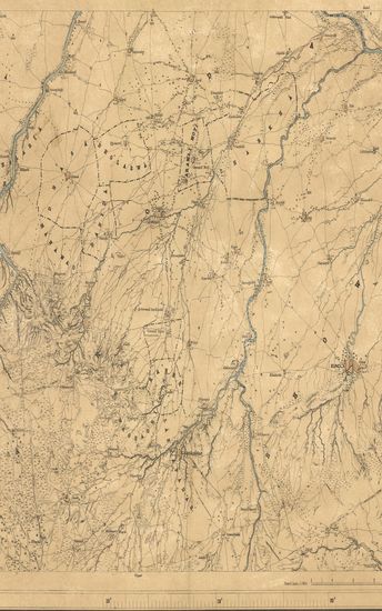
Kathiawar : Part of Gohelwar, Season 1867-68 G.T.Survey of India.
| Resource Type | : | Map |
| Year/Date of Publication | : | 1869 |
| Subject | : | Topographic Map |
| Publisher | : | Dehradun G.T.S. Office 1869 |
| Place of Publication | : | Dehradun |
| Language | : | English |
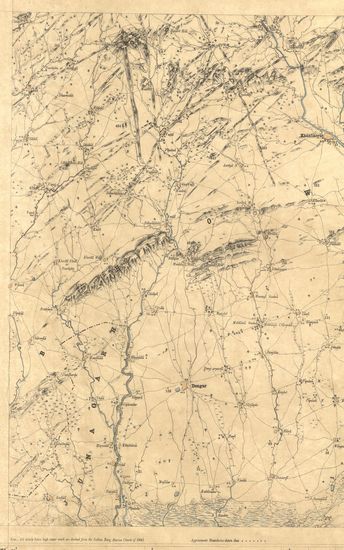
| Notes/Description | : | Orthography in accordance with Bombay Government List (Bombay Places and Common Official Words). Conventional Signs. Trigonometrical Stations & Points respectively & or Taluka Boundaries, Approximate boundaries, Metalled roads, Country roads, Footpaths, cultivation bank. Edge of cultivation, Waste, Pahlias or In memoriam stones. In Villages each block represents 20 houses. In the largest towns the number cannot br thus shown, Numerals with the affix r indicate the relative heights in feet of banks to beds of water courses, thus 17 r; with the affix b they indicate barometrical, and therefore approximate heights in feet. Village boundaries shewn thus are derived from the revenue survey. The latitude are referrible to Kalianpur Observatory, assumed as 24° 7' 11. The longitude are referrible to Madras Observatory, taken as 80° 14' 51. The heights are referrible to Dangarwari H.S. Deduced from Diu Tidal Observations as 97.97 Ft. Index to numbers of adjoining sheets |
| Pages/Folios | : | 1 |
| Identifier | : | MAP_0295 |
| Digitization Sponsor | : | Government of Maharashtra |
Other Similar Items
-
- 26 Views
-
- 30 Views
-
- 54 Views
-
- 23 Views
-
- 36 Views
-
- 44 Views
-
- 37 Views
-
- 42 Views
-
- 49 Views
-
- 57 Views
-
- 39 Views
-
- 33 Views