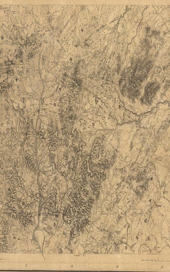
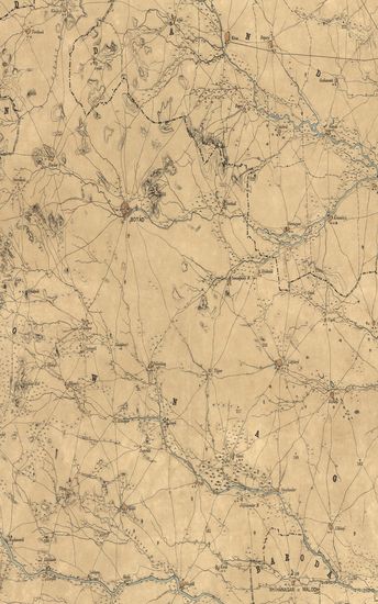
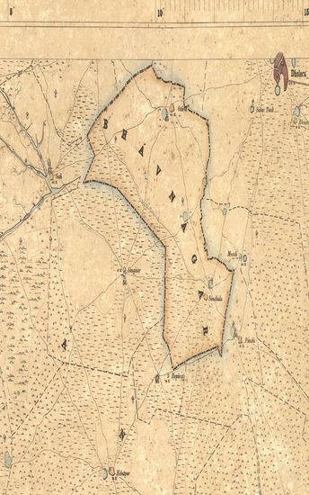
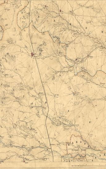
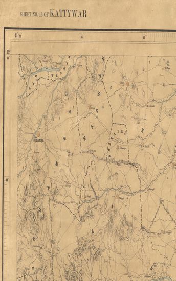
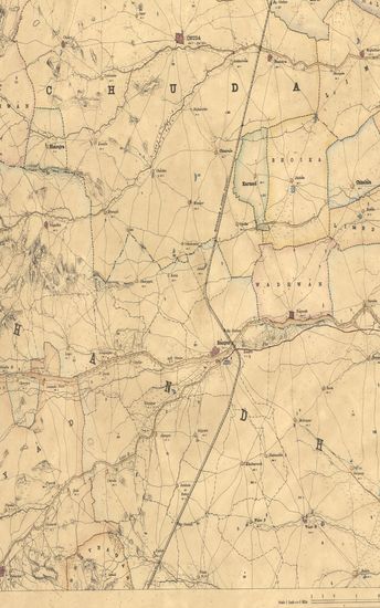
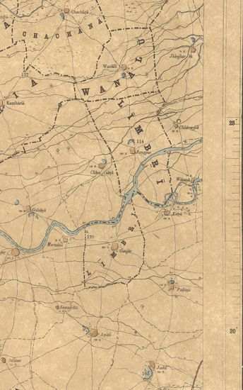
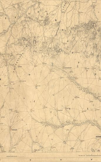
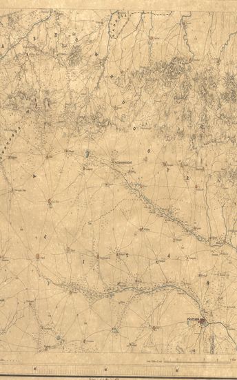
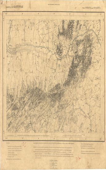
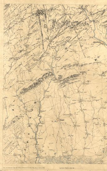
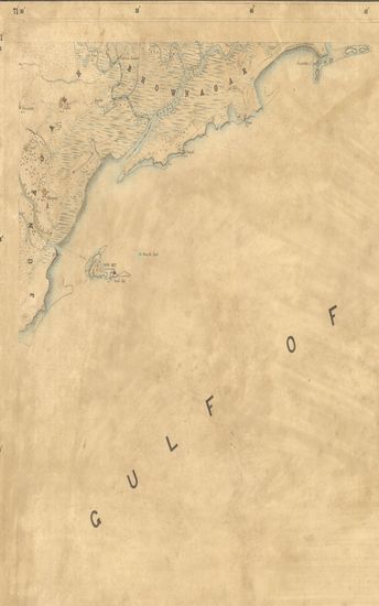
Kathiawar : Parts of Ahmedabad and Gohelwar:1868, 1868-1869
| Resource Type | : | Map |
| Year/Date of Publication | : | 1870 |
| Subject | : | Topographic Map |
| Publisher | : | Dehradun G.T.S Office 1870 |
| Place of Publication | : | Dehradun |
| Language | : | English |
| Notes/Description | : | Orthography. Accents over letters are indicative of the proper pronunciation : a & ā have the sounds respectively of the first and second a in Mama : e has the sound of a in pale; i & ī the vowel sounds in bit & feet; υ that in full, ū that in fool & ai that in dry . Marks under letters indicate the Guzerathi letters from which they are derived, the dot anaswar over another letter. Conventional signs. Trigonometrical stations & Points respectively ◬ & ⊙ or ô taluka boundaries, metalled roads, country roads, foot paths, cultivation, blank. Edge of cultivation, waste, Pahilas or in memoriam stones † numerals without an affix indicate trigonometrical heights in feet above mean sea level; thus 365. Numerals with the affix H indicate the number of houses in town or village whose name they are under, thus 472 H; with affix r they indicate the relative heights in feet of banks to beds of water courses, thus 12 r; with the affix b they indicate barometrical, and therefore approximate heights in feet. The latitude are referrible to Kalianpur Observatory viz. 26° 30' 55. Longitudes to Madras Observatory Old Value viz. 80° 17' 21 Heights to Dangarwari H.S. Deduced from the Diu Tidal Observations97.97 ft. The most recent value of the longitude of Madras Observatory is 80° 14' 20, via Nautical Almanac for 1868, Consequently all longitudes in this map are liable to be diminished by 3', 1 Index to number of adjoining sheets |
| Pages/Folios | : | 1 |
| Identifier | : | MAP_0287 |
| Digitization Sponsor | : | Government of Maharashtra |

Other Similar Items
-
- 44 Views
-
- 12 Views
-
- 31 Views
-
- 42 Views
-
- 34 Views
-
- 29 Views
-
- 40 Views
-
- 38 Views
-
- 42 Views
-
- 39 Views
-
- 31 Views
-
- 37 Views