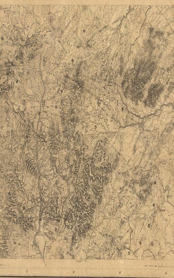
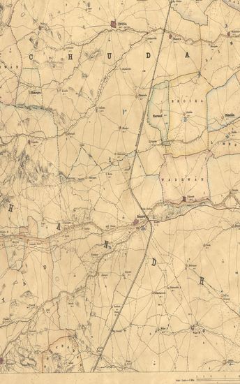
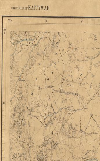
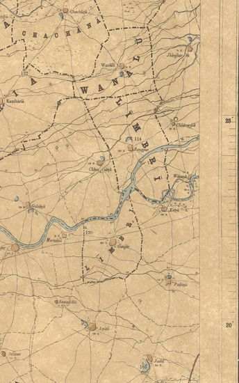
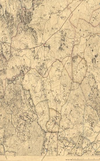
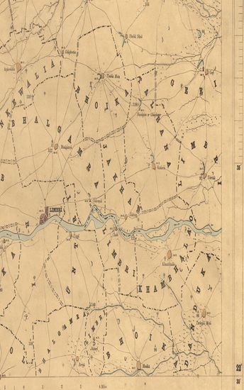
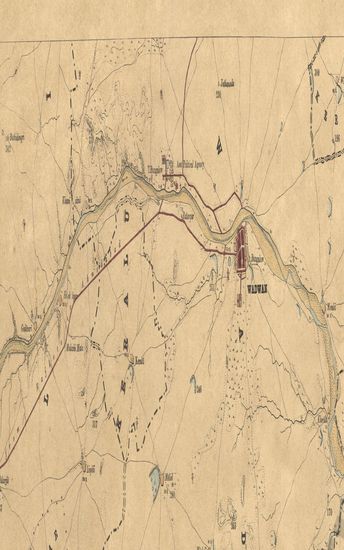
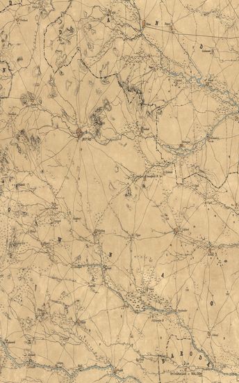
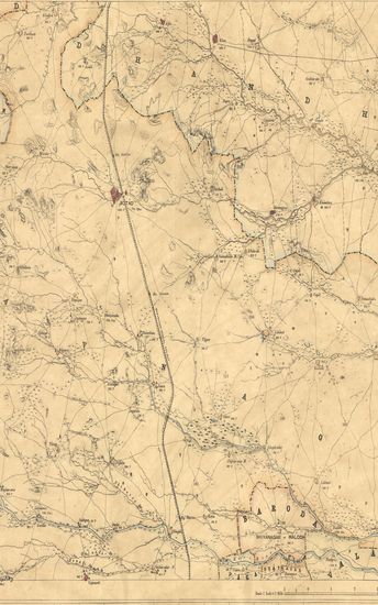
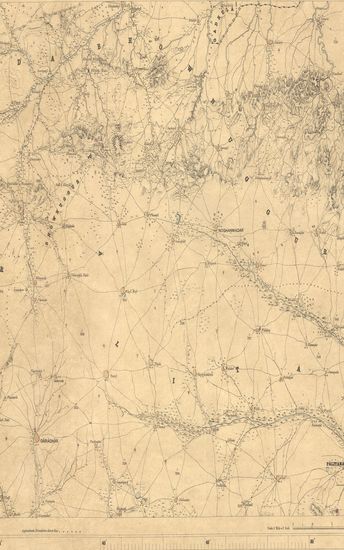
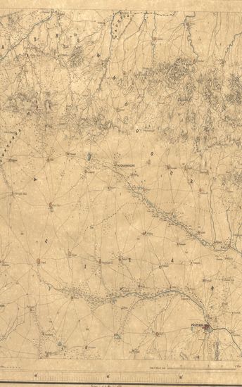
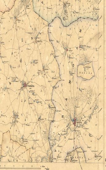
Kathiawar: Parts of North Kathiawar. Ahmedabad & Jhalavad. Season 1868-69. Great Trigonometrical survey of India.
| Resource Type | : | Map |
| Year/Date of Publication | : | 1884 |
| Subject | : | Topographic Map |
| Publisher | : | Dehradun G.T.S.Office 1884 |
| Place of Publication | : | Dehradun |
| Language | : | English |
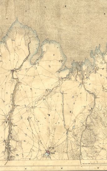
| Notes/Description | : | (Sheet No. 13 of Kathiawar- 2nd ed.) ORTHOGRAPHY in accordance with Bombay Government List (Bombay Places and Common Official Words). CONVENTIONAL SIGNS. Trigonometrical Stations & Points respectively Δ & ο or ό. Taluka Boundaries, Metalled roads, Country roads, Foot paths, Narrow Guage Railway, Cultivation, blank. Edge of Cultivation, Waste, Pahlias or In Memoriam stones †. Numerals without an affix indicate Trigonometrical heights in feet above mean sea level; thus 350. Numerals with the decimal point indicate levels obtained from the P.W.Dept.; thus 82.1 Numerals with the affix P indicate the Population of the town or village they are printed near, thus, 250 P ; with affix r they indicate the relative heights in feet of banks to beds of water courses, thus 12 r. The letters M and N printed after a village name stand for Mota and Nana respectively. thus Waori M, Waori N. Village names printed in Pica Bold Face as Bhurejra, Chhalala, Karol, & c., &c. are Taluka villages having separate jurisdiction. To avoid confusion on the map the Taluka names have been omitted. The latitude are referrible to that of Kalianpur Observatory, assumed as 24° 7' 11. The Longitudes are referrible to Madras Observatory, taken as 80° 17' 21 to which a correction of - 2' 30'' must be applied to reduce to the most recent value, 80° 14' 51. The Heights are referrible to Dangarwari H.S., deduced from Diu Tidal Observations as 97.97 Ft. Index to Numbers of adjoining sheets. |
| Pages/Folios | : | 1 |
| Identifier | : | MAP_0308 |
| Digitization Sponsor | : | Government of Maharashtra |
Other Similar Items
-
- 42 Views
-
- 29 Views
-
- 27 Views
-
- 24 Views
-
- 22 Views
-
- 44 Views
-
- 31 Views
-
- 40 Views
-
- 38 Views
-
- 24 Views
-
- 29 Views
-
- 37 Views