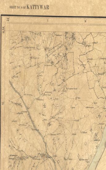
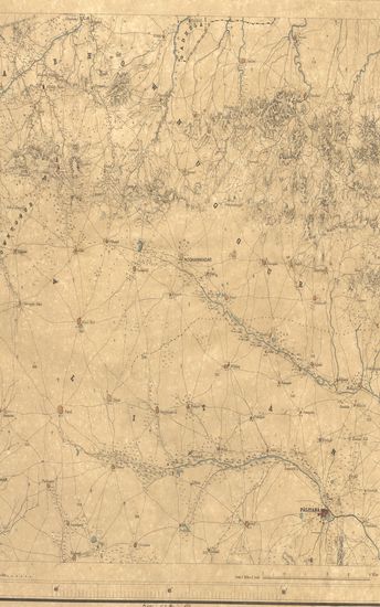
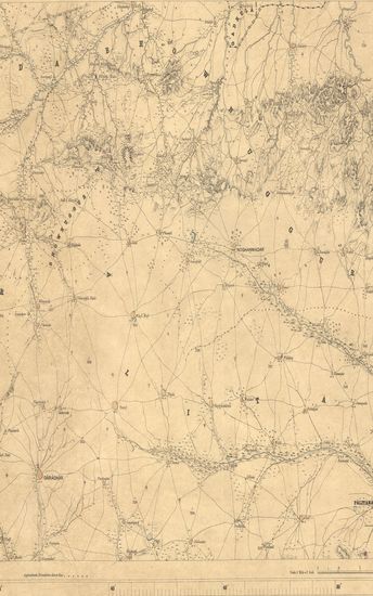
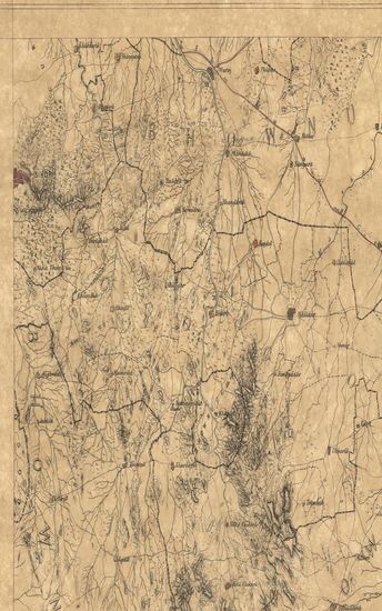
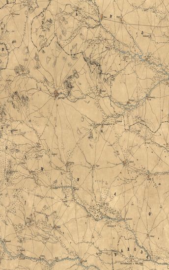
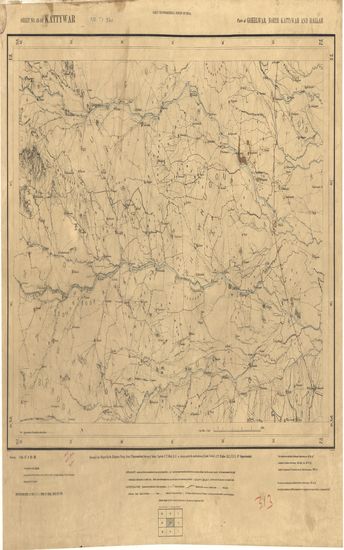
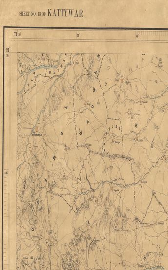
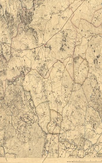
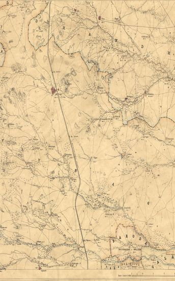
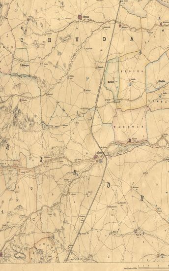
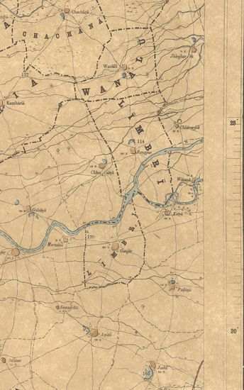
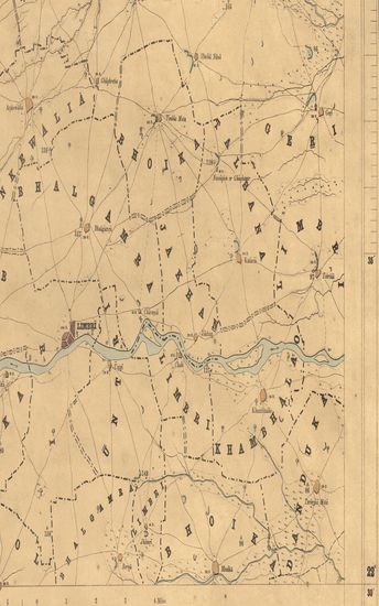
Kathiawar: Part of Gohelwar. Season 1866-67 & 1868-69. Great Trigonometrical suevey of India.
| Resource Type | : | Map |
| Year/Date of Publication | : | 1870 |
| Subject | : | Topographic Map |
| Publisher | : | Dehradun Photozincographed at the G.T.S.Office 1870 |
| Place of Publication | : | Dehradun |
| Language | : | English |
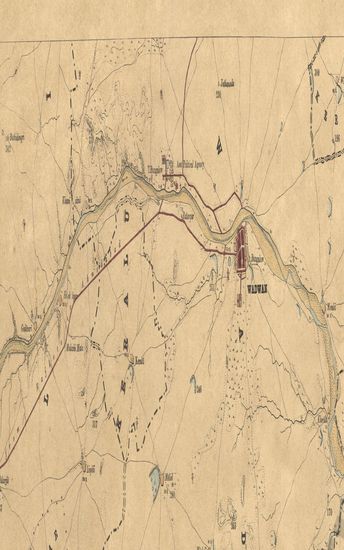
| Notes/Description | : | (Sheet No.16 of Kattywar). ORTHOGRAPHY. Accents over letters are indicative of the proper pronunciation : a & ā have the sounds respectively of the first and second a in Mama : e has the sound of a in pale ; i & i the vowel sounds in bit & feel; u that in full, ū that in fool & ai that in dry. Marks under letters indicate the Guzerathi letters from which they are derived, ... & ṇ the dot called the Anaswar over another letter. CONVENTIONAL SIGNS. Trigonometrical Stations & Points respectively Δ & ο or ό. Taluka Boundaries, Metalled roads, Country roads, Foot paths Cultivation, blank. Edge of Cultivation, Waste, Pahlias or In Memoriam stones † Numerals without an affix indicate Trigonometrical heights in feet above mean sea level; thus 365. Numerals with the affix H indicate the number of houses in the town or village whose name they are printed under, thus 472 H ; with affix r they indicate the relative heights in feet of banks to beds of water courses, thus 12r ; with affix b they indicate barometrical, and therefore approximate height in feet. The Latitude are referrible to Kalianpur Observatory,viz. 26° 30' 55. Longitudes to Madras Observatory Old Values viz. 80° 17' 21 Heights to Dangarwari H.S., deduced from Diu Tidal Observations 97.97 Ft. The most recent value of the Longitude of Madras Observatory is 80° 14' 20, vide Nautical Almanac for 1868; consequently all Longitudes in this map are liable to be diminished by 3'1. Index to Numbers of adjoining sheets. |
| Pages/Folios | : | 1 |
| Identifier | : | MAP_0315 |
| Digitization Sponsor | : | Government of Maharashtra |
Other Similar Items
-
- 40 Views
-
- 49 Views
-
- 44 Views
-
- 54 Views
-
- 42 Views
-
- 27 Views
-
- 31 Views
-
- 34 Views
-
- 29 Views
-
- 24 Views
-
- 22 Views
-
- 23 Views