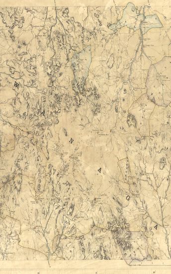
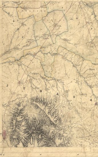
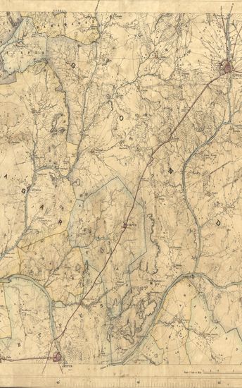
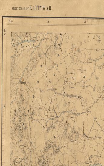
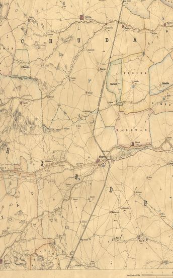
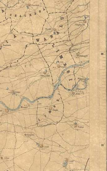
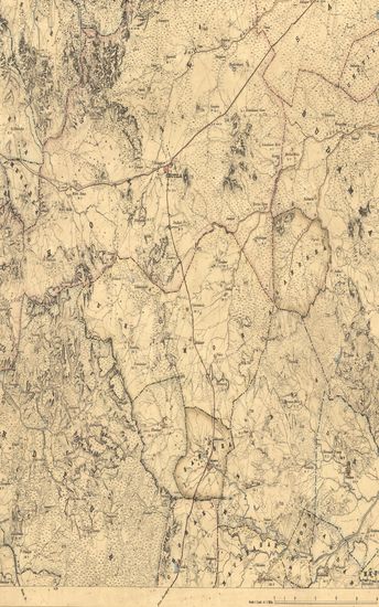
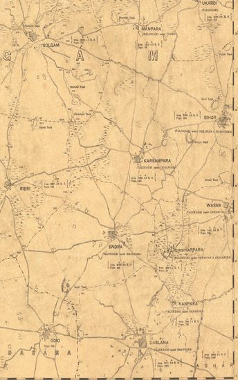
Kathiawar : Parts of Jhalavad, Ahmedabad & Radhanpur. Season 1875-76. G.T. Survey of India.
| Resource Type | : | Map |
| Year/Date of Publication | : | 1884 |
| Subject | : | Topographic Map |
| Publisher | : | Dehradun Photo-Zincographed at the G.T.S.Office 1884 |
| Place of Publication | : | Dehradun |
| Language | : | English |
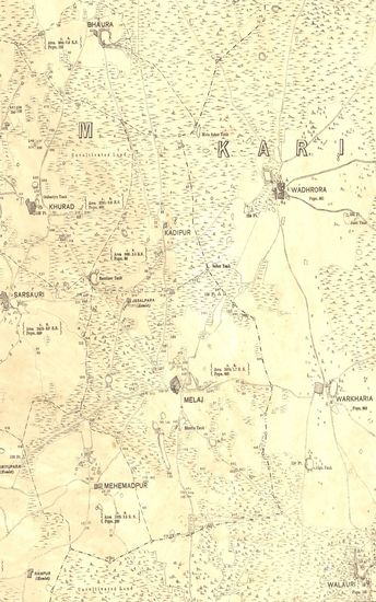
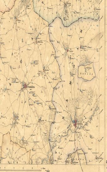
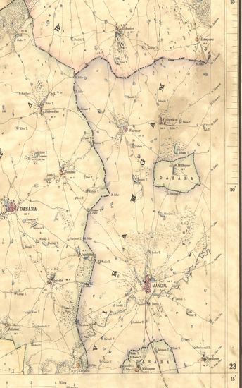
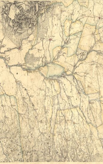
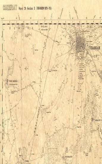
| Notes/Description | : | (Sheet No. 10a of Kathiawar - 2nd ed.) Surveyed and mapped under the direction and superintendence of Lieut.- Colonel J.T. Walker, R.E., F.R.S., & c., Superintendent Trigonometrical Surveys (now Lieut.- General, C.B. and Surveyor General), and finally under the superintendence of J.B.N. Hennessey, Esq., M.A. F.RS., & c., Officiating Deputy Surveyor General in, charge Trigonometrical Survey, by Major (now (now Lieut.- Colonel) Ayrton Pullan, S.C., Deputy Superintendents. ORTHOGRAPHY in accordance with Bombay Government List (Bombay Places and Common Official Words). CONVENTIONAL SIGNS. Trigonometrical Stations & Points respectively Δ & ο or ό. Taluka Boundaries, State boundary, Metalled roads, Country roads, Foot paths Cultivation, blank. Edge of cultivation , waste, Ran or Salt Waste, Pahlias or In Memoriam stones † Paka wells , Kacha wells, Numerals without an affix indicate Trigonometrical heights in feet above mean sea level; thus 365. Numerals with the affix P. indicate the population of the town or village they are printed near, thus, 472 P ; with affix r they indicate the relative heights in feet of banks to beds of water courses, thus 12 r. G.T. Level Heights to 2 places of decimals are shewn thus, □ B.M. 34.44 Approximate Boundaries ●● The latitude are referrible to Kalianpur Observatory, assumed as 24° 7' 11. The Longitudes are referrible to Madras Observatory, taken as 80° 17' 21 to which a correction of - 2' 30'' must be applied to reduce to the most recent value, 80° 14' 51. The Heights are referrible to Dangarwari H.S., deduced from Diu Tidal Observations as 97.97 Ft. Index to Numbers of adjoining sheets. |
| Pages/Folios | : | 1 |
| Identifier | : | MAP_0301 |
| Digitization Sponsor | : | Government of Maharashtra |
Other Similar Items
-
- 35 Views
-
- 33 Views
-
- 28 Views
-
- 52 Views
-
- 24 Views
-
- 42 Views
-
- 34 Views
-
- 29 Views
-
- 27 Views
-
- 34 Views
-
- 52 Views
-
- 49 Views